| Hardtkopf | |
|---|---|
 Hardtkopf | |
| Highest point | |
| Elevation | 601.5 m above sea level (NN) (1,973 ft) [1] |
| Coordinates | 50°10′21″N6°25′12″E / 50.1726°N 6.4201°E Coordinates: 50°10′21″N6°25′12″E / 50.1726°N 6.4201°E |
| Geography | |
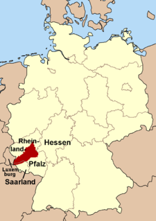
| Location | Bitburg-Prüm, Rhineland-Palatinate, Germany |
| Parent range | South Eifel |
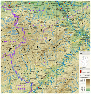
The Hardtkopf is a high hill in the county of Bitburg-Prüm in the German state of Rhineland-Palatinate. It rises in the South Eifel range and, at 601.5 m above sea level (NN) , [1] is the highest point on the edge of the Prüm Limestone Basin (Prümer Kalkmulde).

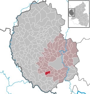
The Eifelkreis Bitburg-Prüm is a district in Rhineland-Palatinate, Germany. It is bounded by Luxembourg, Belgium and the districts of Euskirchen, Vulkaneifel, Bernkastel-Wittlich and Trier-Saarburg.

Rhineland-Palatinate is a state of Germany.
The South Eifel refers to that part of the Eifel mountain region around the Bitburg-Prüm district in the German state of Rhineland-Palatinate.
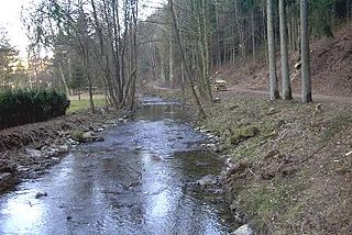
The Hardtkopf is located in the southern part of the High Fens-Eifel Nature Park, south of Prüm and northwest of Schönecken between the villages of Ellwerath (part of Rommersheim) in the north and Oberlauch in the south. To the west of the summit rises the little Prüm tributary, the Hennebach stream.

Prüm is a town in the Westeifel (Rhineland-Palatinate), Germany. Formerly a district capital, today it is the administrative seat of the Verbandsgemeinde Prüm.

Schönecken is a municipality in the district of Bitburg-Prüm, in Rhineland-Palatinate, western Germany.

Rommersheim is a municipality in the district of Bitburg-Prüm, in Rhineland-Palatinate, western Germany.
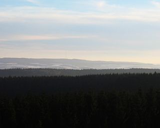
From the top of the Hardtkopf there are views of the who of the Prüm Limestone Basin and of Schöneck Switzerland (Schönecker Schweiz). In good weather, the edge of the Hunsrück mountains may be seen, about 60 kilometres away to the southeast. Until the early 20th century an observation tower stood on the summit. Today there is a transmission tower and a water tower.
The Hunsrück is a low mountain range in Rhineland-Palatinate, Germany. It is bounded by the river valleys of the Moselle (north), the Nahe (south), and the Rhine (east). The Hunsrück is continued by the Taunus mountains on the eastern side of the Rhine. In the north behind the Moselle it is continued by the Eifel. To the south of the Nahe is the Palatinate region.

An observation tower is a structure used to view events from a long distance and to create a full 360 degree range of vision to conduct the long distance observations. They are usually at least 20 metres (66 ft) tall and made from stone, iron, and wood. Many modern towers are also used as TV towers, restaurants, or churches. The towers first appeared in Germany at the end of the 18th century, and their numbers steadily increased, especially after the invention of the lift.

A transmission tower or power tower is a tall structure, usually a steel lattice tower, used to support an overhead power line.