Houston is the most populous city in the U.S. state of Texas and in the Southern United States. Houston is located in Southeast Texas near Galveston Bay and the Gulf of Mexico; it is the seat and largest city of Harris County and the principal city of the Greater Houston metropolitan area, which is the fifth-most populous metropolitan statistical area in the United States and the second-most populous in Texas after Dallas–Fort Worth. With a population of 2,302,878 in 2022, Houston is the fourth-most populous city in the United States after New York City, Los Angeles, and Chicago, and the seventh-most populous city in North America. Houston is the southeast anchor of the greater megaregion known as the Texas Triangle.

Brazoria County is a county in the U.S. state of Texas. As of the 2020 census, the population of the county was 372,031. The county seat is Angleton.

Harris County is a county located in the U.S. state of Texas; as of the 2020 census, the population was 4,731,145, making it the most populous county in Texas and the third most populous county in the United States. Its county seat is Houston, the largest city in Texas and fourth largest city in the United States. The county was founded in 1836 and organized in 1837. It is named for John Richardson Harris, who founded the town of Harrisburg on Buffalo Bayou in 1826. According to the July 2022 census estimate, Harris County's population has shifted to 4,780,913 comprising over 16% of Texas's population. Harris County is included in the nine-county Houston–The Woodlands–Sugar Land metropolitan statistical area, which is the fifth-most populous metropolitan area in the United States.

Aldine is a census-designated place (CDP) in unincorporated central Harris County, Texas, United States, located within the extraterritorial jurisdiction of Houston. The population was 15,999 at the 2020 census. The community is located on the Hardy Toll Road, Union Pacific Railroad, and Farm to Market Road 525. The Aldine area is near Houston's George Bush Intercontinental Airport, the second largest aviation facility in Texas.

Galena Park is a city in Harris County, Texas, United States, within the Houston–Sugar Land–Baytown metropolitan area. The population was 10,740 at the 2020 census. The population is predominantly Hispanic.

Pasadena is a city in the U.S. state of Texas, located in Harris County. It is part of the Houston–The Woodlands–Sugar Land metropolitan area. As of the 2020 U.S. census, the city's population was 151,950, making it the twentieth most populous city in Texas and the second most populous in Harris County. The area was founded in 1893 by John H. Burnett of Galveston, who named the area after Pasadena, California, because of the perceived lush vegetation.

Spring is a census-designated place (CDP) within the extraterritorial jurisdiction of Houston in Harris County, Texas, United States, part of the Houston–The Woodlands–Sugar Land metropolitan area. The population was 62,559 at the 2020 census. While the name "Spring" is popularly applied to a large area of northern Harris County and a smaller area of southern Montgomery County, the original town of Spring, now known as Old Town Spring, is located at the intersection of Spring-Cypress and Hardy roads and encompasses a relatively small area of perhaps 1 square kilometer (0.39 sq mi).
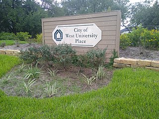
West University Place, often called West University or West U for short, is a city located in the U.S. state of Texas within the Houston–Sugar Land metropolitan area and southwestern Harris County. At the 2020 U.S. census, the population of the city was 14,955. It is nicknamed "The Neighborhood City" and is mainly a bedroom community for upper-class families.

Conroe is a city in and the county seat of Montgomery County, Texas, United States, about 40 miles (64 km) north of Houston. It is a principal city in the Houston–The Woodlands–Sugar Land metropolitan area.

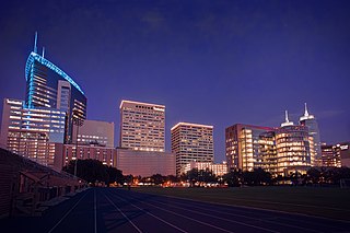
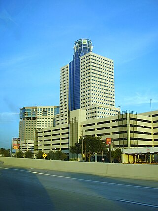
Downtown is the largest central business district in the city of Houston and the largest in the state of Texas, located near the geographic center of the metropolitan area at the confluence of Interstate 10, Interstate 45, and Interstate 69. The 1.84-square-mile (4.8 km2) district, enclosed by the aforementioned highways, contains the original townsite of Houston at the confluence of Buffalo Bayou and White Oak Bayou, a point known as Allen's Landing. Downtown has been the city's preeminent commercial district since its founding in 1836.
The Memorial area of Houston, Texas is located west of Downtown, northwest of Uptown, and south of Spring Branch. The Memorial Super Neighborhood, as defined by the City of Houston, is bounded by Buffalo Bayou to the south, Barker Reservoir to the west, Westview to the north, and the Memorial Villages, a contiguous group of independent municipalities, to the east.

Buffalo Bayou is a slow-moving body of water which flows through Houston in Harris County, Texas. Formed 18,000 years ago, it has its source in the prairie surrounding Katy, Fort Bend County, and flows approximately 53 miles (85 km) east through the Houston Ship Channel into Galveston Bay and the Gulf of Mexico. In addition to drainage water impounded and released by the Addicks and Barker reservoirs, the bayou is fed by natural springs, surface runoff, and several significant tributary bayous, including White Oak Bayou, Greens Bayou, and Brays Bayou. Additionally, Buffalo Bayou is considered a tidal river downstream of a point 440 yards (400 m) west of the Shepherd Drive bridge in west-central Houston.
Cypress is an unincorporated community in Harris County, Texas, United States, located completely inside the extraterritorial jurisdiction of the City of Houston. The Cypress area is located along U.S. Route 290 is twenty-four miles (35 km) northwest of Downtown Houston. The Cypress urban cluster ranks 50th in the top 100 highest-income urban areas in the United States.
Timeline of historical events of Houston, Texas, United States:

Upper Kirby is a commercial district in Houston, Texas, United States. It is named after Kirby Drive, so indirectly takes its name from John Henry Kirby.
The Aldine Independent School District is a public school district based in unincorporated Harris County, Texas, United States. It serves portions of Houston and unincorporated Harris County. Aldine ISD serves the communities of Aldine, most of Greenspoint, most of East Aldine, and portions of Airline, Acres Homes, Kinwood, Bordersville, and Inwood Forest. The district is part of the taxation base for the Lone Star College System. As of 2020, Dr. LaTonya Goffney serves as superintendent of schools.
Meyerland is a community in southwest Houston, Texas, outside of the 610 Loop and inside Beltway 8. The neighborhood is named after the Meyer family, who bought and owned 6,000 acres (24 km2) of land in southwest Houston.

Greater Greenspoint, also referred to as the North Houston District, is a 7-square-mile (18 km2) business district and a suburban neighborhood in northern Harris County, Texas, United States, located mostly within the city limits of Houston. Centered around the junction of Interstate 45 and Texas State Highway Beltway 8 near George Bush Intercontinental Airport, the area is a classic example of a planned edge city. The initial 2,000-acre (8.1 km2) retail and office development centered around Greenspoint Mall was a project of the Friendswood Development Company during the 1970s and early 1980s.
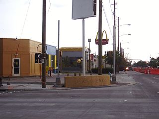
East End Houston, managed by the East End District (EED), is a district in eastern Houston, Texas, United States, located between the eastern edge of downtown to the Port of Houston and South to Hobby Airport. The District is home to Houston's early history and industry and is the site of Harrisburg, the seat of government for the Republic of Texas in 1836. East End Houston consists of many different ethnic groups, including Hispanic, Asian, White, and African American. Latinos make up more than half of the 100,512 residents, The area includes two of Houston's oldest Hispanic neighborhoods, Magnolia Park and Second Ward.

The Energy Corridor is a business district in Houston, Texas, located on the west side of the metropolitan area between Beltway 8 and the Grand Parkway. The district straddles a 7-mile (11 km) stretch of Interstate 10 from Kirkwood Road westward to Barker Cypress Road and extends south along Eldridge Parkway to Briar Forest Drive. Parts of the district overlap with the Memorial area of Houston. The district is located north of Westchase, another major business district of Houston, and east of Greater Katy.

