
Tholey Abbey in Tholey, in the district of Sankt Wendel in Saarland, is a Benedictine monastery dedicated to Saint Maurice. It is part of the Beuronese Congregation within the Benedictine Confederation.

Saint Wendelin of Trier was a hermit and abbot. He is venerated in the Eastern Orthodox and Roman Catholic Churches.
Waldstadion is the name of several stadia or football grounds in Germany and Austria:
SV Röchling Völklingen is a German association football club that plays in Völklingen, part of the greater Saarbrücken, Saarland.

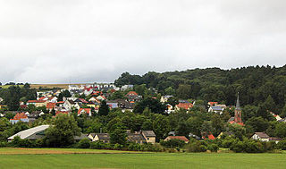
Nohfelden is a municipality in the district of Sankt Wendel, in Saarland, Germany. It is situated approximately 15 kilometres (9.3 mi) north of Sankt Wendel, and 20 kilometres (12 mi) southwest of Idar-Oberstein. It was formed during administrative reform in January, 1974 from the merger of 13 previously independent municipalities.

Kirrberg is a district of Homburg, situated in the eastern part of the Saarpfalz (Saar-Palatinate) district and the Saarland bordering state Rhineland-Palatinate. Until End 1973 was Kirrberg an independent municipality in the former Homburg district. Homburg (5 km), Zweibrücken (7 km), Saarbrücken and Kaiserslautern are the closest towns. As of October 1, 2017, 2,770 inhabitants live in Kirrberg.
Einöd is a village and a district of Homburg in the state Saarland, Germany. Once an independent municipality within the Saarpfalz-Kreis, Einöd was integrated into the city of Homburg in 1974.
Hasborn is an Ortsgemeinde – a municipality belonging to a Verbandsgemeinde, a kind of collective municipality – in the Bernkastel-Wittlich district in Rhineland-Palatinate, Germany.

Hahnweiler is an Ortsgemeinde – a municipality belonging to a Verbandsgemeinde, a kind of collective municipality – in the Birkenfeld district in Rhineland-Palatinate, Germany. It belongs to the Verbandsgemeinde of Baumholder, whose seat is in the like-named town.

SV Rot-Weiss Hasborn-Dautweiler is a German association football club from Tholey, Saarland.
The Verbandsliga Saarland is currently the seventh tier of the German football league system in the German federal state of Saarland. Until the introduction of the Saarlandliga in 2009 it was the sixth tier, until the introduction of the 3. Liga in 2008 it was the fifth tier of the league system, until the introduction of the Regionalligas in 1994 the fourth tier.
The Amateurliga Saarland was the highest football league in the state of Saarland and the third tier of the German football league system from 1951, when the clubs from the Saar returned to Germany, till the formation of the Oberliga Südwest and the Verbandsliga Saarland below it in 1978.
The Saarland Cup is one of the 21 regional cup competitions of German football. The winner of the competition gains entry to the first round of the German Cup. It is limited to clubs from Saarland, however, teams from the Bundesliga and 2. Bundesliga are not permitted to compete.

The Saar-Hunsrück Nature Park was established in 1980 and covers an area of just under 2,000 km² in the German states of Rhineland-Palatinate and the Saarland.

Bisten is a village in the municipality of Überherrn in Saarland, Germany. It was an independent municipality until January 1974, when it was merged with Überherrn. It is situated on the river Bist, close to the border with France.

VfB Theley is a German association football club from the Theley suburb of the town of Tholey, Saarland. The club's greatest success has been promotion to the second tier 2. Oberliga Südwest in 1958 where it played for five seasons. After the introduction of the Bundesliga in 1963 Theley spent another three seasons at the second tier, now the Regionalliga Südwest before dropping out of higher level football altogether in 1974.

St. Wendel station is the most important station in the town of St. Wendel in the German state of Saarland. The station is located at line-kilometer 106.3 of the Nahe Valley Railway (Nahetalbahn) and was the beginning of the now dismantled St. Wendel–Tholey railway. It was opened during the extension of the Nahe Valley Railway from Idar-Oberstein via Türkismühle to Neunkirchen (Saar) on 26 May 1860.


