
Franconia is a region of Germany, characterised by its culture and East Franconian dialect. Franconia is made up of the three Regierungsbezirke of Lower, Middle and Upper Franconia in Bavaria, the adjacent, Franconian-speaking South Thuringia, south of the Thuringian Forest—which constitutes the language boundary between Franconian and Thuringian—and the eastern parts of Heilbronn-Franconia in Baden-Württemberg.

Aschaffenburg is a town in northwest Bavaria, Germany. The town of Aschaffenburg is not part of the district of Aschaffenburg, but is its administrative seat.

Spessart is a Mittelgebirge, a range of low wooded mountains, in the States of Bavaria and Hesse in Germany. It is bordered by the Vogelsberg, Rhön and Odenwald. The highest elevation is the Geiersberg at 586 metres above sea level.
Main-Spessart is a Landkreis (district) in the northwest of Bavaria, Germany. It is located in Lower Franconia and derives its name from the river Main and the wooded hills of the Spessart.

The Rhön Mountains are a group of low mountains in central Germany, located around the border area where the states of Hesse, Bavaria and Thuringia come together. These mountains, which are at the extreme southeast end of the East Hesse Highlands, are partly a result of ancient volcanic activity. They are separated from the Vogelsberg Mountains by the river Fulda and its valley. The highest mountain in the Rhön is the Wasserkuppe, which is in Hesse. The Rhön Mountains are a popular tourist destination and walking area.

Wertheim is a town in southwestern Germany, in the state of Baden-Württemberg with a population of around 23,400. It is located on the confluence of the rivers Tauber and Main. Wertheim is best known for its landmark castle and medieval town centre.

Lohr am Main is a town in the Main-Spessart district in the Regierungsbezirk of Lower Franconia (Unterfranken) in Bavaria, Germany and the seat of the Verwaltungsgemeinschaft of Lohr am Main. It has a population of around 15,000.

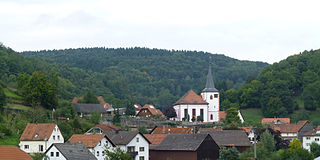
Hasloch is a community in the Main-Spessart district in the Regierungsbezirk of Lower Franconia (Unterfranken) in Bavaria, Germany and a member of the Verwaltungsgemeinschaft of Kreuzwertheim. Hasloch has a population close to 1,400.
Flörsbachtal is a municipality in the Main-Kinzig district, in Hesse, Germany. It has a population close to 2,400. Flösbachtal contains both the oldest parish and the youngest settlement established in the Spessart hills. Located within the municipal territory is the Hermannskoppe, the highest elevation in the Hessian part of the Spessart and the Wiesbüttmoor, a rare hanging bog.

The Kahl is a river in the northern Spessart in Bavaria and Hesse, Germany. It is a right tributary of the Main and is 35.6 km (22.1 mi) long. The name Kahl comes from the Old High German word kaldaha, which means cool and clear. The Kahl rises from two sources left and right of the road at the foot of the Spessart hills, near Kleinkahl. These springs produce 50–60 litres per second. The Kahl flows into the river Main in Kahl am Main. The mouth is near the old Kahl Nuclear Power Plant. The largest tributaries are Westerbach, Sommerkahl, Reichenbach and Geiselbach.
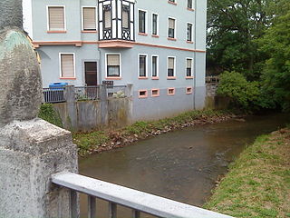
The Aschaff is a river in the northern Spessart in Bavaria, Germany.

Hafenlohr is a river of Bavaria, Germany. It is around 28 km (17 mi) long and discharges into the Main at the town of Hafenlohr. The Hafenlohr is located in the districts of Aschaffenburg and Main-Spessart in the Lower Franconia region.

Lohr is a right tributary of the Main in Germany. Although its origins lie in the Main-Kinzig district of Hessen, most of the course of the Lohr is in the Main-Spessart district of Bavaria. Including its source river Lohrbach, it is 23.0 km long.
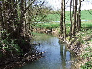
Aschbach is a river in Lower Franconia, Bavaria, Germany.

Blankenbach is a small river of Bavaria, Germany.

Edelbach is a small river of the district Aschaffenburg in the Bavarian part of the Spessart, Germany.

Elsava is a 27-kilometre-long (17 mi) right tributary of the Main in the administrative districts Aschaffenburg and Miltenberg in the Bavarian Spessart. It flows into the river Main in Elsenfeld. The short section upstream from Hessenthal to Mespelbrunn is called Kaltenbach.
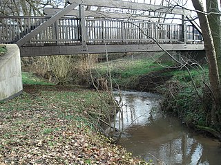
The Sailaufbach is a stream in Bavaria, Germany. It flows in the low mountain range of the Spessart. It is a right-hand and northwestern tributary of the Laufach in the district of Aschaffenburg in Lower Franconia, flowing into the Laufach near Hösbach. It is 6.5 km long and the largest tributary of the Laufach.

The Eselsweg is a long-distance hiking trail that follows an ancient trade route through the Mittelgebirge Spessart, in the states of Hesse and Bavaria, Germany. It is 111 km long and leads from Schlüchtern in the valley of the Kinzig river to Großheubach on the river Main. The trail follows an ancient trade route on which donkey caravans used to transport salt, thus giving rise to the name.
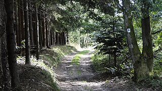
The Birkenhainer Straße is a long-distance hiking trail that follows an ancient trade route through the Mittelgebirge Spessart, in the states of Hesse and Bavaria, Germany. It is 71 km long and leads from Hanau to Gemünden am Main, cutting across the so-called Mainviereck, a large loop of the river Main. The trail follows an ancient trade route which in the Middle Ages was an important road for moving troops and for long-distance trade. The Birkenhainer Straße was a part of the link between Nuremberg and Antwerp. Its origins may lie back as far as the Neolithic period. The name likely derives from a prominent copse of birch trees that used to exist near the road at Geiselbach (Hesse).

