
Oswaldtwistle is a town in the Hyndburn borough of Lancashire, England, 3 miles (5 km) southeast of Blackburn, contiguous with Accrington and Church. The town has a rich industrial heritage, being home to James Hargreaves, inventor of the spinning jenny, and Robert "Parsley" Peel of calico printing fame. The Leeds and Liverpool Canal passes through the town and was responsible for the export of much of the area's cotton produce.
Aislaby is a small village and civil parish on the north bank of the River Tees within the borough of Stockton-on-Tees and the ceremonial county of County Durham, England. It is located to the west of Eaglescliffe and Yarm. The name, first attested as Asulue(s)bi in 1086, is of Viking origin and means "Aslak's farm." Aislaby was listed in the Domesday Book of 1086.

Killerby is a village in the borough of Darlington and the ceremonial county of County Durham, England. It is situated a few miles to the west of Darlington. Details are maintained in the parish of Staindrop.

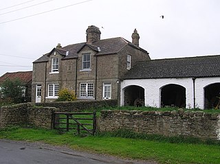
Cornsay is a hamlet and civil parish in County Durham, England. The population of the Civil Parish taken at the 2011 census was 1,128. It is 6 miles (9.7 km) southeast of Consett and 7 miles (11 km) southwest of Durham. It consists of nineteen dwellings, including four farms & is the home of Greenacres nudist club. All formerly belonged to Ushaw College for the training of Catholic priests, hence the organised nomenclature. East and West Farms are now in private hands as homes but the other two are still active, South Farm run by the Suddes family and North Farm by the Tweddle family.

Waskerley is a village in County Durham, England. It is situated six miles to the southwest of Consett and three miles southwest of Castleside and the A68. Stanhope in the Durham Dales is a further six miles to the southwest and the Derwent Reservoir and the village of Edmundbyers is approximately five miles to the north. The village of Muggleswick is three miles to the north.

Ingleton is a village and civil parish in County Durham, England. The population of the parish as taken at the 2011 census was 420. It is situated about eight miles to the west of Darlington, and a short distance from the villages of Langton, Hilton and Killerby. The Church of St John the Evangelist in Ingleton was built in 1843 by Ignatius Bonomi and J.A. Cory., and is a Grade II listed building.

Cornriggs is a hamlet in the civil parish of Stanhope, in County Durham, England. It is situated on the north side of Weardale in the North Pennines, which is designated as both an Area of Outstanding Natural Beauty and a UNESCO Global Geopark.

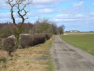
High Haswell is a settlement in County Durham, in England. It is situated at the crest of a hill close to Haswell, a few miles to the east of Durham. The original village of Haswell was located where High Haswell is now, where only a handful of dwellings and farms remain. There is archaeological evidence of pre-Roman settlement.
High Hesleden is a village in Monk Hesleden parish, County Durham, in England. It is situated a few miles north of Hartlepool, between Blackhall Rocks and Hesleden.

Houghton-le-Side is a small village in the borough of Darlington and the ceremonial county of County Durham, England. It is situated a few miles to the south-west of Newton Aycliffe.
Monk Hesleden is a village and civil parish in County Durham, England. The population of the parish at the 2011 Census was 5,722. The parish is situated to the north-west of Hartlepool, and is on the North Sea coast. Monk Hesleden village is situated a short distance to the south of High Hesleden.

Moor End is a place in County Durham, England. It is situated immediately to the east of Durham, close to Gilesgate Moor and Carrville. It is situated within the parish of Belmont and as Belmont and Carrville have expanded is now largely indistinct from its neighbours.

Morley is a village in County Durham, England. It is situated five miles to the west of Bishop Auckland. Morley is first mentioned in 1295, already with its present spelling; its coal mine was mentioned, as Morleypitte already in c. 1440. The name probably means "open ground by a moor", from Old English mōr "moor, clearing, pasture" + lẽah "open ground, clearing".
Morton Tinmouth is a hamlet of a few farms in County Durham, England. It is situated a few miles to the north-west of Darlington close to the village of Bolam.
Butterwick is a small village in County Durham, England. It is situated a short distance to the south east of Fishburn.

Haswell Plough is a village in County Durham, England. It is situated between Durham and Peterlee, south of Haswell. Haswell Plough was first mentioned in the 12th century as being one of three parts of the village of Haswell. It is also the village where MEP of thirty years Stephen Hughes was brought up.
Croxdale and Hett is a civil parish in County Durham, England. It is situated approximately four miles south of Durham. The population of the civil parish as taken at the 2011 census was 866.

Baldersdale is a dale, or valley, on the east side of the Pennines in England, northwest of Barnard Castle. Its principal settlements are Hury and Briscoe. Baldersdale lies within the traditional boundaries of the North Riding of Yorkshire. Under provisions of the Local Government Act 1972, it was incorporated into County Durham for administrative purposes on 1 April 1974, along with the rest of the former Startforth Rural District.

Lambrigg Fell is a hill, the highest point of the area of high ground between Kendal and the M6, in south-eastern Cumbria, England.

Eilean Meadhonach is the second largest of the Crowlin Islands, located in the Inner Sound off the island of Skye, Scotland.
