
The Sabarmati River is one of the major west-flowing rivers in India. It originates in the Aravalli Range of the Udaipur District of Rajasthan and meets the Gulf of Khambhat of Arabian Sea after travelling 371 km (231 mi) in a south-westerly direction across Rajasthan and Gujarat. 48 km (30 mi) of the river length is in Rajasthan, while 323 km (201 mi) is in Gujarat.

Sabarkantha district is one of the 33 districts of Gujarat state of India, located in the northeastern part of the state. The administrative headquarters of the district are located in Himatnagar.

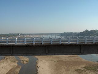
Himatnagar or Himmatnagar is a city and the headquarters of Sabarkantha district in the Indian state of Gujarat. The city is on the bank of the river Hathmati.
Originating from Pavagadh in the Panchmahal District of Gujarat, the Vishwamitri River flows mainly through the west of the city of Vadodara. The name of this river is said to have been derived from the name of the great saint Vishwamitra. Two other tributaries namely Dhadhar and Khanpur merge into it before it amalgamates with the Gulf of Khambhat. Human settlement dating back to 1000 B.C has been found on the bank of river Vishwamitri which ascertains the existence of Stone Age Era. Also in the beginning of the Christian era, a small township was developed on a mound on the banks of this river which later came to be known as Ankotakka while the mound is popular as Dhantekri. The Vishwamitri River was key to the settlement of Vadodara.
Auranga River is a river in western India in Gujarat whose origin is Near Bhervi village. Its basin has a maximum length of 97 km. The total catchment area of the basin is 699 square kilometres (270 sq mi).
Dai-minsar River is a river in Gujarat whose origin is near Moincêr. Its basin has a maximum length of 100 km. The total catchment area of the basin is 1180 km2.

Hiran River is a river in Gujarat in western India, whose source is near the Sasa hills in Gir forest. Its drainage basin has a maximum length of 40 km. The total catchment area of the basin is 518 km. Its major tributaries are the Saraswati River and Ambakhoi stream, and many other unknown branches make this river almost complete near Talala town. Hiran is a major river system which supports a variety of wildlife ecological systems and human settlements. Kamleshwar Dam, often known as Hiran-1 and Umrethi Dam, are some of the major projects on the river. As the river flows from the western part of Gir forest, it is a major source of water for the forest's ecology and biodiversity for the whole year.

Khari River is a river in Western India. It is a tributary of the West Banas River, originating from the Aravalli hills in Sirohi district. It flows in a southwestern direction through Rajasthan and passes through Banaskantha and Mehsana districts in Gujarat before draining into the Little Rann of Kachchh.
Kolak River is a river in Gujarat in western India whose origin is Kaprada taluka. . Its basin has a maximum length of 50 km. The total catchment area of the basin is 584 km2.
Machchundri River is a river in Gujarat, Western India. It originates from Gir Forest and meets in Arabian Sea. The maximum length of the river is 59 km and its total catchment area is approx. 406 km2.
Padalio River is a river in western India in Gujarat whose origin is Khambhaliya hills. Its drainage basin has a maximum length of 110 km. The total catchment area of the basin is 345 square kilometres (133 sq mi).
Rangmati River is a river in western India in Gujarat whose origin is near Rampar. Its basin has a maximum length of 50 km. The total catchment area of the basin is 518 km2. The city of Jamnagar lies on the banks of this river.

Saraswati River is a river in western India in Gujarat whose origin is aravali hill. Its basin has a maximum length of 360 km. The total catchment area of the basin is 370 square kilometres (140 sq mi). The Mokeshwar or Mukteshwar dam is on the Saraswati River.
Suvi River is a river in western India in Gujarat whose origin is near Badargadh village. Its basin has a maximum length of 32 km. The total catchment area of the basin is 160 km2. The Suvi Irrigation Scheme was sanctioned by Government in February 1959 at an estimated cost of Rs. 20.46. The river is now dammed by the Suvi Dam, a 15 metre high dam completed in 1966.
The Sang river is the name of a river which drains through Anjar taluka of Kutch, Gujarat, India.
The Demi River is a river in Saurashtra region of Gujarat, India.
Balaram River is a river in Banaskantha district of Gujarat, India. It flows entirely in Banaskantha district and merges into Banas River at 14 km before Dantiwada Dam.
The Orsang River flows through the Chhota Udaipur district and Vadodara district in Gujarat, India. It joins with the Narmada River at the village of Chandod. It is originates from the forest of Bhavra in Madhya Pradesh and enters in Gujarat near Chhota Udepur town.

Meshwo or Meshwa is a river flowing in the north and central parts of Gujarat, India. It is the tributary of the Sabarmati and subtribunary of the Vatrak River. It rises in the Panchara hills of Aravalli range in the Dungarpur district of Rajasthan and enters Gujarat at Shamlaji.

