The Yungay Province is one of twenty provinces of the Ancash Region in Peru.
Lake Atuncocha, also known as LakeCullicocha (possibly from Quechua kulli a color between blue and carmine is a lake in Peru located in the Ancash Region, Huaylas Province, Santa Cruz District. It is situated at a height of about 4,625 metres, about 1.88 km long and 0.6 km at its widest point. Lake Atuncocha lies in the Cordillera Blanca, northwest of Santa Cruz and Pergarumi, between Lake Rajucocha in the east and Lake Collorcocha in the west.
Jatuncocha is a lake in the Cordillera Blanca in the Andes of Peru located in the Ancash Region, Huaylas Province, Santa Cruz District. It is situated at a height of 3,886 m (12,749 ft) comprising an area of 0.486550 km2 (486,550 m2). Jatunccocha lies in the Santa Cruz gorge between the peaks of Quitaraju in the north and Caraz in the south, northeast of a smaller lake named Ichiccocha.

Jatunñaño Punta or Jatunñano Punta is a mountain in the Vilcanota mountain range in the Andes of Peru, about 5,812 metres (19,068 ft) high. It is situated in the Cusco Region, Canchis Province, Pitumarca District, and in the Quispicanchi Province, Marcapata District. Jatunñaño Punta lies north of the lake Sibinacocha.

Kunka is a mountain in the La Raya mountain range in the Andes of Peru. It is situated at the La Raya Pass and the road and rail which connect Cusco with Lake Titicaca. It is located in the Cusco Region, Canas Province, Layo District, and in the Puno Region, Melgar Province, Santa Rosa District, and about 5,200 metres (17,060 ft) high. Kunka lies southwest of the mountains Yana Khuchilla and Chimpulla. Other neighboring mountains are Huch'uy K'uchu north of it and Hatun Ichhuna Kunka in the south. Between the road and the mountain there is a little lake named Q'umirqucha.
Hatun Machay is a rock forest with archaeological remains in Peru. It was declared a National Cultural Heritage by Resolución Directoral No. 944/INC-2010 on May 7, 2010. Hatun Mach'ay is situated on the western side of the Cordillera Negra in the Ancash Region, Recuay Province, Pampas Chico District, at a height of about 4,200 metres (13,780 ft).
Quello Cunca is a mountain in the Vilcanota mountain range in the Andes of Peru, about 5,100 metres (16,732 ft) high. It is situated in the Cusco Region, Quispicanchi Province, Marcapata District. Quello Cunca lies southwest of the mountains Sullulluni, Llusca Ritti and Jori Pintay, southwest of the mountain Tocllayoc and north of the mountain Condor Puñuna.
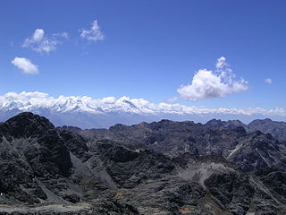
Jatuncunca, Janyaraju or Jangyraju is a mountain in the Cordillera Blanca of the Andes of Peru, about 5,600 metres (18,373 ft) high. It is located in the Ancash Region, Huaraz Province, on the border of the districts Independencia and Tarica. Jatuncunca lies west of Ocshapalca.
Quri Kunka is a mountain in the Peruvian Andes, about 4,600 metres (15,092 ft) high. It is located in the Puno Region, Azángaro Province, San Antón District. Quri Kunka lies southwest of the mountain Ichhu Muruq'u and northwest of Yuraq Apachita.

Cuncapata is a mountain in the Vilcanota mountain range in the Andes of Peru, about 5,400 metres (17,717 ft) high. It is located in the Cusco Region, Canchis Province, Pitumarca District. Cuncapata lies southwest of the mountain Jatunñaño Punta, north of the lake Sibinacocha and southeast of Chumpe.
Jatun Punta is a mountain in the Vilcanota mountain range in the Andes of Peru, about 5,200 metres (17,060 ft) high. It is situated in the Cusco Region, Quispicanchi Province, Ocongate District. Jatun Punta lies southwest of Callangate and west Puca Punta.
Huch'uy K'uchu is a 5,339-metre-high (17,516 ft) mountain in the La Raya mountain range in the Andes of Peru. It is located in the Cusco Region, Canas Province, Layo District, and in the Canchis Province, Marangani District. Huch'uy K'uchu lies near the La Raya pass northwest of Chimpulla and north of Kunka. It stretches along the Hatun K'uchu valley from west to east whose stream flows to the Willkanuta River.
Hatun Ichhuna Kunka is a mountain in the La Raya mountain range in the Andes of Peru, about 5,000 metres (16,404 ft) high. It is located in the Cusco Region, Canas Province, Layo District, and in the Puno Region, Melgar Province, Santa Rosa District. Hatun Ichhuna Kunka lies near the La Raya pass southwest of Kunka. Huch'uy Ichhuna Kunka and Pichaqani are the lower elevations of the ridge to the northwest.
Yana Ranra is a mountain in the La Raya mountain range in the Andes of Peru, about 5,000 metres (16,404 ft) high. It is located in the Cusco Region, Canas Province, Layo District, and in the Canchis Province, Marangani District. Yana Ranra lies near the La Raya pass northwest of Chimpulla and Kunka and southwest of Huch'uy K'uchu. It is situated at the Hatun K'uchu valley whose stream flows to the Willkanuta River.
Hatun Usnu is an archaeological site in Peru on a mountain of the same name (Jatunhosno). It is located in the Ayacucho Region, Huamanga Province, Chiara District.
Jupucunca is a 5,295-metre-high (17,372 ft) mountain in the Vilcanota mountain range in the Andes of Peru. It is situated in the Cusco Region, Canchis Province, on the border of the districts of San Pablo and Sicuani.
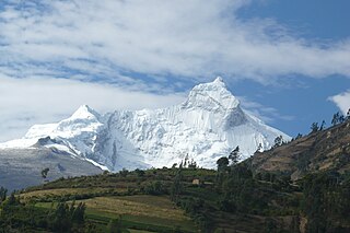
Rocotopunta is a mountain in the Cordillera Blanca in the Andes of Peru which reaches a height of approximately 5,400 m (17,717 ft). It is located in the Ancash Region, Huaylas Province, Caraz District, and in the Yungay Province, Yungay District. Rocotopunta lies west of Huandoy.
Qaqa Rumi Kunka is a mountain in the Cordillera Negra in the Andes of Peru which reaches a height of approximately 4,600 m (15,100 ft). It is located in the Ancash Region, Huaylas Province, Pamparomas District, and in the Yungay Province, Quillo District.
Hatun Hirka is a mountain in the Cordillera Negra in the Andes of Peru which reaches a height of approximately 3,400 m (11,200 ft). It is located in the Ancash Region, Huaylas Province, Pamparomas District, and in the Santa Province, Cáceres del Perú District, northwest of Pamparomas.
Puka Ranra is a mountain in the Cordillera Negra in the Andes of Peru which reaches a height of approximately 4,600 m (15,100 ft). It is located in the Ancash Region, Yungay Province, Quillo District. Puka Ranra lies southwest of a lake named Qanchisqucha.