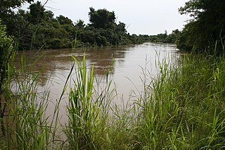
Virunga National Park is a national park in the Albertine Rift Valley in the eastern part of the Democratic Republic of the Congo. It was created in 1925. In elevation, it ranges from 680 m (2,230 ft) in the Semliki River valley to 5,109 m (16,762 ft) in the Rwenzori Mountains. From north to south it extends approximately 300 km (190 mi), largely along the international borders with Uganda and Rwanda in the east. It covers an area of 8,090 km2 (3,120 sq mi).

The High Atlas, also called the Grand Atlas, is a mountain range in central Morocco, North Africa, the highest part of the Atlas Mountains.

The W National Park or W Regional Park is a major national park in West Africa around a meander in the Niger River shaped like the letter W. The park includes areas of the three countries Niger, Benin and Burkina Faso, and is governed by the three governments. Until 2008, the implementation of a regional management was supported by the EU-funded project ECOPAS. The three national parks operate under the name W Transborder Park. The section of W National Park lying in Benin, measuring over 8,000 km2 (3,100 sq mi), came under the full management of African Parks in June 2020. In Benin, W National Park is contiguous with Pendjari National Park which is also under the management of African Parks.

The Mongolian-Manchurian grassland, also known as the Mongolian-Manchurian steppe or Gobi-Manchurian steppe, in the temperate grassland biome, is an ecoregion in East Asia covering parts of Mongolia, the Chinese Autonomous region of Inner Mongolia, and Northeast China.

The Mediterranean woodlands and forests is an ecoregion in the coastal plains, hills, and mountains bordering the Mediterranean Sea and Atlantic Ocean in North Africa. It has a Mediterranean climate, and is in the Mediterranean forests, woodlands, and scrub biome.

Mediterranean conifer and mixed forests is an ecoregion, in the temperate coniferous forest biome, which occupies the high mountain ranges of North Africa. The term is also a botanically recognized plant association in the African and Mediterranean literature.

The Klamath Mountains ecoregion of Oregon and California lies inland and north of the Coast Range ecoregion, extending from the Umpqua River in the north to the Sacramento Valley in the south. It encompasses the highly dissected ridges, foothills, and valleys of the Klamath and Siskiyou Mountains. It corresponds to the Level III ecoregion designated by the Environmental Protection Agency and to the Klamath-Siskiyou forests ecoregion designated by the World Wide Fund for Nature.

The St. Lawrence Parks Commission is a Crown agency of the Government of Ontario that manages parks and heritage sites along the shoreline of the St. Lawrence River in southeastern Ontario. It functions similarly to the Niagara Parks Commission's role in overseeing attractions and conservation on the Ontario side of the Niagara River.

Ifrane National Park is a national park located in the Middle Atlas mountain range, in Morocco. Its territory extends over the Western part of the Middle Atlas mountains and areas within the provinces of Ifrane and Boulmane. It was established in 2004 and covers an area of 125,000 hectares. Much of the park is forested with Atlas cedar. Ifrane National Park is one of the few remaining habitats for the Barbary macaque, Macaca sylvanus; this primate prehistorically had a much broader range in North Africa, but currently survives as an endangered species in narrowly restricted and fragmented habitats.

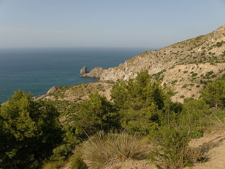
Al Hoceima National Park is a national park located outside the town of Al Hoceima in Morocco. It covers an area of 480 km2 (185 sq mi), including 196 km2 (76 sq mi) of sea. The park was created in 2004 and is managed by the Haut-Commissariat des eaux et forêts et de la lutte contre la désertification.

Réunion National Park is a National Park of France located on the island of Réunion, an overseas department in the western Indian Ocean. Established on 5 March 2007, the park protects the endemic ecosystems of Les Hauts, Réunion's mountainous interior, and covers around 42% of the island. Notable endemic species include the Réunion cuckooshrike and the Reunion Island day gecko.
The Arboretum de la Foux, also known as the Arboretum de Saint-Sauveur-des-Pourcils, is an arboretum located within the Forêt de l'Aigoual near Saint-Sauveur-Camprieu, northwest of Le Vigan, Gard, Languedoc-Roussillon, France. It is open daily without charge.
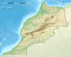
Morocco provides a refuge for a rich and diverse flora with about 4,200 taxa, of which 22% are endemic. The phytogeographic zones of Morocco comprise 8 zones: the Mediterranean zone, the Cedar zone (1000-2000m), the sub-Alpine zone (2,000-2,500m), the Alpine zone (2,500m+), the semi-desert scrub zone, the Reg, the sandy desert zone and the oases.

Chefchaouen is a province in the Moroccan economic region of Tanger-Tetouan-Al Hoceima.
The Ait Yafelman are a large Berber tribal confederation of the eastern High Atlas of Morocco, with their capital at Imilchil. They consist of four tribes: Ayt Morghad, Ayt Haddidou, Ayt Izdeg and Ayt Yehia. These tribes created the alliance in the 17th century to counter the expansion of their Ait Atta neighbours. The Ait Yafelman speak Central Atlas Tamazight.

The Southeastern conifer forests are a temperate coniferous forest ecoregion of the southeastern United States. It is the largest conifer forest ecoregion east of the Mississippi River. It is also the southernmost instance of temperate coniferous forest within the Nearctic realm.

Lake Tislit is a lake located in Morocco's Haut Atlas Oriental National Park, in the administrative division of Imilchil. This is an "agdal" where the tribes of Ayt Ḥdiddu lead their flocks during the summer. The lake has been designated as a protected Ramsar site since 2005.

Prespa National Park is a national park situated in southeastern Albania on the border triangle shared with Greece and North Macedonia. At approximately 277.5 km2 (107.1 sq mi), the park encompasses the country's sections of the Great and Small Prespa Lake. It is considerably characterised by high mountains, narrow islands, vast freshwater wetlands, salt marshes, meadows, reed beds and dense forests.

The Mediterranean High Atlas juniper steppe is a montane grasslands and shrublands ecoregion in Morocco. It extends along the High Atlas range of northwestern Africa's Atlas Mountains.

Parc naturel régional de la Martinique is one of 54 French regional nature parks. With a surface area of approximately 63,000 ha (240 sq mi), it covers more than half of the island, overlapping 32 of 34 communes - including approximately 100,000 inhabitants. The park works to preserve one of 34 biodiversity hotspots on the planet. The biodiversity hotspot map identifies areas for preservation by two criteria, one being a certain rate of endemism: that the flora and fauna are not found elsewhere, and because at least 70% of its primary vegetation has been lost.


