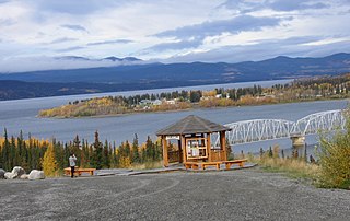
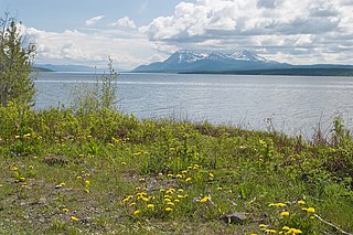
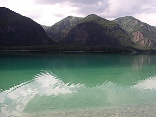
The Teslin Tlingit Council (TTC) is a First Nation band government in the central Yukon in Canada, located in Teslin, Yukon along the Alaska Highway and Teslin Lake. The language originally spoken by the Teslin Tlingit or Deisleen Ḵwáan is Tlingit. Together with the Taku River Tlingit or Áa Tlein Ḵwáan around Atlin Lake of the Taku River Tlingit First Nation in British Columbia, they comprise the Inland Tlingit.

The community of Teslin includes the Village of Teslin in Yukon, Canada. Teslin is situated at historical Mile 804 on the Alaska Highway along Teslin Lake. The Hudson's Bay Company established a small trading post at Teslin in 1903. In the 2011 census, the population of the village was 122, a decrease of 13.5% from the 2006 census, and that of the reserve was 138, a decrease of 11.5% from 2006.

The Teslin River is a river in southern Yukon Territory and northwestern British Columbia, Canada, that flows 632 kilometres (393 mi) from its source south of Teslin Lake to its confluence with the Yukon River.
CIAY-FM, branded as Life 100.7, is a Christian radio station in Whitehorse, Yukon, Canada. CIAY-FM broadcasts at 100.7 FM airing a combination of religious programming and Contemporary Christian music.

Teslin Lake is a large lake spanning the border between British Columbia and Yukon, Canada. It is one of a group of large lakes in the region of far northwestern BC, east of the upper Alaska Panhandle, which are the southern extremity of the basin of the Yukon River, and which are known in Yukon as "the Southern Lakes". The lake is fed and drained primarily by the Teslin River, south and north, but is also fed from the east by the Jennings River and the Swift River, and from the west by the Hayes River.
The Stikine Plateau is a plateau in northern British Columbia, Canada. It lies between the Boundary Ranges of the Coast Mountains on the west and southwest and the Cassiar Mountains along its northeast, and between the Skeena Mountains on its south and southeast and the Jennings and Nakina Rivers on the north.
The Yukon Plateau is a plateau located in the Yukon Territory, comprising much of the central and southern Yukon Territory and the far northern part of British Columbia, Canada between Tagish Lake (W) and the Cassiar Mountains (E) and north of the Nakina River.
The Nisutlin Plateau is a plateau in northern British Columbia, Canada, extending from Teslin Lake to the Cassiar Mountains.
The Swift River is a river that begins in Yukon Territory and flows southwest into British Columbia to its mouth at the east side of Teslin Lake on the Teslin River system. The river drains the uppermost portion of the Cassiar Mountains and in its lower reaches traverses the Nisutlin Plateau, which lies along the east side of Teslin Lake north of the mouth of the Jennings River, which is to the south of the Swift.
The Jennings River is a river in far northern British Columbia, Canada, rising in the northern reaches of the Stikine Ranges of the Cassiar Mountains, at first running southwest, then turning northeast near the Tuya Range to enter Teslin Lake at its southern end, just to the east of the estuary of the Teslin River; also joining the lake in the same area is the Hayes River. The lower reaches of the Jennings form the boundary of the Nisutlin Plateau, which extends north into the Yukon along the eastern flank of Teslin Lake and to the west of the northernmost reaches of the Stikine Ranges; Simpson Peak is one of the few named summits in that region of the Stikines, and stands above the lower Jennings to the east of its estuary. To the south of the Jennings, west of the Tuya Range, is the Kawdy Plateau, which includes the small but rugged Atsutla Range, and southwest of which is the course of the Teslin River, which traverses the Kawdy, a subset of the Stikine Plateau, from south to north.
Simpson Peak 2170 m is the northernmost officially-named summit in the Stikine Ranges of the Cassiar Mountains system in northernmost British Columbia, Canada. It stands on the north side of the lower reaches of the Jennings River, just east of the south end of Teslin Lake, and is to the south of Swan Lake, which is an expansion of the Swift River. The mountain is named for Scott Simpson, an early explorer in the area. The next-highest summit in the unnamed subrange of the Cassiars to the north of the Jennings River is Toozaza Peak.
The Teslin Plateau is a plateau, of the Yukon Plateau physiographic section, in northern British Columbia, Canada, located north of the Nakina River between Atlin Lake and Teslin Lake.
The Taku Plateau is a sub-plateau of the Stikine Plateau in the far northwestern Interior of British Columbia, Canada. It lies to the south of the Teslin Plateau, part of the Yukon Plateau and to the southeast of the Yukon Plateau's other major sub-area within British Columbia, the Tagish Highland. Immediately northeast is the Kawdy Plateau and to the northwest of the Nahlin Plateau. The Inklin River forms the plateau's southwestern boundary with the northwestern extremities of the Tahltan Highland, beyond which are the Boundary Ranges. Very mountainous, its highest summit is Nahlin Mountain.
The Taku River Tlingit First Nation are the band government of the Inland Tlinkit in far northern British Columbia, Canada and also in Yukon. They comprise two ḵwaan (tribes) of the Tlingit people, who are otherwise coastal, the Áa Tlein Ḵwáan of the Atlin Lake area and the Deisleen Ḵwáan of Teslin Lake, whose main focus is the Teslin Tlingit Council in Teslin, Yukon. Their band offices are in Atlin, British Columbia.

The Terminal Range is the northernmost mountain range of the Canadian Rockies, so-named for its position at the northern terminus of the Rockies. Lying west of Muncho Lake and the Trout River, its northern perimeter is the Liard River. The Sentinel Range lies to its east.
Teslin is the anglicized form of the name of the Deisleen Ḵwáan of the Tlingit people, one of two ḵwáan that are today incorporated as the Teslin Tlingit Council government in the Yukon Territory of northern Canada. As a term it may also refer to:
Teslin Lake is an unincorporated area in the Yukon Territory, Canada, located a few kilometres northwest from the Village of Teslin, which is also on the east shore of Teslin Lake.
Teslin River is an unincorporated area in the Yukon Territory, Canada, located on the west bank of the Teslin River at a crossing of that river on the Alaska Highway, about 40 km (25 mi) northwest of the Village of Teslin, which is on the east shore of Teslin Lake as is the neighbouring community of Teslin Lake. The settlement of Johnsons Crossing is on the east bank at that point, while the lake and community of Little Teslin Lake is located farther along the highway about 10 km (6 mi) west.

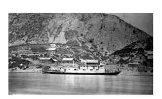
Steamboats operated on the Stikine River in response to gold finds in along that river and in the Cassiar Country of northwestern British Columbia, Canada.


