The Dwight D. Eisenhower National System of Interstate and Defense Highways, commonly known as the Interstate Highway System, or the Eisenhower Interstate System, is a network of controlled-access highways that forms part of the National Highway System in the United States. The system extends throughout the contiguous United States and has routes in Hawaii, Alaska, and Puerto Rico.

Interstate 43 (I-43) is a 191.55-mile-long (308.27 km) Interstate Highway located entirely within the US state of Wisconsin, connecting I-39/I-90 in Beloit with Milwaukee and I-41, U.S. Highway 41 (US 41) and US 141 in Green Bay. State Trunk Highway 32 (WIS 32) runs concurrently with I-43 in two sections and I-94, I-894, US 10, US 41, US 45, and WIS 57 overlap I-43 once each. There are no auxiliary or business routes connected to I-43, though an alternate route to direct traffic during road closures is signed along local and state highways from Milwaukee County north into Brown County.

Interstate 64 (I-64) is an east–west Interstate Highway in the Eastern United States. Its western terminus is at I-70, U.S. Route 40 (US 40), and US 61 in Wentzville, Missouri. Its eastern terminus is at the Bowers Hill Interchange with I-264 and I-664 at Bower's Hill in Chesapeake, Virginia. I-64 connects Greater St. Louis, the Louisville metropolitan area, the Lexington–Fayette metropolitan area, the Charleston metropolitan area, the Greater Richmond Region, and Hampton Roads.
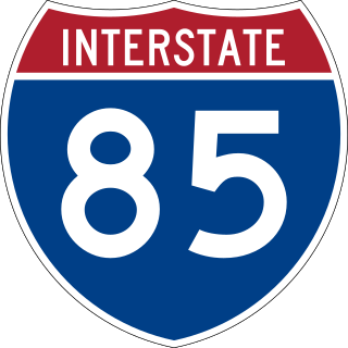
Interstate 85 (I-85) is a major Interstate Highway in the Southeastern United States. Its southern terminus is at an interchange with I-65 in Montgomery, Alabama; its northern terminus is an interchange with I-95 in Petersburg, Virginia, near Richmond. It is nominally north–south as it carries an odd number, but it is physically oriented northeast–southwest and covers a larger east–west span than north–south. While most Interstates that end in a "5" are cross-country, I-85 is primarily a regional route serving five southeastern states: Virginia, North Carolina, South Carolina, Georgia, and Alabama.
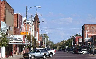
Lexington is a city in Dawson County, Nebraska, United States. The population was 10,348 at the 2020 census, making it the 16th most populous city in Nebraska. It is the county seat of Dawson County. Lexington is located in southern Nebraska, on the Platte River, southeast of North Platte. It sits along the route of U.S. Route 30 and the Union Pacific Railroad. In the 1860s, Lexington was the location of a stop along the Pony Express.

Interstate 680 (I-680) is a north–south auxiliary Interstate Highway in Northern California. It curves around the eastern cities of the San Francisco Bay Area from San Jose to I-80 at Fairfield, bypassing cities along the eastern shore of San Francisco Bay such as Oakland and Richmond while serving others more inland such as Pleasanton and Concord.
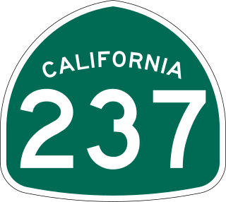
State Route 237 is a state highway in the U.S. state of California that runs from El Camino Real in Mountain View to Interstate 680 in Milpitas. Known as the Southbay Freeway for most of its length, SR 237 runs south of the San Francisco Bay, connecting the East Bay to the Peninsula.

U.S. Route 68 is a United States highway that runs for 560 miles (900 km) from northwest Ohio to Western Kentucky. The highway's western terminus is at US 62 in Reidland, Kentucky. Its present northern terminus is at Interstate 75 in Findlay, Ohio, though the route once extended as far north as Toledo. US 68 intersects with US 62 three times during its route.
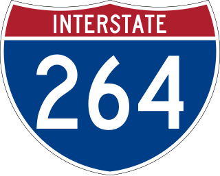
Interstate 264 (I-264) is a partial loop around the city of Louisville, Kentucky, south of the Ohio River. An auxiliary route of I-64, it is signed as the Shawnee Expressway for its first eight miles (13 km) from its western terminus at I-64/U.S. Route 150 (US 150) to US 31W/US 60 and as the Watterson Expressway for the remainder of its length from US 31W/US 60 to its northeastern terminus at I-71. It is 22.93 miles (36.90 km) in length and runs an open circle around central Louisville. It is the only auxiliary route of I-64 outside of Virginia.

Interstate 76 (I-76) is an east–west Interstate Highway in the Western United States that runs from I-70 in Arvada, Colorado – near Denver – to an interchange with I-80 near Big Springs, Nebraska. The highway measures 187.29 miles (301.41 km) long, mostly situated in Colorado but approximately three miles (4.8 km) of which is in Nebraska. Along the route, the highway runs concurrent with US Route 6 (US 6), US 85 in the Denver metropolitan area, and US 34 from Wiggins to Fort Morgan. It has no auxiliary Interstates, but it has two business routes that are located in northeastern Colorado. This route is not connected with the other I-76 that spans from Ohio to New Jersey.
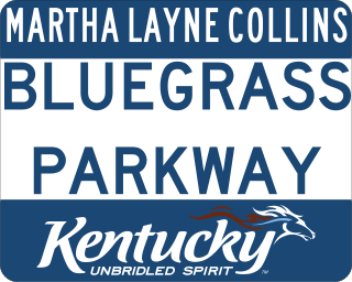
The Martha Layne Collins Blue Grass Parkway is a freeway running from Elizabethtown, Kentucky to Woodford County, Kentucky, for a length of 71.134 miles (114.479 km). It intersects with Interstate 65 at its western terminus, and U.S. Route 60 at its eastern terminus. It is one of seven highways that are part of the Kentucky parkway system. The road is designated unsigned Kentucky Route 9002. It is constructed similar to the Interstate Highway system, though sections do not measure up to current Interstate standards.
Interstate 64 (I-64) in the US state of Virginia runs east–west through the middle of the state from West Virginia to the Hampton Roads region, for a total of 299 miles (481 km). From the West Virginia state line to Chesapeake, it passes through the major cities of Lexington, Staunton, Charlottesville, the state capital of Richmond, Newport News, Hampton, and Norfolk. It is notable for crossing the mouth of the harbor of Hampton Roads on the Hampton Roads Bridge–Tunnel (HRBT), the first bridge–tunnel to incorporate artificial islands, concurrent with U.S. Route 60 (US 60). Also noteworthy is a section through Rockfish Gap, a wind gap in the Blue Ridge Mountains, which was equipped with an innovative system of airport-style runway lighting embedded into the pavement to aid motorists during periods of poor visibility due to fog or other conditions.
Interstate 85 (I-85) is a part of the Interstate Highway System that runs from Montgomery, Alabama, to Petersburg, Virginia. In North Carolina, I-85 travels 231.23 miles (372.13 km) from the South Carolina state line near Grover to the Virginia state line near Wise. Despite being signed north–south, I-85 physically travels in a southwest–northeast direction across the state. The major landscapes traversed by I-85 include urban and rural pockets of the Piedmont region, with views of Kings Pinnacle seen from its southernmost stretch. The Interstate Highway connects the three most populous metropolitan areas of North Carolina: the Charlotte metropolitan area, Piedmont Triad, and Research Triangle, as well as nine of the 20 largest municipalities in the state. Outside of North Carolina, I-85 connects the state with Richmond, Virginia, to the north and Upstate South Carolina and Atlanta, Georgia, to the south. I-85 parallels several US Highways including US Highway 29 (US 29) between South Carolina and Greensboro, US 70 between Greensboro and Durham, US 15 between Durham and Oxford, and US 1 between Henderson and Virginia.

Iowa 80 is the world's largest truck stop, located along Interstate 80 off exit 284 in Walcott, Iowa. It sits on a 220-acre (89 ha) plot of land, three times larger than an average 75 acres (30 ha) truckstop, and it receives 5,000 visitors daily. Iowa 80 features a 67,000 sq ft (6,200 m2) main building, parking for 900 trucks, 15 diesel fuel pumps, and also has a dedicated pump for dispensing bulk diesel exhaust fluid. Four-hundred and fifty employees staff the megaplex.
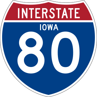
Interstate 80 (I-80) is a transcontinental Interstate Highway in the United States, stretching from San Francisco, California, to Teaneck, New Jersey. In Iowa, the highway travels west to east through the center of the state. It enters the state at the Missouri River in Council Bluffs and heads east through the southern Iowa drift plain. In the Des Moines metropolitan area, I-80 meets up with I-35 and the two routes bypass Des Moines together. On the northern side of Des Moines, the Interstates split and I-80 continues east. In eastern Iowa, it provides access to the University of Iowa in Iowa City. Northwest of the Quad Cities in Walcott is Iowa 80, the world's largest truck stop. I-80 passes along the northern edge of Davenport and Bettendorf and leaves Iowa via the Fred Schwengel Memorial Bridge over the Mississippi River into Illinois.

Interstate 15 (I-15) runs north–south in the U.S. state of Utah through the southwestern and central portions of the state, passing through most of the state's population centers, including St. George and those comprising the Wasatch Front: Provo–Orem, Salt Lake City, and Ogden–Clearfield. It is Utah's primary and only north–south interstate highway, as the vast majority of the state's population lives along its corridor; the Logan metropolitan area is the state's only Metropolitan Statistical Area through which I-15 does not pass. In 1998, the Utah State Legislature designated Utah's entire portion of the road as the Veterans Memorial Highway.
Interstate 64 (I-64) in the US state of Kentucky travels for 191 miles (307 km), passing by the major towns and cities of Louisville, Frankfort, Lexington, and Ashland. It has several major junctions with other Interstates, including I-65, I-71, I-264, and I-265 in Louisville and I-75 in Lexington.
Fort Leonard Wood is a U.S. Army training installation located in the Missouri Ozarks. The main gate is located on the southern boundary of the city of St. Robert. The post was created in December 1940 and named in honor of General Leonard Wood in January 1941. Originally intended to train infantry troops, in 1941 it became an engineer training post with the creation of the Engineer Replacement Training Center. During World War II Italian and German POWs were interned at the fort. In 1984, as part of the Base Realignment and Closure process, most of the U.S. Army Engineer School's operations were consolidated at Fort Leonard Wood. Before that, officer training was conducted at Fort Belvoir, Virginia.

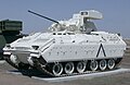
The American Heritage Museum is a military history museum located on the grounds of the Collings Foundation in the town of Stow, Massachusetts, 21 miles (34 km) west of Boston. The collection consists of over 100 artifacts, most of which were formerly part of the Military Vehicle Technology Foundation collection in Portola Valley, California. Over half of the items on display are from the World War II era, with World War I, the Korean War, Vietnam War, Gulf War, Iraq War, and the War on Terror also represented. Most of the items on display, including tanks and artifacts, are American, German, Russian, or British in origin.