Related Research Articles

Opawa is an inner residential suburb of Christchurch, New Zealand. It is located approximately 3.5 kilometres south-east of the city centre. In its early days, a kāinga was located near the present-day Vincent Place and Judge Street intersection. The Māori name for this area is "Ōpāwaho". The area later became a rural-agricultural locality, with many of the early settlers of English descent. It was established around a loop of the Heathcote River, where a number of large houses were built on large riverside sections. Notable heritage-listed buildings in the suburb include "Risingholme" and "The Hollies". Opawa was heavily urbanised during Woolston's industrial development era and its population included factory workers and businesspeople. Opawa amalgamated in to the city area in 1916.
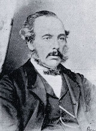
Isaac Luck was a New Zealand architect. A professional builder, he arrived in Lyttelton on the Steadfast in 1851. He was the third chairman of the Christchurch Town Council. He was the brother-in-law of and in partnership with Benjamin Mountfort, and was the less well-known architectural partner for the design of the Canterbury Provincial Council Buildings.
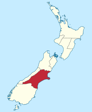
The Canterbury Province was a province of New Zealand from 1853 until the abolition of provincial government in 1876. Its capital was Christchurch.
James Samuel Dickson was a Reform Party Member of Parliament in New Zealand.
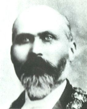
Samuel Manning was a brewer and Mayor of Christchurch in 1890.

Andrew Duncan was Mayor of Christchurch 1869–1870. From a working-class background in Scotland, he emigrated to New Zealand as a young man and became a highly respected member of the Christchurch community. He is remembered for his later work as an immigration agent in Scotland on behalf of the Canterbury Province.

John Ollivier was a Member of Parliament in New Zealand, but was better known for his membership of the Canterbury Provincial Council. He was the second chairman of the Christchurch Town Council.
The 3rd New Zealand Parliament was a term of the Parliament of New Zealand. Elections for this term were held between 12 December 1860 and 28 March 1861 in 43 electorates to elect 53 MPs. Two electorates were added to this during this term, Gold Fields District and a new Dunedin electorate created by splitting the existing City of Dunedin into Dunedin and Suburbs North and Dunedin and Suburbs South, increasing the number of MPs to 57. During the term of this Parliament, six Ministries were in power.
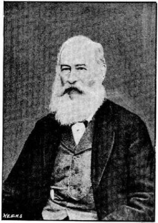
Hugh Percy Murray-Aynsley was a 19th-century Member of Parliament in Canterbury, New Zealand.
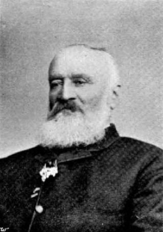
Alfred Cox was a 19th-century runholder and Member of the New Zealand House of Representatives. Born in New South Wales into an upper middle class military family, he was sent home to England to learn about farming. Upon returning to New South Wales, he heard about the large profits that were possible in South Canterbury and bought licences for land that he had not seen. He stocked the land, put a manager in charge and made another trip to England with his wife and their, at that time, small family. He moved to New Zealand permanently in 1857 and lived on his large farm, Raukapuka, which stretched from the sea to the foothills, and of which the homestead was located in present-day Geraldine. He sold his South Canterbury interests and moved to the Waikato, where he bought large land holdings in Hamilton and Thames. He tried to drain his swamp land and lost a lot of money with those ventures. He sold up in 1882 and moved to Christchurch, where he retired.
The Chairman of Committees was an elected position of the New Zealand House of Representatives. The role existed between 1854 and 1992. The roles of the Chairman of Committees were to deputise for the Speaker, and to chair the House when it was in committee. The role is now carried out by the Deputy Speaker. The role of Chairman of Committees also existed for the Legislative Council.
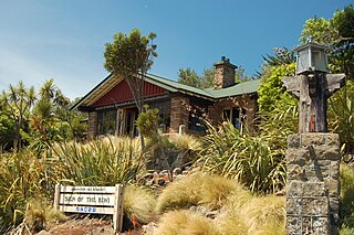
The Sign of the Kiwi, originally called Toll House, is a small café and shop at Dyers Pass on the road between Christchurch and Governors Bay. It was built in 1916–17 by Harry Ell as a staging post and opened as a tearoom and rest house. It has a Category I heritage classification by Heritage New Zealand and is a popular destination for tourists and locals alike. The building was closed some time after the 22 February 2011 Christchurch earthquake and did not open again until 23 January 2017, six years later. Although located within the burned area, the building was not damaged by the 2017 Port Hills fires a month later.

The Barbadoes Street Cemetery is the oldest cemetery in Christchurch, New Zealand. It was set up with three discrete areas for different denominations.

The Mayor of Upper Hutt is the head of the municipal government of Upper Hutt, New Zealand, and presides over the Upper Hutt City Council. The mayor is directly elected using a First Past the Post electoral system. The Upper Hutt Town Board had seven chairmen, with the role regarded as the predecessor role of mayor. The Upper Hutt Borough Council was proclaimed in 1926, and with that, the role of mayor was introduced. In 1966, Upper Hutt became a city council. The current mayor, Wayne Guppy, is the eleventh since the role was created in 1926, and he was first elected in 2001.

Sir Joshua Strange Williams was a New Zealand lawyer, politician, Supreme Court judge and university chancellor.
St Andrews Hill is a hillside suburb in south-east Christchurch, New Zealand.

Westland County, also known as County of Westland, was a local government area on the West Coast of New Zealand's South Island. It existed from 1868 to 1873, and then from 1876 until 1989. In its first incarnation, it constituted the government for the area that was split from the Canterbury Province, with the West Coast Gold Rush having given the impetus for that split. It had the same administrative powers as a provincial council, but the legislative power rested with Parliament in Wellington. The first Westland County was the predecessor to Westland Province.
Sir Walter Kennaway was a provincial politician, farmer and run-holder in Canterbury, New Zealand, before becoming secretary to the Agent-General in London for 35 years.

Lemuel John Bagnall, was a New Zealand businessman and politician who was Mayor of Auckland City from 1910 to 1911.

The Christchurch Wastewater Treatment Plant (CWTP), also known as the Bromley sewage plant, is the main wastewater treatment plant of Christchurch, New Zealand. It is located in the suburb of Bromley, adjacent to the Avon Heathcote Estuary. Opened in 1962, it replaced an earlier sewage disposal farm that had operated since 1882. In late 2021, two trickling filters burned down and adjacent suburbs have since been subjected to a putrid smell.
References
- Scholefield, Guy, ed. (1940). A Dictionary of New Zealand Biography : A–L (PDF). Vol. I. Wellington: Department of Internal Affairs. Archived from the original (PDF) on 9 March 2012. Retrieved 6 October 2013.
- Watson, James (1989). Along the Hills : A history of the Heathcote Road Board and the Heathcote County Council 1864–1989. Heathcote County Council. ISBN 0-473--00851-3.