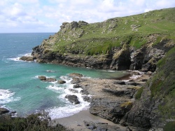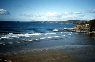
Hemmick Beach is a west-facing beach on the south coast of Cornwall, Britain. It is situated at the east end of Veryan Bay, on the west side of the Dodman Point headland, and to the south of the hamlet of Boswinger and to the west of Penare. [1]

Hemmick Beach is a west-facing beach on the south coast of Cornwall, Britain. It is situated at the east end of Veryan Bay, on the west side of the Dodman Point headland, and to the south of the hamlet of Boswinger and to the west of Penare. [1]
Author David Clegg describes the beach as "small and sandy and just one lovely granite cottage", [2] while the Rough Guide to Britain notes the rocky outcrops, inlets and coves in the vicinity. [3] 0.75 miles (1.21 km) to the east is Lambsoden Cove, accessed via a coastal footpath. There is an estate there with 70 acres of farmland. [4] Nearby is Dead Man Point. [5]
The beach contains the tall grey-flowered plant dittander and reed grass, which typically grows between 8 and 12 feet high. [4]
In 1971, British vessel Ewt 263 was being towed from Santander to Rotterdam by the tug Britannia when she broke in half off Lizard Point. The stern section was towed into Falmouth and the bow section was believed to be washed up between Hemmick beach and Dodman Point. [6]

The South West Coast Path is England's longest waymarked long-distance footpath and a National Trail. It stretches for 630 miles (1,014 km), running from Minehead in Somerset, along the coasts of Devon and Cornwall, to Poole Harbour in Dorset. Because it rises and falls with every river mouth, it is also one of the more challenging trails. The total height climbed has been calculated to be 114,931 ft (35,031 m), almost four times the height of Mount Everest. It has been voted 'Britain's Best Walking route' twice in a row by readers of The Ramblers' Walk magazine, and regularly features in lists of the world's best walks.

The River Camel is a river in Cornwall, England. It rises on the edge of Bodmin Moor and with its tributaries its catchment area covers much of North Cornwall. The river flows into the eastern Celtic Sea between Stepper Point and Pentire Point having covered about 30 miles (50 km) making it the second longest river wholly in Cornwall. The river is tidal upstream to Egloshayle and is popular for sailing, birdwatching and fishing. The name Camel comes from the Cornish language for 'the crooked one', a reference to its winding course. Historically the river was divided into three named stretches. Heyl was the name for the estuary up to Egloshayle, the River Allen was the stretch between Egloshayle and Trecarne, whilst the Camel was reserved for the stretch of river between its source and Trecarne.

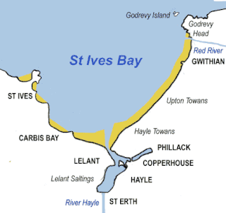
Godrevy is an area on the eastern side of St Ives Bay, west Cornwall, England, United Kingdom, which faces the Atlantic Ocean. It is popular with both the surfing community and walkers. It is part owned by the National Trust, and offshore on Godrevy Island is a lighthouse maintained by Trinity House which is said to be the inspiration for Virginia Woolf's novel To the Lighthouse. Godrevy lies within the Cornwall Area of Outstanding Natural Beauty (AONB) and the South West Coast Path runs around the whole promontory. There are several public car parks on the western side where the National Trust owns and operates a café.

Porthcurno is a small village covering a small valley and beach on the south coast of Cornwall, England in the United Kingdom. It is the main settlement in a civil and an ecclesiastical parish, both named St Levan, which comprise Porthcurno, diminutive St Levan itself, Trethewey and Treen.

Fistral Beach is in Fistral Bay on the north coast of Cornwall, England, United Kingdom. It is situated half a mile west of Newquay at grid reference SW 797 620.

Cadgwith is a village and fishing port in Cornwall, England, United Kingdom. It is on the Lizard Peninsula between The Lizard and Coverack. It is in the civil parish of Grade Ruan.

Gunwalloe is a coastal civil parish in Cornwall, England, United Kingdom. It is situated on the Lizard Peninsula three miles (4.8 km) south of Helston and partly contains The Loe, the largest natural freshwater lake in Cornwall. The parish population including Berepper at the 2011 census was 219. The hamlets in the parish are Chyanvounder, Berepper and Chyvarloe. To the east are the Halzephron cliffs and further east the parish church.

Prussia Cove, formerly called King's Cove, is a small private estate on the coast of Mount's Bay and to the east of Cudden Point, west Cornwall, England, United Kingdom. Part of the area is designated as a Site of Special Scientific Interest (SSSI), a Geological Conservation Review site and is in an Area of Outstanding Natural Beauty (AONB). It consists of four small coves and several cottages and houses. The names of the coves from west to east are Piskies, Bessy's, King's and Coule's. The area is accessible by foot from the South West Coast Path The cove is known for the 18th-century ship-wrecker and smuggler John Carter, also known as the "King of Prussia".

Nanjizal, also known as Mill Bay, is a beach and cove in the civil parish of St Levan, Cornwall, on the south-western coast of Great Britain. Situated one mile to the south-east of Land's End, Nanjizal has no direct access via road, and is usually reached via the South West Coast Path from Land's End in the north, or from Porthgwarra to the south. Nanjizal is also a noted bird watching location.

Vault Beach is situated on the south coast of Cornwall, England, UK, near Gorran Haven. The beach consists mainly of shingle but does have some sand at low tide. Vault Beach faces southeast onto the English Channel and lies between Cadythew Rocks in the north and Dodman Point at the southern end.

Gurnard's Head is a prominent headland on the north coast of the Penwith peninsula in Cornwall, England. The name is supposed to reflect that the rocky peninsula resembles the head of the gurnard fish.

Bolt Tail is a headland in Devon, England, immediately to the southwest of Hope Cove in the South Hams district, at grid reference SX670397.

Dodman Point near Mevagissey is the highest headland on the south Cornwall coast, measuring 374 feet (114 m). It is also known by its earlier names of the Deadman and Deadman's Point. It hosts the remains of an Iron Age promontory fort, and at its seaward end is "Parson Martin's Cross" – a large granite cross erected in 1896 to encourage those involved in Christian service, and which aids navigation around the headland. Dodman Point is mentioned in the shanty Spanish Ladies.

Heddon's Mouth is a rocky cove on the coast of North Devon, England, about a mile down the River Heddon from the Hunter's Inn. It is preserved for the nation by the National Trust.

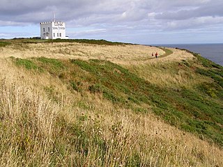
Gribbin Head is a promontory on the south coast of Cornwall, England, UK, owned and managed by the National Trust. It separates St Austell Bay from the estuary of the River Fowey and is marked by a large tower used to aid navigation of ships approaching the local harbours. The nearest town is Fowey. The western point of the headland is called Little Gribbin.

Bass Point is a headland on the coast of Cornwall, England. It is at the southern tip of the Lizard peninsula, in the civil parish of Landewednack. The headland was a communications centre during the Victorian era, with the Lloyds Signal Station, opened in 1872 for shore to ship communications, and Marconi's experiments with wireless at the Lizard Wireless Station.

Tregirls is a farmstead in Cornwall, United Kingdom. It is situated approximately half-a-mile (1 km) north of Padstow. The settlement consists of a farm and converted cottages which are let as holiday accommodation.

Gerrans Bay to Camels Cove is a coastal Site of Special Scientific Interest (SSSI) in south Cornwall, England, UK, noted for both its biological and geological interest.

Veryan Bay along the southern coast of Cornwall, England, is a curving, natural bay that stretches for 4.6 miles in width and recedes by up to 1.5 miles. It lies between the Peneare Head to the west and Dodman Point at the east. The shoreline varies in height from 20 to 200 feet, with indentations forming bights. Along the bay is Porthluney Cove, which is overlooked by Caerhays Castle.