The Atlas Mountains are a mountain range in the Maghreb in North Africa. It separates the Sahara Desert from the Mediterranean Sea and the Atlantic Ocean; the name "Atlantic" is derived from the mountain range, which stretches around 2,500 km (1,600 mi) through Morocco, Algeria and Tunisia. The range's highest peak is Toubkal, which is in central Morocco, with an elevation of 4,167 metres (13,671 ft). The Atlas Mountains are primarily inhabited by Berber populations.

Sousse or Soussa is a city in Tunisia, capital of the Sousse Governorate. Located 140 km (87 mi) south of the capital Tunis, the city has 271,428 inhabitants (2014). Sousse is in the central-east of the country, on the Gulf of Hammamet, which is a part of the Mediterranean Sea. Its economy is based on transport equipment, processed food, olive oil, textiles, and tourism. It is home to the Université de Sousse.

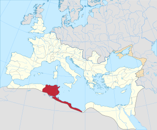
Thelepte was a city in the Roman province of Byzacena, now in western Tunisia. It is located near the border with Algeria about 5 km north from the modern town of Fériana and 30 km south-west of the provincial capital Kasserine.

Téboursouk is a town and commune in the Béja Governorate, Tunisia. It is located at 36° 27′ 26″N, 009° 14′ 54″E.

Ras Jebel, also known as Ras el-Djebel, is a town and commune in the Bizerte Governorate of Tunisia. The name of the city refers to the summit or end of the mountain, thus evoking the end of the Atlas Mountains.

Métlaoui is a town and commune in the Gafsa Governorate, Tunisia. In 2014 it had a population of 39,100.

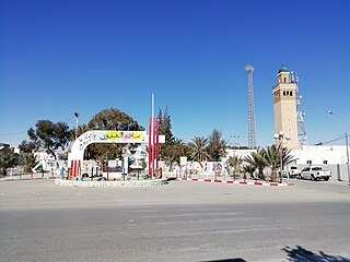
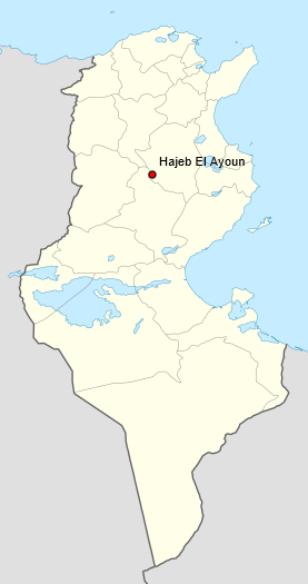
Hajeb El Ayoun is a town and commune in the Kairouan Governorate, Tunisia. As of 2004 it had a population of 9,648. It is also the capital of a district of 35,403 inhabitants.

Somâa is a town and commune in the Nabeul Governorate, Tunisia. As of 2004 it had a population of 6,287.

Kesra is a town and commune in the Siliana Governorate, Tunisia. As of 2004 it had a population of 2,490. In 2014 this was 2,600. Kesra is in Siliana Governorate near Maktar at 35.8N and 9.36e. The town is at altitude of 966m and is near the Jebel Serj national park. During the Roman Empire Kesra was a civitas of the Roman Province of Byzacena called Cusira.
Sidi Bou Ali is a town and commune in the Sousse Governorate, Tunisia. As of 2004 it had a population of 9,011.
Sidi El Hani is a town and commune in the Sousse Governorate, Tunisia located at 35.67n, 10.30e. As of 2004 it had a population of 3,058. It gives its name to the largest lake of the governorate, a natural salt lake or salt pan (sabkha) in dry seasons, the Sebkhet de Sidi El Hani which is shared with between one and two other areas depending on precipitation and its maximum extent forms the official boundary with part of a third, Monastir Governorate. The town is 30 km south-west of the coast, its straightest connection being by Tunisian Railways, with a secondary connection by road, the P12 road which is a principal road to Kairouan from the A1 a few kilometres to the east. it is 19 km from Kairouan and 26 km from Raqqada.
Urusi was a civitas and ancient episcopal see of the Roman province of Africa Proconsularis in present-day Tunisia.

Dzemda is a locality in Tunisia.

Ain-Djoukar also known as Jougar is a locality in Tunisia, located at 36° 14' 50" N, 9° 56' 24" E. It is 371 meters above sea level and at the head waters of the Oued Miliane wadi. The springs at this location near the Djebel Bargou mountains was recognised by the Romans as an important water source and a Roman aqueduct was constructed to Carthage.

Henchir-Ezzguidane or Henchir el Zguidane is a locality in Tunisia.

Henchir Bez is an archaeological site in Tunisia, located at 36° 00′ 23″ N, 9° 32 in the hills overlooking the Oued Miliane river, west of Tunis. Identified by a recently discovered inscription, it is the ruins of the Roman civitas of Vazi Sarra, which include a Christian Basilica and a Byzantine/Roman fort.
Crich El Oued, also known as Qarish el-Wadi, is a village in Tunisia, located between Bordj Toumi and Majaz al Bab in Béja Governorate east of Tunis. The village is on the Medjerda river at the confluence with the Oued el-Ahmar and the town has a mosque
Toukabeur is a town in Béja Governorate, Tunisia located at 36°42′32″N, 9°31′16″E. Toukabeur is in the Medjerda River valley, and 2 km west of Chaouach (Suas) and 7 kilometers northwest of Majaz al Bab,(Membressa). Its postal code is 9024.

Henchir-Aïn-Dourat, also known as Ad-Duwayrat or Henchir Durat, is a former Roman–Berber civitas and archaeological site in Tunisia. It is located at 36.767496n, 9.524142e, in the hills just north of Toukabeur and 15.3 km (9.5 mi) from Majāz al Bāb. It was an ancient Catholic diocese.

Henchir-Sidi-Salah is a rural locality and archaeological site in the hinterland behind Sfax, Tunisia.


