
A swamp is a forested wetland. Swamps are considered to be transition zones because both land and water play a role in creating this environment. Swamps vary in size and are located all around the world. The water of a swamp may be fresh water, brackish water, or seawater. Freshwater swamps form along large rivers or lakes where they are critically dependent upon rainwater and seasonal flooding to maintain natural water level fluctuations. Saltwater swamps are found along tropical and subtropical coastlines. Some swamps have hammocks, or dry-land protrusions, covered by aquatic vegetation, or vegetation that tolerates periodic inundation or soil saturation. The two main types of swamp are "true" or swamp forests and "transitional" or shrub swamps. In the boreal regions of Canada, the word swamp is colloquially used for what is more formally termed a bog, fen, or muskeg. Some of the world's largest swamps are found along major rivers such as the Amazon, the Mississippi, and the Congo.

Ouse Washes is a linear 2,513.6 hectare biological Site of Special Scientific Interest stretching from near St Ives in Cambridgeshire to Downham Market in Norfolk. It is also a Ramsar internationally important wetland site, a Special Protection Area under the European Union Birds Directive, a Special Area of Conservation, and a Nature Conservation Review site, Grade I. An area of 186 hectares between March and Ely is managed by the Wildlife Trust for Bedfordshire, Cambridgeshire and Northamptonshire, and another area near Chatteris is managed by the Royal Society for the Protection of Birds. The Wildfowl & Wetlands Trust manages another area near Welney.

The Wolf River is a 105-mile-long (169 km) alluvial river in western Tennessee and northern Mississippi, whose confluence with the Mississippi River was the site of various Chickasaw, French, Spanish and American communities that eventually became Memphis, Tennessee. It is estimated to be about 12,000 years old, formed by Midwestern glacier runoff carving into the region's soft alluvial soil. It should not be confused with The Wolf River which flows primarily in Middle Tennessee and southern Kentucky. The Wolf River rises in the Holly Springs National Forest at Baker's Pond in Benton County, Mississippi, and flows northwest into Tennessee, before entering the Mississippi River north of downtown Memphis.

The Yolo Bypass is one of the two flood bypasses in California's Sacramento Valley located in Yolo and Solano Counties. Through a system of weirs, the bypass diverts floodwaters from the Sacramento River away from the state's capital city of Sacramento and other nearby riverside communities.

The Cache River is a 92-mile-long (148 km) waterway in southernmost Illinois, in a region sometimes called Little Egypt. The basin spans 737 square miles (1,910 km2) and six counties: Alexander, Johnson, Massac, Pope, Pulaski and Union. Located at the convergence of four major physiographic regions, the river is part of the largest complex of wetlands in Illinois. The Cache River Wetlands — America's northernmost cypress/tupelo swamp — harbors 91 percent of the state's high quality swamp and wetland communities. It provides habitat for more than 100 threatened and endangered species in Illinois. In 1996, the Cache was designated a Wetland of International Importance by the Ramsar Convention.

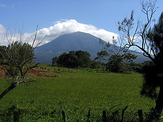
The Okefenokee National Wildlife Refuge is a 402,000‑acre (1,627 km2) National Wildlife Refuge located in Charlton, Ware, and Clinch Counties of Georgia, and Baker County in Florida, United States. The refuge is administered from offices in Folkston, Georgia. The refuge was established in 1937 to protect a majority of the 438,000 acre (1,772 km2) Okefenokee Swamp. The name "Okefenokee" is a Native American word meaning "trembling earth."
Guanacaste Conservation Area is an administrative area which is managed by the Sistema Nacional de Areas de Conservacion (SINAC) of Costa Rica for conservation in the northwestern part of Costa Rica. It contains three national parks, as well as wildlife refuges and other nature reserves. The area contains the Area de Conservación Guanacaste World Heritage Site, which comprises four areas.

The Erie National Wildlife Refuge is an 8,777-acre (3,552 ha) National Wildlife Refuge located in Crawford County, Pennsylvania. Named after the Erie tribe, it was established to provide waterfowl and other migratory birds with nesting, feeding, brooding, and resting habitat.
Loess Bluffs National Wildlife Refuge is a National Wildlife Refuge in northwestern Missouri, United States, established in 1935 by President Franklin D. Roosevelt as a refuge and breeding ground for migratory birds and other wildlife.

The Tualatin River National Wildlife Refuge is a 1,856 acres (751 ha) wetlands and lowlands sanctuary in the northwestern part of the U.S. state of Oregon. Established in 1992 and opened to the public in 2006, it is managed by the United States Fish and Wildlife Service. Located in southeastern Washington County, 15 miles (24 km) southwest of Portland, the refuge is bordered by Sherwood, Tualatin and Tigard. A newer area, extending into northern Yamhill County, is located further west near the city of Gaston surrounding the former Wapato Lake.

Green Cay Wetlands is a nature preserve located in Boynton Beach, Florida. The 100-acre (0.40 km2) property was purchased in 1999 from Ted and Trudy Winsberg, who used the property for farming. The Winsbergs sold the property for 1/3 of its appraised value with the condition that it would be made into a wetland. Construction began in July 2003. It was created jointly by the Palm Beach County Utilities Department and the Palm Beach County Parks and Recreation Department in 2004. This park includes 1.5 miles (2.4 km) of an elevated wooden boardwalk, which takes visitors through various habitats, including cabbage palm hammock, cypress swamp, wetland hammock, and tropical hardwood hammock. The boardwalk also features a Seminole chickee hut as well as several gazebos, which have descriptive signs offering information on the wildlife and plant life.
The Cypress Creek National Wildlife Refuge is located in the Cache River watershed in southernmost Illinois, largely in Pulaski County, but with extensions into Union, Alexander, and Johnson counties. The refuge was established in 1990 under the authority of the Emergency Wetlands Resources Act of 1986. The refuge protects over 16,000 acres (65 km2) of the Cache River wetlands, and has a purchase boundary of 36,000 acres (146 km²) contiguous.

Heron Pond – Little Black Slough Nature Preserve is a parcel of protected wetland property located approximately 5 miles (8 km) southwest of Vienna in Johnson County, Illinois. It was designated a National Natural Landmark in 1972. As part of the Cache River basin, it is classified as a wetland of international importance under the Ramsar Convention.

Horseshoe Lake is an oxbow lake in Alexander County, Illinois. It is the site of Illinois's Horseshoe Lake State Fish and Wildlife Area, a state park 10,645 acres (43 km2) in size. A remnant of a large meander of the Mississippi River, it is today a shallow, isolated patch of water located near Cairo and the southern tip of Illinois. In 1972, the Horseshoe Lake Nature Preserve was designated as a National Natural Landmark by the National Park Service.
Pass a Loutre Wildlife Management Area (WMA) is a 66,000-acre (270 km2) protected wetland in Plaquemines Parish, Louisiana, United States. The WMA is located due south and bordering the 48,000 acre Delta National Wildlife Refuge, accessible only by air or boat, contains the Pass A L'Outre Lighthouse, and Port Eads is within the boundary.
The San Diego National Wildlife Refuge Complex is a series of wildlife refuges established by the United States National Wildlife Service beginning in 1972. The complex incorporates five refuges in San Diego County and Orange County in California.

The Douglas-Hart Nature Center, located in Mattoon, Illinois, is a nature reserve that offers visitors different Illinois habitats, field programs, environmental educational classes, and volunteer opportunities for all ages.