Cypress, Illinois

Last updated
Cypress, Illinois
Cypress-from-Railroad-St-il.jpg
Cypress
Johnson County Illinois Incorporated and Unincorporated areas Cypress Highlighted.svg
Location of Cypress in Johnson County, Illinois
Illinois in United States (US48).svg
Location of Illinois in the United States
Coordinates: 37°21′56″N89°1′3″W / 37.36556°N 89.01750°W / 37.36556; -89.01750 Coordinates: 37°21′56″N89°1′3″W / 37.36556°N 89.01750°W / 37.36556; -89.01750
CountryUnited States
StateIllinois
County Johnson
Area
[1]
  Total0.76 sq mi (1.96 km2)
  Land0.75 sq mi (1.95 km2)
  Water0.00 sq mi (0.01 km2)
Elevation
[2]
381 ft (116 m)
Population
 (2020)
  Total217
  Density288.18/sq mi (111.31/km2)
Time zone UTC-6 (CST)
  Summer (DST) UTC-5 (CDT)
ZIP code
62923
Area code 618
FIPS code 17-18251
GNIS feature ID2398666 [2]
Wikimedia CommonsCypress, Illinois

Cypress is a village in Johnson County, Illinois, United States. The population was 234 at the 2010 census. [3]

Contents

History

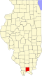
Cypress was established in the late 1890s as a stop along the Chicago and Eastern Illinois Railroad, a Class I railroad. In 1984, the railroad was abandoned. A post office which had been operating at Gray's Mill (east of modern Cypress) was moved to the new location, a former bank. The village's name is likely a reference to the cypress trees that grow in abundance in the Cache River basin. [4] Cypress Grade School was built in 1917, before April 28, 2002, when a tornado hit the school. Around four years later, the current school was finished.

Transportation

No airports or bus systems are active in Cypress. Bicycling is common inside the village. Remains of train tracks from the Chicago and Eastern Illinois Railroad lay, but are currently abandoned and not in use.

Major highways

Geography

Cypress is located in southwestern Johnson County at 37°21′56″N89°1′3″W / 37.36556°N 89.01750°W / 37.36556; -89.01750 (37.365543, -89.017473). [5] The village is situated in the Cache River basin northwest of Karnak and southwest of Vienna. The Heron Pond – Little Black Slough Nature Preserve lies to the east of Cypress. Illinois Route 37 passes through the village.

According to the 2010 census, Cypress has a total area of 0.753 square miles (1.95 km2), of which 0.75 square miles (1.94 km2) (or 99.6%) is land and 0.003 square miles (0.01 km2) (or 0.4%) is water. [6]

Demographics

Historical population
CensusPop.Note
1910 311
1920 43840.8%
1930 377−13.9%
1940 4078.0%
1950 357−12.3%
1960 264−26.1%
1970 261−1.1%
1980 2713.8%
1990 2751.5%
2000 271−1.5%
2010 234−13.7%
2020 217−7.3%
U.S. Decennial Census [7]

As of the census [8] of 2000, there were 271 people, 117 households, and 80 families residing in the village. The population density was 362.7 inhabitants per square mile (140.0/km2). There were 128 housing units at an average density of 171.3 per square mile (66.1/km2). The racial makeup of the village was 99.26% White, and 0.74% from two or more races.

There were 117 households, out of which 23.1% had children under the age of 18 living with them, 55.6% were married couples living together, 6.0% had a female householder with no husband present, and 31.6% were non-families. 25.6% of all households were made up of individuals, and 14.5% had someone living alone who was 65 years of age or older. The average household size was 2.32 and the average family size was 2.81.

In the village, the population was spread out, with 17.7% under the age of 18, 11.8% from 18 to 24, 31.4% from 25 to 44, 22.1% from 45 to 64, and 17.0% who were 65 years of age or older. The median age was 40 years. For every 100 females, there were 103.8 males. For every 100 females age 18 and over, there were 97.3 males.

The median income for a household in the village was $30,208, and the median income for a family was $37,813. Males had a median income of $22,750 versus $17,917 for females. The per capita income for the village was $13,849. About 3.1% of families and 7.6% of the population were below the poverty line, including none of those under the age of eighteen or sixty five or over.

Related Research Articles

<span class="mw-page-title-main">Bureau Junction, Illinois</span> Village in Illinois, United States

Bureau Junction, usually called Bureau, is a village in Bureau County, Illinois, United States. The population was 281 at the 2020 census. The village name is shown as both "Bureau Junction" and "Bureau" on federal maps, and is commonly called "Bureau", including by phone companies and the United States Post Office. It is part of the Ottawa Micropolitan Statistical Area. Bureau Junction was the point where the Rock Island Line railroad's branch line to Peoria split. Track west and south of Bureau is operated by Iowa Interstate, while tracks east to Chicago were formerly operated by CSX but are currently leased to Iowa Interstate.

<span class="mw-page-title-main">Ludlow, Illinois</span> Village in Illinois, United States

Ludlow is a village in Champaign County, Illinois, United States. The population was 308 at the 2020 census.

<span class="mw-page-title-main">Valier, Illinois</span> Village in Illinois, United States

Valier is a village in Franklin County, Illinois, United States. The population was 669 at the 2010 census.

<span class="mw-page-title-main">Junction, Illinois</span> Village in Illinois, United States

Junction is a village in Gallatin County, Illinois, United States. The population was 129 at the 2010 census.

<span class="mw-page-title-main">Ridgway, Illinois</span> Village in Illinois, United States

Ridgway is a village in Gallatin County, Illinois, United States. As of the 2020 census, the population was 851. As of 2018, Rebecca Mitchell was the town mayor.

<span class="mw-page-title-main">De Soto, Illinois</span> Village in Illinois, United States

De Soto is a village in Jackson County, Illinois, United States. The population was 1,590 at the 2010 census, down from 1,653 at the 2000 census. It is named for Hernando de Soto, the discoverer of the Mississippi River.

<span class="mw-page-title-main">Elkville, Illinois</span> Village in Illinois, United States

Elkville is a village in Jackson County, Illinois, United States. The population was 928 at the 2010 census, down from 1,001 at the 2000 census. As of 2018 the estimated population was 871.

<span class="mw-page-title-main">Belknap, Illinois</span> Village in Illinois, United States

Belknap is a village in Johnson County, Illinois, United States. The population was 104 at the 2010 census.

<span class="mw-page-title-main">Williamsfield, Illinois</span> Village in Illinois, United States

Williamsfield is a village in Knox County, Illinois, United States. The population was 578 at the 2010 census. It is part of the Galesburg Micropolitan Statistical Area.

<span class="mw-page-title-main">Livingston, Illinois</span> Village in Illinois, United States

Livingston is a village in Madison County, Illinois, United States. The population was 763 at the 2020 census, down from 858 in 2010.

<span class="mw-page-title-main">Worden, Illinois</span> Village in Illinois, United States

Worden is a village in Madison County, Illinois, United States. The population was 1,096 at the 2020 census.

<span class="mw-page-title-main">Davis Junction, Illinois</span> Village in Illinois, United States

Davis Junction is a village in Ogle County, Illinois, United States. The population was 2,512 at the 2020 census. Named for Jeremiah Davis, it is located where the Illinois Railway Rockford Line and the Canadian Pacific Railway Chicago Subdivision intersect along Illinois Route 72. It is the site of the Orchard Hills Landfill - one of the largest in the United States.

<span class="mw-page-title-main">Pulaski, Illinois</span> Village in Illinois, United States

Pulaski is a village in Pulaski County, Illinois, United States. The population was 235 at the 2010 census. The village is named in honor of Polish Revolutionary War hero Casimir Pulaski.

<span class="mw-page-title-main">Ullin, Illinois</span> Village in Illinois, United States

Ullin is a village in Pulaski County, Illinois, United States. The population was 463 at the 2010 census.

<span class="mw-page-title-main">Stonefort, Illinois</span> Village in Illinois, United States

Stonefort is a village in Saline and Williamson Counties, Illinois, United States. The population was 297 at the 2010 census.

<span class="mw-page-title-main">Alto Pass, Illinois</span> Village in Illinois, United States

Alto Pass is a village in Union County, Illinois, United States. The population was 391 at the 2010 census, an increase from 388 in 2000. The Bald Knob Cross and Bald Knob Wilderness are nearby. Alto Pass lies roughly 5.1 miles to the northwest of downtown Cobden, Illinois.

<span class="mw-page-title-main">Dongola, Illinois</span> Village in Illinois, United States

Dongola is a village in Union County, Illinois, United States. The population was 726 at the 2010 census.

<span class="mw-page-title-main">Bush, Illinois</span> Village in Illinois, United States

Bush is a village in Williamson County, Illinois, United States. As of the 2000 census, the village population was 257.

<span class="mw-page-title-main">Colp, Illinois</span> Village in Illinois, United States

Colp is a village in Williamson County, Illinois, United States. The population was 225 at the 2010 census.

<span class="mw-page-title-main">Panola, Illinois</span> Village in Illinois, United States

Panola is a village in Woodford County, Illinois, United States. The population was 45 at the 2010 census. It is part of the Peoria, Illinois Metropolitan Statistical Area.

References

  1. "2020 U.S. Gazetteer Files". United States Census Bureau. Retrieved March 15, 2022.
  2. 1 2 U.S. Geological Survey Geographic Names Information System: Cypress, Illinois
  3. "Geographic Identifiers: 2010 Census Summary File 1 (G001): Cypress village, Illinois". American Factfinder. U.S. Census Bureau. Archived from the original on February 13, 2020. Retrieved May 14, 2018.
  4. Leorah May Copeland Chapman, A History of Johnson County, Illinois (Press of the Herrin News, 1925), p. 291.
  5. "US Gazetteer files: 2010, 2000, and 1990". United States Census Bureau. 2011-02-12. Retrieved 2011-04-23.
  6. "G001 - Geographic Identifiers - 2010 Census Summary File 1". United States Census Bureau. Archived from the original on 2020-02-13. Retrieved 2015-08-02.
  7. "Census of Population and Housing". Census.gov. Retrieved June 4, 2015.
  8. "U.S. Census website". United States Census Bureau . Retrieved 2008-01-31.