
Kennington Road is a long straight road, approximately a mile in length, in the London Borough of Lambeth in London, England, running south from Westminster Bridge Road to Kennington Park Road.
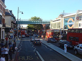
Brixton Road is a road in the London Borough of Lambeth, leading from the Oval at Kennington to Brixton, where it forms the high street and then forks into Effra Road and Brixton Hill at St Matthew's church at the junction with Acre Lane and Coldharbour Lane. Brixton Market is located in Electric Avenue near Brixton Underground station and in a network of covered arcades adjacent to the two railway viaducts. The market arcades were declared listed buildings in 2009 following controversial proposals by Lambeth Council to replace them with a large US-style mall. The former "Brixton Oval" is at the southern end with Lambeth Town Hall, the Ritzy Cinema, the Brixton Tate Library and St Matthew's church. The space was renamed Windrush Square in 2010, in honour of the area's early Caribbean migrants and the HMT Empire Windrush, which in 1948 brought 492 passengers from Jamaica to London.

Kennington Park Road is a main road in south-east London, England, and is part of the A3 trunk road. It runs from Newington Butts at its Y-junction with Kennington Lane, south-west to the Oval, where the A3 continues as Clapham Road, towards Stockwell. At this crossroads junction, Camberwell New Road and Kennington Oval head towards Camberwell Green and Vauxhall respectively.
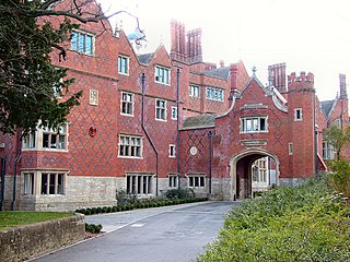
Goldings Estate is a large Elizabethan style country house and surrounding land close to Waterford, north of Hertford, Hertfordshire, England. The house was designed by George Devey (1820–1886), constructed between 1871 and 1877, and is a Grade II* listed building.

The Lincoln Memorial Tower or Lincoln Tower is a Gothic revival tower in Lambeth, London, housing small meeting rooms, that was opened in 1876 in memory of Abraham Lincoln, and paid for partly by Americans. Once part of a complex of nineteenth century philanthropic institutions sited alongside a Congregational chapel, it is all that now remains of the original design. It is located at the corner of Westminster Bridge Road and Kennington Road close to Waterloo station and Lambeth North tube station in London, and is today a listed building associated with, and close to, Christ Church and Upton Chapel.
Prince's ward is an administrative division of the London Borough of Lambeth, England. It is located in the North of the borough, bounded by the River Thames on the west and Kennington Park Road on the east. It is made up of much of Kennington and Vauxhall.

St Mark's Church, Kennington, is an Anglican church in Kennington, London, United Kingdom. The church is a Commissioners' church, receiving a grant from the Church Building Commission towards its cost. The architect was David R. Roper. The total cost of the church, including the land and other expenses, was £22,720. This was paid partly by the local parishioners and partly by Parliament through a grant known as "The Million Fund".

The Dove is a Grade II listed public house at 19 Upper Mall, Hammersmith, London W6 9TA.

ArtsLav was an arts venue located at Kennington Cross in Kennington, London, England. It started life as an underground Victorian gentlemen's public lavatory. It is now a listed and restored Kennington landmark used as a community arts facility, Artslav. Engineered by B. Finch and Co. in 1898. It went out of commission in 1988 during a period of public convenience closures in Lambeth.

The Hare and Hounds is a public house at 104 Sopwell Lane in St Albans, Hertfordshire, England. The timber framed building has a plastered exterior. It is listed Grade II with Historic England and is dated "seventeenth century or earlier".

Durning Library is a public lending library in Kennington, London. It is part of Lambeth Libraries in the London Borough of Lambeth and is in purpose-built Grade II listed building at 167 Kennington Lane, Kennington, London SE11.

The Old Fire Station is a Grade II listed former fire station in Renfrew Road, Kennington, London SE11.

St Anselm's Church is a Grade II listed church at 286 Kennington Road, Kennington, London SE11, built in 1932–33 by Stanley Davenport Adshead and Stanley Churchill Ramsey, on the foundations of an earlier church whose building was interrupted by the First World War; the present church is famously described as "barn-like".
St Peter's, Vauxhall is a Church of England church on Kennington Lane, Vauxhall, London SE11.
St Peter's Vicarage is an Anglican church vicarage at 308 Kennington Lane, Vauxhall, London SE11.

St Anne's Church is a Roman Catholic church at 363 Kennington Lane, Vauxhall, London SE11.

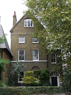
St Anne's House, 363 Kennington Lane, Vauxhall, London SE11, is the presbytery for St Anne's Church next door.
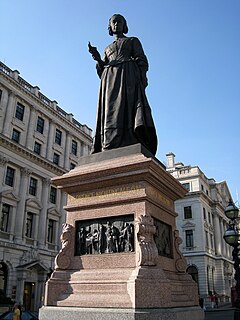
The statue of Florence Nightingale is an outdoor Grade II-listed sculpture in London, United Kingdom. It was sculpted in 1915 by Arthur George Walker, and is a subsidiary part of the Guards Crimean War Memorial.

24th East Surrey Division War Memorial is a First World War memorial in Battersea Park, London. The unusual avant-garde design by Eric Kennington, his first public commission, was unveiled in 1924. It became a Grade II* listed building in 2005.
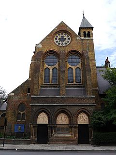
The Wheatsheaf Hall is a former Congregational Church mission hall in Kennington, south London, that is a grade II listed building.


