Related Research Articles
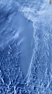
Lake Vostok is the largest of Antarctica's almost 400 known subglacial lakes. Lake Vostok is located at the southern Pole of Cold, beneath Russia's Vostok Station under the surface of the central East Antarctic Ice Sheet, which is at 3,488 m (11,444 ft) above mean sea level. The surface of this fresh water lake is approximately 4,000 m (13,100 ft) under the surface of the ice, which places it at approximately 500 m (1,600 ft) below sea level.
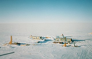
Vostok Station is a Russian research station in inland Princess Elizabeth Land, Antarctica. Founded by the Soviet Union in 1957, the station lies at the southern Pole of Cold, with the lowest reliably measured natural temperature on Earth of −89.2 °C. Research includes ice core drilling and magnetometry. Vostok was named after Vostok, the lead ship of the First Russian Antarctic Expedition captained by Fabian von Bellingshausen. The Bellingshausen Station was named after this captain.

An ice core is a core sample that is typically removed from an ice sheet or a high mountain glacier. Since the ice forms from the incremental buildup of annual layers of snow, lower layers are older than upper, and an ice core contains ice formed over a range of years. Cores are drilled with hand augers or powered drills; they can reach depths of over two miles (3.2 km), and contain ice up to 800,000 years old.

Marie Byrd Land (MBL) is an unclaimed region of Antarctica. With an area of 1,610,000 km2 (620,000 sq mi), it is the largest unclaimed territory on Earth. It was named after the wife of American naval officer Richard E. Byrd, who explored the region in the early 20th century.
The Holocene Climate Optimum (HCO) was a warm period that occurred in the interval roughly 9,000 to 5,000 years ago BP, with a thermal maximum around 8000 years BP. It has also been known by many other names, such as Altithermal, Climatic Optimum, Holocene Megathermal, Holocene Optimum, Holocene Thermal Maximum, Hypsithermal, and Mid-Holocene Warm Period.

The Greenland Ice Core Project (GRIP) was a multinational European research project, organised through the European Science Foundation (ESF). The project ran from 1989 to 1995, with drilling seasons from 1990 to 1992. In 1988, GRIP was first accepted as an ESF associated program and in the summer of 1989, the fieldwork was started in Greenland. The project took place over 7 years from ,1989 to 1995. GRIP aimed to collect and investigate 3000 metre long ice cores drilled at the apex of the Greenland ice sheet, also known as Summit Camp. The Greenland ice sheet occupies more than 90% of the total ice sheet and glacier ice on the Earth, excluding the Antarctic ice sheet. The project is managed by the Steering Committee called Physikalisches Institut der Universität Bern, Switzerland, chaired by Professor Bernhard Stauffer. Funding came from 8 nations, and from the European Union. The Commission of the European Community has offered a part of the funding through the European Research Network of Excellence in Open Cultural Heritage (EPOCH) program.

The Greenland Ice Sheet Project (GISP) was a decade-long project to drill ice cores in Greenland that involved scientists and funding agencies from Denmark, Switzerland and the United States. Besides the U.S. National Science Foundation (NSF), funding was provided by the Swiss National Science Foundation and the Danish Commission for Scientific Research in Greenland. The ice cores provide a proxy archive of temperature and atmospheric constituents that help to understand past climate variations.
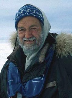
Sir Walter William Herbert was a British polar explorer, writer and artist. In 1969 he became the first man fully recognized for walking to the North Pole, on the 60th anniversary of Robert Peary's disputed expedition. He was described by Sir Ranulph Fiennes as "the greatest polar explorer of our time".

The Cold Regions Research and Engineering Laboratory (CRREL) is a United States Army Corps of Engineers, Engineer Research and Development Center research facility headquartered in Hanover, New Hampshire, that provides scientific and engineering support to the U.S. government and its military with a core emphasis on cold environments. CRREL also provides technical support to non-government customers.

Dome Fuji, also called Dome F or Valkyrie Dome, is an Antarctic base located in the eastern part of Queen Maud Land at 77°30′S37°30′E. With an altitude of 3,810 metres (12,500 ft) above sea level, it is the second-highest summit or ice dome of the East Antarctic Ice Sheet and represents an ice divide. Dome F is the site of Dome Fuji Station, a research station operated by Japan.

Dye 3 is an ice core site and previously part of the DYE section of the Distant Early Warning (DEW) line, located at in Greenland. As a DEW line base, it was disbanded in years 1990/1991.

Summit Camp, also Summit Station, is a year-round staffed research station near the apex of the Greenland ice sheet. The station is located at 3,216 metres (10,551 ft) above sea level. The population of the station is typically five in wintertime and reaches a maximum of 38 in the summer. The station is operated by the United States National Science Foundation through the logistical-support contractor Battelle Arctic Research Operations. A permit from the Danish Polar Center under the auspices of the Home Rule Government of Greenland is required to visit the station.

NEEM Camp was a small research facility on the northern Greenland Ice Sheet, used as a base for ice core drilling. It was located about 313 km east of the closest coast, Peabody Bay in northern Greenland, 275 km northwest of the historical ice sheet camp North Ice, and 484 km east-northeast of Siorapaluk, the closest settlement. There was one heavy-duty tent for accommodation of the researchers during summer. Access was by skiway .
Camp Fistclench was a U.S. Army research camp on and inside the Greenland Ice Cap 200 miles (320 km) east of Thule Air Base. It was in use from 1957 to 1960. It served to test techniques used at the much larger Camp Century.
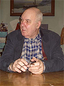
Andrey Petrovich Kapitsa was a Russian geographer and Antarctic explorer, discoverer of Lake Vostok, the largest subglacial lake in Antarctica. He was a member of the Kapitsa family, a scientific dynasty in Russia.

Ice drilling allows scientists studying glaciers and ice sheets to gain access to what is beneath the ice, to take measurements along the interior of the ice, and to retrieve samples. Instruments can be placed in the drilled holes to record temperature, pressure, speed, direction of movement, and for other scientific research, such as neutrino detection.
Scientific ice drilling began in 1840, when Louis Agassiz attempted to drill through the Unteraargletscher in the Alps. Rotary drills were first used to drill in ice in the 1890s, and thermal drilling, with a heated drillhead, began to be used in the 1940s. Ice coring began in the 1950s, with the International Geophysical Year at the end of the decade bringing increased ice drilling activity. In 1966, the Greenland ice sheet was penetrated for the first time with a 1,388 m hole reaching bedrock, using a combination of thermal and electromechanical drilling. Major projects over the following decades brought cores from deep holes in the Greenland and Antarctic ice sheets.
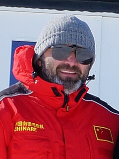
Pavel Grigorievich Talalay, is a Russian professor of drilling engineering and director of the Institute for Polar Science and Engineering in Jilin University, Changchun, China. His research interests are focused on different features of drilling technology in ice and permafrost; dynamics of ice sheets; ice properties and environmental issues in Polar Regions.

A Rodriguez well is a type of well envisioned by Swiss glaciologist Henri Bader of Rutgers University and developed by engineer Raul Rodriguez of the United States Army for economical harvesting of drinking water in polar areas. The project began as a subproject of the Army's Camp Century base in Greenland, created as a demonstration for affordable ice-cap military outposts or bases for scientific research.
References
- ↑ "Japanese American Internee Data File: Herbert T. Ueda". National Archives and Records Administration . Retrieved February 16, 2020.
- ↑ Shoemaker (2002), pp. 1–6.
- ↑ Shoemaker (2002), pp. 9–26.
- ↑ Shoemaker (2002), pp. 27–46.
- ↑ "Herbert Tomatsu Ueda: April 17, 1929 - June 13, 2020". www.stringerfh.com. Retrieved 2020-06-17.