Related Research Articles

The River Wye is the fourth-longest river in the UK, stretching some 250 kilometres from its source on Plynlimon in mid Wales to the Severn Estuary. For much of its length the river forms part of the border between England and Wales. The Wye Valley is designated an Area of Outstanding Natural Beauty. The Wye is important for nature conservation and recreation, but is affected by pollution.

Monmouthshire is a county in the south east of Wales. It borders Powys to the north; the English counties of Herefordshire and Gloucestershire to the north and east; the Severn Estuary to the south, and Torfaen, Newport and Blaenau Gwent to the west. The largest town is Abergavenny, and the administrative centre is Usk.

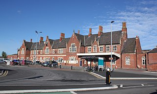
Hereford railway station serves the city of Hereford, in Herefordshire, England. Managed by Transport for Wales, it lies on the Welsh Marches Line between Leominster and Abergavenny, is the western terminus of the Cotswold Line and also has an hourly West Midlands Trains service from Birmingham New Street. The station has four platforms for passenger trains and two additional relief lines for goods services.

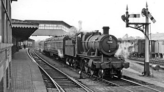
Pontrilas railway station is a former station which served the Herefordshire villages of Pontrilas and Ewyas Harold, and was a little distance from Grosmont, in Monmouthshire, Wales. It was located on the Welsh Marches Line between Hereford and Abergavenny. The Golden Valley Railway ran from here through to the Midland Railway line at Hay on Wye. The station is now a private house with attached self-catering holiday cottage created from the former waiting room.

The A466, also known as the Wye Valley Road, is a road from Hereford, England to Chepstow, Wales via Monmouth, Tintern and the Wye Valley.
The Merthyr, Tredegar and Abergavenny Railway, also known as the Heads of the Valleys line, was a railway line which operated between 1860 and 1958 between the Monmouthshire town of Abergavenny and the Glamorgan town of Merthyr Tydfil in South East Wales.

Llanvihangel Crucorney is a small village in the community (parish) of Crucorney, Monmouthshire, Wales. It is located 5 miles (8.0 km) north of Abergavenny and 18 miles (29 km) southwest of Hereford, England on the A465 road.
The Shrewsbury and Hereford Railway was an English railway company that built a standard gauge line between those places. It opened its main line in 1853.
The Newport, Abergavenny and Hereford Railway was a railway company formed to connect the places in its name. When it sought Parliamentary authorisation, it was denied the southern section, and obliged to use the Monmouthshire Railway between Pontypool and Newport.

The Wye Valley Railway was a standard gauge railway that ran for nearly 15 miles (24 km) along the Lower Wye Valley between the towns of Chepstow and Monmouth, crossing several times between Wales and England. Opened on 1 November 1876, it was leased to, and worked by, the Great Western Railway (GWR), before being fully absorbed by the GWR in 1905.

The River Gavenny or sometimes the Gavenny River is a short river in Monmouthshire in south Wales. It rises 1 mile (1.6 km) southwest of the village of Llanvihangel Crucorney from springs near Penyclawdd Court, supplemented by springs in Blaen-Gavenny Wood and tributary streams there and within the Woodland Trust-owned Great Triley Wood. It flows south for about 4 miles (6.4 km) to its confluence with the River Usk towards the eastern end of Castle Meadows at Abergavenny. The town derives its English-language name from the Gavenny's confluence with the River Usk. Of the buildings on the banks of the river, the Gothic Decorated style church of St Teilo at Llantilio Pertholey is especially notable. Parts of the church date from the thirteenth century with multiple additions since. Blaengavenny Farm, the name of which signifies the 'head of the Gavenny', is a sixteenth-century farmhouse near the river's source.
The Coleford Railway was a railway company that constructed a short railway from near Monmouth to Coleford, close to the Forest of Dean. The company was sponsored by the Great Western Railway. It was built on part of the course of the Monmouth Railway, a horse-operated plateway, and it was intended that its primary business would be the conveyance of minerals and forest products from the Forest of Dean.

The Hereford, Ross and Gloucester Railway was a railway which ran for 22+1⁄2 miles (36.2 km) linking Hereford and Gloucester, England, via Ross-on-Wye. It was opened on 1 June 1855 as a 7 ft 1⁄4 in broad gauge line, it was amalgamated with the Great Western Railway in 1862. In 1869 the railway was converted to 4 ft 8+1⁄2 in standard gauge. The railway was closed to passengers on 2 November 1964, freight services between Ross-on-Wye railway station and Grange Court railway station continued on until 1 November 1965.

The Coleford, Monmouth, Usk & Pontypool Railway (CMU&PR) was a standard gauge railway of 16 miles (26 km) which ran from Monmouth to Little Mill, near Pontypool in Monmouthshire, Wales. It was intended to convey the mineral products of the Forest of Dean to the ironworks of South Wales, by connecting to the Newport, Abergavenny and Hereford Railway at Little Mill Junction. The NAHR made the onward connection over its Taff Vale Extension line. The CMU&PR intended to acquire the Monmouth Railway, actually a horse-operated plateway, and convert it to locomotive operation.

The Ross and Monmouth Railway was a standard gauge railway of 13 miles (21 km) which ran between Ross-on-Wye, in Herefordshire, England and Monmouth, Wales.

Ross-on-Wye railway station is a former junction railway station on the Hereford, Ross and Gloucester Railway constructed just to the north of the Herefordshire town of Ross-on-Wye. It was the terminus of the Ross and Monmouth Railway which joined the Hereford, Ross and Gloucester Railway just south of the station.
The Grosmont Railway was an early horse-drawn railway line in Monmouthshire completed in 1819.

Monmouth Cap is a hamlet in the north of the county of Monmouthshire, Wales. It stands to the north of the village of Grosmont, and to the south of the village of Pontrilas, just over the border in England.

The Llanvihangel Railway was an early horse-drawn railway line in Monmouthshire which operated over a 6.25 mile route between the Brecknock and Abergavenny Canal and Llanvihangel Crucorney from 1814 until 1846. The act of Parliament for the railway, the Llanvihangel Railway Act 1811, received royal assent on 25 May 1811. The line was initially constructed only as far as Blaengavenny and it was 1820 or 1821 before it was extended to Llanvihangel.

Llancillo is a civil parish in south-west Herefordshire, England, and is approximately 13 miles (20 km) south-west from Hereford. The parish borders Wales at the south in which is the nearest town, Abergavenny, 7 miles (11 km) to the south-southwest. In the parish is the isolated Grade II* listed 11th-century Church of St Peter.
References
- ↑ Cook, R.A.; Clinker, C.R. (1984). Early Railways between Abergavenny and Hereford. RCHS. pp. 32, 36, 42, 44. ISBN 0901461369.
- ↑ Cook, R.A.; Clinker, C.R. (1984). Early Railways between Abergavenny and Hereford. RCHS. pp. 77–80. ISBN 0901461369.
- ↑ Helen J Simpson: The Day the Trains Came: the Herefordshire Railways, Gracewing Publishing, 1997