Roxburghshire or the County of Roxburgh is a historic county and registration county in the Southern Uplands of Scotland. It borders Dumfriesshire to the west, Selkirkshire and Midlothian to the north-west, and Berwickshire to the north. To the south-west it borders Cumberland and to the south-east Northumberland, both in England.
Dumfriesshire or the County of Dumfries is a historic county, registration county and lieutenancy area of southern Scotland.

The River Esk, also known as the Border Esk, is a river in Dumfries and Galloway, Scotland, that enters the English county of Cumbria and flows into the Solway Firth.
Liddesdale, the valley of the Liddel Water, in the County of Roxburgh, southern Scotland, extends in a south-westerly direction from the vicinity of Peel Fell to the River Esk, a distance of 21 miles (34 km). The Waverley route of the North British Railway runs down the dale, and the Catrail, or Picts' Dyke, crosses its head.

Nisbet is a small hamlet on the B6400, in Roxburghshire, along the River Teviot, in the Scottish Borders area of Scotland. It is located 5.5 kilometres (3.4 mi) north of Jedburgh and 5 kilometres (3.1 mi) south of Roxburgh.

Liddel Water is a river running through southern Scotland and northern England, for much of its course forming the border between the two countries, and was formerly one of the boundaries of the Debatable Lands.
Cessford Burn is a small stream which eventually runs to meet the Kale Water and then joins the River Teviot, finally entering the River Tweed at Kelso, Scotland.
Holydean Castle was a castle sited near Melrose in Bowden, 1.25 miles SW of the village, in the Scottish Borders region of Scotland, and the former Roxburghshire.

Bowmont Water is a stream in the Scottish Borders and Northumberland, England.
Bedshiel is a village in the Scottish Borders area of Scotland on the B6456, six miles from Duns, two miles from Greenlaw, Longformacus and Westruther.
Leitholm is a village in the Scottish Borders area of Scotland, 4 miles (6.4 km) north-west of Coldstream, in the former county of Berwickshire.
Mowhaugh is a hamlet and farm steading near the Calroust Burn and the Bowmont Water, near Morebattle, in the Scottish Borders area of Scotland, and in the former Roxburghshire. It is situated about 5 miles (8 km) from the Anglo-Scottish Border.

Liddel Castle is a ruined castle in Liddesdale, by the Liddel Water, near Castleton in the Scottish Borders area of Scotland, in the former county of Roxburghshire. Liddel Castle is a scheduled monument.

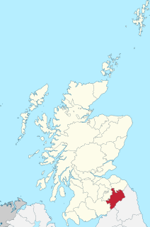
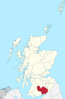
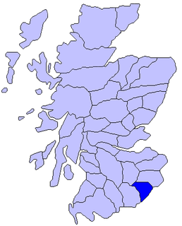
Castleton is a civil parish in the Scottish Borders area of Scotland, in the former Roxburghshire, in the extreme south of the Borders area. It is bounded by Northumberland (England), Dumfries and Galloway, and the parishes of Hobkirk, Southdean and Teviothead. The village of Castleton was commenced in 1793. It was built as a result of the land clearances in the 1790s when people were forced to move from Old Castleton village. While the parish retained the name Castleton, the village later became identified as New Castleton or Newcastleton. The parish is also known by its older name Liddesdale

Saughtree is a hamlet in the Scottish Borders at the junction of the B6357 and an unnamed road from Kielder village in Northumberland, England. It is at the confluence of the River Liddle [Liddel Water] and Dawston Burn. The valley of the Liddle is known as Liddesdale. The nearest settlements on the B6357 are Bonchester Bridge, Newcastleton and Kielder village. It is approximately 6 km from the border with England.
Dinlabyre is a village on the B6357 in Liddesdale, on the edge of the Newcastleton Forest, close to Castleton, in the Scottish Borders area of Scotland, in the former Roxburghshire.
Liddel Strength is an ancient monument near Carwinley, Cumbria, in northwest England. It consists of the earthwork remains of an Anglo-Norman border fortification destroyed by the Scots in 1346 and fragmentary remains of a pele tower subsequently built upon the site. It lies on a cliff on the south bank of the Liddel Water, overlooking the Liddel Water's confluence with the River Esk; the last high ground before the Esk reaches the Solway Plain. The Liddel Water and the Esk (downstream) form the modern Anglo-Scottish border; formerly they were the southern boundary of the Debatable Lands.

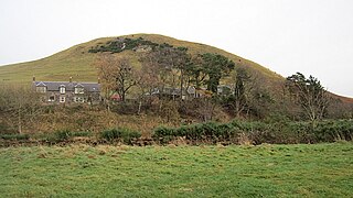
Mangerton Tower is a ruined Scottish tower castle house formerly belonging to the Armstrong family.
