
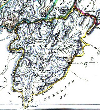
Dumfriesshire or the County of Dumfries or Shire of Dumfries is a historic county and registration county in southern Scotland. The Dumfries lieutenancy area covers a similar area to the historic county.

The River Esk, also known as the Border Esk, is a river that rises in the Scottish region of Dumfries and Galloway before crossing the border to the English county of Cumbria and flowing into the Solway Firth.

Liddesdale, the valley of the Liddel Water, in the County of Roxburgh, southern Scotland, extends in a south-westerly direction from the vicinity of Peel Fell to the River Esk, a distance of 21 miles (34 km). The Waverley route of the North British Railway ran down the dale, and the Catrail, or Picts' Dyke, crosses its head.

The River Garnock, the smallest of Ayrshire's six principal rivers, has its source on the southerly side of the Hill of Stake in the heart of the Clyde Muirshiel Regional Park. About a mile and a half south of this starting point the untested stream tumbles over the Spout of Garnock, the highest waterfall in Ayrshire, once thought to be the river's origin. The river then continues, for a total length of 20 miles (32 km) or so, through the towns of Kilbirnie, Glengarnock, Dalry and Kilwinning to its confluence with the River Irvine at Irvine Harbour.

The Debatable Lands, also known as debatable ground, batable ground or threip lands, lay between Scotland and England. It was formerly in question as to which it belonged when they were distinct kingdoms. The name either signifies litigious or disputable ground, or it comes from the Old English word 'battable'.

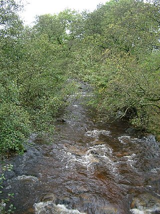
Kershope Burn is a small river; a tributary of both the Liddel Water and the River Esk; its final destination is the Solway Firth. The early stages begin in the Border Forest, from where it flows in a south westerly direction, followed in its entirety by the border between England and Scotland.

The River Irvine is a river that flows through southwest Scotland. Its watershed is on the Lanarkshire border of Ayrshire at an altitude of 810 feet (250 m) above sea-level, near Loudoun Hill, Drumclog, and 7 miles SW by W of Strathaven. It flows 29+1⁄2 mi (47.5 km) westward, dividing the old district of Cunninghame from that of Kyle, until it reaches the sea via Irvine Harbour in the form of the Firth of Clyde, and flows into Irvine Bay by the town of Irvine. It has many tributaries, some of which form parish, district and other boundaries.
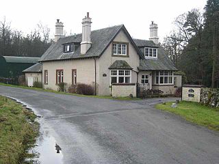
Kershopefoot is a small hamlet in Cumbria, England, traditionally in Cumberland. It is located very close to the Scotland-England border and is near the Kershope Burn and the Liddel Water. Kershopefoot is most well known for its lodge house situated almost a mile from the hamlet. Between 1862 and 1969 a passenger station on the Waverley Line variously known as Kershope or Kershope Foot was located here.
Riccarton is a village and parish in East Ayrshire, Scotland. It lies across the River Irvine from Kilmarnock, this river forming the boundary between Riccarton and Kilmarnock parishes, and also between the historical districts of Kyle and Cunningham. The name is a corruption of 'Richard's town', traditionally said to refer to Richard Wallace, the uncle of Sir William Wallace. The parish also contains the village of Hurlford.

Leader Water is a small tributary of the River Tweed in Lauderdale in the Scottish Borders. It flows southwards from the Lammermuir Hills through the towns of Lauder and Earlston, joining the River Tweed at Leaderfoot.

The Holms Water is a river and a tributary of the Biggar Water, which is a tributary of the River Tweed, in the parish of Broughton, Glenholm and Kilbucho in the Scottish Borders area of Scotland, near Glenkirk, Stanhope, Peeblesshire and Hearthstane.

Liddel Castle is a ruined castle in Liddesdale, by the Liddel Water, near Castleton in the Scottish Borders area of Scotland, in the former county of Roxburghshire. Liddel Castle is a scheduled monument.
Castleton is a civil parish in the Scottish Borders area of Scotland, in the former Roxburghshire, in the extreme south of the Borders area. It is bounded by Northumberland (England), Dumfries and Galloway, and the parishes of Hobkirk, Southdean and Teviothead. The village of Castleton was commenced in 1793. It was built as a result of the land clearances in the 1790s when people were forced to move from Old Castleton village. While the parish retained the name Castleton, the village later became identified as New Castleton or Newcastleton. The parish is also known by its older name Liddesdale

Saughtree is a hamlet in the Scottish Borders at the junction of the B6357 and an unnamed road from Kielder village in Northumberland, England. It is at the confluence of the Liddel Water and Dawston Burn, in Liddesdale. The nearest settlements on the B6357 are Bonchester Bridge, Newcastleton and Kielder village. It is approximately 6 km from the border with England.
The Hermitage Water is a river in Liddesdale, in the Scottish Borders area of Scotland. Among its many feeder burns are Braidley Burn, Dinley Burn, Gorrenberry Burn and Twislehope Burn. The Water flows through the hamlets of Dinley and Gorrenberry, and through the village of Hermitage, and past Hermitage Castle. It continues past Toftholm where it meets the B6399, and passes Newlands, Longhaugh, Leahaugh and Redheugh. At Sandholm it joins the Liddel Water and the dismantled railway.

Megget Water is a river in the parish of Yarrow, Selkirkshire in the Scottish Borders area of Scotland. The Water rises at Broad Law (2,760 ft), passes through Megget Reservoir and empties into St Mary's Loch. Places in the vicinity include Cappercleuch, Craigierig, Cramalt Tower, the Glengaber Burn, Meggethead Farm.

Craigierig is a village on the Megget Reservoir, in the Scottish Borders area of Scotland, in the former Selkirkshire.

Mangerton Tower is a ruined Scottish tower castle house formerly belonging to the Armstrong family.


