This article relies largely or entirely on a single source .(June 2024) |
Burnmouth | |
---|---|
Burnmouth Harbour | |
Location within the Scottish Borders | |
OS grid reference | NT953608 |
Civil parish | |
Council area | |
Lieutenancy area | |
Country | Scotland |
Sovereign state | United Kingdom |
Post town | Eyemouth |
Postcode district | TD14 |
Police | Scotland |
Fire | Scottish |
Ambulance | Scottish |
UK Parliament | |
Scottish Parliament | |
Burnmouth is a small fishing village located adjacent to the A1 road on the east coast of Scotland. [1] It is the first village in Scotland on the A1, after crossing the border with England. Burnmouth is located in the Parish of Ayton, in the Scottish Borders area of Scotland and governed by Scottish Borders Council.
Burnmouth lies at the point where a burn slices through the high cliffs lining this coast en route to the sea. There may have been a mill here in the Middle Ages, but little else until a fishing harbour was built in the 1830s, later extended in 1879 and 1959. The East Coast Main Line railway passes along the top of the cliff here, and was once served by Burnmouth railway station from 1846 to 1962. The Berwickshire Coastal Path is nearby.
Burnmouth itself is split into two areas: Upper Burnmouth and Lower Burnmouth. Upper Burnmouth is sited at the top of the cliff. Lower Burnmouth is hidden away at the foot of cliff and stretches out along the foreshore.
Lower Burnmouth is further split into four smaller communities: Lower Burnmouth, Partanhall, Cowdrait and Ross. Lower Burnmouth sits beside the harbour and Partanhall is located to the north. Cowdrait is located to the south of the harbour. The tiny community of Ross is located just south of Cowdrait. Ross, which now consists of only six houses, was once considered a separate community, as it lies just across the parish boundary, in the parish of Mordington.
Burnmouth has a small church sited halfway down the Brae (the road which ascends the cliff between Lower and Upper Burnmouth). Until 2005, the village had a small primary school. Burnmouth had two pubs - The Flemington Inn and The Gulls Nest (now called the First and Last) - which were sited next to each other adjacent to the A1 road. The Flemington Inn had signs on the north and south gables proclaiming to passing motorists that that pub was "The last inn Scotland" and "The first inn Scotland". In February 2006 the Flemington was gutted by fire and the building was later demolished.
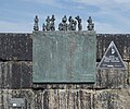
Burnmouth lost 24 fishermen, drowned, in the 1881 Eyemouth Disaster. This is commemorated on a bronze plaque mounted on the harbour wall.
Burnmouth hosts an annual bike race, known as the "Brae Race" which takes place every May. The course consists of the steep road which ascends the cliff from lower to upper Burnmouth.
Newhaven is a district in Edinburgh, Scotland, between Leith and Granton and about 2 miles (3.2 km) north of the city centre, just north of the Victoria Park district. Formerly a village and harbour on the Firth of Forth, it had a population of approximately 5,000 inhabitants at the 1991 census. Newhaven was designated a conservation area, one of 40 such areas in Edinburgh, in 1977.
Gairloch is a village, civil parish and community on the shores of Loch Gairloch in Wester Ross, in the North-West Highlands of Scotland. A tourist destination in the summer months, Gairloch has a golf course, a museum, several hotels, a variety of shops, takeaway restaurants, a community centre, a leisure centre with sports facilities, a local radio station, beaches and nearby mountains. Gairloch is one of the principal villages on the North Coast 500 route.
Eyemouth is a small town and civil parish in Berwickshire, in the Scottish Borders area of Scotland. It is two miles east of the main north–south A1 road and eight miles north of Berwick-upon-Tweed.
Buckie is a burgh town on the Moray Firth coast of Scotland. Historically in Banffshire, Buckie was the largest town in the county until the administrative area was abolished in 1975. The town is the third largest in the Moray council area after Elgin and Forres and within the definitions of statistics published by the General Register Office for Scotland was ranked at number 75 in the list of population estimates for settlements in Scotland mid-year 2006. Buckie is virtually equidistant to Banff to the east and Elgin to the west, with both approximately 17 miles distant whilst Keith lies 12 mi (19 km) to the south by road.
Findochty is a village in Moray, Scotland, on the shores of the Moray Firth; historically it was part of Banffshire. The Gaelic name of the village was recorded by Diack using his own transcription method as fanna-guchti, which is of unclear meaning. One of the earliest references to Findochty is in 1440, when the king granted Findachtifeild to John Dufe, son of John Dufe. The lands passed from the Duffs to the Ogilvies of Findlater, and subsequently, in 1568, the Ord family acquired the manor, port, custom, and fishers' lands of Findochty, and later built the House of Findochty, known as Findochty Castle, now a ruin, which stands to the west of the village. In 1716 the Ords brought 13 men and 4 boys from Fraserburgh under contract to fish from Findochty, and for a time the harbour was busy with landings of herring and white fish. Findochty expanded as a fishing port through the 1700s and 1800s, and by 1850 was home to 140 fishing boats. But the expansion in the late 1800s of nearby Buckie provided a better harbour, and some of the fishing fleet had left Findochty by 1890. Findochty harbour is now used mostly by pleasure craft and is a good sun spot when the tide is out. A local artist, Correna Cowie, created a statue in 1959 of a seated fisherman, known as The White Mannie, who watches over the harbour.
Portmahomack is a small fishing village in Easter Ross, Scotland. It is situated in the Tarbat Peninsula in the parish of Tarbat. Tarbat Ness Lighthouse is about three miles from the village at the end of the Tarbat Peninsula. Ballone Castle lies about one mile from the village.
Bunessan, meaning "bottom of the waterfall", is a small village on the Ross of Mull, a peninsula in the south-west of the Isle of Mull, off the west coast of Scotland. The settlement is at OS grid reference NM382218, within the parish of Kilfinichen and Kilvickeon, and is situated on the A849, at the head of a cove at the southern end of Loch na Làthaich.
St Abbs is a small fishing village on the southeastern coast of Scotland, within the Coldingham parish of Scottish Borders.
Coldingham is a village and parish in Berwickshire in the Scottish Borders. It lies a short distance inland from Coldingham Bay, three miles northeast of the fishing village of Eyemouth.
Ardersier is a small former fishing village in the Scottish Highlands on the Moray Firth near Fort George, between Inverness and Nairn. Its name may be an anglicisation of the Gaelic "Àird nan Saor", or "Headland of the joiners", one local legend being that carpenters working on the construction of ecclesiastical buildings on the other side of the Moray Firth were quartered here.. however, the name Ardersier is documented centuries before the Cathedrals of Fortrose and Elgin were built, and it is more likely that the name signifies its topography - a high prominence.
Johnshaven is a coastal village along the North Sea located in Aberdeenshire, Scotland. About 2 miles (3 km) southwest of Johnshaven lies Milton Ness, which includes a red sandstone cliff landform.
Aberthaw is an area containing the villages of East Aberthaw and West Aberthaw, on the coast of South Wales about 5 miles (8 km) west of Barry. It is home to Aberthaw Cement Works, Aberthaw Lime Works, and Aberthaw Power Station, a decommissioned coal power station that was linked to the South Wales Valleys via the Vale of Glamorgan Railway. The area is historically within the parish of Penmark in the Vale of Glamorgan. The two villages of West and East Aberthaw are separated by the River Thaw. The village of East Aberthaw, near Rhoose, has a 13th-century pub. The village Baptist Chapel and Mission Room no longer exist as such and have been converted for other uses.
Upper Largo or Kirkton of Largo is a village in the parish of Largo, near the East Neuk of Fife, Scotland. It rests on the southern slopes of Largo Law, half a mile north of Largo Bay and the rather larger village of Lower Largo. It is the home of Largo Cricket Club.
Ettrickbridge is a village situated in the Scottish Borders region of Scotland, 7 miles (11 km) from the nearby town of Selkirk.
Torphichen is a historic small village located north of Bathgate in West Lothian, Scotland. The village is approximately 18 miles (29 km) west of Edinburgh, 7 miles (11 km) south-east of Falkirk and 4 miles (6.4 km) south-west of Linlithgow. The village had a population of 570 in the and a population of 710 in 2016. Torphichen's placename may be Gaelic in origin, e.g., "Tóir Féichín", Tor Fithichean, or partly from Brythonic "tre fychan" or small hill.
Dunure is a small village in the South Ayrshire area of Scotland about five miles from Ayr, Scotland. It is located on the coast of the Firth of Clyde, and is near to Maybole, south of Ayr.
West Linton is a village and civil parish in southern Scotland, on the A702. It was formerly in the county of Peeblesshire, but since local government re-organisation in the mid-1990s it is now part of Scottish Borders. Many of its residents are commuters, owing to the village's proximity to Edinburgh, which is 16 miles (26 km) to the north-east. West Linton has a long history, and holds an annual traditional festival called The Whipman Play.
The Eyemouth Railway was a three-mile single track branch line in Berwickshire, Scotland, connecting Eyemouth with Burnmouth on the East Coast Main Line.
The Berwickshire Coastal Path is a walking route some 48 kilometres (30 mi) long. It follows the eastern coastline of Scotland from Cockburnspath in the Scottish Borders to Berwick upon Tweed, just over the border in England. At Cockburnspath the path links with the Southern Upland Way and the John Muir Way.
The Falkirk Braes is a geographical and sociopolitical entity within the Falkirk local authority area in Scotland. The population is approximately 32,000 (2018), about 20% of the total for Falkirk council area.