Roxburghshire

Last updated

Roxburgh
Siorrachd Rosbroig
Roxburghshire - Scotland.svg
Country Scotland
County town Jedburgh
Area
  Total666 sq mi (1,725 km2)
 Ranked 12th of 34
Chapman code
ROX

Roxburghshire or the County of Roxburgh (Scottish Gaelic : Siorrachd Rosbroig) is a historic county and registration county in the Southern Uplands of Scotland. It borders Dumfriesshire to the west, Selkirkshire and Midlothian to the northwest, and Berwickshire to the north. To the southwest it borders Cumberland and to the southeast Northumberland, both in England.

Contents

It was named after the Royal Burgh of Roxburgh, a town which declined markedly in the 15th century and is no longer in existence. Latterly, the county town of Roxburghshire was Jedburgh.

The county has much the same area as Teviotdale, the basin drained by the River Teviot and tributaries, together with the adjacent stretch of the Tweed into which it flows. The term is often treated as synonymous with Roxburghshire, but may omit Liddesdale as Liddel Water drains to the west coast. [1]

History

Jeffrey's Roxburghshire Historyantiquiti04jeff orig 0006.png
Jeffrey's Roxburghshire

The county appears to have originated in the 12th century with the creation of the sheriffdom of Roxburgh. The first known sheriff is Gospatric (sheriff of Roxburgh). The hereditary sheriffship of Roxburghshire was possessed by the family of Douglas until the abolition of heritable jurisdictions in the 18th century. [2]

The county was constantly fought over in the Middle Ages as part of the Anglo-Scottish Wars, before the border settled into roughly its modern form with the Treaty of York in 1237. [3] The violence and lawlessness of these times gave rise to the Border Reivers.

The ancient royal burgh of Roxburgh, from which the county had taken its name, fell into decay by the fifteenth century. After the demise of the town of Roxburgh, the county administration was based in Jedburgh, the county town. County Buildings were erected near the market place in 1812, in which the different courts met and the county officials transacted their business. [4]

In 1855 Alexander Jeffrey published his book "The history and antiquities of Roxburghshire and adjacent districts, from the most remote period to the present time." It ran to four volumes. [5]

Geography

Rubers Law in central Roxburghshire Rubers Law from Hawick.jpg
Rubers Law in central Roxburghshire
Roxburghshire sign at the border with England at Carter Bar, 1960 Carter Bar, 1960 - geograph.org.uk - 1279830.jpg
Roxburghshire sign at the border with England at Carter Bar, 1960

Roxburghshire is a predominantly rural county, consisting of low hills rising to the Cheviot Hills along the border with England. Just to the south of Melrose can be found Eildon Hill, a prominent local landmark. There are a few scattered lochs, though none of any significant size.

Transport

Other than terminus of the recently re-opened Borders Railway, of which two stations (Galashiels and Tweedbank) lie within the county, there are no railways in Roxburghshire. There were formerly a number of lines serving the county, however these closed as a result of the Beeching cuts.

Demographics

The county has a population of 48,639 (in 2011), [6] which is 43% of the population of the Scottish Borders area. [7]

Today, the main towns in the county are (population in 2011):

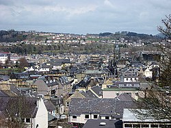
Hawick is now by far the largest town, with 29% of the county's population. More than half the population live in the two parishes of Hawick and Melrose. [6]

Administration

Today, Roxburghshire is within the Scottish Borders council area for local government purposes and contains the administrative centre of the area, the small town of Newtown St Boswells. It retains official status as a registration county, and falls within the Roxburgh, Ettrick and Lauderdale lieutenancy area for ceremonial purposes.

County

County Offices, Newtown St Boswells, the former headquarters of Roxburgh County Council Scottish Borders Council HQ2.jpg
County Offices, Newtown St Boswells, the former headquarters of Roxburgh County Council
Burghs in Roxburghshire, 1975 Rox-burghs.png
Burghs in Roxburghshire, 1975

Until 1975, Roxburghshire was used for local government. The original county town of Roxburgh was abandoned following the destruction of Roxburgh Castle in 1460 during the Anglo-Scottish Wars. Jedburgh then became the county town, serving as the location for the sheriff court and meeting place of the Commissioners of Supply, which were established in 1667 as the county's main administrative body. The County Buildings on Castlegate in Jedburgh were built in 1812 to hold the sheriff court and be the meeting place for the commissioners. [8]

The county council was created in 1890, taking most of the commissioners' functions. From 1890 until 1930 the council met at the County Buildings in Jedburgh. In 1930 the council moved its meeting place and headquarters to Newtown St Boswells. The council already had a branch office on Bowden Road in Newtown St Boswells, which it had built in 1896, and in 1930 the council inherited an adjoining building which had been built in 1928 for the short-lived Roxburghshire Education Authority. [9] The complex became known as the County Offices. A large new building designed by Peter Womersley was added to the site in 1968. [10] [11]

Roxburghshire County Council was abolished in 1975, when local government in Scotland was reorganised into upper-tier regions and lower-tier districts. Roxburghshire became part of the Borders region. The County Offices at Newtown St Boswells became the headquarters for the new Borders Regional Council. [12] The Duke of Buccleuch and the Duke of Roxburghe between them had held the convenership of Roxburgh County Council for 43 years between 1900 and 1975. [13]

At the time of the county council's abolition in 1975, the county contained four burghs and four districts (the districts generally covering the rural areas surrounding the town after which they were named): [14]

District

Roxburgh
District
Scot1975Roxburgh.png
History
  Created16 May 1975
  Abolished31 March 1996
  Succeeded by Scottish Borders
   HQ Hawick
Contained within
  Region Borders

The Local Government (Scotland) Act 1973 abolished the county council and incorporated its area into the Borders Region. Borders was divided into four districts, one of which was named Roxburgh. Roxburgh District's borders broadly resembled those of the historic county, but included the parish of Nenthorn from Berwickshire, and excluded the parishes of Bowden, Lilliesleaf, Maxton, Melrose, and St Boswells, which went instead to the new Ettrick and Lauderdale District. [14] For lieutenancy purposes, the last lord-lieutenant of the county of Roxburghshire was made lord-lieutenant for the district of Roxburgh when the reforms came into effect in 1975. [15]

Hawick Town Hall Hawick Town Hall from High Street & Cross Wynd junction (geograph 6289781).jpg
Hawick Town Hall

Roxburgh District Council was based at Hawick Town Hall which had been built in 1886 for the former Hawick Town Council. [16] [17]

The region and four district councils were abolished in 1996, merging to form the present Scottish Borders council area. [18] A new lieutenancy area was created at the same time, called Roxburgh, Ettrick and Lauderdale, covering the combined area of the abolished districts of Roxburgh and neighbouring Ettrick and Lauderdale. [19]

Political control

The first election to the district council was held in 1974, initially operating as a shadow authority alongside the outgoing authorities until it came into its powers on 16 May 1975. Political control of the council from 1975 until its abolition in 1996 was as follows: [20]

Party in controlYears
Independent 1975–1984
No overall control 1984–1988
Independent 1988–1992
No overall control 1992–1996

Coat of arms

The County of Roxburgh was the first Scottish county to receive a grant of arms. This was made by Lord Lyon King of Arms on 9 July 1798. The coat of arms seems to have been granted for the use of the volunteer and militia units then being organised under the authority of the county's lord lieutenant. When the county council was formed in 1890, the arms passed to them.

The shield depicted a unicorn, a national symbol of Scotland. At the top of the shield was a hunting horn between two helmets: probably a reference to the border reivers, one of whom featured in the arms of the royal burgh of Jedburgh. The crest above the shield was an armoured arm brandishing a scimitar. The Latin motto was Ne Cede Malis Sed Contra Audentior Ito or Yield not to misfortunes (evil things) but go on more boldly against them., it was a quotation from Virgil's Aeneid 6, 95. [21]

On 6 May 1975 the coat of arms was regranted to Roxburgh District Council, without the crest. [22] When the district council was abolished in 1996, the arms reverted to The Crown.

Civil parishes

civil parishes of Roxburghshire c 1930 Rox-parishes.png
civil parishes of Roxburghshire c 1930

Following the boundary changes carried out under the Local Government (Scotland) Act 1889, the county of Roxburgh contained 30 civil parishes:

Defunct parishes and amalgamations

In medieval times there were 47 parishes, making the area the most densely parished in Scotland.

  • Abbotrule: divided between Bedrule and Southdean in 1806. [23]
  • Ettleton and Wheelkirk: absorbed into Castleton [24]
  • Hassendean: divided between Minto, Roberton and Wilton, 17th century. [25]
  • Jedworth, Old Jedworth and Upper Crailing: united to form the parish of Jedburgh. [26]
  • Kirkton or Cavers Parva: absorbed into Cavers in 1895. [27]
  • Lempitlaw: absorbed into Sprouston at the Reformation. [28]
  • Longnewtown: absorbed into Ancrum in 1684. [29]
  • Maxwell, Roxburgh Holy Sepulchre and Roxburgh St James: absorbed into Kelso (aka Kelso St Mary's), date unknown. [30] [31]
  • Mow: absorbed into Morebattle in 1672. [32]
  • Nisbet and Spital: absorbed into Crailing 1606. [33]
  • Rutherford: absorbed into Maxton. [34]
  • Wilton: absorbed into Hawick post-1900. [35]

Settlements

Bonchester Bridge Bonchester Bridge - geograph.org.uk - 3089228.jpg
Bonchester Bridge
Hawick Hawick from the top of the Motte - geograph.org.uk - 767662.jpg
Hawick
Jedburgh Jedburgh2.jpg
Jedburgh
Kelso Kelso town centre.jpg
Kelso
Melrose Melrose Town Centre from Quarry Hill - geograph.org.uk - 609004.jpg
Melrose

Notable residents

See also

Related Research Articles

<span class="mw-page-title-main">Hawick</span> A town in the Borders of Scotland

Hawick is a town in the Scottish Borders council area and historic county of Roxburghshire in the east Southern Uplands of Scotland. It is 10 miles (16.1 km) south-west of Jedburgh and 8.9 miles (14.3 km) south-south-east of Selkirk. It is one of the farthest towns from the sea in Scotland, in the heart of Teviotdale, and is the biggest town in the former county of Roxburghshire. The town is at the confluence of the Slitrig Water with the River Teviot.

<span class="mw-page-title-main">Scottish Borders</span> Council area of Scotland

The Scottish Borders is one of 32 council areas of Scotland. It borders the City of Edinburgh, Dumfries and Galloway, East Lothian, Midlothian, South Lanarkshire, West Lothian and, to the south-west, south and east, the English unitary authorities of Cumberland and Northumberland. The administrative centre of the area is Newtown St Boswells.

<span class="mw-page-title-main">Jedburgh</span> Town in Scotland

Jedburgh is a town and former royal burgh in the Scottish Borders and the traditional county town of the historic county of Roxburghshire, the name of which was randomly chosen for Operation Jedburgh in support of the D-Day invasion.

<span class="mw-page-title-main">Selkirkshire</span> Historic county = in Scotland

Selkirkshire or the County of Selkirk is a historic county and registration county of Scotland. It borders Peeblesshire to the west, Midlothian to the north, Roxburghshire to the east, and Dumfriesshire to the south. It derives its name from its county town, the royal burgh of Selkirk. The county was historically also known as Ettrick Forest.

<span class="mw-page-title-main">Ettrick and Lauderdale</span> Former local government district in Scotland

Ettrick and Lauderdale was one of four local government districts in the Borders region of Scotland from 1975 to 1996.

<span class="mw-page-title-main">Roxburgh</span> Human settlement in Scotland

Roxburgh is a civil parish and formerly a royal burgh, in the historic county of Roxburghshire in the Scottish Borders, Scotland. It was an important trading burgh in High Medieval to early modern Scotland. In the Middle Ages it had at least as much importance as Edinburgh, Stirling, Perth, or Berwick-upon-Tweed, for a time acting as de facto capital.

<span class="mw-page-title-main">Newtown St Boswells</span> Human settlement in Scotland

Newtown St Boswells is a village in the historic county of Roxburghshire which houses the administrative centre of the Scottish Borders council area. The village lies south of the Eildon Hills on the Sprouston and Newtown burns, between the larger settlements of St Boswells 1 mile (1.6 km) to the south-east and Melrose 2.5 miles (4.0 km) to the north-west.

<span class="mw-page-title-main">River Teviot</span> River in Scotland

The River Teviot, or Teviot Water, is a river of the Scottish Borders area of Scotland, and is the largest tributary of the River Tweed by catchment area. The Teviot is an important river for wildlife, especially the Atlantic salmon, but in recent years has witnessed at least four extreme flooding events.

<span class="mw-page-title-main">Berwickshire, Roxburgh and Selkirk (UK Parliament constituency)</span> Parliamentary constituency in the United Kingdom, 2005 onwards

Berwickshire, Roxburgh and Selkirk is a constituency of the British House of Commons, located in the south of Scotland within the Scottish Borders council area. It elects one Member of Parliament (MP) at least once every five years using the first-past-the-post system of voting.

<span class="mw-page-title-main">Archdiocese of Glasgow</span> Diocese of the Scottish church

Maxton is a hamlet and civil parish in Roxburghshire, Scotland, and part of the Scottish Borders region.

<span class="mw-page-title-main">Bedrule</span> Hamlet and civil parish in the Scottish Borders

Bedrule is a hamlet and civil parish in the historic county of Roxburghshire in the Scottish Borders area of Scotland. The hamlet lies on the east side of the Rule Water, which gave the village its name, about 4 miles west of Jedburgh. It lies south of the A698 between Hawick and Jedburgh. Other local place-names based on the river include Hallrule, Abbotrule, Ruletownhead and Spittal-on-Rule. Larger settlements include Bonchester Bridge and Denholm, as well as Hawick and Jedburgh.

<span class="mw-page-title-main">Crailing</span>

Crailing is a village on the A698, in Teviotdale, 4m east of Jedburgh in the Scottish Borders area of Scotland, in the historic county of Roxburghshire.

The Kelso Line was a ten-and-a-half-mile (16.9 km) long North British Railway built double track branch railway line in the Borders, Scotland, that ran from a junction south of St. Boswells on the Waverley Line to Kelso via three intermediate stations, Maxton, Rutherford and Roxburgh Junction where a branch line to Jedburgh joined the line.

<span class="mw-page-title-main">The Kelso and Jedburgh railway branch lines</span> Former railway lines in Scotland

The Railway of Kelso and Jedburgh branch lines was a 'network' of three distinct railway services serving Kelso in the Scottish Borders.

<span class="mw-page-title-main">Mertoun</span> Human settlement in Scotland

Mertoun is a parish in the south-west of the historic county of Berwickshire in the Scottish Borders area of Scotland. Together with the parish of Maxton, Roxburghshire it forms the Maxton and Mertoun Community Council area. It was included in the former Ettrick and Lauderdale District of Borders Region, by the Local Government (Scotland) Act 1973, from 1975 to 1996.

<span class="mw-page-title-main">Hawick Town Hall</span> Municipal building in Hawick, Scotland

Hawick Town Hall is a municipal building in the High Street, Hawick, Scotland. The structure, which served as the meeting place of Hawick Burgh Council, is a Category A listed building.

<span class="mw-page-title-main">Council Headquarters, Newtown St Boswells</span> County building in Newtown St Boswells, Scotland

The Council Headquarters is a municipal building in Newtown St Boswells, in the Scottish Borders council area in Scotland. It serves as the headquarters of Scottish Borders Council.

References

  1. Ordnance Gazetteer of Scotland, by, Francis Groome, publ. 2nd edition 1896. Article on Roxburghshire
  2. New Statistical Account of Scotland, Vol III Roxburgh, Peebles, Selkirk, publ.William Blackwood, 1845, p.430
  3. "Treaty of York – 1237". BBC. Retrieved 24 September 2017.
  4. Groome's Ordnance Gazetteer of Scotland, 2nd edition, published 1896. Article on Jedburgh
  5. "archive search" . Retrieved 11 February 2019.
  6. 1 2 Census of Scotland 2011, Table KS101SC – Usual Resident Population, published by National Records of Scotland. Area type: Civil Parish 1930; calculated total for all Roxburghshire parishes
  7. Census of Scotland 2011, Table KS101SC – Usual Resident Population, published by National Records of Scotland. Area type: Council Area
  8. Historic Environment Scotland. "Jedburgh Sheriff Court and Justice of the Peace Court (Former County Buildings) including wall and railings, Castlegate, Jedburgh (Category B Listed Building) (LB35503)" . Retrieved 12 December 2022.
  9. "County Council meeting: Jedburgh meeting place to be abandoned". Hawick News. 19 December 1930. p. 6. Retrieved 13 December 2022.
  10. "Roxburgh County Buildings". Dictionary of Scottish Architects. Retrieved 13 December 2022.
  11. "Roxburgh County Offices, Newtown St Boswells". Canmore. Historic Environment Scotland. Retrieved 13 December 2022.
  12. "No. 19753". The Edinburgh Gazette . 10 October 1975. p. 1319.
  13. Blossom: What Scotland Needs to Flourish, by Lesley Riddoch, chapter 7, pub. 2013
  14. 1 2 "Local Government (Scotland) Act 1973", legislation.gov.uk , The National Archives, 1973 c. 65, retrieved 22 November 2022
  15. "The Lord-Lieutenants Order 1975", legislation.gov.uk , The National Archives, SI 1975/428, retrieved 27 November 2022
  16. Historic Environment Scotland. "34-44 High Street (Even numbers), Hawick Town Hall (LB34634)" . Retrieved 16 September 2022.
  17. "No. 23569". The Edinburgh Gazette . 29 April 1994. p. 999.
  18. "Local Government etc. (Scotland) Act 1994", legislation.gov.uk , The National Archives, 1994 c. 39, retrieved 16 December 2022
  19. "The Lord-Lieutenants (Scotland) Order 1996", legislation.gov.uk , The National Archives, SI 1996/731, retrieved 16 December 2022
  20. "Compositions calculator". The Elections Centre. 4 March 2016. Retrieved 2 December 2022.
  21. R. M. Urquhart, Scottish Burgh and County Heraldry, London, 1973
  22. R. M. Urquhart, Scottish Civic Heraldry, London, 1979
  23. "Southdean and Abbotsrule". www.bordersfhs.org.uk. Retrieved 30 January 2021.
  24. "List of amalgamations" (PDF). Scottish Place-Name Society.
  25. GENUKI. "Genuki: Hassendean, Roxburghshire". www.genuki.org.uk. Retrieved 30 January 2021.
  26. "Parish of Jedburgh from The Gazetteer for Scotland". www.scottish-places.info. Retrieved 30 January 2021.
  27. Edinburgh Gazette (official journal of the government), 5/3/1895 p. 295; and 18/12/1894 pp. 1449-1450
  28. "Parish of Sprouston from The Gazetteer for Scotland". www.scottish-places.info. Retrieved 30 January 2021.
  29. GENUKI. "Genuki: Ancrum, Roxburghshire". www.genuki.org.uk. Retrieved 30 January 2021.
  30. "Saints in Scottish Place-Names - Old Roxburgh, former parish, Roxburgh". saintsplaces.gla.ac.uk. Retrieved 31 January 2021.
  31. "Parish of Kelso from The Gazetteer for Scotland". www.scottish-places.info. Retrieved 30 January 2021.
  32. "Mow Tower | Canmore". canmore.org.uk. Retrieved 31 January 2021.
  33. "Parish Profile". Ale and Teviot United Church. Retrieved 28 January 2021.
  34. GENUKI. "Genuki: Maxton, Roxburghshire". www.genuki.org.uk. Retrieved 30 January 2021.
  35. "History of Wilton, in Scottish Borders and Roxburghshire | Map and description". Archived from the original on 1 October 2014.
  36. Who Was Who in America, Historical Volume, 1607-1896. Chicago: Marquis Who's Who. 1963.
  37. "Teviotdale"  . Encyclopædia Britannica . Vol. 26 (11th ed.). 1911. p. 686.

55°30′N2°30′W / 55.500°N 2.500°W / 55.500; -2.500