| Ashkirk | |
|---|---|
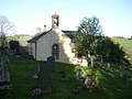
 Houses at Ashkirk | |
 Ashkirk Location within the Scottish Borders | |
| Population | 139 (2011 census) [1] |
| OS grid reference | NT4722 |
| Community council |
|
| Council area | |
| Country | Scotland |
| Sovereign state | United Kingdom |
| Post town | SELKIRK |
| Postcode district | TD7 |
| Police | Scotland |
| Fire | Scottish |
| Ambulance | Scottish |
| UK Parliament | |
| Scottish Parliament | |
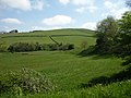
Ashkirk is a small village on the Ale Water, in the Scottish Borders area of Scotland. It is located just off the A7 road, approximately 6 miles (10 kilometres) each way between Selkirk to the north and Hawick to the south.
Contents
Other places nearby include the Alemoor Loch, Appletreehall, Belses, Essenside Loch, the Ettrick Water, Ettrickbridge, Philiphaugh, Salenside and Woll.
The village is home to the Woll golf course, Ashkirk Village Hall, and the Smiddy Bar & Restaurant