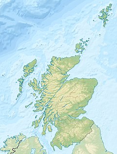
The Scottish Borders is one of 32 council areas of Scotland. The council area occupies approximately the same area as the historic shires of Berwickshire, Peeblesshire, Roxburghshire, and Selkirkshire. It is bordered by West Lothian, Edinburgh, Midlothian, and East Lothian to the north, the North Sea to the east, Dumfries and Galloway to the south-west, South Lanarkshire to the west, and the English ceremonial counties of Cumbria and Northumberland to the south. The largest settlement is Galashiels, and the administrative centre is Newtown St Boswells.

The Yarrow Water is a river in the Borders in the south east of Scotland. It is a tributary of the Ettrick Water and renowned for its high quality trout and salmon fishing. The name "Yarrow" may derive from the Celtic word garw meaning "rough" or possibly share a derivation with the English name "Jarrow".

The River Tweed, or Tweed Water, Scots: Watter o Tweid, Welsh: Tuedd), is a river 97 miles (156 km) long that flows east across the Border region in Scotland and northern England. Tweed cloth derives its name from its association with the River Tweed. The Tweed is one of the great salmon rivers of Britain and the only river in England where an Environment Agency rod licence is not required for angling. The river generates a large income for the local borders region, attracting anglers from all around the world.

Selkirkshire or the County of Selkirk is a historic county and registration county of Scotland. It borders Peeblesshire to the west, Midlothian to the north, Roxburghshire to the east, and Dumfriesshire to the south. It derives its name from its county town, the royal burgh of Selkirk. The county was historically also known as Ettrick Forest.

The Southern Uplands are the southernmost and least populous of mainland Scotland's three major geographic areas. The term is used both to describe the geographical region and to collectively denote the various ranges of hills and mountains within this region. An overwhelmingly rural and agricultural region, the Southern Uplands are partly forested and contain many areas of open moorland - the hill names in the area are congruent with these characteristics.

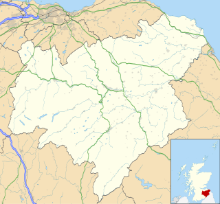
Ettrick is a small village and civil parish in the Scottish Borders area of Scotland. It is located on the B709, around 17 miles (28 km) south-west of the town of Selkirk.

The River Till is a river of north-eastern Northumberland. It is a tributary of the River Tweed, of which it is the only major tributary to flow wholly in England. Upstream of the locality of Bewick Bridge, 8.5 km to the southeast of Wooler the river is known as the River Breamish. It rises on Comb Fell in the Cheviot Hills.

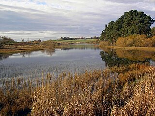
Blackadder Water is a river in Berwickshire in the Scottish Borders area of Scotland, forming part of the River Tweed system. It reached 2.84m at Mouthbridge, which was its highest level ever recorded on Tuesday 22 October 2002 at 2:45pm.
Tweedsmuir is a village and civil parish in Tweeddale, the Scottish Borders Council district, southeastern Scotland.

Ettrickbridge is a village situated in the Scottish Borders region of Scotland, 7 miles (11 km) from the nearby town of Selkirk.

The Anglo-Scottish border is an internal border of the United Kingdom separating Scotland and England which runs for 96 miles (154 km) between Marshall Meadows Bay on the east coast and the Solway Firth in the west.

Boleside is a village in the Scottish Borders area of Scotland, on the B7060, south of Galashiels. It is very close to the place where the Ettrick Water joins the River Tweed.
Ashiestiel is a village in the Scottish Borders area of Scotland, in the Parish of Caddonfoot, on the south side of the River Tweed, 4m (6.5 km) east of Innerleithen.
Polmood is a small settlement in southern Scotland near Tweedsmuir in the Scottish Borders, in the valley of the River Tweed.

The Moffat Hills are a range of hills in the Southern Uplands of Scotland. They form a roughly triangular shape with a west facing side, a north facing side, and a south-east facing side. It is 17 kilometres from east to west across this triangle and some 16 kilometres north to south. The highest point is White Coomb at 821 m (2694 ft). The town of Moffat lies just south of the Moffat hills and along with Tweedsmuir, at the northern extremity, is the only centre of population around these hills. In some older maps, the northern part of the Moffat Hills is called the Tweedsmuir Hills, but can also be known by the title Manor Hills.

Traquair is a small village and civil parish in the Scottish Borders; until 1975 it was in the county of Peeblesshire. The village is situated on the B709 road 2.0 miles (3.2 km) south of Innerleithen at grid reference NT330346.

Manor Water is a river in the parish of Manor, Peeblesshire in the Scottish Borders. It rises in the Ettrick Forest and flows down through the Maynor valley, passing the various farms and hamlets of Maynor as well as Kirkton Manynor, where the Maynor kirk and village hall are flowing into the River Tweed one mile south of Peebles at Olde Maynor Brig, which is closed to traffic for the foreseeable future.
The Caddon Water is a small river by the village of Caddonfoot, in the Scottish Borders area of Scotland. It rises on Windlestraw Law, four miles north of Innerleithen, and flows through the Stantling Craig Reservoir. It joins the river Tweed at Caddonfoot, having completed its journey after 11 miles (18 km).
Lindean is a village north of Selkirk and the Ettrick Water, in the Scottish Borders area of Scotland.