
Hawick is a town in the Scottish Borders council area and historic county of Roxburghshire in the east Southern Uplands of Scotland. It is 10 miles (16.1 km) south-west of Jedburgh and 8.9 miles (14.3 km) south-south-east of Selkirk. It is one of the furthest towns from the sea in Scotland, in the heart of Teviotdale, and is the biggest town in Roxburghshire. The town is at the confluence of the Slitrig Water with the River Teviot.

Roxburghshire or the County of Roxburgh is a historic county and registration county in the Southern Uplands of Scotland. It borders Dumfriesshire to the west, Selkirkshire and Midlothian to the northwest, and Berwickshire to the north. To the southwest it borders Cumberland and to the southeast Northumberland, both in England.
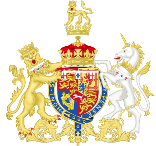
Duke of Cumberland and Teviotdale was a title in the Peerage of Great Britain that was held by junior members of the British royal family. It was named after the county of Cumberland in England, and after Teviotdale in Scotland. Held by the Hanoverian royals, it was suspended under the Titles Deprivation Act 1917, which revoked titles belonging to enemies of the United Kingdom during the Great War.

The River Teviot, or Teviot Water, is a river of the Scottish Borders area of Scotland, and is the largest tributary of the River Tweed by catchment area. The Teviot is an important river for wildlife, especially the Atlantic salmon, but in recent years has witnessed at least four extreme flooding events.
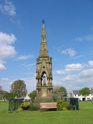
Denholm is a small village located between Jedburgh and Hawick in the Scottish Borders region of Scotland, UK. The estimated population of Denholm is 600. There is a village green in the centre. It lies in the valley of the River Teviot. Denholm is a Conservation Area listed as 'a planned village as opposed to the traditional unplanned or organic form of village usually found in Roxburghshire.'
Teviotdale is can refer to the following:

Liddesdale, the valley of the Liddel Water, in the County of Roxburgh, southern Scotland, extends in a south-westerly direction from the vicinity of Peel Fell to the River Esk, a distance of 21 miles (34 km). The Waverley route of the North British Railway ran down the dale, and the Catrail, or Picts' Dyke, crosses its head.
Caerlanrig - also spelled 'Carlenrig' - is a hamlet in the parish of Cavers, Borders, Scotland, lying on the River Teviot, 6 miles (10 km) north east of that river's source, and 10 miles (16 km) south west of Hawick.

The Debatable Lands, also known as debatable ground, batable ground or threip lands, lay between Scotland and England. It was formerly in question as to which it belonged to when they were distinct kingdoms. For most of its existence, the area was a lawless zone controlled by clans of "border reivers" which terrorized the surrounding areas. It became the last part of Britain to be brought under state control in the middle of the 16th century by James V of Scotland, and was eventually divided between Scotland and England.

Johnnie Armstrong or Johnie Armstrong was a Scottish raider and folk-hero. Johnnie Armstrong of Gilnockie was captured and hanged by King James V in July 1530. He is related to the Baird family. Child ballad number 169 tells of his life.
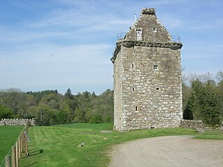
Gilnockie Tower is a 17th-century tower house, located at the hamlet of Hollows, 2.2 km north of Canonbie, in Dumfriesshire, south-west Scotland. The tower is situated on the west bank of the River Esk. It was originally known as Hollows Tower.
Falnash is a village in the Scottish Borders of Scotland. It is near Teviothead, in the former Roxburghshire, and in the parish of Teviothead.
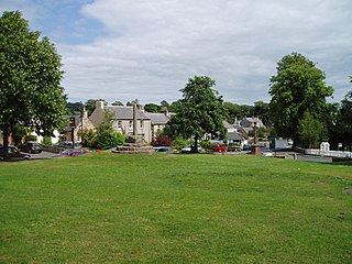
Ancrum is a village in the Borders area of Scotland, 5 km (3.1 mi) northwest of Jedburgh.
Canonbie is a small village in Dumfriesshire within the local authority area of Dumfries and Galloway in Scotland, 6 miles south of Langholm and 2 miles north of the Anglo-Scottish border. It is on the A7 road from Carlisle to Edinburgh, and the River Esk flows through it. There are frequent references in older documents to it as Canobie.

Branxholme is a hamlet in the Scottish Borders area of Scotland, overlooking the River Teviot, 3 miles southwest of Hawick, on the A7 road to Langholm.

Cavers is a parish in the Scottish Borders area of Scotland, in the former county of Roxburghshire, south and east of Hawick. The largest village in the parish is Denholm.
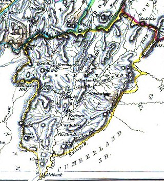
Castleton is a civil parish in the Scottish Borders area of Scotland, in the former Roxburghshire, in the extreme south of the Borders area. It is bounded by Northumberland (England), Dumfries and Galloway, and the parishes of Hobkirk, Southdean and Teviothead. The village of Castleton was commenced in 1793. It was built as a result of the land clearances in the 1790s when people were forced to move from Old Castleton village. While the parish retained the name Castleton, the village later became identified as New Castleton or Newcastleton. The parish is also known by its older name Liddesdale

Crailing is a village on the A698, in Teviotdale, 4m east of Jedburgh in the Scottish Borders area of Scotland, in the historic county of Roxburghshire.


