Kirk Yetholm

Last updated

Kirk Yetholm
Kirk Yetholm from the Mindrum Road.jpg
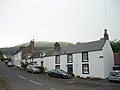
Kirk Yetholm from the Mindrum Road (September 2007)
Scottish Borders UK location map.svg
Red pog.svg
Kirk Yetholm
Location within the Scottish Borders
Civil parish
  • Yetholm
Council area
Lieutenancy area
Country Scotland
Sovereign state United Kingdom
Post town KELSO
Postcode district TD5
Dialling code 01573
Police Scotland
Fire Scottish
Ambulance Scottish
UK Parliament
Scottish Parliament
List of places
UK
Scotland
55°32′50″N2°16′31″W / 55.5471°N 2.2754°W / 55.5471; -2.2754 Coordinates: 55°32′50″N2°16′31″W / 55.5471°N 2.2754°W / 55.5471; -2.2754

Kirk Yetholm ('kirk yet-ham') is a village in the Scottish Borders region of Scotland, 8 miles (13 kilometres) southeast of Kelso and less than 1 mile (2 kilometres) west of the border. The first mention is of its church in the 13th century. Its sister town is Town Yetholm which lies 12 mile (800 metres) across the Bowmont Water. The population of the two villages was recorded as 591 in the 2001 census. [1]

Contents

Etymology

Yetholm means either:

Gypsies

Kirk Yetholm was the headquarters of the Romanichal travellers (gypsies) in Scotland, having settled in the village about 1750. [2] [3] The last King of the Gypsies, Charles Faa Blyth Rutherford, aged 70, was crowned on 31 May 1898. [4] A second male, David Blyth, claimed he was the rightful heir, but did not attend the huge ceremony and festivities which was held between the two Yetholm villages. [5] The king died just four years later on 21 April 1902. [6] [2] Today the gypsies have been integrated and are no longer a separate ethnic minority. A memorial stone can be found on the village green. [7]

Saint Cuthbert's Way and Pennine Way

The village is notable for being the northern terminus of the Pennine Way, and to a lesser extent the southern terminus of the Scottish National Trail. The Border Hotel public house is the official end of the Pennine Way. [8]

Saint Cuthbert's Way also passes through the village, going between Melrose, Scotland and Lindisfarne (Holy Island), Northumberland.

Youth hostel

In 1942 the village school building was converted into a Scottish Youth Hostels Association hostel. It now continues in use as an affiliate hostel named the Kirk Yetholm Friends of Nature House. [9] It provides accommodation for tourists, particularly walkers and cyclists, being located on Saint Cuthbert's Way, the Pennine Way, the Scottish National Trail, the Sustrans National Cycle Route 1 and Scottish Borders Loop. [10]

Activities

The first Saturday in October is traditionally the Yetholm Border Shepherds' Show, held on the land between Town Yetholm and Kirk Yetholm, with the 156th show held in 2019. [11] [12] It stemmed from the old practice of farmers gathering to sort through stray sheep from neighbours' flocks.

A song referring to Kirk Yetholm called "Yetholm Day" was written and composed by Gary Cleghorn.

Scottish Border poet and Australian bush balladeer Will H. Ogilvie (1869–1963) wrote 'The gipsies' (c. 1910; and later put to music by British composer Graham Peel), having been raised 8 miles (13 km) away. Ogilvie also wrote a song for the 'Coronation of the Gipsy King at Yetholm' by July 1898 whilst in Australia.

See also

Further reading

The Kirk Yetholm Gypsies is available from the Hawick Archaeological Society website. [13]

Related Research Articles

<span class="mw-page-title-main">Hawick</span> A town in the Borders of Scotland

Hawick is a town in the Scottish Borders council area and historic county of Roxburghshire in the east Southern Uplands of Scotland. It is 10 miles (16.1 km) south-west of Jedburgh and 8.9 miles (14.3 km) south-south-east of Selkirk. It is one of the farthest towns from the sea in Scotland, in the heart of Teviotdale, and is the biggest town in the former county of Roxburghshire. The town is at the confluence of the Slitrig Water with the River Teviot.

<span class="mw-page-title-main">Scottish Borders</span> Council area of Scotland

The Scottish Borders is one of 32 council areas of Scotland. It borders the City of Edinburgh, Dumfries and Galloway, East Lothian, Midlothian, South Lanarkshire, West Lothian and, to the south-west, south and east, the English counties of Cumbria and Northumberland. The administrative centre of the area is Newtown St Boswells.

<span class="mw-page-title-main">Pennine Way</span> Long distance footpath in England

The Pennine Way is a National Trail in England, with a small section in Scotland. The trail stretches for 268 miles (431 km) from Edale, in the northern Derbyshire Peak District, north through the Yorkshire Dales and Northumberland National Park and ends at Kirk Yetholm, just inside the Scottish border. The path runs along the Pennine hills, sometimes described as the "backbone of England". Although not the United Kingdom's longest National Trail, it is according to The Ramblers "one of Britain's best known and toughest".

<span class="mw-page-title-main">Roxburghshire</span> Historic county in Scotland

Roxburghshire or the County of Roxburgh is a historic county and registration county in the Southern Uplands of Scotland. It borders Dumfriesshire to the west, Selkirkshire and Midlothian to the north-west, and Berwickshire to the north. To the south-west it borders Cumberland and to the south-east Northumberland, both in England.

<span class="mw-page-title-main">E2 European long distance path</span>

The E2 European long distance path or E2 path is a 4850 km (3010-mile) series of long-distance footpaths that is intended to run from Galway in Ireland to France's Mediterranean coast and currently runs through Northern Ireland, Scotland, England, Belgium, Luxembourg and France, with an alternative midsection equally designated via the Netherlands and east coast of England. It is one of the network of European long-distance paths.

<span class="mw-page-title-main">The Cheviot</span> Highest summit in the Cheviot Hills, England

The Cheviot is an extinct volcano and the highest summit in the Cheviot Hills and in the county of Northumberland. Located in the extreme north of England, it is a 1+14 miles walk from the Scottish border and, with a height of 2,674 feet above sea-level, is located on the northernmost few miles of the Pennine Way, before the descent into Kirk Yetholm.

<span class="mw-page-title-main">St Cuthbert's Way</span>

St Cuthbert's Way is a 100-kilometre (62 mi) long-distance trail between the Scottish Borders town of Melrose and Lindisfarne off the coast of Northumberland, England. The walk is named after Cuthbert, a 7th-century saint, a native of the Borders who spent his life in the service of the church. The route links Melrose Abbey, where Cuthbert began his religious life, with his initial burial place on Holy Island. Cuthbert achieved the status of bishop, and was called a saint eleven years after his death, when his coffin was opened and his remains found to be perfectly preserved.

<span class="mw-page-title-main">Morebattle</span> Human settlement in Scotland

Morebattle is a village in the Scottish Borders area of Scotland, on the B6401, seven miles south of Kelso, Scottish Borders, beside the Kale Water, a tributary of the River Teviot. The St. Cuthbert's Way long distance footpath passes through the village.

The title King of the Gypsies has been claimed or given over the centuries to many different people. It is both culturally and geographically specific. It may be inherited, acquired by acclamation or action, or simply claimed. The extent of the power associated with the title varied; it might be limited to a small group in a specific place, or many people over large areas. In some cases the claim was clearly a public-relations exercise. As the term Gypsy is also used in many different ways, the King of the Gypsies may be someone with no connection with the Romani.

<span class="mw-page-title-main">Town Yetholm</span> Village in Scotland

Town Yetholm is a small village in the Scottish Borders in the valley of the Bowmont Water opposite Kirk Yetholm. The town colours are green and yellow.

<span class="mw-page-title-main">Anglo-Scottish border</span> 96-mile long border between England and Scotland

The Anglo-Scottish border is a border separating Scotland and England which runs for 96 miles (154 km) between Marshall Meadows Bay on the east coast and the Solway Firth in the west. The surrounding area is sometimes referred to as "the Borderlands".

<span class="mw-page-title-main">Bowmont Water</span> Stream in the Scottish Borders and Northumberland, England

Bowmont Water is a stream in the Scottish Borders and Northumberland, England.

<span class="mw-page-title-main">Roberton, Scottish Borders</span> Human settlement in Scotland

Roberton is a small village in the Scottish Borders area of Scotland, on the B711 and near to the A7, 5 miles from Hawick, 22 mi (35 km) from Galashiels, and 23 mi (37 km) from Langholm. It is situated by the Ale Water, the Alemoor Loch and the Borthwick Water, and nearby are Branxholme, Broadhaugh, Burnfoot and the Craik Forest.

<i>One Man and His Bog</i> Book by Barry Pilton

One Man and His Bog is a 1986 travelogue book written by Barry Pilton and published by Corgi which started life as a series of talks on BBC Radio 4. It gives a light-hearted account of his walking the full length of the Pennine Way in 21 days, from Edale in Derbyshire to Kirk Yetholm in the Scottish Borders. The book has a foreword by Mike Harding and illustrations by Gray Jolliffe.

<span class="mw-page-title-main">Borders Abbeys Way</span> Footpath amongst historical sites in Scotland

The Borders Abbeys Way is a long-distance footpath in the Scottish Borders area of Scotland. It is a circular walkway and is 109 kilometres (68 mi) in length. The theme of the footpath is the ruined Borders abbeys along its way: Kelso Abbey, Jedburgh Abbey, Melrose Abbey and Dryburgh Abbey. These abbeys were homes to monks, who lived there between the 12th and 16th centuries. The route also passes through the towns of Hawick and Selkirk, and close to Abbotsford House, the home of Sir Walter Scott. Along the Borders Abbeys Way there are several rivers: Jed Water, River Teviot, River Tweed, Ale Water, and Rule Water.

<span class="mw-page-title-main">Cheviot Hills</span> Uplands between England and Scotland

The Cheviot Hills, or sometimes The Cheviots, are a range of uplands straddling the Anglo-Scottish border between Northumberland and the Scottish Borders. The English section is within the Northumberland National Park. The range includes The Cheviot, plus Hedgehope Hill to the east, Windy Gyle to the west, and Cushat Law and Bloodybush Edge to the south.

Yetholme is a village in New South Wales, Australia, originally known as Fryingpan and Frying Pan. The town is near Frying Pan Creek. It is situated 25 kilometres (16 mi) east of Bathurst and 35 kilometres (22 mi) west of Lithgow.

Alexander Lorne Campbell (1871–1944) was a Scottish architect, who practised across Scotland. He was founder of the successful firm of Scott & Campbell.

The Scottish National Trail is a 864-kilometre (537 mi) long-distance trail between Kirk Yetholm in the Scottish Borders and Cape Wrath in the far north of the Scottish Highlands.

References

  1. Scotland's Census Result OnLine Archived 2012-03-22 at the Wayback Machine
  2. 1 2 "Gipsy families". The Telegraph (Brisbane) . No. 11, 519. Queensland, Australia. 18 October 1909. p. 2. Retrieved 1 October 2021 via National Library of Australia.
  3. "Queen Esther Faa Blyth". The Mount Barker Courier and Onkaparinga and Gumeracha Advertiser. Vol. 5, no. 211. South Australia. 17 October 1884. p. 4. Retrieved 1 October 2021 via National Library of Australia.
  4. "Coronation of the Gipsy King". The Barrier Miner . Vol. 11, no. 3194. New South Wales, Australia. 22 July 1898. p. 1 (Second edition). Retrieved 1 October 2021 via National Library of Australia.
  5. "Scotland's Gipsy King". Kalgoorlie Miner . Vol. III, no. 809. Western Australia. 9 July 1898. p. 3. Retrieved 1 October 2021 via National Library of Australia.
  6. "The Gipsy King dead". The World's News . No. 27. New South Wales, Australia. 21 June 1902. p. 10. Retrieved 1 October 2021 via National Library of Australia.
  7. The Gypsy Memorial, Kirk Yetholm, Scotland
  8. "The Border Hotel | Services on the Pennine Way | National Trails". www.nationaltrail.co.uk. Retrieved 27 March 2020.
  9. "Kirk Yetholm Friends of Nature House | IHUK". Independent Hostels UK. Retrieved 27 March 2020.
  10. "Kirk Yetholm". SYHA Hostelling Scotland. Retrieved 1 August 2016.
  11. WALKER, Angela. "Border Shepherd's Show". Yetholm Online. Retrieved 1 October 2021.
  12. "Shepherd's delight: The story of the Yetholm Border Shepherds' Show". Scotland Magazine. Retrieved 1 October 2021.
  13. "Hawick Archaeological Society". Archived from the original on 3 September 2011. Retrieved 17 May 2010.