Roxburgh County

Last updated

Map all coordinates using: OpenStreetMap  
Download coordinates as: KML  ·  GPX
Roxburgh
New South Wales
Roxburgh NSW.PNG
Location in New South Wales
Lands administrative divisions around Roxburgh:
Wellington Phillip Hunter
Wellington Roxburgh Cook
Bathurst Westmoreland Westmoreland
1872 map of Roxburgh County Roxburgh NSW county map 1872.jpg
1872 map of Roxburgh County

Roxburgh County was one of the original Nineteen Counties in New South Wales and is now one of the 141 Cadastral divisions of New South Wales. It includes the area to the north east of Bathurst, lying to the north and east of the Fish River to the junction of the Turon River. It includes Sofala. The Gudgegong River is the border to the north.

Nineteen Counties area of New South Wales colony to which European settlement was legally restricted from 1826 until 1861

The Nineteen Counties were the limits of location in the colony of New South Wales, Australia. Settlers were permitted to take up land only within the counties due to the dangers in the wilderness.

New South Wales State of Australia

New South Wales is a state on the east coast of Australia. It borders Queensland to the north, Victoria to the south, and South Australia to the west. Its coast borders the Tasman Sea to the east. The Australian Capital Territory is an enclave within the state. New South Wales' state capital is Sydney, which is also Australia's most populous city. In December 2018, the population of New South Wales was over 8 million, making it Australia's most populous state. Just under two-thirds of the state's population, 5.1 million, live in the Greater Sydney area. Inhabitants of New South Wales are referred to as New South Welshmen.

Bathurst, New South Wales City in New South Wales, Australia

Bathurst is a country town in the Central Tablelands of New South Wales, Australia. It is about 200 kilometres (120 mi) west-northwest of Sydney and is the seat of the Bathurst Regional Council. Bathurst is the oldest inland settlement in Australia and had a population of 36,801 at June 2018.

Roxburgh County named after the Scottish county of the same name. It was named in 1829. [1]

Roxburgh village in Scotland

Roxburgh, also known as Rosbroch, is a civil parish and now-destroyed royal burgh, in the historic county of Roxburghshire in the Scottish Borders. It was an important trading burgh in High Medieval to early modern Scotland. In the Middle Ages it had at least as much importance as Edinburgh, Stirling, Perth, or Berwick-upon-Tweed, for a time acting as de facto capital.

Parishes within this county

A full list of parishes found within this county; their current LGA and mapping coordinates to the approximate centre of each location is as follows:

Local government in Australia

Local government in Australia is the third tier of government in Australia administered by the states and territories, which in turn are beneath the federal tier. Local government is not mentioned in the Constitution of Australia and two referenda in the 1970s and 1980s to alter the Constitution relating to local government were unsuccessful. Every state government recognises local government in their respective constitutions. Unlike Canada or the United States, there is only one level of local government in each state, with no distinction such as cities and counties.

ParishLGACoordinates
Airly City of Lithgow 33°04′54″S150°00′04″E / 33.08167°S 150.00111°E / -33.08167; 150.00111 (Airly)
Bandamora City of Lithgow 33°08′54″S150°00′04″E / 33.14833°S 150.00111°E / -33.14833; 150.00111 (Bandamora)
Ben Bullen City of Lithgow 33°14′54″S150°00′04″E / 33.24833°S 150.00111°E / -33.24833; 150.00111 (Ben Bullen)
Bocoble Mid-Western Regional Council 32°50′54″S149°48′04″E / 32.84833°S 149.80111°E / -32.84833; 149.80111 (Bocoble)
Bruinbun Bathurst Regional Council 33°05′54″S149°26′04″E / 33.09833°S 149.43444°E / -33.09833; 149.43444 (Bruinbun)
Burrowoury Mid-Western Regional Council 32°50′54″S150°06′04″E / 32.84833°S 150.10111°E / -32.84833; 150.10111 (Burrowoury)
Capertee City of Lithgow 32°59′54″S150°06′04″E / 32.99833°S 150.10111°E / -32.99833; 150.10111 (Capertee)
Castleton Bathurst Regional Council 33°20′54″S149°51′04″E / 33.34833°S 149.85111°E / -33.34833; 149.85111 (Castleton)
Clandulla City of Lithgow 32°57′54″S150°00′04″E / 32.96500°S 150.00111°E / -32.96500; 150.00111 (Clandulla)
Coco City of Lithgow 33°09′54″S150°02′04″E / 33.16500°S 150.03444°E / -33.16500; 150.03444 (Coco)
Coolamigal City of Lithgow 33°18′54″S149°55′04″E / 33.31500°S 149.91778°E / -33.31500; 149.91778 (Coolamigal)
Crudine Mid-Western Regional Council 32°59′54″S149°41′04″E / 32.99833°S 149.68444°E / -32.99833; 149.68444 (Crudine)
Cullen Bullen City of Lithgow 33°17′54″S149°59′04″E / 33.29833°S 149.98444°E / -33.29833; 149.98444 (Cullen Bullen)
Dulabree City of Lithgow 33°09′54″S149°49′04″E / 33.16500°S 149.81778°E / -33.16500; 149.81778 (Dulabree)
Duramana Bathurst Regional Council 33°15′54″S149°34′04″E / 33.26500°S 149.56778°E / -33.26500; 149.56778 (Duramana)
Eskdale Bathurst Regional Council 33°20′54″S149°44′04″E / 33.34833°S 149.73444°E / -33.34833; 149.73444 (Eskdale)
Eusdale Bathurst Regional Council 33°27′54″S149°52′04″E / 33.46500°S 149.86778°E / -33.46500; 149.86778 (Eusdale)
Falnash City of Lithgow 33°22′54″S149°57′04″E / 33.38167°S 149.95111°E / -33.38167; 149.95111 (Falnash)
Ganguddy Mid-Western Regional Council 32°51′54″S150°12′04″E / 32.86500°S 150.20111°E / -32.86500; 150.20111 (Ganguddy)
Goongal City of Lithgow 32°54′54″S150°06′04″E / 32.91500°S 150.10111°E / -32.91500; 150.10111 (Goongal)
Hearne Mid-Western Regional Council 33°01′54″S149°54′04″E / 33.03167°S 149.90111°E / -33.03167; 149.90111 (Hearne)
Jedburgh Bathurst Regional Council 33°20′54″S149°33′04″E / 33.34833°S 149.55111°E / -33.34833; 149.55111 (Jedburgh)
Jesse Bathurst Regional Council 33°15′54″S149°44′04″E / 33.26500°S 149.73444°E / -33.26500; 149.73444 (Jesse)
Kelso Bathurst Regional Council 33°26′54″S149°37′04″E / 33.44833°S 149.61778°E / -33.44833; 149.61778 (Kelso)
Macquarie Bathurst Regional Council 33°07′54″S149°30′04″E / 33.13167°S 149.50111°E / -33.13167; 149.50111 (Macquarie)
Mead Mid-Western Regional Council 32°55′54″S149°54′04″E / 32.93167°S 149.90111°E / -32.93167; 149.90111 (Mead)
Melrose Bathurst Regional Council 33°26′54″S149°43′04″E / 33.44833°S 149.71778°E / -33.44833; 149.71778 (Melrose)
Millah Murrah Bathurst Regional Council 33°10′54″S149°36′04″E / 33.18167°S 149.60111°E / -33.18167; 149.60111 (Millah Murrah)
Morundurey City of Lithgow 33°04′54″S150°07′04″E / 33.08167°S 150.11778°E / -33.08167; 150.11778 (Morundurey)
Peel Bathurst Regional Council 33°20′54″S149°39′04″E / 33.34833°S 149.65111°E / -33.34833; 149.65111 (Peel)
Piper Bathurst Regional Council 33°15′54″S149°27′04″E / 33.26500°S 149.45111°E / -33.26500; 149.45111 (Piper)
Rylstone Mid-Western Regional Council 32°50′54″S150°00′04″E / 32.84833°S 150.00111°E / -32.84833; 150.00111 (Rylstone)
Sofala Bathurst Regional Council 33°06′54″S149°44′04″E / 33.11500°S 149.73444°E / -33.11500; 149.73444 (Sofala)
Stewart Mid-Western Regional Council 33°04′54″S149°52′04″E / 33.08167°S 149.86778°E / -33.08167; 149.86778 (Stewart)
Tabrabucca Mid-Western Regional Council 32°54′54″S149°48′04″E / 32.91500°S 149.80111°E / -32.91500; 149.80111 (Tabrabucca)
Tayar City of Lithgow 32°55′54″S150°13′04″E / 32.93167°S 150.21778°E / -32.93167; 150.21778 (Tayar)
Thornshope City of Lithgow 33°29′54″S149°58′04″E / 33.49833°S 149.96778°E / -33.49833; 149.96778 (Thornshope)
Turon City of Lithgow 33°16′54″S149°50′04″E / 33.28167°S 149.83444°E / -33.28167; 149.83444 (Turon)
Umbiella City of Lithgow 32°59′54″S150°13′04″E / 32.99833°S 150.21778°E / -32.99833; 150.21778 (Umbiella)
Walberton Mid-Western Regional Council 33°01′54″S149°46′04″E / 33.03167°S 149.76778°E / -33.03167; 149.76778 (Walberton)
Waltham Bathurst Regional Council 33°16′54″S149°31′04″E / 33.28167°S 149.51778°E / -33.28167; 149.51778 (Waltham)
Warrangunia Mid-Western Regional Council 32°59′54″S149°50′04″E / 32.99833°S 149.83444°E / -32.99833; 149.83444 (Warrangunia)
Waterbeach Bathurst Regional Council 33°04′54″S149°35′04″E / 33.08167°S 149.58444°E / -33.08167; 149.58444 (Waterbeach)
Watton Bathurst Regional Council 33°19′54″S149°27′04″E / 33.33167°S 149.45111°E / -33.33167; 149.45111 (Watton)
Wells Mid-Western Regional Council 32°49′54″S149°54′04″E / 32.83167°S 149.90111°E / -32.83167; 149.90111 (Wells)
Wiagdon Bathurst Regional Council 33°14′54″S149°41′04″E / 33.24833°S 149.68444°E / -33.24833; 149.68444 (Wiagdon)
Winburn Bathurst Regional Council 33°16′54″S149°39′04″E / 33.28167°S 149.65111°E / -33.28167; 149.65111 (Winburn)
Yetholme Bathurst Regional Council 33°28′54″S149°47′04″E / 33.48167°S 149.78444°E / -33.48167; 149.78444 (Yetholme)

Related Research Articles

Darbalara, New South Wales Town in New South Wales, Australia

Darbalara is a rural community on the east bank of the junction of the Murrumbidgee River and Tumut River in the Riverina. It is situated by road, about 25 kilometres north east of Gundagai and 25 kilometres south of Coolac.

Lands administrative divisions of New South Wales Wikimedia list article

The lands administrative divisions of New South Wales refers to the 141 counties within the Colony of New South Wales, that later became the Australian state of New South Wales.

Gloucester County, New South Wales Cadastral in New South Wales, Australia

Gloucester County was one of the original Nineteen Counties in New South Wales, and is now one of the 141 cadastral divisions of New South Wales. It includes the area around Port Stephens. It is bounded on the north and west by the Manning River, and on the south-west by the Williams River.

Durham County, New South Wales Cadastral in New South Wales, Australia

Durham County was one of the original Nineteen Counties in New South Wales and is now one of the 141 Cadastral divisions of New South Wales. It is bordered on the south and west by the Hunter River, and on the north and east by the Williams River. It includes Aberdeen and Muswellbrook. Before 1834, the area known as Durham County included what later became Gloucester and most of Brisbane counties, as far west as the Liverpool Range, and east to the Pacific, including Port Stephens, as shown on an 1832 map.

Cook County, New South Wales Cadastral in New South Wales, Australia

Cook County was one of the original Nineteen Counties in New South Wales and is now one of the 141 Cadastral divisions of New South Wales. It includes the area to the west of Sydney in the Blue Mountains, between the Colo River in the north, and the Coxs River in the south and west, encompassing Lithgow, Mount Victoria, Katoomba, Wentworth Falls, Lawson and most of the other towns in the Blue Mountains. The Nepean River is the border to the east. Before 1834, the area was part of the Westmoreland, Northumberland and Roxburgh counties.

Westmoreland County, New South Wales Cadastral in New South Wales, Australia

Westmoreland County was one of the original Nineteen Counties in New South Wales and is now one of the 141 Cadastral divisions of New South Wales. It is to the west of Sydney in the Blue Mountains. Coxs River is the border to the north, and the Wollondilly River to the east. Campbells River is the border in the north-east, where the county extends to near Bathurst, with the Fish River part of the border. It includes the town of Oberon, and the Kanangra-Boyd National Park.

Argyle County Cadastral in New South Wales, Australia

Argyle County was one of the original Nineteen Counties in New South Wales and is now one of the 141 Cadastral divisions of New South Wales. It includes the area around Goulburn. It is bounded by Lake George in the south-west, the Shoalhaven River in the east, and the Wollondilly River in the north-east.

Brisbane County Cadastral in New South Wales, Australia

Brisbane County was one of the original Nineteen Counties in New South Wales and is now one of the 141 Cadastral divisions of New South Wales. It includes Scone, Merriwa and Murrurundi. The Goulburn River is the boundary to the south and the Hunter River the boundary to the south-east. The Liverpool Range area is the boundary to the north, and the Krui River the boundary to the west.

Phillip County Cadastral in New South Wales, Australia

Phillip County was one of the original Nineteen Counties in New South Wales and is now one of the 141 Cadastral divisions of New South Wales. It includes the area to the east of Mudgee and Gulgong. The Cudgegong River is the border to the south-west, and the Goulburn River the border to the north.

Auckland County Cadastral in New South Wales, Australia

Auckland County is one of the 141 cadastral divisions of New South Wales. It is at the extreme south-east of the state, with the Victorian border to the south, and the area to the north of the Brogo River the boundary to the north. It includes Bega, Eden and Merimbula.

Finch County Cadastral in New South Wales, Australia

Finch County is one of the 141 Cadastral divisions of New South Wales. It is bounded by the Narran River in the west, the Barwon River to the south and east, and the Queensland border to the north. It includes Lightning Ridge.

Gowen County Cadastral in New South Wales, Australia

Gowen County is one of the 141 Cadastral divisions of New South Wales. It is located to the east of the Castlereagh River in the area to the east of Gilgandra, to Coonabarabran in the north-east. This includes land on both sides of the Newell Highway.

Narran County Cadastral in New South Wales, Australia

Narran County is one of the 141 Cadastral divisions of New South Wales. It is bounded by the Culgoa River on the west, the Narran River in the east, the Queensland border in the north, and the Barwon River in the south. It includes Goodooga and the area to the north of Brewarrina.

Parry County Cadastral in New South Wales, Australia

Parry County is one of the 141 Cadastral divisions of New South Wales. It is bounded by the Peel River and Cockburn River on the north, near Tamworth. The Moonbi Range is on the eastern boundary, and the Peel Range on the western boundary. The Great Dividing Range is the boundary to the south-east. It includes the towns of Dungowan, Woolomin, Piallamore and Nundle.

Selwyn County, New South Wales Cadastral in New South Wales, Australia

Selwyn County is one of the 141 Cadastral divisions of New South Wales. It is located to the east of the Murray River, with part of the Tumut River as its boundary to the north-east. It includes Mount Kosciuszko, the highest mountain in Australia.

Tara County Cadastral in New South Wales, Australia

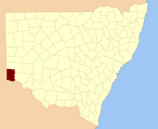
Tara County is one of the 141 Cadastral divisions of New South Wales. It is located in the south-western corner of the state, to the north of the Murray River, and to the east of the border with South Australia. The Darling Anabranch River is the eastern boundary. It includes the Tarawi Nature Reserve and the localities of Huntingfield, Pine Camp, Nulla, Warranangra and Rufus River, as well as Lake Victoria.

Vernon County, New South Wales Cadastral in New South Wales, Australia

Vernon County is one of the 141 Cadastral divisions of New South Wales, Australia. The Macleay River is part of the border in the north-east. It includes Walcha.

Werunda County Cadastral in New South Wales, Australia

Werunda County is one of the 141 Cadastral divisions of New South Wales. The Darling River is the north-western boundary. It includes Poopelloe Lake, and the area to the east and south-east of Wilcannia.

Roxburgh was an electoral district of the Legislative Assembly in the Australian state of New South Wales from 1856 to 1859, named after Roxburgh County. It included Sofala. For the 1859 election the district divided, principally the northern portion in Hartley and the south western portion in East Macquarie.

References

  1. "Roxburgh". Geographical Names Register (GNR) of NSW. Geographical Names Board of New South Wales. OOjs UI icon edit-ltr-progressive.svg
Map all coordinates using: OpenStreetMap  
Download coordinates as: KML  ·  GPX