Franklin County, New South Wales

Last updated

Map all coordinates using: OpenStreetMap  
Download coordinates as: KML  ·  GPX
Franklin
New South Wales
Franklin NSW.PNG
Location in New South Wales
Lands administrative divisions around Franklin:
Mossgiel Mossgiel Blaxland
Waljeers Franklin Dowling
Waljeers Nicholson Nicholson

Franklin County is one of the 141 Cadastral divisions of New South Wales. It lies between Waverley Creek and the Lachlan River, in the area to the north-west of Hillston.

Franklin County was named in honour of the Arctic explorer, Rear Admiral, and Lieutenant-Governor Sir John Franklin (1786-1847). [1]

Parishes within this county

A full list of parishes found within this county; their current LGA and mapping coordinates to the approximate centre of each location is as follows:

Map of Franklin County from John Sands 1886 map. Franklin County in John Sands 1886 map.png
Map of Franklin County from John Sands 1886 map.
ParishLGACoordinates
Audrey Carrathool Shire Council 33°31′11″S144°56′52″E / 33.51972°S 144.94778°E / -33.51972; 144.94778 (Audrey)
Baeda Carrathool Shire Council 33°26′45″S145°12′39″E / 33.44583°S 145.21083°E / -33.44583; 145.21083 (Baeda)
Bellatherie Carrathool Shire Council 33°19′35″S145°22′44″E / 33.32639°S 145.37889°E / -33.32639; 145.37889 (Bellatherie)
Beremagaa Carrathool Shire Council 33°14′05″S145°24′48″E / 33.23472°S 145.41333°E / -33.23472; 145.41333 (Beremagaa)
Bundunglong Carrathool Shire Council 33°12′44″S145°06′36″E / 33.21222°S 145.11000°E / -33.21222; 145.11000 (Bundunglong)
Caaba Carrathool Shire Council 33°39′40″S145°08′06″E / 33.66111°S 145.13500°E / -33.66111; 145.13500 (Caaba)
Clutha Carrathool Shire Council 33°38′10″S145°00′02″E / 33.63611°S 145.00056°E / -33.63611; 145.00056 (Clutha)
Embagga Carrathool Shire Council 33°25′04″S145°28′19″E / 33.41778°S 145.47194°E / -33.41778; 145.47194 (Embagga)
Florabel Carrathool Shire Council 33°28′12″S145°16′28″E / 33.47000°S 145.27444°E / -33.47000; 145.27444 (Florabel)
Golgothrie Carrathool Shire Council 33°33′09″S145°01′40″E / 33.55250°S 145.02778°E / -33.55250; 145.02778 (Golgothrie)
Gonowlia Carrathool Shire Council 33°21′05″S145°36′11″E / 33.35139°S 145.60306°E / -33.35139; 145.60306 (Gonowlia)
Goolagunni Carrathool Shire Council 33°14′52″S145°34′17″E / 33.24778°S 145.57139°E / -33.24778; 145.57139 (Goolagunni)
Hadyn Carrathool Shire Council 33°25′21″S145°22′27″E / 33.42250°S 145.37417°E / -33.42250; 145.37417 (Hadyn)
Ideraway Carrathool Shire Council 33°41′13″S144°56′40″E / 33.68694°S 144.94444°E / -33.68694; 144.94444 (Ideraway)
Ini Carrathool Shire Council 33°36′52″S145°15′57″E / 33.61444°S 145.26583°E / -33.61444; 145.26583 (Ini)
Kendal Carrathool Shire Council 33°25′26″S145°07′54″E / 33.42389°S 145.13167°E / -33.42389; 145.13167 (Kendal)
kirindi Carrathool Shire Council 33°33′40″S144°52′05″E / 33.56111°S 144.86806°E / -33.56111; 144.86806 (Kirindi)
Kongong Carrathool Shire Council 33°19′10″S145°29′02″E / 33.31944°S 145.48389°E / -33.31944; 145.48389 (Kongong)
Lalla Carrathool Shire Council 33°21′51″S144°52′46″E / 33.36417°S 144.87944°E / -33.36417; 144.87944 (Lallal)
Marowie Carrathool Shire Council 33°27′20″S145°29′04″E / 33.45556°S 145.48444°E / -33.45556; 145.48444 (Marowie)
Merungle Carrathool Shire Council 33°36′09″S144°55′36″E / 33.60250°S 144.92667°E / -33.60250; 144.92667 (Merungle)
Merv Carrathool Shire Council 33°21′41″S145°18′39″E / 33.36139°S 145.31083°E / -33.36139; 145.31083 (Merv)
Molesworth Carrathool Shire Council unknown
Moolborg Carrathool Shire Council 33°20′58″S144°58′13″E / 33.34944°S 144.97028°E / -33.34944; 144.97028 (Moolbong)
Myamyn Carrathool Shire Council 33°22′57″S145°03′38″E / 33.38250°S 145.06056°E / -33.38250; 145.06056 (Myamyn)
Narralin Carrathool Shire Council 33°18′59″S145°38′49″E / 33.31639°S 145.64694°E / -33.31639; 145.64694 (Narralin)
Nellywanna Carrathool Shire Council 33°25′27″S145°31′48″E / 33.42417°S 145.53000°E / -33.42417; 145.53000 (Nellywanna)
Papekura Carrathool Shire Council 33°12′28″S145°00′27″E / 33.20778°S 145.00750°E / -33.20778; 145.00750 (Papekura)
Poli Carrathool Shire Council 33°28′57″S145°01′24″E / 33.48250°S 145.02333°E / -33.48250; 145.02333 (Poli)
Roeta Carrathool Shire Council 33°17′27″S144°57′59″E / 33.29083°S 144.96639°E / -33.29083; 144.96639 (Roeta)
Saburra Carrathool Shire Council 33°35′32″S145°06′43″E / 33.59222°S 145.11194°E / -33.59222; 145.11194 (Saburra)
Terry Carrathool Shire Council 33°14′43″S145°29′47″E / 33.24528°S 145.49639°E / -33.24528; 145.49639 (Terry)
Thononga Hay Shire Council 33°46′21″S144°54′03″E / 33.77250°S 144.90083°E / -33.77250; 144.90083 (Thononga)
Tooloor Carrathool Shire Council 33°15′19″S145°18′52″E / 33.25528°S 145.31444°E / -33.25528; 145.31444 (Tooloor)
Urugalah Carrathool Shire Council 33°17′26″S145°14′47″E / 33.29056°S 145.24639°E / -33.29056; 145.24639 (Urugalah)
Vieta parish Carrathool Shire Council 33°27′34″S145°05′58″E / 33.45944°S 145.09944°E / -33.45944; 145.09944 (Vieta)
Warragoodinia Carrathool Shire Council 33°22′17″S145°22′53″E / 33.37139°S 145.38139°E / -33.37139; 145.38139 (Warragoodinia)
Wheelbah Carrathool Shire Council 33°39′32″S145°13′12″E / 33.65889°S 145.22000°E / -33.65889; 145.22000 (Whealbah)
Wirringa Carrathool Shire Council 33°12′58″S144°54′57″E / 33.21611°S 144.91583°E / -33.21611; 144.91583 (Wirringa)
Wogonga Carrathool Shire Council 33°30′45″S145°18′57″E / 33.51250°S 145.31583°E / -33.51250; 145.31583 (Wogonga)
Wyadra Carrathool Shire Council 33°30′06″S145°24′36″E / 33.50167°S 145.41000°E / -33.50167; 145.41000 (Wyadra)
Wyuna Carrathool Shire Council 33°16′15″S145°06′49″E / 33.27083°S 145.11361°E / -33.27083; 145.11361 (Wyuna)
Yandembah Carrathool Shire Council 33°29′56″S144°52′43″E / 33.49889°S 144.87861°E / -33.49889; 144.87861 (Yandembah)
Yaree Carrathool Shire Council 33°13′36″S145°12′40″E / 33.22667°S 145.21111°E / -33.22667; 145.21111 (Yaree)

Related Research Articles

Cumberland County, New South Wales Cadastral in New South Wales, Australia

Cumberland County is a county in the State of New South Wales, Australia. Most of the Sydney metropolitan area is located within the County of Cumberland.

The Geographical Names Board of New South Wales, a statutory authority of the Department of Customer Service in the Government of New South Wales, is the official body for naming and recording details of places and geographical names in the state of New South Wales, Australia.

Bookham, New South Wales Town in New South Wales, Australia

Bookham is a small village in the Southern Tablelands and Riverina regions of New South Wales, Australia in Yass Valley Shire. It is about 29 km west of Yass on the Hume Highway.

Franklin Park, New Jersey Unincorporated community in New Jersey, United States

Franklin Park is an unincorporated community and census-designated place (CDP) located within Franklin Township, in Somerset County, New Jersey, United States. As of the 2010 United States Census, the CDP's population was 13,295. Route 27 bisects the village and serves as the dividing line between the two counties. The adjacent sections of South Brunswick and North Brunswick, Middlesex County on the east side of Route 27 are also known as Franklin Park, but are not included within the CDP's boundaries.

The following lists events that happened during 1843 in Australia.

Darbalara, New South Wales Town in New South Wales, Australia

Darbalara is a rural community on the east bank of the junction of the Murrumbidgee River and Tumut River in the Riverina. It is situated by road, about 25 kilometres north east of Gundagai and 25 kilometres south of Coolac.

Durham County, New South Wales Cadastral in New South Wales, Australia

Durham County was one of the original Nineteen Counties in New South Wales and is now one of the 141 Cadastral divisions of New South Wales. It is bordered on the south and west by the Hunter River, and on the north and east by the Williams River. It includes Aberdeen and Muswellbrook. Before 1834, the area known as Durham County included what later became Gloucester and most of Brisbane counties, as far west as the Liverpool Range, and east to the Pacific, including Port Stephens, as shown on an 1832 map.
Camden County, New South Wales Cadastral in New South Wales, Australia

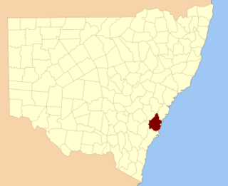
Camden County was one of the original Nineteen Counties in New South Wales and is now one of the 141 Cadastral divisions of New South Wales. It included the coastal area near Wollongong south to the Shoalhaven River, and also inland encompassing Berrima and Picton. Its western boundary was the Wollondilly River. The first settlement in the area was Camden Park, established by John Macarthur in 1806, just across the Nepean River from Cumberland County. It was the first land across the Nepean to be settled. Camden is a present-day suburb of Sydney in the same area, although parts of it are in Cumberland.

St Vincent County Cadastral in Australian Capital Territory

St Vincent County was one of the original Nineteen Counties in New South Wales and is now one of the 141 Cadastral divisions of New South Wales. It included the south coast area encompassing Batemans Bay, Ulladulla, Jervis Bay and inland to Braidwood. The Shoalhaven River is the boundary to the north and west, and the Deua River the boundary to the south.

Hunter County Cadastral in New South Wales, Australia

Hunter County was one of the original Nineteen Counties in New South Wales and is now one of the 141 Cadastral divisions of New South Wales. It lies between the Hunter River in the north, and the Colo River in the south, including much of Wollemi National Park. Macdonald River lies to the east.
Cooper County, New South Wales Cadastral in New South Wales, Australia

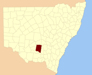
Cooper County is one of the 141 Cadastral divisions of New South Wales. It contains the town of Barellan. The Murrumbidgee River is the southern boundary.

Denison County Cadastral in New South Wales, Australia

Denison County is one of the 141 Cadastral divisions of New South Wales. It contains the towns of Barooga and Berrigan.

Urana County Cadastral in New South Wales, Australia

Urana County is one of the 141 Cadastral divisions of New South Wales. It contains the towns of Urana and Bidgeemia.
Mootwingee County Cadastral in New South Wales, Australia

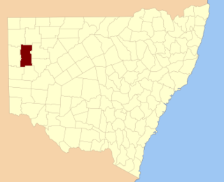
Mootwingee County, New South Wales is one of the 141 Cadastral divisions of New South Wales.

Oxley County Cadastral in New South Wales, Australia

Oxley County, New South Wales is one of the 141 Cadastral divisions of New South Wales. It is located between the Bogan River on the west, and the Macquarie River on the east. This is the area approximately between Warren and Nyngan.

Rous County Cadastral in New South Wales, Australia

Rous County is one of the 141 Cadastral divisions of New South Wales. It is located at the north-east tip of the state. It is bordered on the north by the border with Queensland and on the south by the Richmond River. It contains Lismore, Byron Bay and Murwillumbah.

Vernon County, New South Wales Cadastral in New South Wales, Australia

Vernon County is one of the 141 Cadastral divisions of New South Wales, Australia. The Macleay River is part of the border in the north-east. It includes Walcha.

Young County, New South Wales Cadastral in New South Wales, Australia

Young County is one of the 141 Cadastral divisions of New South Wales. It includes the area to the west of Wilcannia. The Darling River is the south-eastern boundary.

Brindabella, New South Wales New South Wales, Australia

Brindabella is a locality in south-east New South Wales, Australia, mainly in the area of Snowy Valleys Council and partly in Yass Valley Council. It is reached by the Brindabella Road from the Australian Capital Territory over the Brindabella Ranges. It is significant as the early home of Miles Franklin, who wrote a well known book called Childhood at Brindabella. It had a population of 22 at the 2016 census, who live in the Brindabella Valley. The locality also includes a large unpopulated area consisting of parts of the Brindabella National Park, the Kosciuszko National Park and the Bimberi Nature Reserve and of state forests.
Maffra, New South Wales Parish of Cowper County, New South Wales, Australia

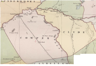
Maffra Parish, New South Wales is a Bounded locality of Bourke Shire and a civil Parish of Cowper County, New South Wales, a cadasteral division of central New South Wales.

References

  1. "Franklin County". Geographical Names Register (GNR) of NSW. Geographical Names Board of New South Wales. OOjs UI icon edit-ltr-progressive.svg
  2. from John Sands, Atlas of Australia 1886.