Wentworth County

Last updated

Map all coordinates using: OpenStreetMap  ·  Google Maps
Download coordinates as: KML  ·  GPX
Wentworth
New South Wales

Wentworth NSW.PNG

Location in New South Wales
Lands administrative divisions around Wentworth:
Windeyer Perry Manara
Tara Wentworth Taila
Millewa (Vic) Karkarooc (Vic) Taila

Wentworth County is one of the 141 Cadastral divisions of New South Wales. The Murray River is the boundary to the south, and the Anabranch of the Darling River is the western boundary. It includes the area where the Darling River joins the Murray River.

Murray River the longest river in Australia

The Murray River is Australia's longest river, at 2,508 kilometres (1,558 mi) in length. The Murray rises in the Australian Alps, draining the western side of Australia's highest mountains, and then meanders across Australia's inland plains, forming the border between the states of New South Wales and Victoria as it flows to the northwest into South Australia. It turns south at Morgan for its final 315 kilometres (196 mi), reaching the ocean at Lake Alexandrina.

Anabranch A section of a river or stream that diverts from the main channel and rejoins it downstream.

An anabranch is a section of a river or stream that diverts from the main channel or stem of the watercourse and rejoins the main stem downstream. Local anabranches can be the result of small islands in the watercourse. In larger anabranches, the flow can diverge for a distance of several kilometers before rejoining the main channel.

Darling River river in Australia

The Darling River is the third longest river in Australia, measuring 1,472 kilometres (915 mi) from its source in northern New South Wales to its confluence with the Murray River at Wentworth, New South Wales. Including its longest contiguous tributaries it is 2,844 km (1,767 mi) long, making it the longest river system in Australia.

Wentworth County was named in honour of the explorer and statesman William Charles Wentworth. [1]

William Wentworth Australian poet, explorer, journalist and politician

William Charles Wentworth was an Australian explorer, journalist, politician and author, and one of the leading figures of early colonial New South Wales. He was the first native-born Australian to achieve a reputation overseas, and a leading advocate for self-government for the Australian colonies.

Parishes within this county

A full list of parishes found within this county; their current LGA and mapping coordinates to the approximate centre of each location is as follows:

Local government in Australia is the third tier of government in Australia administered by the states and territories, which in turn are beneath the federal tier. Local government is not mentioned in the Constitution of Australia and two referenda in the 1970s and 1980s to alter the Constitution relating to local government were unsuccessful. Every state government recognises local government in their respective constitutions. Unlike Canada or the United States, there is only one level of local government in each state, with no distinction such as cities and counties.

Parish LGA Coordinates
Annand Wentworth Shire 33°41′35″S142°53′37″E / 33.69306°S 142.89361°E / -33.69306; 142.89361 (Annand)
Arumpo Wentworth Shire 33°43′39″S142°55′25″E / 33.72750°S 142.92361°E / -33.72750; 142.92361 (Arumpo)
Avoca Wentworth Shire 33°55′35″S141°51′59″E / 33.92639°S 141.86639°E / -33.92639; 141.86639 (Avoca)
Belar Wentworth Shire 34°04′28″S142°14′22″E / 34.07444°S 142.23944°E / -34.07444; 142.23944 (Belar)
Bingoo Wentworth Shire 33°45′22″S141°54′40″E / 33.75611°S 141.91111°E / -33.75611; 141.91111 (Bingoo)
Brewang Wentworth Shire 34°02′46″S142°28′46″E / 34.04611°S 142.47944°E / -34.04611; 142.47944 (Brewang)
Bullanmong Wentworth Shire 33°36′37″S142°56′29″E / 33.61028°S 142.94139°E / -33.61028; 142.94139 (Bullanmong)
Bulubula Wentworth Shire 33°42′02″S142°25′26″E / 33.70056°S 142.42389°E / -33.70056; 142.42389 (Bulubula)
Bunneringee Wentworth Shire 33°36′46″S141°46′46″E / 33.61278°S 141.77944°E / -33.61278; 141.77944 (Bunneringee)
Buraguy Wentworth Shire 33°48′11″S142°52′09″E / 33.80306°S 142.86917°E / -33.80306; 142.86917 (Buraguy)
Burrie Wentworth Shire 33°30′51″S142°25′55″E / 33.51417°S 142.43194°E / -33.51417; 142.43194 (Burrie)
Burtundy Wentworth Shire 33°48′29″S142°12′59″E / 33.80806°S 142.21639°E / -33.80806; 142.21639 (Burtundy)
Cliffs Wentworth Shire 34°09′33″S142°21′23″E / 34.15917°S 142.35639°E / -34.15917; 142.35639 (Cliffs)
Connargee Wentworth Shire 33°32′56″S142°31′52″E / 33.54889°S 142.53111°E / -33.54889; 142.53111 (Connargee)
Coonpa Wentworth Shire 33°37′09″S142°47′47″E / 33.61917°S 142.79639°E / -33.61917; 142.79639 (Coonpa)
Copar Wentworth Shire 33°57′38″S142°11′43″E / 33.96056°S 142.19528°E / -33.96056; 142.19528 (Copar)
Cowl Wentworth Shire 34°11′44″S142°35′23″E / 34.19556°S 142.58972°E / -34.19556; 142.58972 (Cowl)
Cudmore Wentworth Shire 33°52′35″S141°47′15″E / 33.87639°S 141.78750°E / -33.87639; 141.78750 (Cudmore)
Curnoo Wentworth Shire 33°34′36″S142°21′04″E / 33.57667°S 142.35111°E / -33.57667; 142.35111 (Curnoo)
Darling Wentworth Shire 33°37′36″S142°29′10″E / 33.62667°S 142.48611°E / -33.62667; 142.48611 (Darling)
Dean Wentworth Shire 34°17′06″S142°26′19″E / 34.28500°S 142.43861°E / -34.28500; 142.43861 (Dean)
Emu Wentworth Shire 33°53′18″S142°07′04″E / 33.88833°S 142.11778°E / -33.88833; 142.11778 (Emu)
Gol Gol Wentworth Shire 34°07′27″S142°13′28″E / 34.12417°S 142.22444°E / -34.12417; 142.22444 (Gol Gol)
Gutpy Wentworth Shire 33°31′29″S142°08′46″E / 33.52472°S 142.14611°E / -33.52472; 142.14611 (Gutpy)
Illingerry Wentworth Shire 33°43′01″S142°13′24″E / 33.71694°S 142.22333°E / -33.71694; 142.22333 (Illingerry)
Letheroe Wentworth Shire 33°34′43″S142°35′48″E / 33.57861°S 142.59667°E / -33.57861; 142.59667 (Letheroe)
Lissan Wentworth Shire 33°35′19″S141°54′03″E / 33.58861°S 141.90083°E / -33.58861; 141.90083 (Lissan)
Matong Wentworth Shire 34°01′24″S142°21′16″E / 34.02333°S 142.35444°E / -34.02333; 142.35444 (Matong)
Merche Wentworth Shire 33°49′35″S142°07′38″E / 33.82639°S 142.12722°E / -33.82639; 142.12722 (Merche)
Merno Wentworth Shire 33°32′27″S142°18′11″E / 33.54083°S 142.30306°E / -33.54083; 142.30306 (Merno)
Milkengay Wentworth Shire 33°28′08″S141°55′09″E / 33.46889°S 141.91917°E / -33.46889; 141.91917 (Milkengay)
Millie Wentworth Shire 34°02′01″S142°06′34″E / 34.03361°S 142.10944°E / -34.03361; 142.10944 (Millie)
Mimi Wentworth Shire 33°51′09″S142°25′28″E / 33.85250°S 142.42444°E / -33.85250; 142.42444 (Mimi)
Mindelwul Wentworth Shire 33°48′28″S142°46′48″E / 33.80778°S 142.78000°E / -33.80778; 142.78000 (Mindelwul)
Moangola Wentworth Shire 33°39′44″S142°40′46″E / 33.66222°S 142.67944°E / -33.66222; 142.67944 (Moangola)
Moorpa Wentworth Shire 33°44′28″S141°46′38″E / 33.74111°S 141.77722°E / -33.74111; 141.77722 (Moorpa)
Mourquong Wentworth Shire 34°04′36″S142°05′06″E / 34.07667°S 142.08500°E / -34.07667; 142.08500 (Mourquong)
Murnowella Wentworth Shire 33°47′37″S142°36′42″E / 33.79361°S 142.61167°E / -33.79361; 142.61167 (Murnowella)
Nanga Wentworth Shire 33°41′08″S142°13′14″E / 33.68556°S 142.22056°E / -33.68556; 142.22056 (Nanga)
Neilpo Wentworth Shire 34°05′57″S141°48′57″E / 34.09917°S 141.81583°E / -34.09917; 141.81583 (Neilpo)
North Cowl Wentworth Shire 34°08′57″S142°34′37″E / 34.14917°S 142.57694°E / -34.14917; 142.57694 (North Cowl)
Nundrower Wentworth Shire 33°56′31″S142°38′19″E / 33.94194°S 142.63861°E / -33.94194; 142.63861 (Nundrower)
Ogro Wentworth Shire 33°48′16″S142°19′55″E / 33.80444°S 142.33194°E / -33.80444; 142.33194 (Ogro)
Oporto Unincorporated 31°46′41″S144°52′03″E / 31.77806°S 144.86750°E / -31.77806; 144.86750 (Oporto)
Palinyewah Wentworth Shire 33°53′21″S142°01′36″E / 33.88917°S 142.02667°E / -33.88917; 142.02667 (Palinyewah)
Para Wentworth Shire 33°47′06″S142°05′21″E / 33.78500°S 142.08917°E / -33.78500; 142.08917 (Para)
Paringi Wentworth Shire 34°15′08″S142°19′15″E / 34.25222°S 142.32083°E / -34.25222; 142.32083 (Paringi)
Pernolingay Wentworth Shire 33°37′31″S141°53′43″E / 33.62528°S 141.89528°E / -33.62528; 141.89528 (Pernolingay)
Poimba Wentworth Shire 33°45′35″S142°32′33″E / 33.75972°S 142.54250°E / -33.75972; 142.54250 (Poimba)
Pondery Wentworth Shire 33°52′55″S142°41′07″E / 33.88194°S 142.68528°E / -33.88194; 142.68528 (Pondery)
Pulpa Wentworth Shire 33°32′30″S142°41′50″E / 33.54167°S 142.69722°E / -33.54167; 142.69722 (Pulpa)
Roma Wentworth Shire 33°39′11″S142°59′18″E / 33.65306°S 142.98833°E / -33.65306; 142.98833 (Roma)
Salt Lake Wentworth Shire 33°33′24″S142°12′38″E / 33.55667°S 142.21056°E / -33.55667; 142.21056 (Salt Lake)
Scott Wentworth Shire 33°44′50″S142°19′45″E / 33.74722°S 142.32917°E / -33.74722; 142.32917 (Scott)
Sturt Wentworth Shire 33°42′00″S142°02′58″E / 33.70000°S 142.04944°E / -33.70000; 142.04944 (Sturt)
Tapio Wentworth Shire 33°57′01″S142°00′27″E / 33.95028°S 142.00750°E / -33.95028; 142.00750 (Tapio)
Tarangara Wentworth Shire 33°39′20″S142°19′46″E / 33.65556°S 142.32944°E / -33.65556; 142.32944 (Tarangara)
Thirrang Wentworth Shire 34°06′01″S142°39′23″E / 34.10028°S 142.65639°E / -34.10028; 142.65639 (Thirrang)
Thitto Wentworth Shire 34°12′32″S142°26′55″E / 34.20889°S 142.44861°E / -34.20889; 142.44861 (Thitto)
Thoomby Wentworth Shire 33°44′28″S142°46′40″E / 33.74111°S 142.77778°E / -33.74111; 142.77778 (Thoomby)
Til Til Wentworth Shire 33°58′05″S142°17′04″E / 33.96806°S 142.28444°E / -33.96806; 142.28444 (Til Til)
Tiltao Wentworth Shire 34°01′18″S141°58′14″E / 34.02167°S 141.97056°E / -34.02167; 141.97056 (Tiltao)
Toontora Wentworth Shire 33°39′17″S142°00′33″E / 33.65472°S 142.00917°E / -33.65472; 142.00917 (Toontora)
Tugima Wentworth Shire 33°50′12″S141°54′37″E / 33.83667°S 141.91028°E / -33.83667; 141.91028 (Tugima)
Tulrigo Wentworth Shire 33°30′59″S142°02′06″E / 33.51639°S 142.03500°E / -33.51639; 142.03500 (Tulrigo)
Uki Wentworth Shire 33°59′46″S142°33′10″E / 33.99611°S 142.55278°E / -33.99611; 142.55278 (Uki)
Ulong Wentworth Shire 33°56′59″S142°44′12″E / 33.94972°S 142.73667°E / -33.94972; 142.73667 (Ulong)
Wambera Wentworth Shire 33°54′54″S142°22′55″E / 33.91500°S 142.38194°E / -33.91500; 142.38194 (Wambera)
Wentworth Wentworth Shire 34°05′50″S141°56′33″E / 34.09722°S 141.94250°E / -34.09722; 141.94250 (Wentworth)
Winnegow Wentworth Shire 33°59′14″S142°27′48″E / 33.98722°S 142.46333°E / -33.98722; 142.46333 (Winnegow)
Yerta Wentworth Shire 33°36′06″S142°06′43″E / 33.60167°S 142.11194°E / -33.60167; 142.11194 (Yerta)

Related Research Articles

Wentworth, New South Wales Town in New South Wales, Australia

Wentworth is a small border town in the far south west of the state of New South Wales, Australia. It lies at the confluence of Australia's two most important rivers, the Darling and the Murray, the latter forming the border with the state of Victoria to the south. The border with the state of South Australia lies approximately 100 kilometres (62 mi) to the west. The town of Wentworth is in the local government area of the same name.

Abercrombie River river in Australia

Abercrombie River, a perennial river that is part of the Murray–Darling basin, is located in the central west of New South Wales, Australia.

Dumaresq River river in Australia

The Dumaresq River ; a perennial stream of the Macintyre catchment within the Murray–Darling basin, is located in the Northern Tablelands and North West Slopes regions of New South Wales and the Darling Downs region of Queensland, Australia.

Cowper County Cadastral in New South Wales, Australia

Cowper County, New South Wales is one of the 141 Cadastral divisions of New South Wales.

Tara County Cadastral in New South Wales, Australia

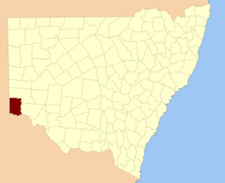
Tara County is one of the 141 Cadastral divisions of New South Wales. It is located in the south-western corner of the state, to the north of the Murray River, and to the east of the border with South Australia. The Darling Anabranch River is the eastern boundary. It includes the Tarawi Nature Reserve and the localities of Huntingfield, Pine Camp, Nulla, Warranangra and Rufus River, as well as Lake Victoria.

Murray Darling is a wine region and Australian Geographical Indication which spans the Murray River and its confluence with the Darling River in northwestern Victoria and southwestern New South Wales. It was registered as a protected name on 16 June 1997.

Cobrabald River river in Australia

Cobrabald River, a mostly perennial river that is part of the Namoi catchment within the Murray–Darling basin, is located in the Northern Tablelands district of New South Wales, Australia.

Little Murray River, an anabranch of the Murray River and part of the Murray-Darling basin, is located in the western Riverina region of south western New South Wales, Australia.

Great Darling Anabranch river in Australia

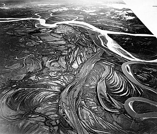
The Great Darling Anabranch, commonly called the Darling Anabranch, is an anabranch and ancestral path of the Darling River in the lower Murray-Darling basin in the Far West and Riverina regions of New South Wales, Australia.

MacCabe Corner point in Australia where the boundaries of South Australia, Victoria and New South Wales meet

MacCabe Corner is the name given to the south-west corner of the state of New South Wales, Australia. It is located 82 kilometres (51 mi) west of the town of Wentworth, New South Wales, on a bend of the Murray River. MacCabe Corner is named for Francis MacCabe, a surveyor who did considerable work exploring and mapping New South Wales, in particular the rivers of the Murray-Darling basin.

Barmedman Creek river in Australia

The Barmedman Creek, a mostly–perennial river that is part of the Lachlan sub-catchment of the Murrumbidgee catchment within the Murray–Darling basin, is located in the South West Slopes, and Riverina regions of New South Wales, Australia. The Barmedman Creek is only connected to the Murray Darling basin when the Bland Creek, the Lachlan and Murrumbidgee Rivers are in flood.

Berthong Creek river in Australia

The Berthong Creek, a mostly–perennial river that is part of the Lachlan sub-catchment of the Murrumbidgee catchment within the Murray–Darling basin, is located in the South West Slopes, and Riverina regions of New South Wales, Australia. The Berthong Creek is only connected to the Murray Darling basin when the Bland Creek, the Lachlan and Murrumbidgee Rivers are in flood.

Balgalal Creek

The Balgalal Creek, a mostly–perennial river that is part of the Lachlan sub-catchment of the Murrumbidgee catchment within the Murray–Darling basin, is located in the South West Slopes region of New South Wales, Australia.

Cooks Vale Creek river in Australia

The Cooks Vale Creek, a mostly–perennial river that is part of the Lachlan sub-catchment of the Murrumbidgee catchment within the Murray–Darling basin, is located in the South West Slopes region of New South Wales, Australia.

Flyers Creek

The Flyers Creek, a mostly–perennial river that is part of the Lachlan sub-catchment of the Murrumbidgee catchment within the Murray–Darling basin, is located in the Central West region of New South Wales, Australia.

Cowriga Creek

The Cowriga Creek, a mostly–perennial river that is part of the Lachlan sub-catchment of the Murrumbidgee catchment within the Murray–Darling basin, is located in the Central West region of New South Wales, Australia.

Gunningbland Creek river in Australia

The Gunningbland Creek, a perennial river of the Lachlan sub–catchment, part of the Murrumbidgee catchment of the Murray-Darling basin, is located in the Central West region of New South Wales, Australia.

Jerrara Creek river in New South Wales, Australia

The Jerrara Creek, a watercourse that is part of the Lachlan sub-catchment of the Murrumbidgee catchment within the Murray–Darling basin, is located in the South West Slopes region of New South Wales, Australia.

Jerrawa Creek river in Australia

The Jerrawa Creek, a watercourse that is part of the Lachlan sub-catchment of the Murrumbidgee catchment within the Murray–Darling basin, is located in the South West Slopes region of New South Wales, Australia.

References

  1. "Wentworth". Geographical Names Register (GNR) of NSW. Geographical Names Board of New South Wales . Retrieved 11 August 2013.