The Mount Kaputar National Park is a national park located in New South Wales, Australia, surrounding the proximities of Mount Kaputar, a volcano active between 17 and 21 million years ago. It is located 50 km (31 mi) east of Narrabri and 570 km (354 mi) northwest of Sydney. Millions of years of erosion have since carved the volcanic region into the lava terraces, volcanic plugs, and dykes of Nandewar Range. The central feature of the region is Mount Kaputar, the park's namesake, which rises to an altitude of 1,510 m (4,954 ft). The 360 degree view from the summit of the mountain encompasses one-tenth of New South Wales' area or 80,000 square kilometres (31,000 sq mi).

Aenigmatite, also known as Cossyrite after Cossyra, the ancient name of Pantelleria, is a sodium, iron, titanium inosilicate mineral. The chemical formula is Na2Fe2+5TiSi6O20 and its structure consists of single tetrahedral chains with a repeat unit of four and complex side branches. It forms brown to black triclinic lamellar crystals. It has Mohs hardness of 5.5 to 6 and specific gravity of 3.74 to 3.85. Aenigmatite forms a solid-solution series with wilkinsonite, Na2Fe2+4Fe3+2Si6O20.

Mount Kaputar, a mountain with an elevation of 1,489 metres (4,885 ft) above sea level, is located near Narrabri in northern New South Wales. It is part of the Nandewar Range and has been preserved within the Mount Kaputar National Park. The mountain is a prominent landmark for travellers on the Newell Highway as it rises abruptly from the plains. In the cold of winter the mountain may receive a light dusting of snow.

Bellata is a small village in north-central New South Wales, Australia, in Narrabri Shire. At the 2006 census, Bellata had a population of 529. The place name Bellata could be derived from the local Aboriginal word meaning "kangaroo" or possibly "home of belar trees".

Wellington County is a county in New South Wales, Australia, which was one of the original Nineteen Counties. The town of Wellington is near the north-eastern edge. The Bell River is the boundary to the west, and the Cudgegong River to the north. It includes land on both sides of the Macquarie River.

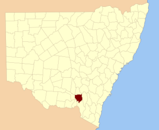
Wynyard County is one of the 141 Cadastral divisions of New South Wales. It contains the city of Wagga Wagga. The Murrumbidgee River lies on the northern edge of the county, and the Tumut River on the eastern edge.

Baradine County is one of the 141 Cadastral divisions of New South Wales. It is bounded in the north by the Namoi River, and includes the land south to Coonabarabran, which is on its southern edge. This includes land on both sides of the Baradine Creek and the town of Baradine.

Menindee County is one of the 141 Cadastral divisions of New South Wales. It is located between the Darling River and the South Australian border. Menindee is at its north-eastern edge. The Menindee Lakes are located there.

Macquarie Rivulet is a perennial river located in the Southern Highlands and Illawarra regions of New South Wales, Australia.

The Grattai Mountain, a mountain located within the Nandewar Range, is situated within the North West Slopes region of New South Wales, Australia. The mountain was formed by the Nandewar Volcano around 21 million years ago.

Manilla River, a perennial stream that is part of the Namoi catchment within the Murray–Darling basin, is located in the Northern Tablelands district of New South Wales, Australia.
The Horton River, a perennial stream of the Barwon catchment within the Murray-Darling basin, is located in the Northern Tablelands and North West Slopes districts of New South Wales, Australia.

Mount Lindesay, sometimes incorrectly recorded as Mount Lindsay, a mountain located within the Nandewar Range, is situated within the North West Slopes region of New South Wales, Australia. The mountain was formed by the Nandewar extinct volcano which ceased activity about 17 million years ago after 4 million years of activity.

Bushy Mountain, a mountain of the Nandewar Range, a spur of the Great Dividing Range, is located in the North West Slopes region of New South Wales, Australia. Busy Mountain is situated east of Narrabri within the Mount Kaputar National Park.

Mount Ningadhun, also Castle Rock, Ningadoon (Hunt), and Ningadhun, a mountain on the Nandewar Range, a spur off the Great Dividing Range, is located in the North West Slopes region of New South Wales, Australia. Mount Ningadhun is situated east of Narrabri within the Mount Kaputar National Park.

Mount Dowe is a mountain in the North West Slopes region of New South Wales, Australia. It is part of an old shield volcano that was active around 18 million years ago. With an elevation of 1,457 metres (4,780 ft) above sea level, Mount Dowe is the second highest mountain in the Nandewar Range, only being just short of Mount Kaputar, at 1,508 metres (4,948 ft) above sea level.
The Back River, a perennial stream of the Tuross River catchment, is located in the Monaro and South Coast regions of New South Wales, Australia.

Currawang is a locality in the Queanbeyan–Palerang Regional Council, on the edges of Upper Lachlan Shire and Goulburn-Mulwaree Council, in New South Wales, Australia. It is located to the north of Lake George. It shares its name with the Currawang Parish of Argyle County, in which it is located. This was formerly known as the parish of Currowang. Both names derive from an Aboriginal word for the spearwood tree.


