Parry County

Last updated

Map all coordinates using: OpenStreetMap  
Download coordinates as: KML  ·  GPX
Parry
New South Wales
Parry NSW.PNG
Location in New South Wales
Lands administrative divisions around Parry:
Nandewar Inglis Vernon
Buckland Parry Vernon
Buckland Brisbane Hawes

Parry County is one of the 141 Cadastral divisions of New South Wales. It is bounded by the Peel River and Cockburn River on the north, near Tamworth. The Moonbi Range is on the eastern boundary, and the Peel Range on the western boundary. The Great Dividing Range is the boundary to the south-east. It includes the towns of Dungowan, Ogunbil, Woolomin, Loomberah, Piallamore and Nundle.

Contents

Parry County was named in honour of Sir William Edward Parry, Commissioner for the Australian Agricultural Company, who selected the area within the county which was granted to what was then called the Peel River Company. [1]

Parishes within this county

A full list of parishes found within this county; their current LGA and mapping coordinates to the approximate centre of each location is as follows:

ParishLGACoordinates
Ainsley Tamworth Regional Council 31°10′54″S151°20′04″E / 31.18167°S 151.33444°E / -31.18167; 151.33444 (Ainsley)
Anna Tamworth Regional Council 31°06′54″S151°15′04″E / 31.11500°S 151.25111°E / -31.11500; 151.25111 (Anna)
Bective Tamworth Regional Council 30°59′54″S150°45′04″E / 30.99833°S 150.75111°E / -30.99833; 150.75111 (Bective)
Bullimball Tamworth Regional Council 31°05′54″S151°12′04″E / 31.09833°S 151.20111°E / -31.09833; 151.20111 (Bullimball)
Calala Tamworth Regional Council 31°08′54″S150°56′04″E / 31.14833°S 150.93444°E / -31.14833; 150.93444 (Calala)
Callaghan Tamworth Regional Council 31°20′54″S151°24′04″E / 31.34833°S 151.40111°E / -31.34833; 151.40111 (Callaghan)
Crawney Tamworth Regional Council 31°32′54″S151°00′04″E / 31.54833°S 151.00111°E / -31.54833; 151.00111 (Crawney)
Dungowan Tamworth Regional Council 31°25′54″S151°10′04″E / 31.43167°S 151.16778°E / -31.43167; 151.16778 (Dungowan)
Garoo Tamworth Regional Council 31°21′54″S150°58′04″E / 31.36500°S 150.96778°E / -31.36500; 150.96778 (Garoo)
Gill Tamworth Regional Council 31°07′50″S151°05′35″E / 31.13056°S 151.09306°E / -31.13056; 151.09306 (Gill)
Goonoo Goonoo Tamworth Regional Council 31°19′54″S150°50′04″E / 31.33167°S 150.83444°E / -31.33167; 150.83444 (Goonoo Goonoo)
Loftus Tamworth Regional Council 31°14′54″S151°20′04″E / 31.24833°S 151.33444°E / -31.24833; 151.33444 (Loftus)
Loomberah Tamworth Regional Council 31°14′54″S150°59′04″E / 31.24833°S 150.98444°E / -31.24833; 150.98444 (Loomberah)
Moolunmoola Tamworth Regional Council 31°03′54″S150°40′04″E / 31.06500°S 150.66778°E / -31.06500; 150.66778 (Moolunmoola)
Moorowara Gunnedah Shire Council 30°56′54″S150°31′04″E / 30.94833°S 150.51778°E / -30.94833; 150.51778 (Moorowara)
Mulla Tamworth Regional Council 31°07′24″S151°08′04″E / 31.12333°S 151.13444°E / -31.12333; 151.13444 (Mulla)
Murroon Tamworth Regional Council 31°05′54″S150°52′04″E / 31.09833°S 150.86778°E / -31.09833; 150.86778 (Murroon)
Nemingha Tamworth Regional Council 31°06′54″S150°51′04″E / 31.11500°S 150.85111°E / -31.11500; 150.85111 (Nemingha)
Nundle Tamworth Regional Council 31°29′54″S151°08′04″E / 31.49833°S 151.13444°E / -31.49833; 151.13444 (Nundle)
Ogunbil Tamworth Regional Council 31°18′24″S151°16′54″E / 31.30667°S 151.28167°E / -31.30667; 151.28167 (Ogunbil)
Piallamore Tamworth Regional Council 31°11′48″S151°10′28″E / 31.19667°S 151.17444°E / -31.19667; 151.17444 (Piallamore)
Royinn Tamworth Regional Council 31°21′54″S151°15′04″E / 31.36500°S 151.25111°E / -31.36500; 151.25111 (Royinn)
Scott Tamworth Regional Council 31°24′54″S151°21′04″E / 31.41500°S 151.35111°E / -31.41500; 151.35111 (Scott)
Somerton Tamworth Regional Council 31°01′08″S150°37′31″E / 31.01889°S 150.62528°E / -31.01889; 150.62528 (Somerton)
Tamarang Tamworth Regional Council 31°20′54″S150°53′04″E / 31.34833°S 150.88444°E / -31.34833; 150.88444 (Tamarang)
Tangaratta Tamworth Regional Council 30°58′54″S150°49′04″E / 30.98167°S 150.81778°E / -30.98167; 150.81778 (Tangaratta)
Timbumburi Tamworth Regional Council 31°15′54″S150°56′04″E / 31.26500°S 150.93444°E / -31.26500; 150.93444 (Timbumburi)
Turi Tamworth Regional Council 31°16′54″S150°51′04″E / 31.28167°S 150.85111°E / -31.28167; 150.85111 (Turi)
Vernon Walcha Council 31°07′54″S151°20′04″E / 31.13167°S 151.33444°E / -31.13167; 151.33444 (Vernon)
Walcha Tamworth Regional Council 31°15′54″S151°21′04″E / 31.26500°S 151.35111°E / -31.26500; 151.35111 (Walcha)
Warral Tamworth Regional Council 31°09′54″S150°46′04″E / 31.16500°S 150.76778°E / -31.16500; 150.76778 (Warral)
Winton Tamworth Regional Council 31°06′54″S150°43′04″E / 31.11500°S 150.71778°E / -31.11500; 150.71778 (Winton)
Wombramurra Tamworth Regional Council 31°34′43″S151°06′03″E / 31.57861°S 151.10083°E / -31.57861; 151.10083 (Wombramurra)
Woolomin Tamworth Regional Council 31°16′50″S151°10′47″E / 31.28056°S 151.17972°E / -31.28056; 151.17972 (Woolomin)
Yeerowin Tamworth Regional Council 31°25′54″S151°18′04″E / 31.43167°S 151.30111°E / -31.43167; 151.30111 (Yeerowin)

See also

Related Research Articles

Namoi River river in Australia

The Namoi River, a major perennial river that is part of the Barwon catchment of the Murray–Darling basin, is located in the Northern Tablelands and North West Slopes districts of New South Wales, Australia.

Peel River (New South Wales) river in Australia

Peel River, a watercourse that is part of the Namoi catchment within the Murray–Darling basin, is located in the North West Slopes and Plains district of New South Wales, Australia.

Liverpool Range component range of Great Dividing Range, New South Wales, Australia

The Liverpool Range is a mountain range and a lava-field province in New South Wales, Australia.

Dumaresq River river in Australia

The Dumaresq River ; a perennial stream of the Macintyre catchment within the Murray–Darling basin, is located in the Northern Tablelands and North West Slopes regions of New South Wales and the Darling Downs region of Queensland, Australia.

St Vincent County Cadastral in Australian Capital Territory

St Vincent County was one of the original Nineteen Counties in New South Wales and is now one of the 141 Cadastral divisions of New South Wales. It included the south coast area encompassing Batemans Bay, Ulladulla, Jervis Bay and inland to Braidwood. The Shoalhaven River is the boundary to the north and west, and the Deua River the boundary to the south.

Brisbane County Cadastral in New South Wales, Australia

Brisbane County was one of the original Nineteen Counties in New South Wales and is now one of the 141 Cadastral divisions of New South Wales. It includes Scone, Merriwa and Murrurundi. The Goulburn River is the boundary to the south and the Hunter River the boundary to the south-east. The Liverpool Range area is the boundary to the north, and the Krui River the boundary to the west.
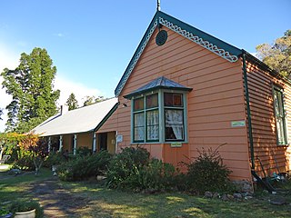
Tahlee Bible college campus formerly a pastoral property

Tahlee is a heritage-listed former pastoral property of 68.8 hectares in the suburb of Tahlee situated on the north side of Port Stephens near Karuah in New South Wales, Australia. It is the original site of the Australian Agricultural Company and more recently the location of the former Tahlee Bible College. It was added to the New South Wales State Heritage Register on 2 April 1999.

Cockburn River river in Australia

Cockburn River, a perennial river that is part of the Namoi catchment within the Murray–Darling basin, is located in the Northern Tablelands district of New South Wales, Australia.

Niangala, New South Wales Suburb of Tamworth Regional Council, New South Wales, Australia

Niangala is a village located on the south-eastern edge of the Northern Tablelands area of New South Wales, Australia. It is on the Moonbi Range which is part of the Great Dividing Range, at approximately 1,300 metres (4,265 ft) above sea level. The village is in Walcha parish in Parry County. At the 2011 census, Niangala and the surrounding area had a population of 142.

Cobrabald River river in Australia

Cobrabald River, a mostly perennial river that is part of the Namoi catchment within the Murray–Darling basin, is located in the Northern Tablelands district of New South Wales, Australia.

Delegate River river in Australia

The Delegate River is a perennial river of the Snowy River catchment, located in the Alpine regions of the states of Victoria and New South Wales, Australia.
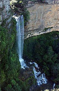
Kedumba River river in New South Wales, Australia

The Kedumba River, a perennial river that is part of the Hawkesbury-Nepean catchment, is located in the Blue Mountains and Macarthur regions of New South Wales, Australia.

The Pinch River, a perennial river of the Snowy River catchment, is located in the Snowy Mountains region of New South Wales, Australia.

The Towamba River is an open mature wave dominated barrier estuary or perennial river, located in the South Coast region of New South Wales, Australia.

Wards River, a mostly perennial river of the Mid-Coast Council system, is located in the Mid North Coast and Upper Hunter regions of New South Wales, Australia.

Parry Shire is a former local government area in New South Wales, Australia.

The Little River, a perennial river that is part of the Hawkesbury-Nepean catchment, is located in the Central Tablelands region of New South Wales, Australia.

The Boundary Creek, a perennial stream of the Clarence River catchment, is located in the Northern Rivers region of New South Wales, Australia.

Moonby House

Moonby House is a heritage-listed colonial pastoral station and now retirement village located on the New England Highway in Kootingal in the Tamworth Regional Council local government area of New South Wales, Australia. The house was built from 1895 to 1896. It is also known as Moonbi Retirement Homes. The property is owned by the Freemasons Institution of NSW and was added to the New South Wales State Heritage Register on 2 April 1999.

References

  1. "Parry". Geographical Names Register (GNR) of NSW. Geographical Names Board of New South Wales . Retrieved 7 August 2013. OOjs UI icon edit-ltr-progressive.svg