Vernon County, New South Wales

Last updated

Map all coordinates using: OpenStreetMap  
Download coordinates as: KML  ·  GPX
Vernon
New South Wales
Vernon NSW.PNG
Location in New South Wales
Lands administrative divisions around Vernon:
Inglis Sandon Clarke
Parry Vernon Dudley & Macquarie County
Parry Hawes Macquarie

Vernon County is one of the 141 Cadastral divisions of New South Wales, Australia. The Macleay River is part of the border in the north-east. It includes Walcha.

Vernon County was named in honour of George John Venables-Vernon, 5th Baron Vernon (1803–1866). [1]

Parishes within this county

A full list of parishes found within this county; their current LGA and mapping coordinates to the approximate centre of each location is as follows:

ParishLGACoordinates
Aberbaldie Walcha Council 31°07′54″S151°25′04″E / 31.13167°S 151.41778°E / -31.13167; 151.41778 (Aberbaldie)
Andy Walcha Council 31°08′54″S151°39′04″E / 31.14833°S 151.65111°E / -31.14833; 151.65111 (Andy)
Apsley Walcha Council 31°03′54″S151°39′04″E / 31.06500°S 151.65111°E / -31.06500; 151.65111 (Apsley)
Benditi Walcha Council 31°00′54″S151°59′04″E / 31.01500°S 151.98444°E / -31.01500; 151.98444 (Benditi)
Bergen-Op-Zoom Walcha Council 30°56′54″S151°30′04″E / 30.94833°S 151.50111°E / -30.94833; 151.50111 (Bergen-Op-Zoom)
Boulton Walcha Council 31°00′54″S151°29′04″E / 31.01500°S 151.48444°E / -31.01500; 151.48444 (Boulton)
Branga Walcha Council 31°13′54″S151°33′04″E / 31.23167°S 151.55111°E / -31.23167; 151.55111 (Branga)
Brassey Walcha Council 31°14′54″S152°06′04″E / 31.24833°S 152.10111°E / -31.24833; 152.10111 (Brassey)
Cobrabald Walcha Council 31°09′54″S151°32′04″E / 31.16500°S 151.53444°E / -31.16500; 151.53444 (Cobrabald)
Cochrane Armidale Regional Council 30°44′54″S152°15′04″E / 30.74833°S 152.25111°E / -30.74833; 152.25111 (Cochrane)
Denne Walcha Council 31°06′54″S151°55′04″E / 31.11500°S 151.91778°E / -31.11500; 151.91778 (Denne)
Ella Walcha Council 30°55′54″S151°54′04″E / 30.93167°S 151.90111°E / -30.93167; 151.90111 (Ella)
Emu Walcha Council 31°01′54″S151°47′04″E / 31.03167°S 151.78444°E / -31.03167; 151.78444 (Emu)
Enfield Walcha Council 31°12′54″S151°56′04″E / 31.21500°S 151.93444°E / -31.21500; 151.93444 (Enfield)
Europambela Walcha Council 30°55′54″S151°41′04″E / 30.93167°S 151.68444°E / -30.93167; 151.68444 (Europambela)
Fenwick Walcha Council 31°02′54″S151°51′04″E / 31.04833°S 151.85111°E / -31.04833; 151.85111 (Fenwick)
Fitzroy Walcha Council 30°55′54″S152°11′04″E / 30.93167°S 152.18444°E / -30.93167; 152.18444 (Fitzroy)
Fletcher Walcha Council 31°21′54″S151°31′04″E / 31.36500°S 151.51778°E / -31.36500; 151.51778 (Fletcher)
Gill Walcha Council 30°51′54″S151°53′04″E / 30.86500°S 151.88444°E / -30.86500; 151.88444 (Gill)
Glen Morrison Walcha Council 31°13′51″S151°28′18″E / 31.23083°S 151.47167°E / -31.23083; 151.47167 (Glen Morrison)
Halloran Walcha Council 31°03′54″S151°34′04″E / 31.06500°S 151.56778°E / -31.06500; 151.56778 (Halloran)
Ingleba Walcha Council 31°21′54″S151°28′04″E / 31.36500°S 151.46778°E / -31.36500; 151.46778 (Ingleba)
Junction Walcha Council 31°03′54″S152°00′04″E / 31.06500°S 152.00111°E / -31.06500; 152.00111 (Junction)
Kangaroo Flat Walcha Council 31°07′54″S152°08′04″E / 31.13167°S 152.13444°E / -31.13167; 152.13444 (Kangaroo Flat)
Kunderang Kempsey Shire Council 30°51′54″S152°15′04″E / 30.86500°S 152.25111°E / -30.86500; 152.25111 (Kunderang)
Loch Walcha Council 31°04′54″S152°15′04″E / 31.08167°S 152.25111°E / -31.08167; 152.25111 (Loch)
Macleay Walcha Council 30°49′54″S151°58′04″E / 30.83167°S 151.96778°E / -30.83167; 151.96778 (Macleay)
Moona Walcha Council 31°02′54″S151°58′04″E / 31.04833°S 151.96778°E / -31.04833; 151.96778 (Moona)
Mooraback Walcha Council 31°01′54″S152°08′04″E / 31.03167°S 152.13444°E / -31.03167; 152.13444 (Mooraback)
Norton Walcha Council 31°05′54″S151°47′04″E / 31.09833°S 151.78444°E / -31.09833; 151.78444 (Norton)
Ohio Walcha Council 30°52′54″S151°32′04″E / 30.88167°S 151.53444°E / -30.88167; 151.53444 (Ohio)
Oorundunby Walcha Council 31°07′54″S151°33′04″E / 31.13167°S 151.55111°E / -31.13167; 151.55111 (Oorundunby)
Salway Walcha Council 31°17′54″S151°38′04″E / 31.29833°S 151.63444°E / -31.29833; 151.63444 (Salway)
Shelving Walcha Council 31°12′54″S151°50′04″E / 31.21500°S 151.83444°E / -31.21500; 151.83444 (Shelving)
St Clair Walcha Council 31°08′54″S151°43′04″E / 31.14833°S 151.71778°E / -31.14833; 151.71778 (St Clair)
St Leonard Walcha Council 31°11′54″S151°35′04″E / 31.19833°S 151.58444°E / -31.19833; 151.58444 (St Leonard)
Styx Walcha Council 30°55′54″S152°04′04″E / 30.93167°S 152.06778°E / -30.93167; 152.06778 (Styx)
Tia Walcha Council 31°13′54″S151°43′04″E / 31.23167°S 151.71778°E / -31.23167; 151.71778 (Tia)
Tiara Walcha Council 31°05′54″S151°52′04″E / 31.09833°S 151.86778°E / -31.09833; 151.86778 (Tiara)
Trinidad Walcha Council 31°05′54″S151°59′04″E / 31.09833°S 151.98444°E / -31.09833; 151.98444 (Trinidad)
Walcha Walcha Council 31°00′54″S151°36′04″E / 31.01500°S 151.60111°E / -31.01500; 151.60111 (Walcha)
Waterloo Walcha Council 31°00′54″S151°42′04″E / 31.01500°S 151.70111°E / -31.01500; 151.70111 (Waterloo)
Winterbourne Walcha Council 30°49′54″S151°48′04″E / 30.83167°S 151.80111°E / -30.83167; 151.80111 (Winterbourne)
Yarrowitch Walcha Council 31°13′54″S151°59′04″E / 31.23167°S 151.98444°E / -31.23167; 151.98444 (Yarrowitch)

Related Research Articles

Vernon may refer to:

Mount Vernon, Illinois City in Illinois, United States

Mount Vernon is a city in and the county seat of Jefferson County, Illinois, United States. The population was 15,277 at the 2010 census.

Mount Vernon, New York City in New York, United States

Mount Vernon is a city in Westchester County, New York, United States. It is an inner suburb of New York City, immediately to the north of the borough of the Bronx. As of the 2010 census, Mount Vernon had a population of 67,292.

Vernon, Vermont Town in Vermont, United States

Vernon is a town in Windham County, Vermont, in the United States. The population was 2,206 at the 2010 census. Vernon is the site of the now-defunct Vermont Yankee, the state of Vermont's only nuclear power plant, which closed in December 2014.

Cumberland County, New South Wales Cadastral in New South Wales, Australia

Cumberland County is a county in the State of New South Wales, Australia. Most of the Sydney metropolitan area is located within the County of Cumberland.

South Creek (New South Wales)

The South Creek or Wianamatta, a creek that is part of the Hawkesbury-Nepean catchment, is located on the Cumberland Plain, also referred to as Greater Western Sydney, New South Wales, Australia.

The Geographical Names Board of New South Wales, a statutory authority of the Department of Customer Service in the Government of New South Wales, is the official body for naming and recording details of places and geographical names in the state of New South Wales, Australia.

Darbalara, New South Wales Town in New South Wales, Australia

Darbalara is a rural community on the east bank of the junction of the Murrumbidgee River and Tumut River in the Riverina. It is situated by road, about 25 kilometres north east of Gundagai and 25 kilometres south of Coolac.

Vernon Township, Lake County, Illinois Township in Illinois, United States

Vernon Township is a township in Lake County, Illinois, USA. As of the 2010 census, its population was 67,095.

Gloucester County, New South Wales Cadastral in New South Wales, Australia

Gloucester County was one of the original Nineteen Counties in New South Wales, and is now one of the 141 cadastral divisions of New South Wales. It includes the area around Port Stephens. It is bounded on the north and west by the Manning River, and on the south-west by the Williams River.

Northumberland County, New South Wales Cadastral in New South Wales, Australia

Northumberland County was one of the original Nineteen Counties in New South Wales and is now one of the 141 Cadastral divisions of New South Wales. It included the area to the north of Broken Bay, including Lake Macquarie and Newcastle. It was bounded by the part of the Hawkesbury River to the south, the Macdonald River to the south-west, and the Hunter River to the north.
Camden County, New South Wales Cadastral in New South Wales, Australia

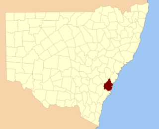
Camden County was one of the original Nineteen Counties in New South Wales and is now one of the 141 Cadastral divisions of New South Wales. It included the coastal area near Wollongong south to the Shoalhaven River, and also inland encompassing Berrima and Picton. Its western boundary was the Wollondilly River. The first settlement in the area was Camden Park, established by John Macarthur in 1806, just across the Nepean River from Cumberland County. It was the first land across the Nepean to be settled. Camden is a present-day suburb of Sydney in the same area, although parts of it are in Cumberland.

St Vincent County Cadastral in Australian Capital Territory

St Vincent County was one of the original Nineteen Counties in New South Wales and is now one of the 141 Cadastral divisions of New South Wales. It included the south coast area encompassing Batemans Bay, Ulladulla, Jervis Bay and inland to Braidwood. The Shoalhaven River is the boundary to the north and west, and the Deua River the boundary to the south.

Cowper County Cadastral in New South Wales, Australia

Cowper County, New South Wales is one of the 141 Cadastral divisions of New South Wales.

Irrara County Cadastral in New South Wales, Australia

Irrara County is one of the 141 Cadastral divisions of New South Wales. It is located south of the border with Queensland, east of the Paroo River, and west of the Warrego River.
Kennedy County Cadastral in New South Wales, Australia

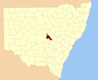
Kennedy County is one of the 141 Cadastral divisions of New South Wales. It is located to the west of the Bogan River in the area around Tottenham and Tullamore.

George Venables-Vernon, 5th Baron Vernon

George John Warren Venables-Vernon, 5th Baron Vernon, was a British politician. He was one of the last members of parliament for Derbyshire and the first for South Derbyshire. Vernon had a lifetime enthusiasm for Italian literature, particularly Dante after visiting Italy as a child. Vernon county is named after him in Australia.
Yarrowitch, New South Wales Town in New South Wales, Australia

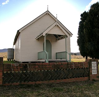
Yarrowitch is a small rural locality on the Northern Tablelands, New South Wales, Australia. It is located in the picturesque Yarrowitch River Valley on the Oxley Highway 48 kilometres east of Walcha. The settlement is included in the Walcha Shire Local Government Area in the New England region. The locality is at an elevation of about 995 metres and the area is part of Vernon County. At the 2011 census, the Yarrowitch area had a population of 167.

Cobrabald River

Cobrabald River, a mostly perennial river that is part of the Namoi catchment within the Murray–Darling basin, is located in the Northern Tablelands district of New South Wales, Australia.

Currawang Cadastral in New South Wales, Australia

Currawang is a locality in the Queanbeyan–Palerang Regional Council, on the edges of Upper Lachlan Shire and Goulburn-Mulwaree Council, in New South Wales, Australia. It is located to the north of Lake George. It shares its name with the Currawang Parish of Argyle County, in which it is located. This was formerly known as the parish of Currowang. Both names derive from an Aboriginal word for the spearwood tree.

References

  1. "Vernon". Geographical Names Register (GNR) of NSW. Geographical Names Board of New South Wales . Retrieved 11 August 2013. OOjs UI icon edit-ltr-progressive.svg