The Culgoa River is a river that is part of the Darling catchment within the Murray–Darling basin and is located in South West Queensland.

The Goobang Creek, a perennial stream of the Lachlan sub–catchment, part of the Murrumbidgee catchment of the Murray-Darling basin, is located in the Central West region of New South Wales, Australia.

Cowper County, New South Wales is one of the 141 Cadastral divisions of New South Wales.

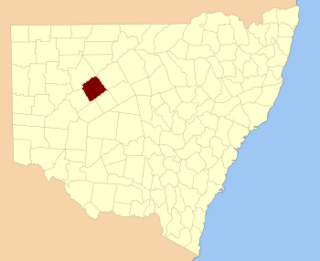
Gunderbooka County is one of the 141 Cadastral divisions of New South Wales. The Warrego River is the western boundary, and the Culgoa River and Darling River is the south-eastern boundary. It includes the area down to where the Warrego meets the Darling, to the north of Bourke.

Killara County is one of the 141 Cadastral divisions of New South Wales. The Darling River is its south eastern boundary.

Rankin County is one of the 141 Cadastral divisions of New South Wales. It includes part of the Paroo-Darling National Park. The border to the north-west is the Darling River.

Wentworth County is one of the 141 Cadastral divisions of New South Wales. The Murray River is the boundary to the south, and the Anabranch of the Darling River is the western boundary. It includes the area where the Darling River joins the Murray River.

The Bland Creek, a mostly–perennial river that is part of the Lachlan sub-catchment of the Murrumbidgee catchment within the Murray–Darling basin, is located in the South West Slopes, and Riverina regions of New South Wales, Australia. The Bland Creek is only connected to the Murray Darling basin when both the Lachlan and Murrumbidgee Rivers are in flood.

The Barmedman Creek, a mostly–perennial river that is part of the Lachlan sub-catchment of the Murrumbidgee catchment within the Murray–Darling basin, is located in the South West Slopes, and Riverina regions of New South Wales, Australia. The Barmedman Creek is only connected to the Murray Darling basin when the Bland Creek, the Lachlan and Murrumbidgee Rivers are in flood.

The Berthong Creek, a mostly–perennial river that is part of the Lachlan sub-catchment of the Murrumbidgee catchment within the Murray–Darling basin, is located in the South West Slopes, and Riverina regions of New South Wales, Australia. The Berthong Creek is only connected to the Murray Darling basin when the Bland Creek, the Lachlan and Murrumbidgee Rivers are in flood.

The Balgalal Creek, a mostly–perennial river that is part of the Lachlan sub-catchment of the Murrumbidgee catchment within the Murray–Darling basin, is located in the South West Slopes region of New South Wales, Australia.

The Cooks Vale Creek, a mostly–perennial river that is part of the Lachlan sub-catchment of the Murrumbidgee catchment within the Murray–Darling basin, is located in the South West Slopes region of New South Wales, Australia.

The Flyers Creek, a mostly–perennial river that is part of the Lachlan sub-catchment of the Murrumbidgee catchment within the Murray–Darling basin, is located in the Central West region of New South Wales, Australia.

The Cowriga Creek, a mostly–perennial river that is part of the Lachlan sub-catchment of the Murrumbidgee catchment within the Murray–Darling basin, is located in the Central West region of New South Wales, Australia.

The Bulla Creek, a mostly–perennial river that is part of the Lachlan sub-catchment of the Murrumbidgee catchment within the Murray–Darling basin, is located in the South West Slopes region of New South Wales, Australia. The Bulla Creek is only connected to the Murray Darling basin when the Bland Creek and both the Lachlan and Murrumbidgee Rivers are in flood.

The Gunningbland Creek, a perennial river of the Lachlan sub–catchment, part of the Murrumbidgee catchment of the Murray-Darling basin, is located in the Central West region of New South Wales, Australia.

The Jerrara Creek, a watercourse that is part of the Lachlan sub-catchment of the Murrumbidgee catchment within the Murray–Darling basin, is located in the South West Slopes region of New South Wales, Australia.

The Jerrawa Creek, a watercourse that is part of the Lachlan sub-catchment of the Murrumbidgee catchment within the Murray–Darling basin, is located in the South West Slopes region of New South Wales, Australia.

The Peelwood Creek, a watercourse that is part of the Lachlan sub-catchment of the Murrumbidgee catchment within the Murray–Darling basin, is located in the South West Slopes region of New South Wales, Australia.

The Sandy Creek, a partly–perennial stream that is part of the Lachlan sub-catchment of the Murrumbidgee catchment within the Murray–Darling basin, is located in the Riverina region of New South Wales, Australia. The course of the Sandy Creek becomes indefinite at its mouth.


