The Federation of Australia was the process by which the six separate British self-governing colonies of Queensland, New South Wales, Victoria, Tasmania, South Australia, and Western Australia agreed to unite and form the Commonwealth of Australia, establishing a system of federalism in Australia. Fiji and New Zealand were originally part of this process, but they decided not to join the federation. Following federation, the six colonies that united to form the Commonwealth of Australia as states kept the systems of government that they had developed as separate colonies, but they also agreed to have a federal government that was responsible for matters concerning the whole nation. When the Constitution of Australia came into force, on 1 January 1901, the colonies collectively became states of the Commonwealth of Australia.

The South Creek or Wianamatta, a creek that is part of the Hawkesbury-Nepean catchment, is located on the Cumberland Plain, also referred to as Greater Western Sydney, New South Wales, Australia.
The Geographical Names Board of New South Wales, a statutory authority of the Land and Property Information division, Department of Finance and Services in the Government of New South Wales, is the official body for naming and recording details of places and geographical names in the state of New South Wales, Australia.

Gregory Paul Inglis is an Australian former professional rugby league footballer who last played for the South Sydney Rabbitohs in the NRL. A Queensland State of Origin and Australian international representative outside back, he previously played for the Melbourne Storm, with whom he won two grand finals, a Clive Churchill Medal and the Golden Boot Award; he is an indigenous Australian. Inglis was a versatile back, having played in several positions during his career. He originally played on the wing or in the centres for the Storm, occasionally filling in at fullback when injuries demanded. Between 2007 and early 2009 he played at five-eighth for the Melbourne Storm before he switched to centre when Brett Finch arrived at the club, where he played for the remainder of his time there until the end of 2010. Inglis' representative matches for Queensland and Australia have been as a wing, centre, and fullback. In November 2009, Inglis won the Golden Boot Award as the world's best player – presented to him by Rugby League World magazine, becoming the third consecutive Storm player to win it, after Cameron Smith (2007) and Billy Slater (2008). In 2018 he was given the captaincy of the Queensland Maroons for the series against the New South Wales Blues (2018).

Darbalara is a rural community on the east bank of the junction of the Murrumbidgee River and Tumut River in the Riverina. It is situated by road, about 25 kilometres north east of Gundagai and 25 kilometres south of Coolac.

Gloucester County was one of the original Nineteen Counties in New South Wales, and is now one of the 141 cadastral divisions of New South Wales. It includes the area around Port Stephens. It is bounded on the north and west by the Manning River, and on the south-west by the Williams River.

Northumberland County was one of the original Nineteen Counties in New South Wales and is now one of the 141 Cadastral divisions of New South Wales. It included the area to the north of Broken Bay, including Lake Macquarie and Newcastle. It was bounded by the part of the Hawkesbury River to the south, the Macdonald River to the south-west, and the Hunter River to the north.

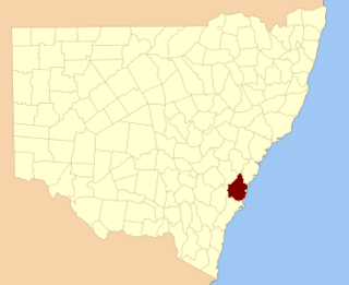
Camden County was one of the original Nineteen Counties in New South Wales and is now one of the 141 Cadastral divisions of New South Wales. It included the coastal area near Wollongong south to the Shoalhaven River, and also inland encompassing Berrima and Picton. Its western boundary was the Wollondilly River. The first settlement in the area was Camden Park, established by John Macarthur in 1806, just across the Nepean River from Cumberland County. It was the first land across the Nepean to be settled. Camden is a present-day suburb of Sydney in the same area, although parts of it are in Cumberland.

St Vincent County was one of the original Nineteen Counties in New South Wales and is now one of the 141 Cadastral divisions of New South Wales. It included the south coast area encompassing Batemans Bay, Ulladulla, Jervis Bay and inland to Braidwood. The Shoalhaven River is the boundary to the north and west, and the Deua River the boundary to the south.

Cowper County, New South Wales is one of the 141 Cadastral divisions of New South Wales.

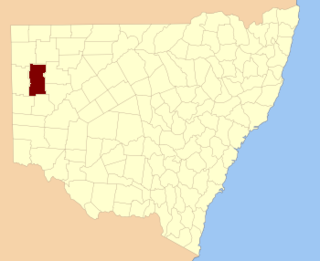
Irrara County is one of the 141 Cadastral divisions of New South Wales. It is located south of the border with Queensland, east of the Paroo River, and west of the Warrego River.

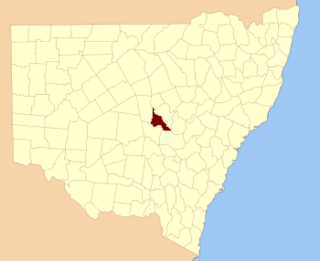
Kennedy County is one of the 141 Cadastral divisions of New South Wales. It is located to the west of the Bogan River in the area around Tottenham and Tullamore.

Mootwingee County, New South Wales is one of the 141 Cadastral divisions of New South Wales.

The 1998 United States Senate election in South Carolina was held November 3, 1998. Incumbent Democratic U.S. Senator Fritz Hollings won reelection to his sixth full term. As of 2019, this is the last Senate election in South Carolina won by a Democrat.

Cobrabald River, a mostly perennial river that is part of the Namoi catchment within the Murray–Darling basin, is located in the Northern Tablelands district of New South Wales, Australia.

Inglis is an unincorporated community in Columbia County, Oregon, United States. Inglis post office was established on September 30, 1902, and was named after the first postmaster, John E. Inglis. The post office closed in 1910, then reopened in 1914, finally closing in 1918. The railroad station at this locale was named Inglis Station.

The 2012 State of Origin series was the 31st time the annual best-of-three series between the Queensland and New South Wales rugby league teams was played entirely under 'state of origin' rules. For the fourth successive year a Queensland victory set a new record for consecutive State of Origin titles, reaching seven. Game I was played at Melbourne's sold out Etihad Stadium and won by Queensland; its television broadcast watched by more than 2.5 million viewers, rating it as the most-watched State of Origin broadcast since the introduction of OzTAM ratings in 1999. New South Wales' series-equalling win in Game II, played at Sydney's sold out ANZ Stadium, set a new TV ratings record for most-watched second game of any series in State of Origin history. The decider, Game III was played at Brisbane's Suncorp Stadium and was won by Queensland. This game set a new record for the highest television audience in Australia for a rugby league match since the introduction of the OzTam ratings system in 2001.
James Inglis was a tea merchant, writer and politician in colonial New South Wales.

Blowering, New South wales is a rural locality in the Snowy Mountains of New South wales and a civil Parish of Buccleuch County.


