Buccleuch County

Last updated

Map all coordinates using: OpenStreetMap  
Download coordinates as: KML  ·  GPX
Buccleuch
New South Wales
Buccleuch NSW.PNG
Location in New South Wales
Lands administrative divisions around Buccleuch:
Clarendon Harden Harden
Wynyard Buccleuch Cowley
Selwyn Wallace Wallace

Buccleuch County is one of the 141 Cadastral divisions of New South Wales. It contains the locality of Adjungbilly. The Murrumbidgee River is at the northern boundary, with the Goodradigbee River on the eastern boundary, and the Tumut River on the western boundary. It includes the northern part of the Kosciuszko National Park.

Murrumbidgee River river in New South Wales, Australia

Murrumbidgee River, a major tributary of the Murray River within the Murray–Darling basin and the second longest river in Australia. It flows through the Australian state of New South Wales and the Australian Capital Territory. It descends 1,500 metres (4,900 ft) as it flows 1,485 kilometres (923 mi) in a west-northwesterly direction from the foot of Peppercorn Hill in the Fiery Range of the Snowy Mountains towards its confluence with the Murray River near Boundary Bend.

Goodradigbee River

Goodradigbee River, a perennial stream that is part of the Murrumbidgee catchment within the Murray–Darling basin, is located in the Snowy Mountains district of New South Wales, Australia.

Tumut River

The Tumut River, a perennial stream that is part of the Murrumbidgee catchment within the Murray–Darling basin, is located in the Snowy Mountains and South West Slopes districts of New South Wales, Australia.

Buccleuch County was named in honour of the Duke of Buccleuch (1806-1884). [1]

Duke of Buccleuch Scottish title of nobility

The title Duke of Buccleuch, formerly also spelt Duke of Buccleugh, is a title in the Peerage of Scotland created twice on 20 April 1663, first for James Scott, 1st Duke of Monmouth and second suo jure for his wife Anne Scott, 4th Countess of Buccleuch. Monmouth, the eldest illegitimate son of Charles II was attainted after his 1685 rebellion, but his wife's title was unaffected and passed on to their descendants, who have successively borne the surnames Scott, Montagu-Scott, Montagu Douglas Scott and Scott again. In 1810, the 3rd Duke of Buccleuch inherited the Dukedom of Queensberry, also in the Peerage of Scotland, thus separating that title from the Marquessate of Queensberry.

Parishes within this county

A full list of parishes found within this county; their current LGA and mapping coordinates to the approximate centre of each location is as follows:

Local government in Australia

Local government in Australia is the third tier of government in Australia administered by the states and territories, which in turn are beneath the federal tier. Local government is not mentioned in the Constitution of Australia and two referenda in the 1970s and 1980s to alter the Constitution relating to local government were unsuccessful. Every state government recognises local government in their respective constitutions. Unlike Canada or the United States, there is only one level of local government in each state, with no distinction such as cities and counties.

ParishLGACoordinates
Adjungbilly Cootamundra-Gundagai Regional Council 35°05′54″S148°24′04″E / 35.09833°S 148.40111°E / -35.09833; 148.40111 (Adjungbilly)
Baloo Snowy Valleys Council 35°25′54″S148°23′04″E / 35.43167°S 148.38444°E / -35.43167; 148.38444 (Baloo)
Blowering Snowy Valleys Council 35°22′54″S148°17′04″E / 35.38167°S 148.28444°E / -35.38167; 148.28444 (Blowering)
Bogong Snowy Valleys Council 35°26′54″S148°18′04″E / 35.44833°S 148.30111°E / -35.44833; 148.30111 (Bogong)
Boraig Snowy Valleys Council 35°38′54″S148°22′04″E / 35.64833°S 148.36778°E / -35.64833; 148.36778 (Boraig)
Bramina Snowy Valleys Council 35°27′54″S148°40′04″E / 35.46500°S 148.66778°E / -35.46500; 148.66778 (Bramina)
Brungle Snowy Valleys Council 35°09′54″S148°15′04″E / 35.16500°S 148.25111°E / -35.16500; 148.25111 (Brungle)
Bundarbo Cootamundra-Gundagai Regional Council 34°54′49″S148°21′08″E / 34.91361°S 148.35222°E / -34.91361; 148.35222 (Bundarbo)
Bungongo Cootamundra-Gundagai Regional Council 34°59′49″S148°26′04″E / 34.99694°S 148.43444°E / -34.99694; 148.43444 (Bungongo)
Childowla Cootamundra-Gundagai Regional Council 34°59′54″S148°30′04″E / 34.99833°S 148.50111°E / -34.99833; 148.50111 (Childowla)
Clive Yass Valley Council 35°14′54″S148°40′04″E / 35.24833°S 148.66778°E / -35.24833; 148.66778 (Clive)
Cooleman Snowy Valleys Council 35°17′54″S148°26′04″E / 35.29833°S 148.43444°E / -35.29833; 148.43444 (Cooleman)
Cowrajago Snowy Valleys Council 35°08′54″S148°30′04″E / 35.14833°S 148.50111°E / -35.14833; 148.50111 (Cowrajago)
Cromwell Snowy Valleys Council 35°19′54″S148°41′04″E / 35.33167°S 148.68444°E / -35.33167; 148.68444 (Cromwell)
Darbalara Cootamundra-Gundagai Regional Council 35°01′54″S148°15′04″E / 35.03167°S 148.25111°E / -35.03167; 148.25111 (Darbalara)
Garnet Snowy Valleys Council 35°23′54″S148°34′04″E / 35.39833°S 148.56778°E / -35.39833; 148.56778 (Garnet)
Goobarragandra Snowy Valleys Council 35°29′54″S148°33′04″E / 35.49833°S 148.55111°E / -35.49833; 148.55111 (Goobarragandra)
Goobarralong Cootamundra-Gundagai Regional Council 34°58′54″S148°21′04″E / 34.98167°S 148.35111°E / -34.98167; 148.35111 (Goobarralong)
Jibeen Snowy Valleys Council 35°29′54″S148°30′04″E / 35.49833°S 148.50111°E / -35.49833; 148.50111 (Jibeen)
Jounama Snowy Valleys Council 35°37′54″S148°25′04″E / 35.63167°S 148.41778°E / -35.63167; 148.41778 (Jounama)
Killimicat Snowy Valleys Council 35°14′54″S148°15′04″E / 35.24833°S 148.25111°E / -35.24833; 148.25111 (Killimicat)
Mundongo Snowy Valleys Council 35°16′54″S147°19′04″E / 35.28167°S 147.31778°E / -35.28167; 147.31778 (Mundongo)
Nanangroe Cootamundra-Gundagai Regional Council 34°55′54″S148°28′04″E / 34.93167°S 148.46778°E / -34.93167; 148.46778 (Nanangroe)
Napier Yass Valley Council 35°16′54″S148°34′04″E / 35.28167°S 148.56778°E / -35.28167; 148.56778 (Napier)
Nimbo Snowy Valleys Council 35°19′54″S148°30′04″E / 35.33167°S 148.50111°E / -35.33167; 148.50111 (Nimbo)
Peppercorn Snowy Valleys Council 35°33′54″S148°36′04″E / 35.56500°S 148.60111°E / -35.56500; 148.60111 (Peppercorn)
Pinbeyan Snowy Valleys Council 35°44′54″S148°24′04″E / 35.74833°S 148.40111°E / -35.74833; 148.40111 (Pinbeyan)
Talbingo Snowy Valleys Council 35°33′54″S148°20′04″E / 35.56500°S 148.33444°E / -35.56500; 148.33444 (Talbingo)
The Peaks Snowy Valleys Council 35°36′54″S148°30′04″E / 35.61500°S 148.50111°E / -35.61500; 148.50111 (The Peaks)
Tumorrama Snowy Valleys Council 35°14′54″S148°30′04″E / 35.24833°S 148.50111°E / -35.24833; 148.50111 (Tumorrama)
Wagara Cootamundra-Gundagai Regional Council 35°04′54″S148°15′04″E / 35.08167°S 148.25111°E / -35.08167; 148.25111 (Wagara)
Wee Jasper Yass Valley Council 35°10′54″S148°38′04″E / 35.18167°S 148.63444°E / -35.18167; 148.63444 (Wee Jasper)
West Goodradigbee Yass Valley Council 35°02′54″S148°37′04″E / 35.04833°S 148.61778°E / -35.04833; 148.61778 (West Goodradigbee)
Wyangle Snowy Valleys Council 35°12′54″S148°23′04″E / 35.21500°S 148.38444°E / -35.21500; 148.38444 (Wyangle)
Yarrangobilly Snowy Valleys Council 35°44′54″S148°30′04″E / 35.74833°S 148.50111°E / -35.74833; 148.50111 (Yarrangobilly)

Related Research Articles

Darbalara, New South Wales Town in New South Wales, Australia

Darbalara is a rural community on the east bank of the junction of the Murrumbidgee River and Tumut River in the Riverina. It is situated by road, about 25 kilometres north east of Gundagai and 25 kilometres south of Coolac.
King County, New South Wales Cadastral in New South Wales, Australia

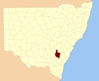
King County was one of the original Nineteen Counties in New South Wales and is now one of the 141 Cadastral divisions of New South Wales. It is in the area to the east of Yass. The northern part of it lies between the Lachlan River and the Boorowa River, including the locations of Frogmore, Taylors Flat, Gunnary, Rugby and Rye Park. The Crookwell River is also part of the northern boundary. The Yass River is the southern boundary.

Bathurst County Cadastral in New South Wales, Australia

Bathurst County was one of the original Nineteen Counties in New South Wales and is now one of the 141 Cadastral divisions of New South Wales. It includes the area to the south-west of Bathurst to Cowra and Orange. The Lachlan River is the boundary to the south-west, the Belubula River forms part of the northern boundary, with the Fish River on the northeastern boundary. Blayney is located roughly in the middle.

Bligh County Cadastral in New South Wales, Australia

Bligh County was one of the original Nineteen Counties in New South Wales and is now one of the 141 Cadastral divisions of New South Wales. The Cudgegong River and the Goulburn River are its southern boundaries; the Krui River is the eastern boundary, and the Burragundy River the northern boundary. It includes the villages of Cassilis and Dunedoo.
Cowley County, New South Wales Cadastral in New South Wales, Australia

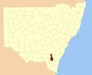
Cowley County is one of the 141 Cadastral divisions of New South Wales. It contains the locality of Cavan. It was originally bordered on the north, east and part of the south by the Murrumbidgee River, and on the west by the Goodradigbee River. A large part of the county was transferred to the Commonwealth to make the Australian Capital Territory in 1909, with the remaining part the area to the north-west of the ACT as far north as the Burrinjuck Dam, and thin strips of land along the western, southern and south-eastern borders of the ACT.

Waradgery County Cadastral in New South Wales, Australia

Waradgery County is one of the 141 Cadastral divisions of New South Wales. It contains the town of Hay. It includes the area between the Lachlan River and the Murrumbidgee River where they meet. The Lachlan River is the northern boundary of the county, and the Murrumbidgee for a small section is the southern boundary, but the county also includes some of the land to the south of the Murrumbidgee near Hay.
Wallace County, New South Wales Cadastral in New South Wales, Australia

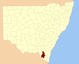
Wallace County is one of the 141 Cadastral divisions of New South Wales. The Snowy River is the boundary to the south and south-east, and the Murrumbidgee River is the northern boundary. It includes the area around Jindabyne.
Murrumbidgee District Cadastral in New South Wales, Australia

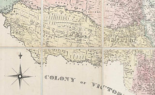
The Murrumbidgee District was a district used in New South Wales in the nineteenth century to refer to the land between the Murrumbidgee River and Murray River, that is now mostly known as the Riverina region. Some maps show the district included the parts of what is now the Australian Capital Territory that was to the west of the Murrumbidgee River. The district was originally one of the districts used to refer to the area outside the limits of location, but later continued to be used as the name after counties were proclaimed within this area. It went out of use after 1884, when new districts were proclaimed.

The Coolumbooka River, a perennial river of the Snowy River catchment, is located in the Monaro region of New South Wales, Australia.

Napier is a locality in the Riverina district of New South Wales, Australia and also a civil parish of Buccleuch County, New South Wales.

The Boundary Creek, a perennial stream of the Clarence River catchment, is located in the Northern Rivers region of New South Wales, Australia.

The Boundary Creek, a perennial stream of the Clarence River catchment, is located in the Northern Rivers region of New South Wales, Australia.

Baloo, New South wales is a rural locality in the Snowy Mountains of New South wales and a civil Parish of the Buccleuch County.]].

Blowering, New South Wales

Blowering, New South wales is a rural locality in the Snowy Mountains of New South wales and a civil Parish of Buccleuch County.

Goobarragandra, New South Wales is a rural locality in the Snowy Mountains west of Canberra, Australia.

Boraig, New South Wales is a rural locality in the Snowy Mountains, west of Canberra, Australia, and is also a civil Parish of Buccleuch County.

Birrema, New South Wales

Birrema, New South Wales is a civil parish of Harden County, New South Wales.

Childowla, New South Wales is a civil parish of Buccleuch County, New South Wales.

Coppabella, New South Wales

Coppabella, New South Wales is a rural locality of Hilltops Council and a civil parish of Harden County, New South Wales.

Cumbamurra, New South Wales

Cumbamurra, New South Wales is a civil parish of Harden County, New South Wales.

References

  1. "Buccleuch County". Geographical Names Register (GNR) of NSW. Geographical Names Board of New South Wales. OOjs UI icon edit-ltr-progressive.svg