Cunningham County

Last updated

Map all coordinates using: OpenStreetMap  
Download coordinates as: KML  ·  GPX
Cunningham
New South Wales
Cunningham NSW.PNG
Location in New South Wales
Lands administrative divisions around Cunningham:
Flinders Kennedy Kennedy
Blaxland Cunningham Ashburnham
Dowling Gipps Forbes

Cunningham County is one of the 141 Cadastral divisions of New South Wales. It is located to the north of the Lachlan River near Condobolin.

Lachlan River tributary to the Murrumbidgee River in New South Wales, Australia

The Lachlan River is an intermittent river that is part of the Murrumbidgee catchment within the Murray–Darling basin, located in the Southern Tablelands, Central West, and Riverina regions of New South Wales, Australia.

Condobolin Town in New South Wales, Australia

Condobolin is a town in the west of the Central West region of New South Wales, Australia, on the Lachlan River. At the 2016 census, Condobolin had a population of 3,486.

Cunningham County was named in honour of the botanist and explorer Allan Cunningham (1791-1839). [1]

Allan Cunningham (botanist) British botanist

Allan Cunningham was an English botanist and explorer, primarily known for his travels in Australia to collect plants.

Parishes within this county

A full list of parishes found within this county; their current LGA and mapping coordinates to the approximate centre of each location is as follows:

Local government in Australia third tier of government in Australia

Local government in Australia is the third tier of government in Australia administered by the states and territories, which in turn are beneath the federal tier. Local government is not mentioned in the Constitution of Australia and two referenda in the 1970s and 1980s to alter the Constitution relating to local government were unsuccessful. Every state government recognises local government in their respective constitutions. Unlike Canada or the United States, there is only one level of local government in each state, with no distinction such as cities and counties.

ParishLGACoordinates
Baratta Lachlan Shire Council 32°59′54″S147°02′04″E / 32.99833°S 147.03444°E / -32.99833; 147.03444 (Baratta)
Bedgerebong Forbes Shire Council 33°18′54″S147°40′04″E / 33.31500°S 147.66778°E / -33.31500; 147.66778 (Bedgerebong)
Berewombenia Forbes Shire Council 33°05′54″S147°30′04″E / 33.09833°S 147.50111°E / -33.09833; 147.50111 (Berewombenia)
Bimbella Lachlan Shire Council 32°59′54″S146°53′04″E / 32.99833°S 146.88444°E / -32.99833; 146.88444 (Bimbella)
Bomobbin Forbes Shire Council 33°10′54″S147°20′04″E / 33.18167°S 147.33444°E / -33.18167; 147.33444 (Bomobbin)
Boona East Lachlan Shire Council 32°42′54″S147°12′04″E / 32.71500°S 147.20111°E / -32.71500; 147.20111 (Boona East)
Boona West Lachlan Shire Council 32°39′54″S147°05′04″E / 32.66500°S 147.08444°E / -32.66500; 147.08444 (Boona West)
Botfields Parkes Shire Council 33°00′54″S147°45′04″E / 33.01500°S 147.75111°E / -33.01500; 147.75111 (Botfields)
Bundaburra Lachlan Shire Council 33°01′54″S147°19′04″E / 33.03167°S 147.31778°E / -33.03167; 147.31778 (Bundaburra)
Burrawong Forbes Shire Council 33°13′54″S147°31′04″E / 33.23167°S 147.51778°E / -33.23167; 147.51778 (Burrawong)
Byong Parkes Shire Council 33°00′54″S147°35′04″E / 33.01500°S 147.58444°E / -33.01500; 147.58444 (Byong)
Carroboblin Parkes Shire Council 33°12′54″S147°42′04″E / 33.21500°S 147.70111°E / -33.21500; 147.70111 (Carroboblin)
Condobolin Lachlan Shire Council 33°02′54″S147°09′04″E / 33.04833°S 147.15111°E / -33.04833; 147.15111 (Condobolin)
Cookeys Plains Parkes Shire Council 33°04′54″S147°39′04″E / 33.08167°S 147.65111°E / -33.08167; 147.65111 (Cookeys Plains)
Corella Lachlan Shire Council 32°41′54″S147°18′04″E / 32.69833°S 147.30111°E / -32.69833; 147.30111 (Corella)
Corridgery Forbes Shire Council 33°18′54″S147°46′04″E / 33.31500°S 147.76778°E / -33.31500; 147.76778 (Corridgery)
Derriwong Lachlan Shire Council 33°06′54″S147°21′04″E / 33.11500°S 147.35111°E / -33.11500; 147.35111 (Derriwong)
Dulhunty Parkes Shire Council 33°09′54″S147°47′04″E / 33.16500°S 147.78444°E / -33.16500; 147.78444 (Dulhunty)
Ellerslie Lachlan Shire Council 32°48′54″S147°19′04″E / 32.81500°S 147.31778°E / -32.81500; 147.31778 (Ellerslie)
Elsmore Lachlan Shire Council 32°54′54″S147°20′04″E / 32.91500°S 147.33444°E / -32.91500; 147.33444 (Elsmore)
Emu Plains Lachlan Shire Council 32°53′54″S147°11′04″E / 32.89833°S 147.18444°E / -32.89833; 147.18444 (Emu Plains)
Gillenbine Lachlan Shire Council 32°48′54″S147°34′04″E / 32.81500°S 147.56778°E / -32.81500; 147.56778 (Gillenbine)
Gindoono Lachlan Shire Council 32°36′25″S146°54′37″E / 32.60694°S 146.91028°E / -32.60694; 146.91028 (Gindoono)
Goobang Forbes Shire Council 33°11′54″S147°35′04″E / 33.19833°S 147.58444°E / -33.19833; 147.58444 (Goobang)
Greenock Lachlan Shire Council 32°49′09″S146°53′31″E / 32.81917°S 146.89194°E / -32.81917; 146.89194 (Greenock)
Gulgo Lachlan Shire Council 33°02′54″S147°03′04″E / 33.04833°S 147.05111°E / -33.04833; 147.05111 (Gulgo)
Gunning Parkes Shire Council 33°13′54″S147°48′04″E / 33.23167°S 147.80111°E / -33.23167; 147.80111 (Gunning)
Gunningbland Parkes Shire Council 33°04′54″S147°48′04″E / 33.08167°S 147.80111°E / -33.08167; 147.80111 (Gunningbland)
Jerula Lachlan Shire Council 32°49′29″S147°10′33″E / 32.82472°S 147.17583°E / -32.82472; 147.17583 (Jerula)
Julandery Lachlan Shire Council 32°54′18″S146°44′15″E / 32.90500°S 146.73750°E / -32.90500; 146.73750 (Julandery)
Kalinga Lachlan Shire Council 33°01′54″S146°44′04″E / 33.03167°S 146.73444°E / -33.03167; 146.73444 (Kalinga)
Kars Parkes Shire Council 33°02′54″S147°31′04″E / 33.04833°S 147.51778°E / -33.04833; 147.51778 (Kars)
Kiargathur Lachlan Shire Council 33°02′54″S146°50′04″E / 33.04833°S 146.83444°E / -33.04833; 146.83444 (Kiargathur)
Mamre Lachlan Shire Council 32°42′12″S146°41′45″E / 32.70333°S 146.69583°E / -32.70333; 146.69583 (Mamre)
Melrose Lachlan Shire Council 32°39′54″S147°01′04″E / 32.66500°S 147.01778°E / -32.66500; 147.01778 (Melrose)
Micabil Lachlan Shire Council 33°03′54″S147°00′04″E / 33.06500°S 147.00111°E / -33.06500; 147.00111 (Micabil)
Milpose Parkes Shire Council 33°00′54″S147°51′04″E / 33.01500°S 147.85111°E / -33.01500; 147.85111 (Milpose)
Monomie Parkes Shire Council 33°07′54″S147°42′04″E / 33.13167°S 147.70111°E / -33.13167; 147.70111 (Monomie)
Monwonga Forbes Shire Council 33°14′54″S147°36′04″E / 33.24833°S 147.60111°E / -33.24833; 147.60111 (Monwonga)
Mount Nobby Lachlan Shire Council 32°45′24″S146°55′15″E / 32.75667°S 146.92083°E / -32.75667; 146.92083 (Mount Nobby)
Mowabla Lachlan Shire Council 32°51′54″S147°04′04″E / 32.86500°S 147.06778°E / -32.86500; 147.06778 (Mowabla)
Mulguthrie Forbes Shire Council 33°11′54″S147°25′04″E / 33.19833°S 147.41778°E / -33.19833; 147.41778 (Mulguthrie)
Murda Lachlan Shire Council 33°00′54″S147°08′04″E / 33.01500°S 147.13444°E / -33.01500; 147.13444 (Murda)
Murga Lachlan Shire Council 32°51′54″S147°27′04″E / 32.86500°S 147.45111°E / -32.86500; 147.45111 (Murga)
Murrumbogie Lachlan Shire Council 32°59′54″S147°26′04″E / 32.99833°S 147.43444°E / -32.99833; 147.43444 (Murrumbogie)
Oxley North Lachlan Shire Council 32°28′12″S146°37′32″E / 32.47000°S 146.62556°E / -32.47000; 146.62556 (Oxley North)
Oxley South Lachlan Shire Council 32°33′28″S146°39′45″E / 32.55778°S 146.66250°E / -32.55778; 146.66250 (Oxley South)
Palisthan Lachlan Shire Council 32°50′13″S146°44′33″E / 32.83694°S 146.74250°E / -32.83694; 146.74250 (Palisthan)
Plevna Parkes Shire Council 32°52′54″S147°44′04″E / 32.88167°S 147.73444°E / -32.88167; 147.73444 (Plevna)
Sebastopol Lachlan Shire Council 32°52′54″S147°29′04″E / 32.88167°S 147.48444°E / -32.88167; 147.48444 (Sebastopol)
Taratta Lachlan Shire Council 32°43′54″S147°04′04″E / 32.73167°S 147.06778°E / -32.73167; 147.06778 (Taratta)
Tinda Lachlan Shire Council 32°35′03″S146°48′02″E / 32.58417°S 146.80056°E / -32.58417; 146.80056 (Tinda)
Tollingo Lachlan Shire Council 32°42′10″S146°49′50″E / 32.70278°S 146.83056°E / -32.70278; 146.83056 (Tollingo)
Trundle Parkes Shire Council 32°56′54″S147°44′04″E / 32.94833°S 147.73444°E / -32.94833; 147.73444 (Trundle)
Walker Lachlan Shire Council 32°29′40″S146°44′07″E / 32.49444°S 146.73528°E / -32.49444; 146.73528 (Walker)
Wicklow Lachlan Shire Council 32°23′35″S146°37′00″E / 32.39306°S 146.61667°E / -32.39306; 146.61667 (Wicklow)
Willama Lachlan Shire Council 32°38′54″S146°41′32″E / 32.64833°S 146.69222°E / -32.64833; 146.69222 (Willama)
Wollongong Lachlan Shire Council 33°06′54″S147°16′04″E / 33.11500°S 147.26778°E / -33.11500; 147.26778 (Wollongong)
Yarrabandai Forbes Shire Council 33°08′54″S147°32′04″E / 33.14833°S 147.53444°E / -33.14833; 147.53444 (Yarrabandai)

Related Research Articles

Illawarra Region in New South Wales, Australia

Illawarra is a region in the Australian state of New South Wales. It is a coastal region situated immediately south of Sydney and north of the Shoalhaven or South Coast region. It encompasses the cities of Wollongong, Shellharbour and the town of Kiama.

Bingara, New South Wales Town in New South Wales, Australia

Bingara is a small town on the Gwydir River in Murchison County in the New England region of New South Wales, Australia. Bingara is currently the administrative centre for the Gwydir Shire that was created in 2003. Bingara is one of the few places in Australia where diamonds have been found. The Gwydir River being a main highlight of the town is a main catchment of the Murray-Darling System.

Namoi River river in Australia

The Namoi River, a major perennial river that is part of the Barwon catchment of the Murray–Darling basin, is located in the Northern Tablelands and North West Slopes districts of New South Wales, Australia.
Macintyre River river

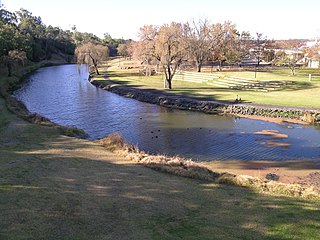
The Macintyre River, a perennial river that forms part of the Border Rivers group, is part of the Barwon catchment of the Murray-Darling basin, located in the Northern Tablelands and North West Slopes regions of New South Wales, and the Southern Downs region of Queensland, Australia.

Division of Cunningham Australian federal electoral division

The Division of Cunningham is an Australian electoral division in the state of New South Wales.

South Creek (New South Wales) river in New South Wales, Australia

The South Creek or Wianamatta, a creek that is part of the Hawkesbury-Nepean catchment, is located on the Cumberland Plain, also referred to as Greater Western Sydney, New South Wales, Australia.
Richmond River river in New South Wales, Australia

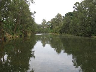
The Richmond River is a river with a mature wave dominated, barrier estuary, situated in the Northern Rivers region of New South Wales, Australia.

The Geographical Names Board of New South Wales, a statutory authority of the Land and Property Information division, Department of Finance and Services in the Government of New South Wales, is the official body for naming and recording details of places and geographical names in the state of New South Wales, Australia.

Dumaresq River river in Australia

The Dumaresq River ; a perennial stream of the Macintyre catchment within the Murray–Darling basin, is located in the Northern Tablelands and North West Slopes regions of New South Wales and the Darling Downs region of Queensland, Australia.

Darbalara, New South Wales Town in New South Wales, Australia

Darbalara is a rural community on the east bank of the junction of the Murrumbidgee River and Tumut River in the Riverina. It is situated by road, about 25 kilometres north east of Gundagai and 25 kilometres south of Coolac.

Gloucester County, New South Wales Cadastral in New South Wales, Australia

Gloucester County was one of the original Nineteen Counties in New South Wales, and is now one of the 141 cadastral divisions of New South Wales. It includes the area around Port Stephens. It is bounded on the north and west by the Manning River, and on the south-west by the Williams River.

Cowper County Cadastral in New South Wales, Australia

Cowper County, New South Wales is one of the 141 Cadastral divisions of New South Wales.

Pandoras Pass mountain pass in Australia

The Pandoras Pass, also Brennans Gap and Pandora's Pass is a mountain pass across the Warrumbungle Range, a spur off the Great Dividing Range, located in the Coolah Tops National Park in northwestern New South Wales, Australia.

Derriwong Town in New South Wales, Australia

Derriwong is a rural locality in Cunningham County a Cadastral divisions of New South Wales, Australia.

Binnia is a civil parish of Napier County in New South Wales.
Lowe, New South Wales

Lowe Parish is a civil Parish of Napier County, New South Wales.

Mumbedah, New South Wales

Mumbedah is a civil parish, a creek and a hill in central New South Wales.
Coolah Parish, New South Wales New South Wales, Australia

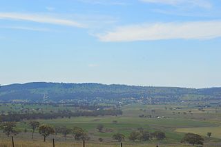
Coolah Parish is a civil parish of the County of Napier, a county in the central western part of New South Wales, Australia in Warrumbungle Shire. The only town of the parish is Coolah, New South Wales and at the 2006 census, Coolah township had a population of 910.

Narangarie is a civil parish of Napier County, New South Wales.

References

  1. "Cunningham". Geographical Names Register (GNR) of NSW. Geographical Names Board of New South Wales . Retrieved 4 August 2013. OOjs UI icon edit-ltr-progressive.svg