Lincoln County, New South Wales

Last updated

Map all coordinates using: OpenStreetMap  
Download coordinates as: KML
Lincoln
New South Wales
Lincoln NSW.PNG
Location in New South Wales
Lands administrative divisions around Lincoln:
Ewenmar Gowen Napier
Narromine Lincoln Bligh
Gordon Bligh Bligh

Lincoln County is one of the 141 Cadastral divisions of New South Wales. It contains Dubbo.

Contents

Lincoln County was named in honour of Henry Fiennes Pelham Clinton, 5th Duke of Newcastle (1811-1864), styled Earl of Lincoln. [1]

Parishes within this county

A full list of parishes found within this county; their current LGA and mapping coordinates to the approximate centre of each location is as follows:

ParishLGACoordinates
Adelyne Warrumbungle Shire 32°00′54″S149°16′04″E / 32.01500°S 149.26778°E / -32.01500; 149.26778 (Adelyne)
Bald Hill Dubbo Regional Council 32°13′54″S149°01′04″E / 32.23167°S 149.01778°E / -32.23167; 149.01778 (Bald Hill)
Ballimore Dubbo Regional Council 32°07′54″S148°55′04″E / 32.13167°S 148.91778°E / -32.13167; 148.91778 (Ballimore)
Barbigal Dubbo Regional Council 32°12′54″S148°49′04″E / 32.21500°S 148.81778°E / -32.21500; 148.81778 (Barbigal)
Beni Dubbo Regional Council 32°14′54″S148°45′04″E / 32.24833°S 148.75111°E / -32.24833; 148.75111 (Beni)
Bickanbeenie Dubbo Regional Council 32°01′54″S148°46′04″E / 32.03167°S 148.76778°E / -32.03167; 148.76778 (Bickanbeenie)
Blackheath Warrumbungle Shire 32°07′54″S149°15′04″E / 32.13167°S 149.25111°E / -32.13167; 149.25111 (Blackheath)
Bodangora Dubbo Regional Council 32°26′54″S149°05′04″E / 32.44833°S 149.08444°E / -32.44833; 149.08444 (Bodangora)
Bolaro Warrumbungle Shire 32°03′54″S149°22′04″E / 32.06500°S 149.36778°E / -32.06500; 149.36778 (Bolaro)
Boomley Warrumbungle Shire 32°04′54″S149°04′04″E / 32.08167°S 149.06778°E / -32.08167; 149.06778 (Boomley)
Boston Warrumbungle Shire 32°01′54″S149°10′04″E / 32.03167°S 149.16778°E / -32.03167; 149.16778 (Boston)
Breelong South Dubbo Regional Council 31°59′54″S148°58′04″E / 31.99833°S 148.96778°E / -31.99833; 148.96778 (Breelong South)
Breelong Gilgandra Shire 31°51′54″S149°00′04″E / 31.86500°S 149.00111°E / -31.86500; 149.00111 (Breelong)
Bruah Dubbo Regional Council 32°07′54″S148°44′04″E / 32.13167°S 148.73444°E / -32.13167; 148.73444 (Bruah)
Bulladoran Dubbo Regional Council 31°59′54″S148°54′04″E / 31.99833°S 148.90111°E / -31.99833; 148.90111 (Bulladoran)
Bullinda Warrumbungle Shire 31°54′54″S149°29′04″E / 31.91500°S 149.48444°E / -31.91500; 149.48444 (Bullinda)
Bungiebomar Warrumbungle Shire 32°18′54″S149°09′04″E / 32.31500°S 149.15111°E / -32.31500; 149.15111 (Bungiebomar)
Caledonia Dubbo Regional Council 31°59′54″S148°40′04″E / 31.99833°S 148.66778°E / -31.99833; 148.66778 (Caledonia)
Dubbo Regional Council Dubbo Regional Council 32°16′08″S148°38′26″E / 32.26889°S 148.64056°E / -32.26889; 148.64056 (Dubbo Regional Council)
Cobbora Warrumbungle Shire 32°04′54″S149°16′04″E / 32.08167°S 149.26778°E / -32.08167; 149.26778 (Cobbora)
Cobrauraguy Dubbo Regional Council 32°12′54″S149°09′04″E / 32.21500°S 149.15111°E / -32.21500; 149.15111 (Cobrauraguy)
Coolbaggie Dubbo Regional Council 32°07′54″S148°31′04″E / 32.13167°S 148.51778°E / -32.13167; 148.51778 (Coolbaggie)
Daley Dubbo Regional Council 32°02′54″S148°33′04″E / 32.04833°S 148.55111°E / -32.04833; 148.55111 (Daley)
Dapper Warrumbungle Shire 32°12′54″S149°15′04″E / 32.21500°S 149.25111°E / -32.21500; 149.25111 (Dapper)
Dewar Dubbo Regional Council 32°01′54″S148°51′04″E / 32.03167°S 148.85111°E / -32.03167; 148.85111 (Dewar)
Donelly Dubbo Regional Council 31°56′54″S148°46′04″E / 31.94833°S 148.76778°E / -31.94833; 148.76778 (Donelly)
Dunedoo Warrumbungle Shire 32°00′24″S149°21′04″E / 32.00667°S 149.35111°E / -32.00667; 149.35111 (Dunedoo)
Elong Elong Dubbo Regional Council 32°10′54″S149°02′04″E / 32.18167°S 149.03444°E / -32.18167; 149.03444 (Elong Elong)
Erskine Dubbo Regional Council 32°08′54″S148°50′04″E / 32.14833°S 148.83444°E / -32.14833; 148.83444 (Erskine)
Gamba Warrumbungle Shire 32°04′54″S149°09′04″E / 32.08167°S 149.15111°E / -32.08167; 149.15111 (Gamba)
Geurie Dubbo Regional Council 32°24′54″S148°49′04″E / 32.41500°S 148.81778°E / -32.41500; 148.81778 (Geurie)
Goonoo Dubbo Regional Council 32°03′54″S148°39′04″E / 32.06500°S 148.65111°E / -32.06500; 148.65111 (Goonoo)
Lincoln Gilgandra Shire 31°52′54″S148°49′04″E / 31.88167°S 148.81778°E / -31.88167; 148.81778 (Lincoln)
Macquarie Dubbo Regional Council 32°20′24″S148°49′34″E / 32.34000°S 148.82611°E / -32.34000; 148.82611 (Macquarie)
Medway Dubbo Regional Council 32°09′54″S149°10′04″E / 32.16500°S 149.16778°E / -32.16500; 149.16778 (Medway)
Micketymulga Dubbo Regional Council 32°26′54″S148°53′04″E / 32.44833°S 148.88444°E / -32.44833; 148.88444 (Micketymulga)
Mirrie Warrumbungle Shire 32°00′54″S149°04′04″E / 32.01500°S 149.06778°E / -32.01500; 149.06778 (Mirrie)
Mitchell Dubbo Regional Council 32°22′54″S149°07′04″E / 32.38167°S 149.11778°E / -32.38167; 149.11778 (Mitchell)
Murrumbidgerie Dubbo Regional Council 32°26′54″S148°44′04″E / 32.44833°S 148.73444°E / -32.44833; 148.73444 (Murrumbidgerie)
Murrungundie Dubbo Regional Council 32°11′54″S148°55′04″E / 32.19833°S 148.91778°E / -32.19833; 148.91778 (Murrungundie)
Narran Dubbo Regional Council 32°08′54″S149°02′04″E / 32.14833°S 149.03444°E / -32.14833; 149.03444 (Narran)
Richardson Warrumbungle Shire 31°51′54″S149°03′04″E / 31.86500°S 149.05111°E / -31.86500; 149.05111 (Richardson)
Spring Creek Dubbo Regional Council 32°02′54″S148°57′04″E / 32.04833°S 148.95111°E / -32.04833; 148.95111 (Spring Creek)
Taylor Warrumbungle Shire 31°54′54″S149°17′04″E / 31.91500°S 149.28444°E / -31.91500; 149.28444 (Taylor)
Tenandra Dubbo Regional Council 32°19′54″S148°59′04″E / 32.33167°S 148.98444°E / -32.33167; 148.98444 (Tenandra)
Terramungamine Dubbo Regional Council 32°08′54″S148°39′04″E / 32.14833°S 148.65111°E / -32.14833; 148.65111 (Terramungamine)
Tuckland Warrumbungle Shire 32°12′54″S149°20′04″E / 32.21500°S 149.33444°E / -32.21500; 149.33444 (Tuckland)
Wallaroo Warrumbungle Shire 31°52′54″S149°10′04″E / 31.88167°S 149.16778°E / -31.88167; 149.16778 (Wallaroo)
Warrie Dubbo Regional Council 32°20′54″S148°39′34″E / 32.34833°S 148.65944°E / -32.34833; 148.65944 (Warrie)
Woorooboomi Dubbo Regional Council 32°20′54″S148°55′04″E / 32.34833°S 148.91778°E / -32.34833; 148.91778 (Woorooboomi)
Yarindury Dubbo Regional Council 32°15′54″S148°55′04″E / 32.26500°S 148.91778°E / -32.26500; 148.91778 (Yarindury)
Yarrow Warrumbungle Shire 32°07′54″S149°21′04″E / 32.13167°S 149.35111°E / -32.13167; 149.35111 (Yarrow)

See also

Related Research Articles

A vale is a type of valley.

A hundred is an administrative division that is geographically part of a larger region. It was formerly used in England, Wales, some parts of the United States, Denmark, Southern Schleswig, Sweden, Finland, Norway, Bishopric of Ösel–Wiek, Curonia, the Ukrainian state of Cossack Hetmanate and in Cumberland County in the British Colony of New South Wales. It is still used in other places, including in Australia.

Lincoln County may refer to:

Mount Wilson can refer to several things:

The Geographical Names Board of New South Wales, a statutory authority of the Department of Customer Service in the Government of New South Wales, is the official body for naming and recording details of places and geographical names in the state of New South Wales, Australia.

Darbalara, New South Wales Town in New South Wales, Australia

Darbalara is a rural community on the east bank of the junction of the Murrumbidgee River and Tumut River in the Riverina. It is situated by road, about 25 kilometres north east of Gundagai and 25 kilometres south of Coolac.

Gloucester County, New South Wales Cadastral in New South Wales, Australia

Gloucester County was one of the original Nineteen Counties in New South Wales, and is now one of the 141 cadastral divisions of New South Wales. It includes the area around Port Stephens. It is bounded on the north and west by the Manning River, and on the south-west by the Williams River.
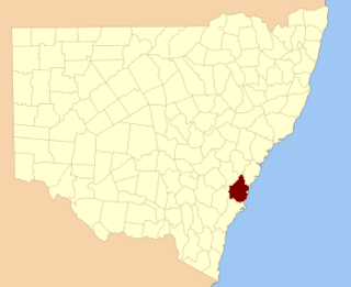
Camden County, New South Wales Cadastral in New South Wales, Australia

Camden County was one of the original Nineteen Counties in New South Wales and is now one of the 141 Cadastral divisions of New South Wales. It included the coastal area near Wollongong south to the Shoalhaven River, and also inland encompassing Berrima and Picton. Its western boundary was the Wollondilly River. The first settlement in the area was Camden Park, established by John Macarthur in 1806, just across the Nepean River from Cumberland County. It was the first land across the Nepean to be settled. Camden is a present-day suburb of Sydney in the same area, although parts of it are in Cumberland.

St Vincent County Cadastral in Australian Capital Territory

St Vincent County was one of the original Nineteen Counties in New South Wales and is now one of the 141 Cadastral divisions of New South Wales. It included the south coast area encompassing Batemans Bay, Ulladulla, Jervis Bay and inland to Braidwood. The Shoalhaven River is the boundary to the north and west, and the Deua River the boundary to the south.

Blaxland County Cadastral in New South Wales, Australia

Blaxland County is one of the 141 Cadastral divisions of New South Wales. It is bounded to the south by the Lachlan River and a small part of Waverley Creek. It includes Mount Hope and the Nombinnie Nature Reserve.

Cowper County Cadastral in New South Wales, Australia

Cowper County, New South Wales is one of the 141 Cadastral divisions of New South Wales.
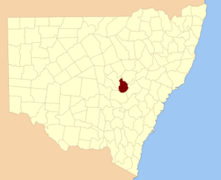
Gordon County, New South Wales Cadastral in New South Wales, Australia

Gordon County is one of the 141 Cadastral divisions of New South Wales. The Macquarie River is the north-eastern boundary.
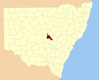
Kennedy County Cadastral in New South Wales, Australia

Kennedy County is one of the 141 Cadastral divisions of New South Wales. It is located to the west of the Bogan River in the area around Tottenham and Tullamore.
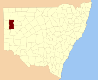
Mootwingee County Cadastral in New South Wales, Australia

Mootwingee County, New South Wales is one of the 141 cadastral divisions of New South Wales.

Oxley County Cadastral in New South Wales, Australia

Oxley County, New South Wales is one of the 141 Cadastral divisions of New South Wales. It is located between the Bogan River on the west, and the Macquarie River on the east. This is the area approximately between Warren and Nyngan.

Parts of Lincolnshire

The three parts of the English county of Lincolnshire are or were divisions of the second-largest county in England. Similar in nature to the three ridings of Yorkshire, they existed as local government units until commencement of the Local Government Act 1972.

Cobrabald River

Cobrabald River, a mostly perennial river that is part of the Namoi catchment within the Murray–Darling basin, is located in the Northern Tablelands district of New South Wales, Australia.
Wallaroo, New South Wales Town in New South Wales, Australia

Wallaroo is a rural locality in New South Wales close to the Australian Capital Territory. It lies north of the Australian Capital Territory border, north west of Hall, west of the Barton Highway, and east of the Murrumbidgee River. It is approximately 19 kilometres north-west of the Australian city of Canberra. At the 2016 census, it had a population of 707.

References

  1. "Lincoln County". Geographical Names Register (GNR) of NSW. Geographical Names Board of New South Wales. OOjs UI icon edit-ltr-progressive.svg