Cook County, New South Wales

Last updated
Map all coordinates using: OpenStreetMap  ·  Google Maps
Download coordinates as: KML  ·  GPX
Cook
New South Wales

Cook NSW.PNG

Location in New South Wales

Aus nsw nepean river dsc05078.jpg

Looking north on the Nepean River near Penrith; Cook County is on the left of the river; Cumberland is on the right
Lands administrative divisions around Cook:
Roxburgh Hunter Hunter
Westmoreland Cook Cumberland
Westmoreland Camden Cumberland

Cook County was one of the original Nineteen Counties in New South Wales and is now one of the 141 Cadastral divisions of New South Wales. It includes the area to the west of Sydney in the Blue Mountains, between the Colo River in the north, and the Coxs River in the south and west, encompassing Lithgow, Mount Victoria, Katoomba, Wentworth Falls, Lawson and most of the other towns in the Blue Mountains. The Nepean River is the border to the east. Before 1834, the area was part of the Westmoreland, Northumberland and Roxburgh counties.

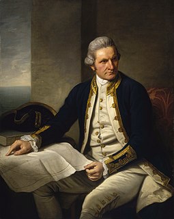
Cook County was named in honour of the navigator James Cook (1728–1779). [1] The Electoral district of Cook and Westmoreland was the first state electoral district for the area, between 1856 and 1859.

James Cook 18th-century British explorer

Captain James Cook was a British explorer, navigator, cartographer, and captain in the Royal Navy. He made detailed maps of Newfoundland prior to making three voyages to the Pacific Ocean, during which he achieved the first recorded European contact with the eastern coastline of Australia and the Hawaiian Islands, and the first recorded circumnavigation of New Zealand.

Cook and Westmoreland was an electoral district of the Legislative Assembly in the Australian state of New South Wales in the first and second Parliaments (1856–1859), named after Cook and Westmoreland counties in the Blue Mountains, Lithgow and Oberon areas. It was largely replaced by Hartley. It elected two members simultaneously, with voters casting two votes and the first two candidates being elected.

Parishes within this county

A full list of parishes found within this county; their current LGA and mapping coordinates to the approximate centre of each location is as follows:

Local government in Australia

Local government in Australia is the third tier of government in Australia administered by the states and territories, which in turn are beneath the federal tier. Local government is not mentioned in the Constitution of Australia and two referenda in the 1970s and 1980s to alter the Constitution relating to local government were unsuccessful. Every state government recognises local government in their respective constitutions. Unlike Canada or the United States, there is only one level of local government in each state, with no distinction such as cities and counties.

Parish LGA Coordinates
Barton City of Lithgow 33°14′54″S150°15′04″E / 33.24833°S 150.25111°E / -33.24833; 150.25111 (Barton Parish)
Bilpin City of Hawkesbury 33°29′54″S150°30′04″E / 33.49833°S 150.50111°E / -33.49833; 150.50111 (Bilpin Parish)
Blackheath City of Blue Mountains 33°38′54″S150°19′04″E / 33.64833°S 150.31778°E / -33.64833; 150.31778 (Blackheath Parish)
Bowen City of Blue Mountains 33°25′54″S150°30′04″E / 33.43167°S 150.50111°E / -33.43167; 150.50111 (Bowen Parish)
Burralow City of Hawkesbury 33°33′54″S150°35′04″E / 33.56500°S 150.58444°E / -33.56500; 150.58444 (Burralow Parish)
Capertee City of Lithgow 33°11′54″S150°24′04″E / 33.19833°S 150.40111°E / -33.19833; 150.40111 (Capertee Parish)
Clwydd City of Lithgow 33°29′54″S150°17′04″E / 33.49833°S 150.28444°E / -33.49833; 150.28444 (Clwydd Parish)
Colo City of Hawkesbury 33°25′54″S150°46′04″E / 33.43167°S 150.76778°E / -33.43167; 150.76778 (Colo Parish)
Cooba City of Blue Mountains 33°52′54″S150°27′04″E / 33.88167°S 150.45111°E / -33.88167; 150.45111 (Cooba Parish)
Cook City of Lithgow 33°17′46″S150°13′42″E / 33.29611°S 150.22833°E / -33.29611; 150.22833 (Cook Parish)
Coomassie City of Blue Mountains 33°38′54″S150°34′04″E / 33.64833°S 150.56778°E / -33.64833; 150.56778 (Coomassie Parish)
Cox City of Lithgow 33°19′54″S150°05′04″E / 33.33167°S 150.08444°E / -33.33167; 150.08444 (Cox Parish)
Currency City of Hawkesbury 33°32′54″S150°45′04″E / 33.54833°S 150.75111°E / -33.54833; 150.75111 (Currency Parish)
Falnash City of Lithgow 33°22′54″S149°59′04″E / 33.38167°S 149.98444°E / -33.38167; 149.98444 (Falnash Parish)
Gindantherie City of Lithgow 33°09′54″S150°15′04″E / 33.16500°S 150.25111°E / -33.16500; 150.25111 (Gindantherie Parish)
Goollooinboin City of Lithgow 33°10′54″S150°08′04″E / 33.18167°S 150.13444°E / -33.18167; 150.13444 (Goollooinboin Parish)
Govett City of Lithgow 33°14′54″S150°26′04″E / 33.24833°S 150.43444°E / -33.24833; 150.43444 (Govett Parish)
Govett South City of Lithgow 33°17′54″S150°23′04″E / 33.29833°S 150.38444°E / -33.29833; 150.38444 (Govett South Parish)
Grose City of Blue Mountains 33°35′54″S150°30′04″E / 33.59833°S 150.50111°E / -33.59833; 150.50111 (Grose Parish)
Hartley City of Lithgow 33°33′54″S150°14′04″E / 33.56500°S 150.23444°E / -33.56500; 150.23444 (Hartley Parish)
Irvine City of Hawkesbury 33°31′54″S150°23′04″E / 33.53167°S 150.38444°E / -33.53167; 150.38444 (Irvine Parish)
Jamison City of Blue Mountains 33°42′54″S150°22′04″E / 33.71500°S 150.36778°E / -33.71500; 150.36778 (Jamison Parish)
Kanimbla City of Lithgow 33°39′54″S150°13′04″E / 33.66500°S 150.21778°E / -33.66500; 150.21778 (Kanimbla Parish)
Kedumba City of Blue Mountains 33°49′54″S150°22′04″E / 33.83167°S 150.36778°E / -33.83167; 150.36778 (Kedumba Parish)
Kurrajong City of Hawkesbury 33°33′54″S150°39′04″E / 33.56500°S 150.65111°E / -33.56500; 150.65111 (Kurrajong Parish)
Lett City of Lithgow 33°31′54″S150°09′04″E / 33.53167°S 150.15111°E / -33.53167; 150.15111 (Lett Parish)
Lidsdale City of Lithgow 33°27′54″S150°02′04″E / 33.46500°S 150.03444°E / -33.46500; 150.03444 (Lidsdale Parish)
Linden City of Blue Mountains 33°44′54″S150°28′04″E / 33.74833°S 150.46778°E / -33.74833; 150.46778 (Linden Parish)
Magdala City of Blue Mountains 33°44′54″S150°33′04″E / 33.74833°S 150.55111°E / -33.74833; 150.55111 (Magdala Parish)
Marrangaroo City of Lithgow 33°25′54″S150°10′04″E / 33.43167°S 150.16778°E / -33.43167; 150.16778 (Marrangaroo Parish)
Meehan City of Hawkesbury 33°29′54″S150°48′04″E / 33.49833°S 150.80111°E / -33.49833; 150.80111 (Meehan Parish)
Megalong City of Blue Mountains 33°44′54″S150°15′04″E / 33.74833°S 150.25111°E / -33.74833; 150.25111 (Megalong Parish)
Merroo City of Hawkesbury 33°29′54″S150°40′04″E / 33.49833°S 150.66778°E / -33.49833; 150.66778 (Merroo Parish)
Mouin City of Blue Mountains 33°51′54″S150°15′04″E / 33.86500°S 150.25111°E / -33.86500; 150.25111 (Mouin Parish)
Nepean City of Hawkesbury 33°38′54″S150°38′04″E / 33.64833°S 150.63444°E / -33.64833; 150.63444 (Nepean Parish)
Rock Hill City of Lithgow 33°22′35″S150°18′24″E / 33.37639°S 150.30667°E / -33.37639; 150.30667 (Rock Hill Parish)
Strathdon City of Penrith 33°44′54″S150°38′04″E / 33.74833°S 150.63444°E / -33.74833; 150.63444 (Strathdon Parish)
Warragamba City of Blue Mountains 33°50′54″S150°32′04″E / 33.84833°S 150.53444°E / -33.84833; 150.53444 (Warragamba Parish)
Wheeny City of Hawkesbury 33°29′54″S150°35′04″E / 33.49833°S 150.58444°E / -33.49833; 150.58444 (Wheeny Parish)
Wilberforce City of Hawkesbury 33°31′24″S150°51′04″E / 33.52333°S 150.85111°E / -33.52333; 150.85111 (Wilberforce Parish)
Wolgan City of Lithgow 33°14′54″S150°10′04″E / 33.24833°S 150.16778°E / -33.24833; 150.16778 (Wolgan Parish)
Wollangambe City of Lithgow 33°29′54″S150°20′04″E / 33.49833°S 150.33444°E / -33.49833; 150.33444 (Wollangambe Parish)
Wollangambe North City of Lithgow 33°21′24″S150°24′04″E / 33.35667°S 150.40111°E / -33.35667; 150.40111 (Wollangambe North Parish)
Wollemi City of Hawkesbury 33°14′54″S150°30′04″E / 33.24833°S 150.50111°E / -33.24833; 150.50111 (Wollemi Parish)
Woodford City of Blue Mountains 33°39′54″S150°30′04″E / 33.66500°S 150.50111°E / -33.66500; 150.50111 (Woodford Parish)

Related Research Articles

Cumberland is one of the historic counties of England.

Blue Mountains (New South Wales) Region in New South Wales, Australia

The Blue Mountains are a mountainous region and a mountain range located in New South Wales, Australia. The region borders on Sydney's metropolitan area, its foothills starting about 50 kilometres (31 mi) west of centre of the state capital. The public's understanding of the extent of the Blue Mountains is varied, as it forms only part of an extensive mountainous area associated with the Great Dividing Range. Officially the Blue Mountains region is bounded by the Nepean and Hawkesbury rivers in the east, the Coxs River and Lake Burragorang to the west and south, and the Wolgan and Colo rivers to the north. Geologically, it is situated in the central parts of the Sydney Basin.

Illawarra Region in New South Wales, Australia

Illawarra is a region in the Australian state of New South Wales. It is a coastal region situated immediately south of Sydney and north of the Shoalhaven or South Coast region. It encompasses the cities of Wollongong, Shellharbour and the town of Kiama.

Mount Victoria, New South Wales Town in New South Wales, Australia

Mount Victoria is a small township in the Blue Mountains of New South Wales, Australia. It is the westernmost village in the City of Blue Mountains, located about 120 kilometres (75 mi) by road from the Sydney central business district and at an altitude of about 1,052 metres (3,451 ft) AHD . The settlement had a population of 823 people at the 2011 Census.

Geographic regions of the Commonwealth of Pennsylvania, United States of America.

Lands administrative divisions of New South Wales Wikimedia list article

The lands administrative divisions of New South Wales refers to the 141 counties within the Colony of New South Wales, that later became the Australian state of New South Wales.
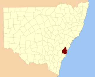
Camden County, New South Wales Cadastral in New South Wales, Australia

Camden County was one of the original Nineteen Counties in New South Wales and is now one of the 141 Cadastral divisions of New South Wales. It included the coastal area near Wollongong south to the Shoalhaven River, and also inland encompassing Berrima and Picton. Its western boundary was the Wollondilly River. The first settlement in the area was Camden Park, established by John Macarthur in 1806, just across the Nepean River from Cumberland County. It was the first land across the Nepean to be settled. Camden is a present-day suburb of Sydney in the same area, although parts of it are in Cumberland.

St Vincent County Cadastral in New South Wales, Australia

St Vincent County was one of the original Nineteen Counties in New South Wales and is now one of the 141 Cadastral divisions of New South Wales. It included the south coast area encompassing Batemans Bay, Ulladulla, Jervis Bay and inland to Braidwood. The Shoalhaven River is the boundary to the north and west, and the Deua River the boundary to the south.

Westmoreland County, New South Wales Cadastral in New South Wales, Australia

Westmoreland County was one of the original Nineteen Counties in New South Wales and is now one of the 141 Cadastral divisions of New South Wales. It is to the west of Sydney in the Blue Mountains. Coxs River is the border to the north, and the Wollondilly River to the east. Campbells River is the border in the north-east, where the county extends to near Bathurst, with the Fish River part of the border. It includes the town of Oberon, and the Kanangra-Boyd National Park.

Argyle County Cadastral in New South Wales, Australia

Argyle County was one of the original Nineteen Counties in New South Wales and is now one of the 141 Cadastral divisions of New South Wales. It includes the area around Goulburn. It is bounded by Lake George in the south-west, the Shoalhaven River in the east, and the Wollondilly River in the north-east.

Bathurst County Cadastral in New South Wales, Australia

Bathurst County was one of the original Nineteen Counties in New South Wales and is now one of the 141 Cadastral divisions of New South Wales. It includes the area to the south west of Bathurst to Cowra and Orange. The Lachlan River is the boundary to the south-west, the Belubula River forms part of the northern boundary, with the Fish River on the northeastern boundary. Blayney is located roughly in the middle.

Brisbane County Cadastral in New South Wales, Australia

Brisbane County was one of the original Nineteen Counties in New South Wales and is now one of the 141 Cadastral divisions of New South Wales. It includes Scone, Merriwa and Murrurundi. The Goulburn River is the boundary to the south and the Hunter River the boundary to the south-east. The Liverpool Range area is the boundary to the north, and the Krui River the boundary to the west.

Bligh County Cadastral in New South Wales, Australia

Bligh County was one of the original Nineteen Counties in New South Wales and is now one of the 141 Cadastral divisions of New South Wales. The Cudgegong River and the Goulburn River are its southern boundaries; the Krui River is the eastern boundary, and the Burragundy River the northern boundary. It includes the villages of Cassilis and Dunedoo.

Phillip County Cadastral in New South Wales, Australia

Phillip County was one of the original Nineteen Counties in New South Wales and is now one of the 141 Cadastral divisions of New South Wales. It includes the area to the east of Mudgee and Gulgong. The Cudgegong River is the border to the south-west, and the Goulburn River the border to the north.

Hartley was an electoral district of the Legislative Assembly in the Australian state of New South Wales, created in 1859 in the Lithgow area and named after the town of Hartley, near Lithgow. It replaced part of Cook and Westmoreland. From 1891 to 1894, it elected two members. In 1920, with the introduction of proportional representation, it was absorbed into Bathurst, along with Orange. It was recreated in 1927 and abolished in 1968 and partly replaced by Blue Mountains.

Western Boroughs was an electoral district for the Legislative Assembly in the Australian state of New South Wales from 1856 to 1859. It included the towns of Bathurst, Carcoar and Kelso, while the surrounding rural areas were in Bathurst (County) and Cook and Westmoreland. It was replaced by Bathurst and Carcoar.

The Central Tablelands in New South Wales is a geographic area that lies between the Sydney Metropolitan Area and the Central Western Slopes and Plains. The Great Dividing Range passes in a north–south direction through the Central Tablelands and includes the Blue Mountains. The region shares borders with the Hunter, Central West Slopes and Plains, Southern Tablelands, North Western Slopes and Plains, the Sydney Metropolitan Area and the Illawarra.

Grose River river in Australia

The Grose River, a perennial river that is part of the Hawkesbury-Nepean catchment, is located in the Blue Mountains region of New South Wales, Australia.

References

  1. "Cook County". Geographical Names Register (GNR) of NSW. Geographical Names Board of New South Wales.