Dudley County

Last updated

Map all coordinates using: OpenStreetMap  
Download coordinates as: KML  ·  GPX
Dudley
New South Wales
Dudley NSW.PNG
Location in New South Wales
Lands administrative divisions around Dudley:
Clarke Raleigh Pacific Ocean
Vernon Dudley Pacific Ocean
Hawes Macquarie Pacific Ocean

Dudley County is one of the 141 Cadastral divisions of New South Wales. Part of the southern border near the coast is the Apsley River.

Apsley River (New South Wales) river in New South Wales, Australia

Apsley River, a perennial stream of the Macleay River catchment, is located in the Northern Tablelands district of New South Wales, Australia.

Dudley County was named in honour of Dudley Ryder, Second Earl of Harrowby (1798-1882). [1]

Dudley Ryder, 2nd Earl of Harrowby British politician

Dudley Ryder, 2nd Earl of Harrowby KG, PC, FRS, styled Viscount Sandon between 1809 and 1847, was a British politician. He held office under Lord Palmerston as Chancellor of the Duchy of Lancaster in 1855 and as Lord Privy Seal between 1855 and 1858.

Parishes within this county

A list of parishes found within this county; their LGA and mapping coordinates to the approximate centre of each location is as follows:

A county is a geographical region of a country used for administrative or other purposes, in certain modern nations. The term is derived from the Old French conté or cunté denoting a jurisdiction under the sovereignty of a count (earl) or a viscount. The modern French is comté, and its equivalents in other languages are contea, contado, comtat, condado, Grafschaft, graafschap, Gau, etc..

Local government in Australia

Local government in Australia is the third tier of government in Australia administered by the states and territories, which in turn are beneath the federal tier. Local government is not mentioned in the Constitution of Australia and two referenda in the 1970s and 1980s to alter the Constitution relating to local government were unsuccessful. Every state government recognises local government in their respective constitutions. Unlike Canada or the United States, there is only one level of local government in each state, with no distinction such as cities and counties.

ParishLGACoordinates
Bandi Bandi Kempsey Shire Council 31°06′54″S152°30′04″E / 31.11500°S 152.50111°E / -31.11500; 152.50111 (Bandi Bandi)
Barraganyatti Kempsey Shire Council 30°51′54″S152°56′04″E / 30.86500°S 152.93444°E / -30.86500; 152.93444 (Barraganyatti)
Bellbrook Kempsey Shire Council 30°46′54″S152°33′04″E / 30.78167°S 152.55111°E / -30.78167; 152.55111 (Bellbrook)
Boonanghi Kempsey Shire Council 31°04′54″S152°36′04″E / 31.08167°S 152.60111°E / -31.08167; 152.60111 (Boonanghi)
Burragong Kempsey Shire Council 30°57′54″S152°42′04″E / 30.96500°S 152.70111°E / -30.96500; 152.70111 (Burragong)
Clarke Kempsey Shire Council 30°59′54″S152°20′04″E / 30.99833°S 152.33444°E / -30.99833; 152.33444 (Clarke)
Cliffs Kempsey Shire Council 30°32′54″S152°25′04″E / 30.54833°S 152.41778°E / -30.54833; 152.41778 (Cliffs)
Clybucca Kempsey Shire Council 30°55′54″S152°58′04″E / 30.93167°S 152.96778°E / -30.93167; 152.96778 (Clybucca)
Collombatti Kempsey Shire Council 30°55′54″S152°45′04″E / 30.93167°S 152.75111°E / -30.93167; 152.75111 (Collombatti)
Comara Kempsey Shire Council 30°37′54″S152°22′04″E / 30.63167°S 152.36778°E / -30.63167; 152.36778 (Comara)
Cooroobongatti Kempsey Shire Council 30°58′54″S152°56′04″E / 30.98167°S 152.93444°E / -30.98167; 152.93444 (Cooroobongatti)
Dudley Kempsey Shire Council 31°04′54″S152°25′04″E / 31.08167°S 152.41778°E / -31.08167; 152.41778 (Dudley)
Gordon Kempsey Shire Council 30°46′54″S152°37′04″E / 30.78167°S 152.61778°E / -30.78167; 152.61778 (Gordon)
Hickey Kempsey Shire Council 30°53′14″S152°39′50″E / 30.88722°S 152.66389°E / -30.88722; 152.66389 (Hickey)
Kalateenee Kempsey Shire Council 31°05′54″S152°47′04″E / 31.09833°S 152.78444°E / -31.09833; 152.78444 (Kalateenee)
Kemp Kempsey Shire Council 31°03′54″S152°30′04″E / 31.06500°S 152.50111°E / -31.06500; 152.50111 (Kemp)
Kullatine Kempsey Shire Council 31°04′54″S152°41′04″E / 31.08167°S 152.68444°E / -31.08167; 152.68444 (Kullatine)
Loftus Kempsey Shire Council 30°36′54″S152°30′04″E / 30.61500°S 152.50111°E / -30.61500; 152.50111 (Loftus)
Macleay Kempsey Shire Council 30°51′54″S152°24′04″E / 30.86500°S 152.40111°E / -30.86500; 152.40111 (Macleay)
Nulla Nulla Kempsey Shire Council 30°44′54″S152°29′04″E / 30.74833°S 152.48444°E / -30.74833; 152.48444 (Nulla Nulla)
Oreen Kempsey Shire Council 30°52′54″S152°30′04″E / 30.88167°S 152.50111°E / -30.88167; 152.50111 (Oreen)
Panton Kempsey Shire Council 30°56′54″S152°26′04″E / 30.94833°S 152.43444°E / -30.94833; 152.43444 (Panton)
Parrabel Kempsey Shire Council 30°57′54″S152°36′04″E / 30.96500°S 152.60111°E / -30.96500; 152.60111 (Parrabel)
Pee Dee Kempsey Shire Council 30°44′54″S152°25′04″E / 30.74833°S 152.41778°E / -30.74833; 152.41778 (Pee Dee)
Stuart Kempsey Shire Council 30°42′54″S152°26′04″E / 30.71500°S 152.43444°E / -30.71500; 152.43444 (Stuart)
Tanban Kempsey Shire Council 30°55′54″S152°51′04″E / 30.93167°S 152.85111°E / -30.93167; 152.85111 (Tanban)
Uralgurra Kempsey Shire Council 30°50′54″S152°36′04″E / 30.84833°S 152.60111°E / -30.84833; 152.60111 (Uralgurra)
Vernon Kempsey Shire Council 30°55′54″S152°20′04″E / 30.93167°S 152.33444°E / -30.93167; 152.33444 (Vernon)
Warbro Kempsey Shire Council 30°56′54″S152°30′04″E / 30.94833°S 152.50111°E / -30.94833; 152.50111 (Warbro)
Warne Kempsey Shire Council 30°49′54″S152°20′04″E / 30.83167°S 152.33444°E / -30.83167; 152.33444 (Warne)
Willawarrin Kempsey Shire Council 30°55′54″S152°38′04″E / 30.93167°S 152.63444°E / -30.93167; 152.63444 (Willawarrin)
Willi Willi Kempsey Shire Council 30°59′54″S152°26′04″E / 30.99833°S 152.43444°E / -30.99833; 152.43444 (Willi Willi)
Wittitrin Kempsey Shire Council 31°07′21″S152°40′56″E / 31.12250°S 152.68222°E / -31.12250; 152.68222 (Wittitrin)
Wolseley Kempsey Shire Council 30°37′54″S152°25′04″E / 30.63167°S 152.41778°E / -30.63167; 152.41778 (Wolseley)
Yarrabandini Kempsey Shire Council 30°58′54″S152°49′04″E / 30.98167°S 152.81778°E / -30.98167; 152.81778 (Yarrabandini)
Yarrahapinni Kempsey Shire Council 30°48′54″S152°58′04″E / 30.81500°S 152.96778°E / -30.81500; 152.96778 (Yarrahapinni)
Yarravel Kempsey Shire Council 31°01′54″S152°44′04″E / 31.03167°S 152.73444°E / -31.03167; 152.73444 (Yarravel)

Related Research Articles

West Midlands (county) County of England

The West Midlands is a metropolitan county and combined authority area in western-central England with a 2014 estimated population of 2,808,356, making it the second most populous county in England after Greater London. It came into existence as a metropolitan county in 1974 after the passage of the Local Government Act 1972, formed from parts of Staffordshire, Worcestershire and Warwickshire. The county itself is a NUTS 2 region within the wider NUTS 1 region of the same name. The county consists of seven metropolitan boroughs: the City of Birmingham, the City of Coventry and the City of Wolverhampton, as well as the boroughs of Dudley, Sandwell, Solihull and Walsall.

Dudley is a town in the West Midlands of England.

South Creek (New South Wales) river in New South Wales, Australia

The South Creek or Wianamatta, a creek that is part of the Hawkesbury-Nepean catchment, is located on the Cumberland Plain, also referred to as Greater Western Sydney, New South Wales, Australia.

The Geographical Names Board of New South Wales, a statutory authority of the Land and Property Information division, Department of Finance and Services in the Government of New South Wales, is the official body for naming and recording details of places and geographical names in the state of New South Wales, Australia.

Dudley, New South Wales Suburb of Newcastle, New South Wales, Australia

Dudley is a southern coastal suburb of Newcastle, New South Wales, Australia, 13 kilometres (8 mi) southwest of Newcastle's central business district on the eastern side of Lake Macquarie. It is part of the City of Lake Macquarie local government area.
Quinebaug River river in the United States of America

The Quinebaug River is a river in south-central Massachusetts and eastern Connecticut, with watershed extending into western Rhode Island. The name "Quinebaug" comes from the southern New England Native American term, spelled variously Qunnubbâgge, Quinibauge, etc., meaning "long pond", from qunni-, "long", and -paug, "pond". The river is one of the namesake rivers in the Quinebaug and Shetucket Rivers Valley National Heritage Corridor.

Darbalara, New South Wales Town in New South Wales, Australia

Darbalara is a rural community on the east bank of the junction of the Murrumbidgee River and Tumut River in the Riverina. It is situated by road, about 25 kilometres north east of Gundagai and 25 kilometres south of Coolac.

Gloucester County, New South Wales Cadastral in New South Wales, Australia

Gloucester County was one of the original Nineteen Counties in New South Wales, and is now one of the 141 cadastral divisions of New South Wales. It includes the area around Port Stephens. It is bounded on the north and west by the Manning River, and on the south-west by the Williams River.

Northumberland County, New South Wales Cadastral in New South Wales, Australia

Northumberland County was one of the original Nineteen Counties in New South Wales and is now one of the 141 Cadastral divisions of New South Wales. It included the area to the north of Broken Bay, including Lake Macquarie and Newcastle. It was bounded by the part of the Hawkesbury River to the south, the Macdonald River to the south-west, and the Hunter River to the north.
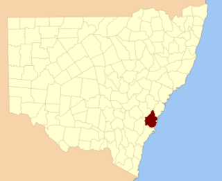
Camden County, New South Wales Cadastral in New South Wales, Australia

Camden County was one of the original Nineteen Counties in New South Wales and is now one of the 141 Cadastral divisions of New South Wales. It included the coastal area near Wollongong south to the Shoalhaven River, and also inland encompassing Berrima and Picton. Its western boundary was the Wollondilly River. The first settlement in the area was Camden Park, established by John Macarthur in 1806, just across the Nepean River from Cumberland County. It was the first land across the Nepean to be settled. Camden is a present-day suburb of Sydney in the same area, although parts of it are in Cumberland.

St Vincent County Cadastral in Australian Capital Territory

St Vincent County was one of the original Nineteen Counties in New South Wales and is now one of the 141 Cadastral divisions of New South Wales. It included the south coast area encompassing Batemans Bay, Ulladulla, Jervis Bay and inland to Braidwood. The Shoalhaven River is the boundary to the north and west, and the Deua River the boundary to the south.

Sandon County Cadastral in New South Wales, Australia

Sandon County is one of the 141 Cadastral divisions of New South Wales. It is centred on Armidale, and also includes Uralla.

Cowper County Cadastral in New South Wales, Australia

Cowper County, New South Wales is one of the 141 Cadastral divisions of New South Wales.
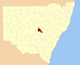
Kennedy County Cadastral in New South Wales, Australia

Kennedy County is one of the 141 Cadastral divisions of New South Wales. It is located to the west of the Bogan River in the area around Tottenham and Tullamore.
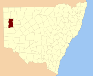
Mootwingee County Cadastral in New South Wales, Australia

Mootwingee County, New South Wales is one of the 141 Cadastral divisions of New South Wales.

Oxley County Cadastral in New South Wales, Australia

Oxley County, New South Wales is one of the 141 Cadastral divisions of New South Wales. It is located between the Bogan River on the west, and the Macquarie River on the east. This is the area approximately between Warren and Nyngan.

Allen Mountain (New York) mountain in New York, United States of America

Allen Mountain is a mountain located in Essex County, New York. It is part of the Marcy Group of the Great Range of the Adirondack Mountains, and is flanked to the north by Mount Skylight.

Mount Redfield mountain in United States of America

Mount Redfield is a mountain located in Essex County, New York. The mountain is part of the Marcy Group of the Great Range of the Adirondack Mountains. Mount Redfield is flanked to the northwest by Cliff Mountain, and to the northeast by Mount Skylight.

Bandi Bandi, New South Wales

Bandi Bandi located at 31°06′54″S 152°30′04″E in the hinterland behind Kempsey, New South Wales is a civil parish of Dudley County. and rural locality in the Kempsey Shire Council Area of the midnorth coast of New South Wales, Australia.

Blowering, New South Wales

Blowering, New South wales is a rural locality in the Snowy Mountains of New South wales and a civil Parish of Buccleuch County.

References

  1. "Dudley". Geographical Names Register (GNR) of NSW. Geographical Names Board of New South Wales . Retrieved 5 August 2013. OOjs UI icon edit-ltr-progressive.svg