Finch County

Last updated

Map all coordinates using: OpenStreetMap  
Download coordinates as: KML  ·  GPX
Finch
New South Wales
Finch NSW.PNG
Location in New South Wales
Lands administrative divisions around Finch:
Queensland Queensland Queensland
Narran Finch Benarba
Clyde Leichhardt Denham

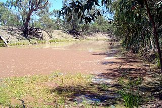
Finch County is one of the 141 Cadastral divisions of New South Wales. It is bounded by the Narran River in the west, the Barwon River to the south and east, and the Queensland border to the north. It includes Lightning Ridge.

Narran River river in Queensland, Australia

Narran River, a watercourse of the Barwon catchment within the Murray–Darling basin, is located in the Southern Downs district of Queensland and Orana district of New South Wales, Australia.

Barwon River (New South Wales) river located in the Orana region of New South Wales, Australia

Barwon River, a perennial river that is part of the Murray–Darling basin, is located in the north-west slopes and Orana regions of New South Wales, Australia.

Queensland North-east state of Australia

Queensland is the second-largest and third-most populous state in the Commonwealth of Australia. Situated in the north-east of the country, it is bordered by the Northern Territory, South Australia and New South Wales to the west, south-west and south respectively. To the east, Queensland is bordered by the Coral Sea and Pacific Ocean. To its north is the Torres Strait, with Papua New Guinea located less than 200 km across it from the mainland. The state is the world's sixth-largest sub-national entity, with an area of 1,852,642 square kilometres (715,309 sq mi).

Finch County was named in honour of surveyor Heneage Finch, the grandson of Heneage Finch, 3rd Earl of Aylesford. [1] [2] [3]

Heneage Finch (1793–1850) was a 19th-century surveyor. He is known for his surveying work in the Colony of New South Wales, Australia.

Heneage Finch, 3rd Earl of Aylesford Member of the Parliament of Great Britain

Heneage Finch, 3rd Earl of Aylesford, styled Lord Guernsey between 1719 and 1757, was a British peer and politician.

Parishes within this county

A full list of parishes found within this county; their current LGA and mapping coordinates to the approximate centre of each location is as follows:

Local government in Australia

Local government in Australia is the third tier of government in Australia administered by the states and territories, which in turn are beneath the federal tier. Local government is not mentioned in the Constitution of Australia and two referenda in the 1970s and 1980s to alter the Constitution relating to local government were unsuccessful. Every state government recognises local government in their respective constitutions. Unlike Canada or the United States, there is only one level of local government in each state, with no distinction such as cities and counties.

ParishLGACoordinates
Bagot Walgett Shire 29°05′46″S148°39′44″E / 29.09611°S 148.66222°E / -29.09611; 148.66222 (Bagot)
Baloon Walgett Shire 29°00′55″S148°36′21″E / 29.01528°S 148.60583°E / -29.01528; 148.60583 (Baloon)
Barnbah Walgett Shire 29°54′45″S147°45′24″E / 29.91250°S 147.75667°E / -29.91250; 147.75667 (Barnbah)
Barrangeel Walgett Shire 29°27′16″S148°03′55″E / 29.45444°S 148.06528°E / -29.45444; 148.06528 (Barrangeel)
Bibble Moree Plains Shire 29°07′28″S148°50′55″E / 29.12444°S 148.84861°E / -29.12444; 148.84861 (Bibble)
Bimber Walgett Shire 29°49′43″S147°57′07″E / 29.82861°S 147.95194°E / -29.82861; 147.95194 (Bimber)
Birben Walgett Shire 29°17′09″S147°51′08″E / 29.28583°S 147.85222°E / -29.28583; 147.85222 (Birben)
Birrah Walgett Shire 29°13′26″S148°02′04″E / 29.22389°S 148.03444°E / -29.22389; 148.03444 (Birrah)
Blackwood Walgett Shire 29°38′29″S147°36′58″E / 29.64139°S 147.61611°E / -29.64139; 147.61611 (Blackwood)
Bloxsome Walgett Shire 29°28′12″S148°09′35″E / 29.47000°S 148.15972°E / -29.47000; 148.15972 (Bloxsome)
Bogra Walgett Shire 29°54′29″S147°52′09″E / 29.90806°S 147.86917°E / -29.90806; 147.86917 (Bogra)
Bon Bon Walgett Shire 29°53′36″S148°00′58″E / 29.89333°S 148.01611°E / -29.89333; 148.01611 (Bon Bon)
Boorara Walgett Shire 29°01′30″S148°29′08″E / 29.02500°S 148.48556°E / -29.02500; 148.48556 (Boorara)
Boorooma Walgett Shire 30°00′44″S147°29′08″E / 30.01222°S 147.48556°E / -30.01222; 147.48556 (Boorooma)
Borah Walgett Shire 29°39′00″S148°08′00″E / 29.65000°S 148.13333°E / -29.65000; 148.13333 (Borah)
Buddah Walgett Shire 29°48′14″S147°34′45″E / 29.80389°S 147.57917°E / -29.80389; 147.57917 (Buddah)
Buggee Walgett Shire 29°33′08″S147°59′26″E / 29.55222°S 147.99056°E / -29.55222; 147.99056 (Buggee)
Bukkulla Walgett Shire 29°24′02″S148°25′06″E / 29.40056°S 148.41833°E / -29.40056; 148.41833 (Bukkulla)
Bumble Walgett Shire 29°07′43″S148°10′56″E / 29.12861°S 148.18222°E / -29.12861; 148.18222 (Bumble)
Bundabarrina Walgett Shire 29°39′08″S148°24′29″E / 29.65222°S 148.40806°E / -29.65222; 148.40806 (Bundabarrina)
Bundah Walgett Shire 29°36′14″S148°08′30″E / 29.60389°S 148.14167°E / -29.60389; 148.14167 (Bundah)
Bunghill Walgett Shire 29°47′17″S147°43′21″E / 29.78806°S 147.72250°E / -29.78806; 147.72250 (Bunghill)
Burbah Walgett Shire 29°01′08″S148°17′25″E / 29.01889°S 148.29028°E / -29.01889; 148.29028 (Burbah)
Burrabebe Walgett Shire 29°23′02″S147°54′30″E / 29.38389°S 147.90833°E / -29.38389; 147.90833 (Burrabebe)
Burran Burran Walgett Shire 29°11′25″S148°42′14″E / 29.19028°S 148.70389°E / -29.19028; 148.70389 (Burran Burran)
Burrandown Walgett Shire 29°01′25″S148°50′41″E / 29.02361°S 148.84472°E / -29.02361; 148.84472 (Burrandown)
Burrawandool Walgett Shire 29°07′09″S148°27′50″E / 29.11917°S 148.46389°E / -29.11917; 148.46389 (Burrawandool)
Calmuldi Walgett Shire 29°44′46″S148°20′58″E / 29.74611°S 148.34944°E / -29.74611; 148.34944 (Calmuldi)
Cambo Cambo Walgett Shire 29°05′41″S148°33′23″E / 29.09472°S 148.55639°E / -29.09472; 148.55639 (Cambo Cambo)
Campbell Walgett Shire 29°39′13″S148°13′32″E / 29.65361°S 148.22556°E / -29.65361; 148.22556 (Campbell)
Collarindabri Walgett Shire 29°32′03″S148°35′13″E / 29.53417°S 148.58694°E / -29.53417; 148.58694 (Collarindabri)
Combadery Walgett Shire 30°00′02″S147°58′29″E / 30.00056°S 147.97472°E / -30.00056; 147.97472 (Combadery)
Coocoran Walgett Shire 29°26′41″S147°44′35″E / 29.44472°S 147.74306°E / -29.44472; 147.74306 (Coocoran)
Coogarah Walgett Shire 29°34′41″S147°52′47″E / 29.57806°S 147.87972°E / -29.57806; 147.87972 (Coogarah)
Corona Walgett Shire 29°45′42″S147°27′59″E / 29.76167°S 147.46639°E / -29.76167; 147.46639 (Corona)
Cowelba Walgett Shire 29°22′00″S148°20′20″E / 29.36667°S 148.33889°E / -29.36667; 148.33889 (Cowelba)
Cumborah Walgett Shire 29°45′50″S147°43′50″E / 29.76389°S 147.73056°E / -29.76389; 147.73056 (Cumborah)
Cunnianna Walgett Shire 29°33′17″S148°18′46″E / 29.55472°S 148.31278°E / -29.55472; 148.31278 (Cunnianna)
Currall Walgett Shire 29°38′56″S147°26′34″E / 29.64889°S 147.44278°E / -29.64889; 147.44278 (Currall)
Daraaba Walgett Shire 29°04′57″S148°16′04″E / 29.08250°S 148.26778°E / -29.08250; 148.26778 (Daraaba)
Deripas Walgett Shire 29°31′29″S148°03′40″E / 29.52472°S 148.06111°E / -29.52472; 148.06111 (Deripas)
Dungalear Walgett Shire 29°49′16″S148°15′15″E / 29.82111°S 148.25417°E / -29.82111; 148.25417 (Dungalear)
Dungell Walgett Shire 29°21′43″S148°05′46″E / 29.36194°S 148.09611°E / -29.36194; 148.09611 (Dungell)
Dunumbral Walgett Shire 29°30′54″S148°13′47″E / 29.51500°S 148.22972°E / -29.51500; 148.22972 (Dunumbral)
Durabeba Walgett Shire 29°32′25″S147°53′54″E / 29.54028°S 147.89833°E / -29.54028; 147.89833 (Durabeba)
Eales Walgett Shire 29°58′17″S147°38′02″E / 29.97139°S 147.63389°E / -29.97139; 147.63389 (Eales)
Eckford Walgett Shire 29°18′23″S148°39′04″E / 29.30639°S 148.65111°E / -29.30639; 148.65111 (Eckford)
Elphinstone Walgett Shire 29°12′51″S147°53′53″E / 29.21417°S 147.89806°E / -29.21417; 147.89806 (Elphinstone)
Eulan Walgett Shire 29°20′37″S147°58′09″E / 29.34361°S 147.96917°E / -29.34361; 147.96917 (Eulan)
Euminbah Walgett Shire 29°54′34″S148°09′17″E / 29.90944°S 148.15472°E / -29.90944; 148.15472 (Euminbah)
Eurawin Walgett Shire 29°40′50″S147°52′39″E / 29.68056°S 147.87750°E / -29.68056; 147.87750 (Eurawin)
Finch Walgett Shire 29°23′36″S147°39′52″E / 29.39333°S 147.66444°E / -29.39333; 147.66444 (Finch)
Gamalally Walgett Shire 29°20′49″S148°32′22″E / 29.34694°S 148.53944°E / -29.34694; 148.53944 (Gamalally)
Gingie Walgett Shire 29°58′10″S148°03′24″E / 29.96944°S 148.05667°E / -29.96944; 148.05667 (Gingie)
Glatherindi Walgett Shire 29°36′30″S148°23′16″E / 29.60833°S 148.38778°E / -29.60833; 148.38778 (Glatherindi)
Gooningeri Walgett Shire 29°22′51″S148°15′31″E / 29.38083°S 148.25861°E / -29.38083; 148.25861 (Gooningeri)
Gooraway Walgett Shire 29°35′10″S148°01′34″E / 29.58611°S 148.02611°E / -29.58611; 148.02611 (Gooraway)
Gordon Walgett Shire 29°44′20″S148°03′59″E / 29.73889°S 148.06639°E / -29.73889; 148.06639 (Gordon)
Gorie Gorie Walgett Shire 29°52′32″S147°45′33″E / 29.87556°S 147.75917°E / -29.87556; 147.75917 (Gorie Gorie)
Grawin Walgett Shire 29°31′11″S147°40′04″E / 29.51972°S 147.66778°E / -29.51972; 147.66778 (Grawin)
Greaves Walgett Shire 29°02′30″S148°05′59″E / 29.04167°S 148.09972°E / -29.04167; 148.09972 (Greaves)
Green Walgett Shire 29°29′56″S148°30′36″E / 29.49889°S 148.51000°E / -29.49889; 148.51000 (Green)
Gummanaldi Walgett Shire 29°18′25″S148°20′45″E / 29.30694°S 148.34583°E / -29.30694; 148.34583 (Gummanaldi)
Gundabloui Walgett Shire 29°12′26″S148°34′39″E / 29.20722°S 148.57750°E / -29.20722; 148.57750 (Gundabloui)
Gurilly Walgett Shire 29°32′46″S147°30′22″E / 29.54611°S 147.50611°E / -29.54611; 147.50611 (Gurilly)
Gurley Walgett Shire 29°32′03″S147°48′25″E / 29.53417°S 147.80694°E / -29.53417; 147.80694 (Gurley)
Hungerford Walgett Shire 29°45′52″S148°16′28″E / 29.76444°S 148.27444°E / -29.76444; 148.27444 (Hungerford)
Imbergee Walgett Shire unknown
Kee Kee Walgett Shire 29°46′44″S147°57′15″E / 29.77889°S 147.95417°E / -29.77889; 147.95417 (Kee Kee)
Keilmoi Walgett Shire 29°02′00″S148°11′33″E / 29.03333°S 148.19250°E / -29.03333; 148.19250 (Keilmoi)
Kennedy Walgett Shire 29°17′54″S148°27′04″E / 29.29833°S 148.45111°E / -29.29833; 148.45111 (Kennedy)
Kigwigil Walgett Shire 29°40′55″S147°37′32″E / 29.68194°S 147.62556°E / -29.68194; 147.62556 (Kigwigil)
Kurragong Walgett Shire 29°58′22″S147°31′34″E / 29.97278°S 147.52611°E / -29.97278; 147.52611 (Kurragong)
Langloh Walgett Shire 29°22′14″S147°49′21″E / 29.37056°S 147.82250°E / -29.37056; 147.82250 (Langloh)
Llanillo Walgett Shire 29°35′39″S147°56′15″E / 29.59417°S 147.93750°E / -29.59417; 147.93750 (Llanillo)
Lolleep Walgett Shire 29°52′26″S147°38′57″E / 29.87389°S 147.64917°E / -29.87389; 147.64917 (Lolleep)
Maggarie Walgett Shire 29°08′54″S147°56′49″E / 29.14833°S 147.94694°E / -29.14833; 147.94694 (Maggarie)
Manning Walgett Shire 29°43′27″S147°35′16″E / 29.72417°S 147.58778°E / -29.72417; 147.58778 (Manning)
Mebea Walgett Shire 29°24′27″S147°54′11″E / 29.40750°S 147.90306°E / -29.40750; 147.90306 (Mebea)
Mein Walgett Shire 29°35′24″S147°36′05″E / 29.59000°S 147.60139°E / -29.59000; 147.60139 (Mein)
Milrea Walgett Shire 30°03′00″S147°37′16″E / 30.05000°S 147.62111°E / -30.05000; 147.62111 (Milrea)
Mogil Mogul Walgett Shire 29°23′39″S148°38′05″E / 29.39417°S 148.63472°E / -29.39417; 148.63472 (Mogil Mogul)
Moongulla Walgett Shire 29°27′28″S148°19′31″E / 29.45778°S 148.32528°E / -29.45778; 148.32528 (Moongulla)
Mooni Walgett Shire 29°02′37″S148°43′32″E / 29.04361°S 148.72556°E / -29.04361; 148.72556 (Mooni)
Mooroo Walgett Shire 29°51′28″S148°05′19″E / 29.85778°S 148.08861°E / -29.85778; 148.08861 (Mooroo)
Moramina Walgett Shire 29°52′40″S147°54′27″E / 29.87778°S 147.90750°E / -29.87778; 147.90750 (Moramina)
Morendah Walgett Shire 29°33′34″S147°42′22″E / 29.55944°S 147.70611°E / -29.55944; 147.70611 (Morendah)
Mullingowba Walgett Shire 29°12′17″S148°19′45″E / 29.20472°S 148.32917°E / -29.20472; 148.32917 (Mullingowba)
Mundoo Walgett Shire 29°14′59″S148°10′08″E / 29.24972°S 148.16889°E / -29.24972; 148.16889 (Mundoo)
Mureabun Walgett Shire 29°36′32″S147°28′10″E / 29.60889°S 147.46944°E / -29.60889; 147.46944 (Mureabun)
Narran Walgett Shire 29°02′30″S148°23′03″E / 29.04167°S 148.38417°E / -29.04167; 148.38417 (Narran)
Peelborough Walgett Shire 29°25′04″S148°11′43″E / 29.41778°S 148.19528°E / -29.41778; 148.19528 (Peelborough)
Pine Walgett Shire 29°39′48″S147°33′08″E / 29.66333°S 147.55222°E / -29.66333; 147.55222 (Pine)
Pinegobla Walgett Shire 29°15′58″S148°15′39″E / 29.26611°S 148.26083°E / -29.26611; 148.26083 (Pinegobla)
Plumbolah Walgett Shire 29°48′01″S147°50′08″E / 29.80028°S 147.83556°E / -29.80028; 147.83556 (Plumbolah)
Queega Walgett Shire 29°29′19″S147°49′43″E / 29.48861°S 147.82861°E / -29.48861; 147.82861 (Queega)
Rose Walgett Shire 29°43′43″S147°56′51″E / 29.72861°S 147.94750°E / -29.72861; 147.94750 (Rose)
Scott Walgett Shire 30°01′59″S147°50′15″E / 30.03306°S 147.83750°E / -30.03306; 147.83750 (Scott)
Somerville Walgett Shire 29°36′59″S148°13′31″E / 29.61639°S 148.22528°E / -29.61639; 148.22528 (Somerville)
Talawa Walgett Shire 29°12′16″S148°10′43″E / 29.20444°S 148.17861°E / -29.20444; 148.17861 (Talawa)
Telinebone Walgett Shire 29°49′54″S147°50′46″E / 29.83167°S 147.84611°E / -29.83167; 147.84611 (Telinebone)
Tomorrago Walgett Shire 29°22′33″S148°01′28″E / 29.37583°S 148.02444°E / -29.37583; 148.02444 (Tomorrago)
Townday Walgett Shire 29°06′41″S148°45′26″E / 29.11139°S 148.75722°E / -29.11139; 148.75722 (Townday)
Tutawa Walgett Shire 29°11′36″S148°07′29″E / 29.19333°S 148.12472°E / -29.19333; 148.12472 (Tutawa)
Ulah Walgett Shire 30°01′11″S147°43′42″E / 30.01972°S 147.72833°E / -30.01972; 147.72833 (Ulah)
Urandool Walgett Shire 29°41′21″S148°02′52″E / 29.68917°S 148.04778°E / -29.68917; 148.04778 (Urandool)
Wallah Walgett Shire 29°36′18″S148°18′18″E / 29.60500°S 148.30500°E / -29.60500; 148.30500 (Wallah)
Wallangulla Walgett Shire 29°27′47″S147°58′33″E / 29.46306°S 147.97583°E / -29.46306; 147.97583 (Wallangulla)
Wammell Walgett Shire 29°25′53″S147°49′00″E / 29.43139°S 147.81667°E / -29.43139; 147.81667 (Wammell)
Waugh Walgett Shire 29°49′19″S148°05′44″E / 29.82194°S 148.09556°E / -29.82194; 148.09556 (Waugh)
Wee Warra Walgett Shire 29°42′06″S147°44′25″E / 29.70167°S 147.74028°E / -29.70167; 147.74028 (Wee Warra)
Werribilla Walgett Shire 29°27′21″S148°38′17″E / 29.45583°S 148.63806°E / -29.45583; 148.63806 (Werribilla)
Wilby Wilby Walgett Shire 29°26′18″S147°36′04″E / 29.43833°S 147.60111°E / -29.43833; 147.60111 (Wilby Wilby)
Wilga Walgett Shire 29°43′14″S148°10′55″E / 29.72056°S 148.18194°E / -29.72056; 148.18194 (Wilga)
Wilkie Walgett Shire 29°52′22″S147°32′26″E / 29.87278°S 147.54056°E / -29.87278; 147.54056 (Wilkie)
Wooburrabebe Walgett Shire 29°16′29″S148°00′06″E / 29.27472°S 148.00167°E / -29.27472; 148.00167 (Wooburrabebe)
Yarraman Walgett Shire 29°29′33″S148°23′41″E / 29.49250°S 148.39472°E / -29.49250; 148.39472 (Yarraman)
Yeranbah Walgett Shire 29°04′53″S148°06′56″E / 29.08139°S 148.11556°E / -29.08139; 148.11556 (Yeranbah)
Yerangle Walgett Shire 29°47′42″S148°11′30″E / 29.79500°S 148.19167°E / -29.79500; 148.19167 (Yerangle)
Yourblah Walgett Shire 29°19′09″S148°06′20″E / 29.31917°S 148.10556°E / -29.31917; 148.10556 (Yourblah)

Related Research Articles

Earl of Winchilsea Title in the Peerage of England

Earl of Winchilsea is a title in the Peerage of England held by the Finch-Hatton family. It has been united with the title of Earl of Nottingham under a single holder since 1729. The Finch family is believed to be descended from Henry FitzHerbert, Lord Chamberlain to Henry I. The name change to Finch came in the 1350s after marriage to an heiress by a member of the Finch family. In 1660 the 3rd Earl of Winchilsea was created Baron FitzHerbert of Eastwell, Kent, in recompense for his efficient aid in the Restoration of the Monarchy. The Herbert family of Wales, Earls of Pembroke, share common ancestry but bear differenced arms. A later member of the family, Sir William Finch, was knighted in 1513. His son Sir Thomas Finch, was also knighted for his share in suppressing Sir Thomas Wyatt's insurrection against Queen Mary I, and was the son-in-law of Sir Thomas Moyle, some of whose lands Finch's wife inherited. Thomas's eldest son Moyle Finch represented Weymouth, Kent and Winchelsea in the House of Commons. In 1611 he was created a baronet, of Eastwell in the County of Kent.

Thomas Mitchell (explorer) Scottish surveyor and explorer in Australia

Lieutenant Colonel Sir Thomas Livingstone Mitchell, surveyor and explorer of south-eastern Australia, was born at Grangemouth in Stirlingshire, Scotland. In 1827 he took up an appointment as Assistant Surveyor General of New South Wales. The following year he became Surveyor General and remained in this position until his death. Mitchell was knighted in 1839 for his contribution to the surveying of Australia.

Earl of Aylesford

Earl of Aylesford, in the County of Kent, is a title in the Peerage of Great Britain. It was created in 1714 for the lawyer and politician Heneage Finch, 1st Baron Guernsey. He had already been created Baron Guernsey in the Peerage of England in 1703. Finch was the younger son of Heneage Finch, 1st Earl of Nottingham and the great-grandson of Elizabeth Heneage, 1st Countess of Winchilsea. Lord Aylesford's eldest son, the second Earl, represented Maidstone and Surrey in Parliament. In 1712, he married Mary Fisher, daughter of Sir Clement Fisher, 3rd Baronet. Through this marriage Packington Hall in Warwickshire came into the Finch family. Their son, the third Earl, sat as a Member of Parliament for Leicestershire and Maidstone. His eldest son, the fourth Earl, represented Castle Rising and Maidstone in the House of Commons, and after entering the House of Lords on his father's death, served as Captain of the Yeomen of the Guard from 1783 to 1804 and as Lord Steward of the Household from 1804 to 1812.
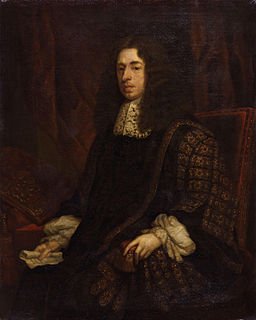
Heneage Finch, 1st Earl of Nottingham 17th-century English earl and politician

Heneage Finch, 1st Earl of Nottingham, PC, Lord Chancellor of England, was descended from the old family of Finch, many of whose members had attained high legal eminence, and was the eldest son of Sir Heneage Finch, Recorder of London, by his first wife Frances Bell, daughter of Sir Edmond Bell of Beaupre Hall, Norfolk.

George Evans (explorer) Australian explorer

George William Evans was a surveyor and early explorer in the Colony of New South Wales. Evans was born in Warwick, England, migrating to Australia in October 1802.

The Geographical Names Board of New South Wales, a statutory authority of the Land and Property Information division, Department of Finance and Services in the Government of New South Wales, is the official body for naming and recording details of places and geographical names in the state of New South Wales, Australia.

Argyle County Cadastral in New South Wales, Australia

Argyle County was one of the original Nineteen Counties in New South Wales and is now one of the 141 Cadastral divisions of New South Wales. It includes the area around Goulburn. It is bounded by Lake George in the south-west, the Shoalhaven River in the east, and the Wollondilly River in the north-east.
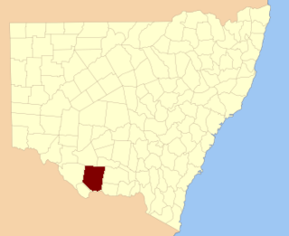
Townsend County Cadastral in New South Wales, Australia

Townsend County is one of the 141 Cadastral divisions of New South Wales. It is in the south of New South Wales with the Murray River to the south. Deniliquin is located there.
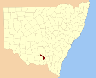
Mitchell County, New South Wales Cadastral in New South Wales, Australia

Mitchell County is one of the 141 Cadastral divisions of New South Wales. It contains the town of Collingullie. The Murrumbidgee River is the northern boundary.

Oxley County Cadastral in New South Wales, Australia

Oxley County, New South Wales is one of the 141 Cadastral divisions of New South Wales. It is located between the Bogan River on the west, and the Macquarie River on the east. This is the area approximately between Warren and Nyngan.

Perry County, New South Wales Cadastral in New South Wales, Australia

Perry County is one of the 141 Cadastral divisions of New South Wales. It is located to the east of the Darling River near Pooncarie.

Harold Heneage Finch-Hatton was a British politician and Australian federationist.

Dangarsleigh, New South Wales Town in New South Wales, Australia

Dangarsleigh is a rural locality and minor trigonometrical station about 11 km south east of Armidale, New South Wales. The locality is at an altitude of about 1,020 metres on the Northern Tablelands in the New England region of New South Wales, Australia. The name Dangarsleigh commemorates the surveyor and pastoralist Henry Dangar’s name. It is within the Armidale Regional Council local government area and Sandon County.

Wollombi, New South Wales Town in New South Wales, Australia

Wollombi is a small village in the Hunter Region of New South Wales, Australia. It is within the Cessnock City Council LGA, situated 29 kilometres (18 mi) southwest of Cessnock and 128 km (80 mi) north of Sydney. To the south is the village of Laguna, to the east, the village of Millfield and to the north, the village of Broke.

Laguna, New South Wales Suburb of Cessnock, New South Wales, Australia

Laguna is a locality in the city of Cessnock, in the Hunter Region of New South Wales, Australia. It is located about 37 km (23 mi) southwest of Cessnock in the Wollombi Valley.

The Mogo Creek, a perennial stream of the Hawkesbury-Nepean catchment, is located in the Blue Mountains region of New South Wales, Australia.

James Charles Burnett Australian surveyor

James Charles Burnett (1815—1854) a.k.a. "John" was a surveyor and explorer in New South Wales, Australia. He was the head of the first Survey Office established at Brisbane in 1844.

References

  1. "Heneage Finch". The Convict Trail. Retrieved 16 July 2015.
  2. Hodgetts, Michael (2002). Heneage Finch of Laguna.
  3. "Finch County". Geographical Names Register (GNR) of NSW. Geographical Names Board of New South Wales . Retrieved 16 July 2015. OOjs UI icon edit-ltr-progressive.svg , citing Atchison, J.F. (1980). 'The Counties of New South Wales'. The Australian Surveyor, Vol. 30, No. 1, pp.30-43. Not available online in July 2015 from the publishers, Taylor & Francis Online