Denham County

Last updated

Map all coordinates using: OpenStreetMap  
Download coordinates as: KML  ·  GPX
Denham
New South Wales
Denham NSW.PNG
Location in New South Wales
Lands administrative divisions around Denham:
Finch Finch Benarba
Finch Denham Jamison
Baradine Baradine Baradine

Denham County, is one of the 141 Cadastral divisions of New South Wales. It lies between the Barwon River and the Namoi River, where the two rivers meet. It includes the localities of Koothney, Cryon and Bugilbone.

Barwon River (New South Wales) river located in the Orana region of New South Wales, Australia

Barwon River, a perennial river that is part of the Murray–Darling basin, is located in the north-west slopes and Orana regions of New South Wales, Australia.

Namoi River river in Australia

The Namoi River, a major perennial river that is part of the Barwon catchment of the Murray–Darling basin, is located in the Northern Tablelands and North West Slopes districts of New South Wales, Australia.

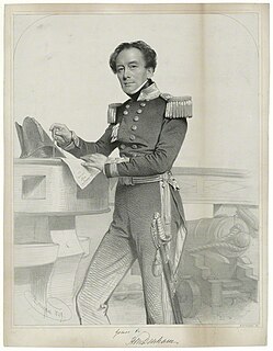
Denham County was named in honour of Captain H. M. Denham, H.M.S. Herald. [1]

Henry Mangles Denham British Royal Navy officer

Vice Admiral Sir Henry Mangles Denham was a Royal Navy officer who went on to be Commander-in-Chief, Pacific Station.

Parishes within this county

A full list of parishes found within this county; their current LGA and mapping coordinates to the approximate centre of each location is as follows:

Local government in Australia third tier of government in Australia

Local government in Australia is the third tier of government in Australia administered by the states and territories, which in turn are beneath the federal tier. Local government is not mentioned in the Constitution of Australia and two referenda in the 1970s and 1980s to alter the Constitution relating to local government were unsuccessful. Every state government recognises local government in their respective constitutions. Unlike Canada or the United States, there is only one level of local government in each state, with no distinction such as cities and counties.

ParishLGACoordinates
Baraneal Walgett Shire 30°06′54″S148°28′04″E / 30.11500°S 148.46778°E / -30.11500; 148.46778 (Baraneal)
Barwon Walgett Shire 29°41′54″S148°26′04″E / 29.69833°S 148.43444°E / -29.69833; 148.43444 (Barwon)
Benn Walgett Shire 30°03′54″S148°42′04″E / 30.06500°S 148.70111°E / -30.06500; 148.70111 (Benn)
Bergan Walgett Shire 30°07′54″S148°34′04″E / 30.13167°S 148.56778°E / -30.13167; 148.56778 (Bergan)
Berryabar Walgett Shire 30°13′54″S148°38′04″E / 30.23167°S 148.63444°E / -30.23167; 148.63444 (Berryabar)
Browne Walgett Shire 29°43′54″S148°40′04″E / 29.73167°S 148.66778°E / -29.73167; 148.66778 (Browne)
Bugilbone Walgett Shire 30°13′54″S148°46′04″E / 30.23167°S 148.76778°E / -30.23167; 148.76778 (Bugilbone)
Buriembri Walgett Shire 29°57′54″S148°24′04″E / 29.96500°S 148.40111°E / -29.96500; 148.40111 (Buriembri)
Cabul Walgett Shire 29°48′54″S148°32′04″E / 29.81500°S 148.53444°E / -29.81500; 148.53444 (Cabul)
Christie Walgett Shire 29°42′54″S148°50′04″E / 29.71500°S 148.83444°E / -29.71500; 148.83444 (Christie)
Cryon Walgett Shire 29°53′54″S148°37′04″E / 29.89833°S 148.61778°E / -29.89833; 148.61778 (Cryon)
Denham Walgett Shire 30°01′54″S148°24′04″E / 30.03167°S 148.40111°E / -30.03167; 148.40111 (Denham)
Denuleroi Walgett Shire 29°53′54″S148°24′04″E / 29.89833°S 148.40111°E / -29.89833; 148.40111 (Denuleroi)
Dewhurst Walgett Shire 29°41′54″S148°40′04″E / 29.69833°S 148.66778°E / -29.69833; 148.66778 (Dewhurst)
Eastlake Walgett Shire 29°59′54″S148°46′04″E / 29.99833°S 148.76778°E / -29.99833; 148.76778 (Eastlake)
Eton Walgett Shire 29°48′54″S148°50′04″E / 29.81500°S 148.83444°E / -29.81500; 148.83444 (Eton)
Eurie Eurie Walgett Shire 29°53′54″S148°18′04″E / 29.89833°S 148.30111°E / -29.89833; 148.30111 (Eurie Eurie)
Finley Walgett Shire 29°48′54″S148°45′04″E / 29.81500°S 148.75111°E / -29.81500; 148.75111 (Finley)
Glass Walgett Shire 29°55′54″S148°12′04″E / 29.93167°S 148.20111°E / -29.93167; 148.20111 (Glass)
Gorian Walgett Shire 29°52′54″S148°50′04″E / 29.88167°S 148.83444°E / -29.88167; 148.83444 (Gorian)
Jereel Walgett Shire 30°08′54″S148°39′04″E / 30.14833°S 148.65111°E / -30.14833; 148.65111 (Jereel)
Katambone Walgett Shire 30°04′54″S148°47′04″E / 30.08167°S 148.78444°E / -30.08167; 148.78444 (Katambone)
Long Point Walgett Shire 29°35′54″S148°41′04″E / 29.59833°S 148.68444°E / -29.59833; 148.68444 (Long Point)
Manilla Walgett Shire 29°51′54″S148°20′04″E / 29.86500°S 148.33444°E / -29.86500; 148.33444 (Manilla)
Merrywinebone Walgett Shire 29°42′54″S148°45′04″E / 29.71500°S 148.75111°E / -29.71500; 148.75111 (Merrywinebone)
Mungerarra Walgett Shire 29°57′54″S148°30′04″E / 29.96500°S 148.50111°E / -29.96500; 148.50111 (Mungerarra)
Murkadool Walgett Shire 29°39′54″S148°33′04″E / 29.66500°S 148.55111°E / -29.66500; 148.55111 (Murkadool)
Murra Murra Walgett Shire 29°56′54″S148°47′04″E / 29.94833°S 148.78444°E / -29.94833; 148.78444 (Murra Murra)
Myall Walgett Shire 30°02′54″S148°31′04″E / 30.04833°S 148.51778°E / -30.04833; 148.51778 (Myall)
Myallwirrie Walgett Shire 30°11′54″S148°28′04″E / 30.19833°S 148.46778°E / -30.19833; 148.46778 (Myallwirrie)
Pagan Walgett Shire 29°49′54″S148°22′04″E / 29.83167°S 148.36778°E / -29.83167; 148.36778 (Pagan)
Pearse Walgett Shire 29°50′54″S148°39′04″E / 29.84833°S 148.65111°E / -29.84833; 148.65111 (Pearse)
Pian Walgett Shire 29°57′54″S148°18′04″E / 29.96500°S 148.30111°E / -29.96500; 148.30111 (Pian)
Pokataroo Walgett Shire 29°35′54″S148°34′04″E / 29.59833°S 148.56778°E / -29.59833; 148.56778 (Pokataroo)
Reynolds Walgett Shire 29°59′54″S148°37′04″E / 29.99833°S 148.61778°E / -29.99833; 148.61778 (Reynolds)
Roberts Walgett Shire 29°42′54″S148°33′04″E / 29.71500°S 148.55111°E / -29.71500; 148.55111 (Roberts)
Tareela Walgett Shire 30°09′54″S148°46′04″E / 30.16500°S 148.76778°E / -30.16500; 148.76778 (Tareela)
Terribie Walgett Shire 29°49′54″S148°16′04″E / 29.83167°S 148.26778°E / -29.83167; 148.26778 (Terribie)
Thalaba Walgett Shire 29°52′54″S148°32′04″E / 29.88167°S 148.53444°E / -29.88167; 148.53444 (Thalaba)
Tholoo Walgett Shire 30°03′54″S148°35′04″E / 30.06500°S 148.58444°E / -30.06500; 148.58444 (Tholoo)
Toryweewha Walgett Shire 30°05′54″S148°24′04″E / 30.09833°S 148.40111°E / -30.09833; 148.40111 (Toryweewha)
Walgett Walgett Shire 29°57′54″S148°12′04″E / 29.96500°S 148.20111°E / -29.96500; 148.20111 (Walgett)
Walmar Walgett Shire 30°03′54″S148°18′04″E / 30.06500°S 148.30111°E / -30.06500; 148.30111 (Walmar)
Yarraldool Walgett Shire 30°15′54″S148°32′04″E / 30.26500°S 148.53444°E / -30.26500; 148.53444 (Yarraldool)

Related Research Articles

Peel River (New South Wales) river in Australia

Peel River, a watercourse that is part of the Namoi catchment within the Murray–Darling basin, is located in the North West Slopes and Plains district of New South Wales, Australia.

John Verge (1782—1861) was an English architect, builder, pioneer settler in the Colony of New South Wales, who migrated to Australia and pursued his career there. Verge was one of the earliest and the most important architect of the Greek Revival in Australia. He also brought more comprehensive range of Regency style than any contemporary architects. His design indicates the increasing of sophistication compared to previous architect's design.
City of Campbelltown (New South Wales) Local government area in New South Wales, Australia

The City of Campbelltown is a local government area in the Macarthur region of south-western Sydney, in New South Wales, Australia. The area is located about 55 kilometres (34 mi) south west of the Sydney central business district and comprises 312 square kilometres (120 sq mi).

Denham Court, New South Wales Suburb of Sydney, New South Wales, Australia

Denham Court is a suburb of Sydney, in the state of New South Wales, Australia located 44 kilometres (27 mi) south-west of the Sydney central business district, in the local government areas of the City of Campbelltown and City of Liverpool. It is part of the Macarthur region.

Yass River river in New South Wales, Australia

The Yass River, a perennial river that is part of the Murrumbidgee catchment within the Murray–Darling basin, is located in the Southern Tablelands and South Western Slopes districts of New South Wales, Australia.

Bannaby, New South Wales Town in New South Wales, Australia

Bannaby is a locality in the Southern Tablelands of New South Wales, Australia in Upper Lachlan Shire. It is located near the township of Taralga, on the Bannaby road. At the 2016 census, it had a population of 36.

Cabramatta Creek, an urban watercourse of the Georges River catchment, is located in the south-western region of Sydney, in New South Wales, Australia.

Dilpurra, New South Wales Town in New South Wales, Australia

Dilpurra is a village community in the south western part of the Riverina in New South Wales, Australia.

Darbalara, New South Wales Town in New South Wales, Australia

Darbalara is a rural community on the east bank of the junction of the Murrumbidgee River and Tumut River in the Riverina. It is situated by road, about 25 kilometres north east of Gundagai and 25 kilometres south of Coolac.

Gloucester County, New South Wales Cadastral in New South Wales, Australia

Gloucester County was one of the original Nineteen Counties in New South Wales, and is now one of the 141 cadastral divisions of New South Wales. It includes the area around Port Stephens. It is bounded on the north and west by the Manning River, and on the south-west by the Williams River.

Northumberland County, New South Wales Cadastral in New South Wales, Australia

Northumberland County was one of the original Nineteen Counties in New South Wales and is now one of the 141 Cadastral divisions of New South Wales. It included the area to the north of Broken Bay, including Lake Macquarie and Newcastle. It was bounded by the part of the Hawkesbury River to the south, the Macdonald River to the south-west, and the Hunter River to the north.
Camden County, New South Wales Cadastral in New South Wales, Australia

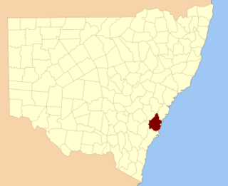
Camden County was one of the original Nineteen Counties in New South Wales and is now one of the 141 Cadastral divisions of New South Wales. It included the coastal area near Wollongong south to the Shoalhaven River, and also inland encompassing Berrima and Picton. Its western boundary was the Wollondilly River. The first settlement in the area was Camden Park, established by John Macarthur in 1806, just across the Nepean River from Cumberland County. It was the first land across the Nepean to be settled. Camden is a present-day suburb of Sydney in the same area, although parts of it are in Cumberland.

St Vincent County Cadastral in Australian Capital Territory

St Vincent County was one of the original Nineteen Counties in New South Wales and is now one of the 141 Cadastral divisions of New South Wales. It included the south coast area encompassing Batemans Bay, Ulladulla, Jervis Bay and inland to Braidwood. The Shoalhaven River is the boundary to the north and west, and the Deua River the boundary to the south.

Cowper County Cadastral in New South Wales, Australia

Cowper County, New South Wales is one of the 141 Cadastral divisions of New South Wales.

Dangarsleigh, New South Wales Town in New South Wales, Australia

Dangarsleigh is a rural locality and minor trigonometrical station about 11 km south east of Armidale, New South Wales. The locality is at an altitude of about 1,020 metres on the Northern Tablelands in the New England region of New South Wales, Australia. The name Dangarsleigh commemorates the surveyor and pastoralist Henry Dangar’s name. It is within the Armidale Regional Council local government area and Sandon County.

Karuah River river in New South Wales, Australia

Karuah River, an open semi-mature tide dominated drowned valley estuary is located in the Mid North Coast and Hunter regions of New South Wales, Australia.

Cobrabald River river in Australia

Cobrabald River, a mostly perennial river that is part of the Namoi catchment within the Murray–Darling basin, is located in the Northern Tablelands district of New South Wales, Australia.

Ellson, Minnesota Unincorporated community in Minnesota, United States

Ellson is an unincorporated community in Bremen Township, Pine County, Minnesota, United States.

Jerrabattgulla Creek, a perennial stream of the Shoalhaven River catchment, is located in the Southern Tablelands region of New South Wales, Australia.

Bettowynd Creek, a partly perennial stream of the Moruya River catchment, is located in the Southern Tablelands and South Coast regions of New South Wales, Australia.

References

  1. "Denham". Geographical Names Register (GNR) of NSW. Geographical Names Board of New South Wales . Retrieved 4 August 2013. OOjs UI icon edit-ltr-progressive.svg