Rankin County, New South Wales

Last updated

Map all coordinates using: OpenStreetMap  
Download coordinates as: KML  ·  GPX
Rankin
New South Wales
Rankin NSW.PNG
Location in New South Wales
Lands administrative divisions around Rankin:
Killara Landsborough Yanda
Killara Rankin Robinson
Werunda Woore Booroondarra

Rankin County is one of the 141 Cadastral divisions of New South Wales. It includes part of the Paroo-Darling National Park. The border to the north-west is the Darling River.

Darling River river in Australia

The Darling River is the third longest river in Australia, measuring 1,472 kilometres (915 mi) from its source in northern New South Wales to its confluence with the Murray River at Wentworth, New South Wales. Including its longest contiguous tributaries it is 2,844 km (1,767 mi) long, making it the longest river system in Australia.

Rankin County was named after Rankin Range – Mount Rankin which is in Bathurst, New South Wales. [1]

Bathurst, New South Wales City in New South Wales, Australia

Bathurst is a country town in the Central Tablelands of New South Wales, Australia. It is about 200 kilometres (120 mi) west-northwest of Sydney and is the seat of the Bathurst Regional Council. Bathurst is the oldest inland settlement in Australia and had a population of 36,801 at June 2018.

Parishes within this county

A full list of parishes found within this county; their current LGA and mapping coordinates to the approximate centre of each location is as follows:

Local government in Australia

Local government in Australia is the third tier of government in Australia administered by the states and territories, which in turn are beneath the federal tier. Local government is not mentioned in the Constitution of Australia and two referenda in the 1970s and 1980s to alter the Constitution relating to local government were unsuccessful. Every state government recognises local government in their respective constitutions. Unlike Canada or the United States, there is only one level of local government in each state, with no distinction such as cities and counties.

Map of Rankin County from John Sands 1886 Atlas of Australia. Rankin County JOhn Sands 1886 Map.png
Map of Rankin County from John Sands 1886 Atlas of Australia.
ParishLGACoordinates
Albert Cobar Shire 31°02′03″S144°44′21″E / 31.03417°S 144.73917°E / -31.03417; 144.73917 (Albert)
Basin Bank Cobar Shire 31°23′39″S144°18′01″E / 31.39417°S 144.30028°E / -31.39417; 144.30028 (Basin Bank)
Bilbo Cobar Shire 31°19′24″S144°38′12″E / 31.32333°S 144.63667°E / -31.32333; 144.63667 (Bilbo)
Booborowie Cobar Shire 31°13′01″S144°19′55″E / 31.21694°S 144.33194°E / -31.21694; 144.33194 (Booborowie)
Buckinbe Cobar Shire 30°59′39″S144°30′07″E / 30.99417°S 144.50194°E / -30.99417; 144.50194 (Buckinbe)
Budda Cobar Shire 31°07′15″S144°16′48″E / 31.12083°S 144.28000°E / -31.12083; 144.28000 (Budda)
Bulla Bulla Cobar Shire 31°34′56″S144°46′17″E / 31.58222°S 144.77139°E / -31.58222; 144.77139 (Bulla Bulla)
Clarke Cobar Shire 31°28′54″S144°40′00″E / 31.48167°S 144.66667°E / -31.48167; 144.66667 (Clarke)
Coombes Cobar Shire 31°24′10″S144°44′00″E / 31.40278°S 144.73333°E / -31.40278; 144.73333 (Coombes)
Darling Cobar Shire 31°20′46″S144°10′34″E / 31.34611°S 144.17611°E / -31.34611; 144.17611 (Darling)
Deniehy Cobar Shire 31°29′22″S144°54′28″E / 31.48944°S 144.90778°E / -31.48944; 144.90778 (Deniehy)
Donald Plain Cobar Shire 31°34′47″S144°31′49″E / 31.57972°S 144.53028°E / -31.57972; 144.53028 (Donald Plain)
Donalroe Cobar Shire 31°11′32″S144°10′24″E / 31.19222°S 144.17333°E / -31.19222; 144.17333 (Donalroe)
Etty Cobar Shire 31°23′10″S144°58′31″E / 31.38611°S 144.97528°E / -31.38611; 144.97528 (Etty)
Gidgiegalumba Cobar Shire 31°02′20″S144°50′58″E / 31.03889°S 144.84944°E / -31.03889; 144.84944 (Gidgiegalumba)
Greenough Cobar Shire unknown
Keilor Cobar Shire 31°27′59″S144°15′10″E / 31.46639°S 144.25278°E / -31.46639; 144.25278 (Keilor)
Kendall Cobar Shire 31°24′00″S144°29′33″E / 31.40000°S 144.49250°E / -31.40000; 144.49250 (Kendall)
Kirkingle Cobar Shire 31°12′46″S144°32′56″E / 31.21278°S 144.54889°E / -31.21278; 144.54889 (Kirkingle)
Lawrence Cobar Shire 31°19′25″S144°50′11″E / 31.32361°S 144.83639°E / -31.32361; 144.83639 (Lawrence)
Mary Cobar Shire 31°07′11″S144°27′47″E / 31.11972°S 144.46306°E / -31.11972; 144.46306 (Mary)
Millpillbury Cobar Shire 31°19′54″S144°23′39″E / 31.33167°S 144.39417°E / -31.33167; 144.39417 (Millpillbury)
Mulga Cobar Shire 31°30′51″S144°22′54″E / 31.51417°S 144.38167°E / -31.51417; 144.38167 (Mulga)
Munbunya Cobar Shire 31°08′57″S144°41′24″E / 31.14917°S 144.69000°E / -31.14917; 144.69000 (Munbunya)
Salisbury Central Darling Shire unknown
Stanley Cobar Shire 31°38′24″S144°37′04″E / 31.64000°S 144.61778°E / -31.64000; 144.61778 (Stanley)
Stanley Cobar Shire 31°39′34″S144°36′26″E / 31.65944°S 144.60722°E / -31.65944; 144.60722 (Stanley)
Tankarook Cobar Shire 31°02′14″S144°25′37″E / 31.03722°S 144.42694°E / -31.03722; 144.42694 (Tankarook)
Thourumble Cobar Shire 31°09′25″S144°54′11″E / 31.15694°S 144.90306°E / -31.15694; 144.90306 (Thourumble)
Turner Cobar Shire 31°19′36″S145°05′39″E / 31.32667°S 145.09417°E / -31.32667; 145.09417 (Turner)
Wallandra Cobar Shire 30°55′11″S144°33′51″E / 30.91972°S 144.56417°E / -30.91972; 144.56417 (Wallandra)
Weelong Bourke Shire 30°54′54″S144°43′48″E / 30.91500°S 144.73000°E / -30.91500; 144.73000 (Weelong)
Weelongbar Cobar Shire 30°58′40″S144°44′43″E / 30.97778°S 144.74528°E / -30.97778; 144.74528 (Weelongbar)
Wigilla Cobar Shire 31°13′03″S144°44′01″E / 31.21750°S 144.73361°E / -31.21750; 144.73361 (Wigilla)
Woore Cobar Shire 31°43′54″S144°32′19″E / 31.73167°S 144.53861°E / -31.73167; 144.53861 (Woore)
Woore Cobar Shire 31°46′36″S144°29′56″E / 31.77667°S 144.49889°E / -31.77667; 144.49889 (Woore)

Related Research Articles

Severn River (Queensland) river in New South Wales, Australia

The Severn River, a perennial river that forms part of the Border Rivers group, is part of the Macintyre catchment of the Murray-Darling basin, located in the Darling Downs region of Queensland, Australia.

Cowper County Cadastral in New South Wales, Australia

Cowper County, New South Wales is one of the 141 Cadastral divisions of New South Wales.
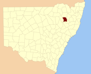
Darling County Cadastral in New South Wales, Australia

Darling County is one of the 141 Cadastral divisions of New South Wales. It includes Manilla and Barraba

Barmedman Creek river in Australia

The Barmedman Creek, a mostly–perennial river that is part of the Lachlan sub-catchment of the Murrumbidgee catchment within the Murray–Darling basin, is located in the South West Slopes, and Riverina regions of New South Wales, Australia. The Barmedman Creek is only connected to the Murray Darling basin when the Bland Creek, the Lachlan and Murrumbidgee Rivers are in flood.

Balgalal Creek

The Balgalal Creek, a mostly–perennial river that is part of the Lachlan sub-catchment of the Murrumbidgee catchment within the Murray–Darling basin, is located in the South West Slopes region of New South Wales, Australia.

Cooks Vale Creek river in Australia

The Cooks Vale Creek, a mostly–perennial river that is part of the Lachlan sub-catchment of the Murrumbidgee catchment within the Murray–Darling basin, is located in the South West Slopes region of New South Wales, Australia.

Flyers Creek

The Flyers Creek, a mostly–perennial river that is part of the Lachlan sub-catchment of the Murrumbidgee catchment within the Murray–Darling basin, is located in the Central West region of New South Wales, Australia.

Cowriga Creek

The Cowriga Creek, a mostly–perennial river that is part of the Lachlan sub-catchment of the Murrumbidgee catchment within the Murray–Darling basin, is located in the Central West region of New South Wales, Australia.

Gunningbland Creek river in Australia

The Gunningbland Creek, a perennial river of the Lachlan sub–catchment, part of the Murrumbidgee catchment of the Murray-Darling basin, is located in the Central West region of New South Wales, Australia.

Jerrara Creek river in New South Wales, Australia

The Jerrara Creek, a watercourse that is part of the Lachlan sub-catchment of the Murrumbidgee catchment within the Murray–Darling basin, is located in the South West Slopes region of New South Wales, Australia.

Jerrawa Creek river in Australia

The Jerrawa Creek, a watercourse that is part of the Lachlan sub-catchment of the Murrumbidgee catchment within the Murray–Darling basin, is located in the South West Slopes region of New South Wales, Australia.
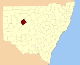
Parish of Donalroe

Donalroe Parish in Cobar Shire is a civil parish of Rankin County,; a Cadastral division of New South Wales.

Parish of Budda

Budda Parish in Cobar Shire is a civil parish of Rankin County,; a Cadastral division of New South Wales.

Parish of Tankarook

Tankarrok Parish in Cobar Shire is a civil parish of Rankin County,; a Cadastral division of New South Wales.

Parish of Buckinbe

Buckinbe Parish in Cobar Shire is a civil parish of Rankin County,; a Cadastral division of New South Wales.

Parish of Wallandra

Wallandra Parish in Cobar Shire is a civil parish of Rankin County, a Cadastral division of New South Wales. The Parish is on the Darling River upstream of Wilcannia, New South Wales and is located at 30°55′11″S 144°33′51″E. The only town of the parish is Tilpa, New South Wales.

Cumbedore Parish, Yanda County in Bourke Shire is a civil parish of Yanda County, a cadasteral division of New South Wales; a Cadastral division of New South Wales.

Canpadore Parish, Yanda County in Bourke Shire is a civil parish of Yanda County, a cadasteral division of New South Wales; a Cadastral division of New South Wales.

Dunlop Parish (Yanda County) New South Wales, Australia

Dunlop Parish is a civil parish, of Yanda County, a cadasteral division of New South Wales; a Cadastral division of New South Wales.

Gundabooka, Yanda New South Wales, Australia

Gundabooka Parish is a civil parish, of Yanda County, a cadasteral division of New South Wales; a Cadastral division of New South Wales.

References

  1. "Rankin". Geographical Names Register (GNR) of NSW. Geographical Names Board of New South Wales . Retrieved 4 August 2013. OOjs UI icon edit-ltr-progressive.svg