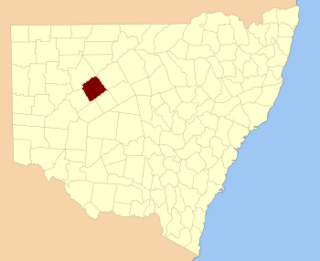
Irrara County is one of the 141 cadastral divisions of New South Wales. It is located south of the border with Queensland, east of the Paroo River, and west of the Warrego River.

Mouramba County is one of the 141 cadastral divisions of New South Wales.

Terangan is a rural locality of Warren Shire and a civil parish of Oxley County, New South Wales, a Cadastral divisions of New South Wales.

Tabraton Parish, New South Wales is a rural locality of Warren Shire and a civil parish of Oxley County, New South Wales, a Cadastral divisions of New South Wales.

Warien Parish, New South Wales is a rural locality of Warren Shire and a civil parish of Oxley County, New South Wales, a Cadastral divisions of New South Wales.

Budda Parish in Cobar Shire is a civil parish of Rankin County,; a Cadastral division of New South Wales.

Tankarrok Parish in Cobar Shire is a civil parish of Rankin County,; a Cadastral division of New South Wales.

Buckinbe Parish in Cobar Shire is a civil parish of Rankin County,; a Cadastral division of New South Wales.

Wallandra Parish in Cobar Shire is a civil parish of Rankin County, a Cadastral division of New South Wales. The Parish is on the Darling River upstream of Wilcannia, New South Wales and is located at 30.5511°N 144.3351°E. The only town of the parish is Tilpa, New South Wales.
Cumbedore Parish, Yanda County in Bourke Shire is a civil parish of Yanda County, a cadasteral division of New South Wales.
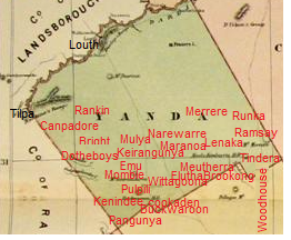
Canpadore Parish, Yanda County in Bourke Shire is a civil parish of Yanda County, a cadasteral division of New South Wales; a Cadastral division of New South Wales.

Dootheboy, in Cobar Shire is a civil parish of Yanda County a Cadastral division of New South Wales.
Bright Parish, in Cobar Shire is a civil parish of Yanda County, a Cadastral division of New South Wales.
Kenindee Parish, in Cobar Shire is a civil parish of Yanda County a Cadastral division of New South Wales.
Kenindee Parish, in Cobar Shire is a civil parish of Yanda County a Cadastral division of New South Wales.
Emu Parish, in Cobar Shire is a civil parish of Yanda County a Cadastral division of New South Wales.

Dunlop Parish is a civil parish, of Yanda County, a cadasteral division of New South Wales; a Cadastral division of New South Wales.
Gundabooka Parish is a civil parish, of Yanda County, a cadasteral division of New South Wales; a Cadastral division of New South Wales.
Yanda Parish, is a civil parish, of Yanda County, a cadasteral division of New South Wales; a Cadastral division of New South Wales.
Loftus Parish is a civil parish of Cowper County, New South Wales; a Cadastral division of New South Wales. located at 30°13'05.0"S 146°27'57.0"E between Byrock, New South Wales and Bourke, New South Wales.


