Canbelego County

Last updated

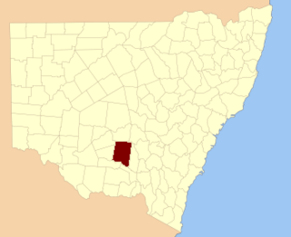
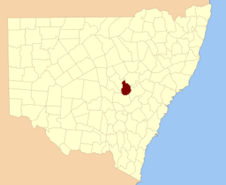
Canbelego
New South Wales
Canbelego NSW.PNG
Location in New South Wales
Lands administrative divisions around Canbelego:
Yanda Cowper Clyde
Robinson Canbelego Gregory
Mouramba Flinders Oxley

Canbelego County is one of the 141 Cadastral divisions of New South Wales.

Canbelego is believed to be derived from a local Aboriginal word. [1]

Parishes within this county

A full list of parishes found within this county; their current LGA and mapping coordinates to the approximate centre of each location is as follows:

ParishLGACoordinates
Antares Bogan Shire 31°05′54″S146°54′04″E / 31.09833°S 146.90111°E / -31.09833; 146.90111 (Antares)
Bannan Bogan Shire 31°05′54″S146°43′59″E / 31.09833°S 146.73306°E / -31.09833; 146.73306 (Bannan)
Berry Bogan Shire 31°06′37″S146°40′10″E / 31.11028°S 146.66944°E / -31.11028; 146.66944 (Berry)
Boree Bogan Shire 31°27′54″S147°04′04″E / 31.46500°S 147.06778°E / -31.46500; 147.06778 (Boree)
Carnbilly Bogan Shire 31°23′54″S146°46′04″E / 31.39833°S 146.76778°E / -31.39833; 146.76778 (Carnbilly)
Caro Bogan Shire 31°23′54″S146°54′04″E / 31.39833°S 146.90111°E / -31.39833; 146.90111 (Caro)
Coreen Bogan Shire 31°27′54″S147°02′04″E / 31.46500°S 147.03444°E / -31.46500; 147.03444 (Coreen)
Courebone Bogan Shire 31°13′54″S147°00′04″E / 31.23167°S 147.00111°E / -31.23167; 147.00111 (Courebone)
Currawong Bogan Shire 31°27′54″S146°46′04″E / 31.46500°S 146.76778°E / -31.46500; 146.76778 (Currawong)
Eton Cobar Shire 31°15′26″S146°25′13″E / 31.25722°S 146.42028°E / -31.25722; 146.42028 (Eton)
Florida Cobar Shire 31°27′03″S146°18′18″E / 31.45083°S 146.30500°E / -31.45083; 146.30500 (Florida)
Gidalambone Bogan Shire 31°11′54″S146°48′04″E / 31.19833°S 146.80111°E / -31.19833; 146.80111 (Gidalambone)
Gilgies Bogan Shire 31°30′49″S146°25′03″E / 31.51361°S 146.41750°E / -31.51361; 146.41750 (Gilgies)
Gilgoenbon Bogan Shire 31°25′54″S147°02′04″E / 31.43167°S 147.03444°E / -31.43167; 147.03444 (Gilgoenbon)
Glenariff Bogan Shire 31°00′05″S146°45′45″E / 31.00139°S 146.76250°E / -31.00139; 146.76250 (Glenariff)
Goyder Cobar Shire 31°21′45″S146°21′06″E / 31.36250°S 146.35167°E / -31.36250; 146.35167 (Goyder)
Grahweed Bogan Shire 31°17′54″S147°02′04″E / 31.29833°S 147.03444°E / -31.29833; 147.03444 (Grahweed)
Hall Bogan Shire 31°05′54″S147°02′04″E / 31.09833°S 147.03444°E / -31.09833; 147.03444 (Hall)
Hermitage Bogan Shire 31°25′54″S146°40′04″E / 31.43167°S 146.66778°E / -31.43167; 146.66778 (Hermitage)
Kelley Cobar Shire 31°19′45″S146°27′18″E / 31.32917°S 146.45500°E / -31.32917; 146.45500 (Kelley)
Kidgery Bogan Shire 31°25′54″S147°02′04″E / 31.43167°S 147.03444°E / -31.43167; 147.03444 (Kidgery)
King Bogan Shire 31°23′54″S146°30′04″E / 31.39833°S 146.50111°E / -31.39833; 146.50111 (King)
Langtree Cobar Shire 31°23′41″S146°24′50″E / 31.39472°S 146.41389°E / -31.39472; 146.41389 (Langtree)
Lincoln Bogan Shire 31°15′54″S146°44′04″E / 31.26500°S 146.73444°E / -31.26500; 146.73444 (Lincoln)
Lynch Bogan Shire 31°27′54″S147°08′04″E / 31.46500°S 147.13444°E / -31.46500; 147.13444 (Lynch)
Meeson Bogan Shire 31°12′05″S146°33′21″E / 31.20139°S 146.55583°E / -31.20139; 146.55583 (Meeson)
Mepunga Bogan Shire 31°07′57″S146°29′28″E / 31.13250°S 146.49111°E / -31.13250; 146.49111 (Mepunga)
Merri Bogan Shire 31°11′59″S146°40′01″E / 31.19972°S 146.66694°E / -31.19972; 146.66694 (Merri)
Monkellan Bogan Shire 31°23′54″S146°34′04″E / 31.39833°S 146.56778°E / -31.39833; 146.56778 (Monkellan)
Mulga Cobar Shire 31°16′36″S146°10′30″E / 31.27667°S 146.17500°E / -31.27667; 146.17500 (Mulga)
Muriel Bogan Shire 31°27′54″S146°34′04″E / 31.46500°S 146.56778°E / -31.46500; 146.56778 (Muriel)
Narrama Cobar Shire 31°23′50″S146°16′33″E / 31.39722°S 146.27583°E / -31.39722; 146.27583 (Narrama)
Neiley Bogan Shire 31°17′54″S147°00′04″E / 31.29833°S 147.00111°E / -31.29833; 147.00111 (Neiley)
Nirranda Bogan Shire 31°27′54″S146°52′04″E / 31.46500°S 146.86778°E / -31.46500; 146.86778 (Nirranda)
Nullawarra Cobar Shire 31°18′55″S146°16′05″E / 31.31528°S 146.26806°E / -31.31528; 146.26806 (Nullawarra)
Orion Bogan Shire 31°15′54″S146°38′04″E / 31.26500°S 146.63444°E / -31.26500; 146.63444 (Orion)
Quandong Cobar Shire 31°14′10″S146°16′17″E / 31.23611°S 146.27139°E / -31.23611; 146.27139 (Quandong)
Sturt Bogan Shire 31°01′54″S146°56′04″E / 31.03167°S 146.93444°E / -31.03167; 146.93444 (Sturt)
The Brothers Bogan Shire 31°09′54″S146°44′04″E / 31.16500°S 146.73444°E / -31.16500; 146.73444 (The Brothers)
The Pines Bogan Shire 31°07′54″S146°54′04″E / 31.13167°S 146.90111°E / -31.13167; 146.90111 (The Pines)
Tootalally Bogan Shire 31°05′54″S146°48′04″E / 31.09833°S 146.80111°E / -31.09833; 146.80111 (Tootalally)
Tooram Bogan Shire 31°10′26″S146°22′12″E / 31.17389°S 146.37000°E / -31.17389; 146.37000 (Tooram)
Tritton Bogan Shire 31°19′54″S146°38′04″E / 31.33167°S 146.63444°E / -31.33167; 146.63444 (Tritton)
Vega Bogan Shire 31°00′51″S146°39′39″E / 31.01417°S 146.66083°E / -31.01417; 146.66083 (Vega)
Warong Bogan Shire 31°27′54″S146°30′04″E / 31.46500°S 146.50111°E / -31.46500; 146.50111 (Warong)
Warranbilla Bogan Shire 31°09′54″S146°58′04″E / 31.16500°S 146.96778°E / -31.16500; 146.96778 (Warranbilla)
Warrego Bogan Shire 31°17′54″S146°32′04″E / 31.29833°S 146.53444°E / -31.29833; 146.53444 (Warrego)
Warungo Bogan Shire 30°59′54″S146°50′04″E / 30.99833°S 146.83444°E / -30.99833; 146.83444 (Warungo)
Waveney Bogan Shire 31°04′21″S146°34′09″E / 31.07250°S 146.56917°E / -31.07250; 146.56917 (Waveney)
Wilgabone Bogan Shire 31°17′54″S146°50′04″E / 31.29833°S 146.83444°E / -31.29833; 146.83444 (Wilgabone)
Willeroon Bogan Shire 31°01′54″S147°02′04″E / 31.03167°S 147.03444°E / -31.03167; 147.03444 (Willeroon)
Yarran Bogan Shire 31°06′39″S146°19′09″E / 31.11083°S 146.31917°E / -31.11083; 146.31917 (Yarran)

Related Research Articles

<span class="mw-page-title-main">Gloucester County, New South Wales</span> Cadastral in New South Wales, Australia

Gloucester County was one of the original Nineteen Counties in New South Wales, and is now one of the 141 cadastral divisions of New South Wales. It includes the area around Port Stephens. It is bounded on the north and west by the Manning River, and on the south-west by the Williams River.

<span class="mw-page-title-main">Durham County, New South Wales</span> Cadastral in New South Wales, Australia

Durham County was one of the original Nineteen Counties in New South Wales and is now one of the 141 Cadastral divisions of New South Wales. It is bordered on the south and west by the Hunter River, and on the north and east by the Williams River. It includes Aberdeen and Muswellbrook. Before 1834, the area known as Durham County included what later became Gloucester and most of Brisbane counties, as far west as the Liverpool Range, and east to the Pacific, including Port Stephens, as shown on an 1832 map.

<span class="mw-page-title-main">Northumberland County, New South Wales</span> Cadastral in New South Wales, Australia

Northumberland County was one of the original Nineteen Counties in New South Wales and is now one of the 141 Cadastral divisions of New South Wales. It included the area to the north of Broken Bay, which compasses the Central Coast region and Lake Macquarie as well as Newcastle(Greater Newcastle) in the Hunter region. It was bounded by the part of the Hawkesbury River to the south, the Macdonald River to the south-west, and the Hunter River to the north.

<span class="mw-page-title-main">Camden County, New South Wales</span> Cadastral in New South Wales, Australia

Camden County was one of the original Nineteen Counties in New South Wales and is now one of the 141 Cadastral divisions of New South Wales. It included the coastal area near Wollongong south to the Shoalhaven River, and also inland encompassing Berrima and Picton. Its western boundary was the Wollondilly River. The first settlement in the area was Camden Park, established by John Macarthur in 1806, just across the Nepean River from Cumberland County. It was the first land across the Nepean to be settled. Camden is a present-day suburb of Sydney in the same area, although parts of it are in Cumberland.

<span class="mw-page-title-main">Roxburgh County</span> Cadastral in New South Wales, Australia

Roxburgh County was one of the original Nineteen Counties in New South Wales and is now one of the 141 Cadastral divisions of New South Wales. It includes the area to the north east of Bathurst, lying to the north and east of the Fish River to the junction of the Turon River. It includes Sofala. The Gudgegong River is the border to the north.

<span class="mw-page-title-main">Yancowinna County</span> Cadastral in New South Wales, Australia

Yancowinna County is one of the 141 Cadastral divisions of New South Wales.

<span class="mw-page-title-main">Cooper County, New South Wales</span> Cadastral in New South Wales, Australia

Cooper County is one of the 141 Cadastral divisions of New South Wales. It contains the town of Barellan. The Murrumbidgee River is the southern boundary.

<span class="mw-page-title-main">Harden County</span> Cadastral in New South Wales, Australia

Harden County is one of the 141 cadastral divisions of New South Wales. It contains the town of Harden.

<span class="mw-page-title-main">Blaxland County</span> Cadastral in New South Wales, Australia

Blaxland County is one of the 141 Cadastral divisions of New South Wales. It is bounded to the south by the Lachlan River and a small part of Waverley Creek. It includes Mount Hope and the Nombinnie Nature Reserve.

<span class="mw-page-title-main">Evelyn County, New South Wales</span> Cadastral in New South Wales, Australia

Evelyn County is one of the 141 Cadastral divisions of New South Wales, Australia.

<span class="mw-page-title-main">Gordon County, New South Wales</span> Cadastral in New South Wales, Australia

Gordon County is one of the 141 Cadastral divisions of New South Wales. The Macquarie River is the north-eastern boundary.

<span class="mw-page-title-main">Gowen County</span> Cadastral in New South Wales, Australia

Gowen County is one of the 141 Cadastral divisions of New South Wales. It is located to the east of the Castlereagh River in the area to the east of Gilgandra, to Coonabarabran in the north-east. This includes land on both sides of the Newell Highway.

<span class="mw-page-title-main">Kennedy County</span> Cadastral in New South Wales, Australia

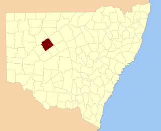
Kennedy County is one of the 141 Cadastral divisions of New South Wales. It is located to the west of the Bogan River in the area around Tottenham and Tullamore.

<span class="mw-page-title-main">Mootwingee County</span> Cadastral in New South Wales, Australia

Mootwingee County, New South Wales is one of the 141 cadastral divisions of New South Wales.

<span class="mw-page-title-main">Mouramba County</span> Cadastral in New South Wales, Australia

Mouramba County is one of the 141 Cadastral divisions of New South Wales.

<span class="mw-page-title-main">Napier County</span> Cadastral in New South Wales, Australia

Napier County is one of the 141 Cadastral divisions of New South Wales.

<span class="mw-page-title-main">Oxley County</span> Cadastral in New South Wales, Australia

Oxley County, New South Wales is one of the 141 Cadastral divisions of New South Wales. It is located between the Bogan River on the west, and the Macquarie River on the east. This is the area approximately between Warren and Nyngan.

<span class="mw-page-title-main">Rankin County, New South Wales</span> Cadastral in New South Wales, Australia

Rankin County is one of the 141 Cadastral divisions of New South Wales. It includes part of the Paroo-Darling National Park. The border to the north-west is the Darling River.

<span class="mw-page-title-main">Selwyn County, New South Wales</span> Cadastral in New South Wales, Australia

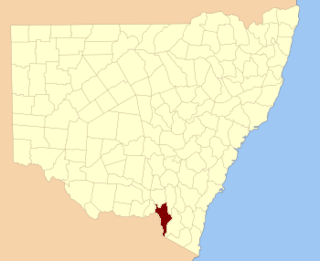
Selwyn County is one of the 141 Cadastral divisions of New South Wales. It is located to the east of the Murray River, with part of the Tumut River as its boundary to the north-east. It includes Mount Kosciuszko, the highest mountain in Australia.

<span class="mw-page-title-main">Yungnulgra County</span> Cadastral in New South Wales, Australia

Yungnulgra County is one of the 141 Cadastral divisions of New South Wales.

References

  1. "Canbelego County". Geographical Names Register (GNR) of NSW. Geographical Names Board of New South Wales. OOjs UI icon edit-ltr-progressive.svg