Mouramba County

Last updated

Map all coordinates using: OpenStreetMap  
Download coordinates as: KML
Mouramba
New South Wales
Mouramba NSW.PNG
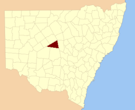
Location in New South Wales
Lands administrative divisions around Mouramba:
Robinson Canbelego Flinders
Booroondarra Mouramba Flinders
Mossgiel Blaxland Flinders
Map of Mouramba County (New South Wales) in 1886. Mouramba County 1886.png
Map of Mouramba County (New South Wales) in 1886.

Mouramba County is one of the 141 Cadastral divisions of New South Wales.

Mouramba is believed to be derived from a local Aboriginal word and is the name of nearby Mouramba Station. [2]

Parishes within this county

The parishes in the county, and mapping coordinates to the approximate centre of each, are:[ citation needed ]

ParishLGACoordinates
Adams 31°43′36″S146°16′36″E / 31.72667°S 146.27667°E / -31.72667; 146.27667 (Adams)
Albyn 32°06′53″S145°55′14″E / 32.11472°S 145.92056°E / -32.11472; 145.92056 (Albyn)
Barton 31°56′52″S146°04′38″E / 31.94778°S 146.07722°E / -31.94778; 146.07722 (Barton)
Beloura 32°12′04″S146°26′11″E / 32.20111°S 146.43639°E / -32.20111; 146.43639 (Beloura)
Blaxland 32°16′02″S145°48′44″E / 32.26722°S 145.81222°E / -32.26722; 145.81222 (Blaxland)
Booth 32°13′48″S145°45′17″E / 32.23000°S 145.75472°E / -32.23000; 145.75472 (Booth)
Brigstocke 32°10′53″S145°59′35″E / 32.18139°S 145.99306°E / -32.18139; 145.99306 (Brigstocke)
Buppe 31°39′25″S146°17′15″E / 31.65694°S 146.28750°E / -31.65694; 146.28750 (Buppe)
Byron 32°03′41″S145°51′27″E / 32.06139°S 145.85750°E / -32.06139; 145.85750 (Byron)
Canbelego 31°49′43″S146°19′59″E / 31.82861°S 146.33306°E / -31.82861; 146.33306 (Canbelego)
Carlisle 32°16′03″S146°01′06″E / 32.26750°S 146.01833°E / -32.26750; 146.01833 (Carlisle)
Chaucer 32°05′30″S145°24′24″E / 32.09167°S 145.40667°E / -32.09167; 145.40667 (Chaucer)
Coree 31°55′36″S146°17′32″E / 31.92667°S 146.29222°E / -31.92667; 146.29222 (Coree)
Crowl 32°17′32″S145°59′36″E / 32.29222°S 145.99333°E / -32.29222; 145.99333 (Crowl)
Devon 32°01′12″S146°17′13″E / 32.02000°S 146.28694°E / -32.02000; 146.28694 (Devon)
Donaldson 31°47′39″S145°59′00″E / 31.79417°S 145.98333°E / -31.79417; 145.98333 (Donaldson)
Dowling 32°02′09″S145°32′11″E / 32.03583°S 145.53639°E / -32.03583; 145.53639 (Dowling)
Dryden 32°19′00″S146°15′48″E / 32.31667°S 146.26333°E / -32.31667; 146.26333 (Dryden)
Dunstan 31°55′09″S146°12′26″E / 31.91917°S 146.20722°E / -31.91917; 146.20722 (Dunstan)
Ellerslie 32°14′43″S145°36′37″E / 32.24528°S 145.61028°E / -32.24528; 145.61028 (Ellerslie)
Ellis 31°58′51″S146°03′53″E / 31.98083°S 146.06472°E / -31.98083; 146.06472 (Ellis)
Erimeran 32°16′18″S146°18′47″E / 32.27167°S 146.31306°E / -32.27167; 146.31306 (Erimeran)
Evans 32°00′41″S145°56′39″E / 32.01139°S 145.94417°E / -32.01139; 145.94417 (Evans)
Fisher 31°43′13″S146°07′41″E / 31.72028°S 146.12806°E / -31.72028; 146.12806 (Fisher)
Flinders 31°58′49″S146°22′34″E / 31.98028°S 146.37611°E / -31.98028; 146.37611 (Flinders)
Fulton 32°10′48″S145°29′13″E / 32.18000°S 145.48694°E / -32.18000; 145.48694 (Fulton)
Gilgunniaunknown
Goold 31°55′44″S145°56′32″E / 31.92889°S 145.94222°E / -31.92889; 145.94222 (Gilgunnia)
Gwynne 31°51′29″S145°58′53″E / 31.85806°S 145.98139°E / -31.85806; 145.98139 (Gwynne)
Hartwood 32°03′04″S146°22′47″E / 32.05111°S 146.37972°E / -32.05111; 146.37972 (Hartwood)
Hathaway 32°13′10″S146°20′56″E / 32.21944°S 146.34889°E / -32.21944; 146.34889 (Hathaway)
Hume 32°07′54″S146°04′59″E / 32.13167°S 146.08306°E / -32.13167; 146.08306 (Hume)
Jamieson 32°08′37″S146°10′26″E / 32.14361°S 146.17389°E / -32.14361; 146.17389 (Jamieson)
Johnston 31°50′50″S146°13′07″E / 31.84722°S 146.21861°E / -31.84722; 146.21861 (Johnston)
Kangerong 31°56′42″S145°41′21″E / 31.94500°S 145.68917°E / -31.94500; 145.68917 (Kangerong)
Keira 31°53′49″S146°17′50″E / 31.89694°S 146.29722°E / -31.89694; 146.29722 (Keira)
Kiamba 32°07′50″S145°32′05″E / 32.13056°S 145.53472°E / -32.13056; 145.53472 (Kiamba)
Kinchelsea 32°15′00″S145°53′27″E / 32.25000°S 145.89083°E / -32.25000; 145.89083 (Kinchelsea)
Kinnear 32°14′04″S146°09′34″E / 32.23444°S 146.15944°E / -32.23444; 146.15944 (Kinnear)
Knox 32°04′15″S146°04′36″E / 32.07083°S 146.07667°E / -32.07083; 146.07667 (Knox)
Kruge 32°20′50″S146°10′04″E / 32.34722°S 146.16778°E / -32.34722; 146.16778 (Kruge)
Mcgregor 32°06′22″S145°50′07″E / 32.10611°S 145.83528°E / -32.10611; 145.83528 (Mcgregor)
Middlesex 32°19′27″S146°04′24″E / 32.32417°S 146.07333°E / -32.32417; 146.07333 (Middlesex)
Moothumbool 32°19′14″S146°20′59″E / 32.32056°S 146.34972°E / -32.32056; 146.34972 (Moothumbool)
Mossgiel 32°11′22″S145°17′25″E / 32.18944°S 145.29028°E / -32.18944; 145.29028 (Mossgiel)
Mouramba 32°19′54″S146°27′15″E / 32.33167°S 146.45417°E / -32.33167; 146.45417 (Mouramba)
Nymagee 31°59′55″S146°12′16″E / 31.99861°S 146.20444°E / -31.99861; 146.20444 (Nymagee)
Pangee 32°16′37″S145°27′02″E / 32.27694°S 145.45056°E / -32.27694; 145.45056 (Pangee)
Priory Plains 32°05′00″S146°16′40″E / 32.08333°S 146.27778°E / -32.08333; 146.27778 (Priory Plains)
Restdown 31°45′58″S146°14′21″E / 31.76611°S 146.23917°E / -31.76611; 146.23917 (Restdown)
Robinson 32°02′41″S145°40′00″E / 32.04472°S 145.66667°E / -32.04472; 145.66667 (Robinson)
Roset 32°07′48″S146°23′01″E / 32.13000°S 146.38361°E / -32.13000; 146.38361 (Roset)
Scott 31°51′17″S146°05′29″E / 31.85472°S 146.09139°E / -31.85472; 146.09139 (Scott)
Shenandoah 32°00′46″S145°45′34″E / 32.01278°S 145.75944°E / -32.01278; 145.75944 (Shenandoah)
Teran 32°22′55″S146°27′24″E / 32.38194°S 146.45667°E / -32.38194; 146.45667 (Teran)
The Rookery 31°45′33″S146°07′13″E / 31.75917°S 146.12028°E / -31.75917; 146.12028 (The Rookery)
Urolie 32°05′09″S145°39′17″E / 32.08583°S 145.65472°E / -32.08583; 145.65472 (Urolie)
Walker 32°09′10″S146°15′28″E / 32.15278°S 146.25778°E / -32.15278; 146.25778 (Walker)
Wallace 31°57′32″S145°51′24″E / 31.95889°S 145.85667°E / -31.95889; 145.85667 (Wallace)
Werlong 32°16′41″S145°43′10″E / 32.27806°S 145.71944°E / -32.27806; 145.71944 (Werlong)
Wills 32°04′06″S146°11′40″E / 32.06833°S 146.19444°E / -32.06833; 146.19444 (Wills)
Yamma 32°11′54″S145°38′16″E / 32.19833°S 145.63778°E / -32.19833; 145.63778 (Yamma)
Yanko 32°09′12″S145°44′18″E / 32.15333°S 145.73833°E / -32.15333; 145.73833 (Yanko)
Youyangunknown

All are in Cobar Shire.

Related Research Articles

Historic counties of England Category of areas of England

The historic counties of England are areas that were established for administration by the Normans, in many cases based on earlier kingdoms and shires created by the Anglo-Saxons, Jutes, Celts and others. They are alternatively known as ancient counties, traditional counties, former counties or simply as counties. In the centuries that followed their establishment, as well as their administrative function, the counties also helped define local culture and identity. This role continued even after the counties ceased to be used for administration after the creation of administrative counties in 1889, which were themselves amended by further local government reforms in the years following.

Cumberland County, New South Wales Cadastral in New South Wales, Australia

Cumberland County is a county in the State of New South Wales, Australia. Most of the Sydney metropolitan area is located within the County of Cumberland.

South Creek (New South Wales)

The South Creek or Wianamatta, a creek that is part of the Hawkesbury-Nepean catchment, is located on the Cumberland Plain, also referred to as Greater Western Sydney, New South Wales, Australia.

The Geographical Names Board of New South Wales, a statutory authority of the Department of Customer Service in the Government of New South Wales, is the official body for naming and recording details of places and geographical names in the state of New South Wales, Australia.

Darbalara, New South Wales Town in New South Wales, Australia

Darbalara is a rural community on the east bank of the junction of the Murrumbidgee River and Tumut River in the Riverina. It is situated by road, about 25 kilometres north east of Gundagai and 25 kilometres south of Coolac.

Gloucester County, New South Wales Cadastral in New South Wales, Australia

Gloucester County was one of the original Nineteen Counties in New South Wales, and is now one of the 141 cadastral divisions of New South Wales. It includes the area around Port Stephens. It is bounded on the north and west by the Manning River, and on the south-west by the Williams River.

Northumberland County, New South Wales Cadastral in New South Wales, Australia

Northumberland County was one of the original Nineteen Counties in New South Wales and is now one of the 141 Cadastral divisions of New South Wales. It included the area to the north of Broken Bay, including Lake Macquarie and Newcastle. It was bounded by the part of the Hawkesbury River to the south, the Macdonald River to the south-west, and the Hunter River to the north.

Camden County, New South Wales Cadastral in New South Wales, Australia

Camden County was one of the original Nineteen Counties in New South Wales and is now one of the 141 Cadastral divisions of New South Wales. It included the coastal area near Wollongong south to the Shoalhaven River, and also inland encompassing Berrima and Picton. Its western boundary was the Wollondilly River. The first settlement in the area was Camden Park, established by John Macarthur in 1806, just across the Nepean River from Cumberland County. It was the first land across the Nepean to be settled. Camden is a present-day suburb of Sydney in the same area, although parts of it are in Cumberland.

St Vincent County Cadastral in Australian Capital Territory

St Vincent County was one of the original Nineteen Counties in New South Wales and is now one of the 141 Cadastral divisions of New South Wales. It included the south coast area encompassing Batemans Bay, Ulladulla, Jervis Bay and inland to Braidwood. The Shoalhaven River is the boundary to the north and west, and the Deua River the boundary to the south.

Yancowinna County Cadastral in New South Wales, Australia

Yancowinna County is one of the 141 Cadastral divisions of New South Wales.

Cowper County Cadastral in New South Wales, Australia

Cowper County, New South Wales is one of the 141 Cadastral divisions of New South Wales.

Irrara County Cadastral in New South Wales, Australia

Irrara County is one of the 141 Cadastral divisions of New South Wales. It is located south of the border with Queensland, east of the Paroo River, and west of the Warrego River.

Mootwingee County Cadastral in New South Wales, Australia

Mootwingee County, New South Wales is one of the 141 cadastral divisions of New South Wales.

Oxley County Cadastral in New South Wales, Australia

Oxley County, New South Wales is one of the 141 Cadastral divisions of New South Wales. It is located between the Bogan River on the west, and the Macquarie River on the east. This is the area approximately between Warren and Nyngan.

Cobrabald River, a mostly perennial river that is part of the Namoi catchment within the Murray–Darling basin, is located in the Northern Tablelands district of New South Wales, Australia.

Parish of Walker (Yungnulgra County)

Walker Parish, New South Wales in Central Darling Shire is a civil parish of Yungnulgra County in far North West New South Wales.

Shuttleton is an Australian ghost town located in the Parish of Hume, County of Mouramba, New South Wales. The former village site is 29 km west-south-west of Nymagee.

Parish of Erimeran

Erimeran Parish in Mouramba County, central New South Wales is a cadasteral parish of Australia. The topography of the parish is generally flat with a thin scrub forest and the main economy of the area is agriculture.

Middlesex Parish, New South Wales

The Parish of Middlesex in Mouramba County, central New South Wales is a rural locality of Cobar Shire and cadasteral parish of Australia.

Moothumbool, New South Wales

Moothumbool in central New South Wales is a rural locality of Cobar Shire and a cadasteral parish of in Mouramba County, Australia. The parish is centered on the Balowra Conservation Area and nearby Nangerybang Conservation Area.

References

  1. from John Sands, Atlas of Australia 1886.
  2. "Mouramba County". Geographical Names Register (GNR) of NSW. Geographical Names Board of New South Wales. OOjs UI icon edit-ltr-progressive.svg