Mossgiel County

Last updated

Map all coordinates using: OpenStreetMap  
Download coordinates as: KML  ·  GPX
Mossgiel
New South Wales
Mossgiel NSW.PNG
Location in New South Wales
Lands administrative divisions around Mossgiel:
Woore Booroondarra Mouramba
Manara Mossgiel Blaxland
Manara Waljeers Franklin

Mossgiel County is one of the 141 Cadastral divisions of New South Wales, Australia. Waverley Creek is the boundary to the south. It includes Trida.

Trida is a locality in Central Darling Shire in the Far West region of New South Wales, Australia.

Mossgiel County appears to have been named from the nearby Mossgiel Station. [1]

Parishes within this county

A full list of parishes found within this county; their current LGA and mapping coordinates to the approximate centre of each location is as follows:

Local government in Australia third tier of government in Australia

Local government in Australia is the third tier of government in Australia administered by the states and territories, which in turn are beneath the federal tier. Local government is not mentioned in the Constitution of Australia and two referenda in the 1970s and 1980s to alter the Constitution relating to local government were unsuccessful. Every state government recognises local government in their respective constitutions. Unlike Canada or the United States, there is only one level of local government in each state, with no distinction such as cities and counties.

ParishLGACoordinates
Barrigan Cobar Shire 32°21′30″S145°16′03″E / 32.35833°S 145.26750°E / -32.35833; 145.26750 (Barrigan Parish)
Bennett Cobar Shire 32°36′19″S145°10′19″E / 32.60528°S 145.17194°E / -32.60528; 145.17194 (Bennett Parish)
Berriganbam Cobar Shire 32°29′04″S145°07′54″E / 32.48444°S 145.13167°E / -32.48444; 145.13167 (Berriganbam Parish)
Bevan Carrathool Shire 32°56′23″S145°15′36″E / 32.93972°S 145.26000°E / -32.93972; 145.26000 (Bevan Parish)
Billabah Cobar Shire 32°39′09″S145°07′57″E / 32.65250°S 145.13250°E / -32.65250; 145.13250 (Billabah Parish)
Binda Binda Cobar Shire 32°28′32″S145°18′20″E / 32.47556°S 145.30556°E / -32.47556; 145.30556 (Binda Binda Parish)
Bolaro Cobar Shire 32°18′20″S145°26′46″E / 32.30556°S 145.44611°E / -32.30556; 145.44611 (Bolaro Parish)
Boobooran Carrathool Shire 33°02′55″S145°06′32″E / 33.04861°S 145.10889°E / -33.04861; 145.10889 (Boobooran Parish)
Brougham Central Darling Shire 32°35′56″S144°44′38″E / 32.59889°S 144.74389°E / -32.59889; 144.74389 (Brougham Parish)
Bundamutta Central Darling Shire 32°43′04″S144°42′37″E / 32.71778°S 144.71028°E / -32.71778; 144.71028 (Bundamutta Parish)
Burrenyinah Cobar Shire 32°35′52″S145°02′16″E / 32.59778°S 145.03778°E / -32.59778; 145.03778 (Burrenyinah Parish)
Burrinyanni Cobar Shire 32°25′33″S144°47′14″E / 32.42583°S 144.78722°E / -32.42583; 144.78722 (Burrinyanni Parish)
Calytria South Cobar Shire 32°37′36″S145°26′31″E / 32.62667°S 145.44194°E / -32.62667; 145.44194 (Calytria South Parish)
Cameron Central Darling Shire 32°47′32″S144°42′46″E / 32.79222°S 144.71278°E / -32.79222; 144.71278 (Cameron Parish)
Carowra Central Darling Shire 32°33′56″S144°55′04″E / 32.56556°S 144.91778°E / -32.56556; 144.91778 (Carowra Parish)
Carter Cobar Shire 32°40′51″S145°23′15″E / 32.68083°S 145.38750°E / -32.68083; 145.38750 (Carter Parish)
Cogie Central Darling Shire 32°59′50″S145°04′46″E / 32.99722°S 145.07944°E / -32.99722; 145.07944 (Cogie Parish)
Conoble Central Darling Shire 32°49′21″S144°42′32″E / 32.82250°S 144.70889°E / -32.82250; 144.70889 (Conoble Parish)
Cookenmabourne Central Darling Shire 32°31′09″S144°48′22″E / 32.51917°S 144.80611°E / -32.51917; 144.80611 (Cookenmabourne Parish)
Coombie Carrathool Shire 32°48′51″S145°27′07″E / 32.81417°S 145.45194°E / -32.81417; 145.45194 (Coombie Parish)
Eildon Carrathool Shire 32°57′58″S145°20′35″E / 32.96611°S 145.34306°E / -32.96611; 145.34306 (Eildon Parish)
Elie Central Darling Shire 33°07′53″S144°38′19″E / 33.13139°S 144.63861°E / -33.13139; 144.63861 (Elie Parish)
Goonaburra Cobar Shire 32°21′00″S144°55′03″E / 32.35000°S 144.91750°E / -32.35000; 144.91750 (Goonaburra Parish)
Gunnabonna Central Darling Shire 33°00′25″S144°50′53″E / 33.00694°S 144.84806°E / -33.00694; 144.84806 (Gunnabonna Parish)
Gunnagia Carrathool Shire 33°04′26″S145°19′09″E / 33.07389°S 145.31917°E / -33.07389; 145.31917 (Gunnagia Parish)
Haines Carrathool Shire 33°09′31″S145°14′02″E / 33.15861°S 145.23389°E / -33.15861; 145.23389 (Haines Parish)
Ivanhoe Central Darling Shire 32°53′17″S144°20′21″E / 32.88806°S 144.33917°E / -32.88806; 144.33917 (Ivanhoe Parish)
Kajuligah Central Darling Shire 32°33′39″S144°38′00″E / 32.56083°S 144.63333°E / -32.56083; 144.63333 (Kajuligah Parish)
Katarah Carrathool Shire 32°43′57″S145°12′18″E / 32.73250°S 145.20500°E / -32.73250; 145.20500 (Katarah Parish)
Keewong Cobar Shire 32°18′50″S145°06′09″E / 32.31389°S 145.10250°E / -32.31389; 145.10250 (Keewong Parish)
Keleela Cobar Shire 32°32′59″S145°17′35″E / 32.54972°S 145.29306°E / -32.54972; 145.29306 (Keleela Parish)
Kilkoobwal Central Darling Shire 32°56′02″S144°22′25″E / 32.93389°S 144.37361°E / -32.93389; 144.37361 (Kilkoobwal Parish)
Langcalcal Central Darling Shire 32°57′47″S144°42′38″E / 32.96306°S 144.71056°E / -32.96306; 144.71056 (Langcalcal Parish)
Largoh Cobar Shire 32°30′50″S144°57′07″E / 32.51389°S 144.95194°E / -32.51389; 144.95194 (Largoh Parish)
Malagadery Carrathool Shire 33°01′30″S145°24′58″E / 33.02500°S 145.41611°E / -33.02500; 145.41611 (Malagadery Parish)
Mallee Carrathool Shire 32°41′42″S145°17′53″E / 32.69500°S 145.29806°E / -32.69500; 145.29806 (Mallee Parish)
Manfred Central Darling Shire 32°42′32″S144°24′31″E / 32.70889°S 144.40861°E / -32.70889; 144.40861 (Manfred Parish)
Marea Central Darling Shire 32°39′38″S144°34′33″E / 32.66056°S 144.57583°E / -32.66056; 144.57583 (Marea Parish)
Maroopna Carrathool Shire 32°45′16″S145°27′40″E / 32.75444°S 145.46111°E / -32.75444; 145.46111 (Maroopna Parish)
Marributa Cobar Shire 32°28′52″S144°39′56″E / 32.48111°S 144.66556°E / -32.48111; 144.66556 (Marributa Parish)
Maybah Central Darling Shire 32°39′51″S144°24′57″E / 32.66417°S 144.41583°E / -32.66417; 144.41583 (Maybah Parish)
Mimmilinji Central Darling Shire 32°52′58″S144°28′15″E / 32.88278°S 144.47083°E / -32.88278; 144.47083 (Mimmilinji Parish)
Miparo Central Darling Shire 32°36′39″S144°25′27″E / 32.61083°S 144.42417°E / -32.61083; 144.42417 (Miparo Parish)
Moolah Cobar Shire 32°42′18″S145°01′16″E / 32.70500°S 145.02111°E / -32.70500; 145.02111 (Moolah Parish)
Moongoola Carrathool Shire 32°51′44″S145°11′06″E / 32.86222°S 145.18500°E / -32.86222; 145.18500 (Moongoola Parish)
Murringobunni Central Darling Shire 32°46′39″S144°49′05″E / 32.77750°S 144.81806°E / -32.77750; 144.81806 (Murringobunni Parish)
Murrurah Carrathool Shire 33°06′56″S144°57′31″E / 33.11556°S 144.95861°E / -33.11556; 144.95861 (Murrurah Parish)
Nerrada Central Darling Shire 32°38′14″S144°55′45″E / 32.63722°S 144.92917°E / -32.63722; 144.92917 (Nerrada Parish)
Nintie Central Darling Shire 32°48′54″S145°00′15″E / 32.81500°S 145.00417°E / -32.81500; 145.00417 (Nintie Parish)
Palmyra Central Darling Shire 33°01′22″S144°31′21″E / 33.02278°S 144.52250°E / -33.02278; 144.52250 (Palmyra Parish)
Papotoitoi Central Darling Shire 32°55′43″S144°59′10″E / 32.92861°S 144.98611°E / -32.92861; 144.98611 (Papotoitoi Parish)
Pingunnia Cobar Shire 32°27′14″S144°49′16″E / 32.45389°S 144.82111°E / -32.45389; 144.82111 (Pingunnia Parish)
Pittenweem Central Darling Shire 33°07′47″S144°32′34″E / 33.12972°S 144.54278°E / -33.12972; 144.54278 (Pittenweem Parish)
Plevna Central Darling Shire 33°09′07″S144°42′57″E / 33.15194°S 144.71583°E / -33.15194; 144.71583 (Plevna Parish)
Scholefield Carrathool Shire 33°07′17″S145°03′08″E / 33.12139°S 145.05222°E / -33.12139; 145.05222 (Scholefield Parish)
St Monans Central Darling Shire 33°03′21″S144°41′39″E / 33.05583°S 144.69417°E / -33.05583; 144.69417 (St Monans Parish)
Tholloolaboy Carrathool Shire 33°03′22″S144°51′12″E / 33.05611°S 144.85333°E / -33.05611; 144.85333 (Tholloolaboy Parish)
Thoolamagoogi Central Darling Shire 32°38′04″S144°35′39″E / 32.63444°S 144.59417°E / -32.63444; 144.59417 (Thoolamagoogi Parish)
Tiarri Central Darling Shire 32°44′43″S145°00′51″E / 32.74528°S 145.01417°E / -32.74528; 145.01417 (Tiarri Parish)
Tibara Central Darling Shire 32°51′44″S144°53′38″E / 32.86222°S 144.89389°E / -32.86222; 144.89389 (Tibara Parish)
Ticehurst Central Darling Shire 32°47′25″S144°24′33″E / 32.79028°S 144.40917°E / -32.79028; 144.40917 (Ticehurst Parish)
Tinkoh Central Darling Shire 32°46′33″S145°06′47″E / 32.77583°S 145.11306°E / -32.77583; 145.11306 (Tinkoh Parish)
Toorak Central Darling Shire 33°05′13″S144°19′07″E / 33.08694°S 144.31861°E / -33.08694; 144.31861 (Toorak Parish)
Trewalla Central Darling Shire 33°05′36″S144°26′09″E / 33.09333°S 144.43583°E / -33.09333; 144.43583 (Trewalla Parish)
Trida Central Darling Shire 32°58′45″S144°58′41″E / 32.97917°S 144.97806°E / -32.97917; 144.97806 (Trida Parish)
Umphelby Carrathool Shire 32°47′42″S145°16′56″E / 32.79500°S 145.28222°E / -32.79500; 145.28222 (Umphelby Parish)
Waiko Central Darling Shire 32°46′16″S144°31′47″E / 32.77111°S 144.52972°E / -32.77111; 144.52972 (Waiko Parish)
Wallangery Central Darling Shire 32°31′37″S144°31′41″E / 32.52694°S 144.52806°E / -32.52694; 144.52806 (Wallangery Parish)
Wanga Carrathool Shire 32°52′54″S145°21′21″E / 32.88167°S 145.35583°E / -32.88167; 145.35583 (Wanga Parish)
Wangaroa Carrathool Shire 32°58′06″S145°10′08″E / 32.96833°S 145.16889°E / -32.96833; 145.16889 (Wangaroa Parish)
Warranary Carrathool Shire 33°10′22″S145°08′04″E / 33.17278°S 145.13444°E / -33.17278; 145.13444 (Warranary Parish)
Warrenitchie Central Darling Shire 33°01′40″S144°21′32″E / 33.02778°S 144.35889°E / -33.02778; 144.35889 (Warrenitchie Parish)
Wee Elwah Carrathool Shire 33°05′30″S145°12′32″E / 33.09167°S 145.20889°E / -33.09167; 145.20889 (Wee Elwah Parish)
Weejugalah Central Darling Shire 33°02′17″S144°59′17″E / 33.03806°S 144.98806°E / -33.03806; 144.98806 (Weejugalah Parish)
Weenigoota Cobar Shire 32°24′52″S145°08′35″E / 32.41444°S 145.14306°E / -32.41444; 145.14306 (Weenigoota Parish)
Weeribinyah Central Darling Shire 32°54′08″S144°36′30″E / 32.90222°S 144.60833°E / -32.90222; 144.60833 (Weeribinyah Parish)
Wharparoo Central Darling Shire 32°50′00″S144°36′31″E / 32.83333°S 144.60861°E / -32.83333; 144.60861 (Wharparoo Parish)
Whittingham Carrathool Shire 33°10′23″S145°22′38″E / 33.17306°S 145.37722°E / -33.17306; 145.37722 (Whittingham Parish)
Willingerie Central Darling Shire 32°42′33″S144°49′46″E / 32.70917°S 144.82944°E / -32.70917; 144.82944 (Willingerie Parish)
Winderima Cobar Shire 32°35′23″S145°18′16″E / 32.58972°S 145.30444°E / -32.58972; 145.30444 (Winderima Parish)
Woore Cobar Shire 32°18′22″S144°57′53″E / 32.30611°S 144.96472°E / -32.30611; 144.96472 (Woore Parish)
Wooroola Carrathool Shire 33°07′39″S144°50′30″E / 33.12750°S 144.84167°E / -33.12750; 144.84167 (Wooroola Parish)
Yallock Cobar Shire 32°26′55″S144°57′45″E / 32.44861°S 144.96250°E / -32.44861; 144.96250 (Yallock Parish)
Yaradah Central Darling Shire 32°56′09″S144°43′36″E / 32.93583°S 144.72667°E / -32.93583; 144.72667 (Yaradah Parish)
Yathong Cobar Shire unknown
Youyang Cobar Shire unknown
Yugaruree Cobar Shire 32°17′15″S145°16′40″E / 32.28750°S 145.27778°E / -32.28750; 145.27778 (Yugaruree Parish)

Related Research Articles

Cobb Highway highway in New South Wales

The Cobb Highway is a state highway in the western Riverina and the far western regions of New South Wales, with a short section in Victoria, Australia.

South Creek (New South Wales) river in New South Wales, Australia

The South Creek or Wianamatta, a creek that is part of the Hawkesbury-Nepean catchment, is located on the Cumberland Plain, also referred to as Greater Western Sydney, New South Wales, Australia.

The Geographical Names Board of New South Wales, a statutory authority of the Land and Property Information division, Department of Finance and Services in the Government of New South Wales, is the official body for naming and recording details of places and geographical names in the state of New South Wales, Australia.

Mossgiel is a location in New South Wales, Australia, in Carrathool Shire. It was a township on the coach route between the Lachlan and Darling Rivers, 50 km southeast of Ivanhoe near the junction with the road to Hillston. The settlement experienced a steady decline during the 20th century. Nowadays Mossgiel township consists of one house and a community hall.

Darbalara, New South Wales Town in New South Wales, Australia

Darbalara is a rural community on the east bank of the junction of the Murrumbidgee River and Tumut River in the Riverina. It is situated by road, about 25 kilometres north east of Gundagai and 25 kilometres south of Coolac.

Gloucester County, New South Wales Cadastral in New South Wales, Australia

Gloucester County was one of the original Nineteen Counties in New South Wales, and is now one of the 141 cadastral divisions of New South Wales. It includes the area around Port Stephens. It is bounded on the north and west by the Manning River, and on the south-west by the Williams River.

Northumberland County, New South Wales Cadastral in New South Wales, Australia

Northumberland County was one of the original Nineteen Counties in New South Wales and is now one of the 141 Cadastral divisions of New South Wales. It included the area to the north of Broken Bay, including Lake Macquarie and Newcastle. It was bounded by the part of the Hawkesbury River to the south, the Macdonald River to the south-west, and the Hunter River to the north.

Camden County, New South Wales Cadastral in New South Wales, Australia

Camden County was one of the original Nineteen Counties in New South Wales and is now one of the 141 Cadastral divisions of New South Wales. It included the coastal area near Wollongong south to the Shoalhaven River, and also inland encompassing Berrima and Picton. Its western boundary was the Wollondilly River. The first settlement in the area was Camden Park, established by John Macarthur in 1806, just across the Nepean River from Cumberland County. It was the first land across the Nepean to be settled. Camden is a present-day suburb of Sydney in the same area, although parts of it are in Cumberland.

St Vincent County Cadastral in Australian Capital Territory

St Vincent County was one of the original Nineteen Counties in New South Wales and is now one of the 141 Cadastral divisions of New South Wales. It included the south coast area encompassing Batemans Bay, Ulladulla, Jervis Bay and inland to Braidwood. The Shoalhaven River is the boundary to the north and west, and the Deua River the boundary to the south.

Cowper County Cadastral in New South Wales, Australia

Cowper County, New South Wales is one of the 141 Cadastral divisions of New South Wales.

Irrara County Cadastral in New South Wales, Australia

Irrara County is one of the 141 Cadastral divisions of New South Wales. It is located south of the border with Queensland, east of the Paroo River, and west of the Warrego River.

Kennedy County Cadastral in New South Wales, Australia

Kennedy County is one of the 141 Cadastral divisions of New South Wales. It is located to the west of the Bogan River in the area around Tottenham and Tullamore.

Mootwingee County Cadastral in New South Wales, Australia

Mootwingee County, New South Wales is one of the 141 Cadastral divisions of New South Wales.

Mossgiel can refer to:

Cobrabald River river in Australia

Cobrabald River, a mostly perennial river that is part of the Namoi catchment within the Murray–Darling basin, is located in the Northern Tablelands district of New South Wales, Australia.

<i>Hillston-Ivanhoe Spectator</i>

The Hillston-Ivanhoe Spectator is a newspaper published in Hillston, New South Wales, Australia. It has previously been published as the Hillston Spectator, The Hillston Spectator and Lachlan River Advertiser, and The Hillston Spectator and Mount Hope, Willanthry, Cudgellico, Booligal, Euabalong, Ivanhoe, Mossgiel, Gunbar and Lachlan River Advertiser.

Riverina is an Australian Geographical Indication (AGI) registered in the Register of Protected GIs as a wine region. The Riverina AGI is centred on Griffith and is roughly circular with towns on the boundary including Mossgiel, Condobolin, Temora, Junee, Culcairn, Berrigan, Finley, Deniliquin and Moulamein. It does not extend as far south as the Murray River. As such, the Riverina wine region is smaller than the generally known Riverina area.

<i>The Hillston News</i>

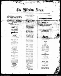
TheHillston News was a weekly English language newspaper published in Hillston, New South Wales, Australia.

Blowering, New South Wales

Blowering, New South wales is a rural locality in the Snowy Mountains of New South wales and a civil Parish of Buccleuch County.

Parish of Mossgiel

Mossgiel Parish in Mouramba County, central New South Wales is a cadasteral parish of Australia.

References

  1. "Mossgiel County". Geographical Names Register (GNR) of NSW. Geographical Names Board of New South Wales. OOjs UI icon edit-ltr-progressive.svg