Caira County

Last updated
Map all coordinates using: OpenStreetMap  ·  Google Maps
Download coordinates as: KML  ·  GPX
Caira
New South Wales

Caira NSW.PNG

Location in New South Wales
Lands administrative divisions around Caira:
Taila County Kilfera County Waljeers County
Taila County Caira Waradgery County
Tatchera (Vic) Wakool County Wakool County

Caira County is one of the 141 Cadastral divisions of New South Wales. It contains the city of Balranald. It is located between where the Murrumbidgee River joins the Murray River to where the Lachlan River joins the Murrumbidgee, containing much of the western Lowbidgee Floodplain. The name "Caira" is believed to derive from a local Aboriginal word. [1]

Murrumbidgee River river in New South Wales, Australia

Murrumbidgee River, a major tributary of the Murray River within the Murray–Darling basin and the second longest river in Australia. It flows through the Australian state of New South Wales and the Australian Capital Territory. It descends 1,500 metres (4,900 ft) as it flows 1,485 kilometres (923 mi) in a west-northwesterly direction from the foot of Peppercorn Hill in the Fiery Range of the Snowy Mountains towards its confluence with the Murray River near Boundary Bend.

Murray River the longest river in Australia

The Murray River is Australia's longest river, at 2,508 kilometres (1,558 mi) in length. The Murray rises in the Australian Alps, draining the western side of Australia's highest mountains, and then meanders across Australia's inland plains, forming the border between the states of New South Wales and Victoria as it flows to the northwest into South Australia. It turns south at Morgan for its final 315 kilometres (196 mi), reaching the ocean at Lake Alexandrina.

Lachlan River tributary to the Murrumbidgee River in New South Wales, Australia

The Lachlan River is an intermittent river that is part of the Murrumbidgee catchment within the Murray–Darling basin, located in the Southern Tablelands, Central West, and Riverina regions of New South Wales, Australia.

Parishes within this county

A full list of parishes found within this county; their current LGA and mapping coordinates to the approximate centre of each location is as follows:

Local government in Australia

Local government in Australia is the third tier of government in Australia administered by the states and territories, which in turn are beneath the federal tier. Local government is not mentioned in the Constitution of Australia and two referenda in the 1970s and 1980s to alter the Constitution relating to local government were unsuccessful. Every state government recognises local government in their respective constitutions. Unlike Canada or the United States, there is only one level of local government in each state, with no distinction such as cities and counties.

Parish LGA Coordinates
Bahpunga Hay Shire 34°34′54″S144°09′04″E / 34.58167°S 144.15111°E / -34.58167; 144.15111 (Bahpunga Parish)
Ballah Balranald Shire 34°20′27″S143°31′36″E / 34.34083°S 143.52667°E / -34.34083; 143.52667 (Ballah Parish)
Balranald Balranald Shire 34°36′35″S143°34′57″E / 34.60972°S 143.58250°E / -34.60972; 143.58250 (Balranald Parish)
Belaimong Balranald Shire 34°09′04″S143°50′33″E / 34.15111°S 143.84250°E / -34.15111; 143.84250 (Belaimong Parish)
Belar Murray River Council 34°43′54″S143°40′04″E / 34.73167°S 143.66778°E / -34.73167; 143.66778 (Belar Parish)
Benongal Balranald Shire 34°43′54″S143°31′04″E / 34.73167°S 143.51778°E / -34.73167; 143.51778 (Benongal Parish)
Bidura Balranald Shire 34°08′05″S143°19′47″E / 34.13472°S 143.32972°E / -34.13472; 143.32972 (Bidura Parish)
Bluff Hay Shire 34°42′54″S144°04′04″E / 34.71500°S 144.06778°E / -34.71500; 144.06778 (Bluff Parish)
Boocathan Balranald Shire 34°08′41″S144°01′57″E / 34.14472°S 144.03250°E / -34.14472; 144.03250 (Boocathan Parish)
Budgerie Balranald Shire 34°12′09″S143°27′10″E / 34.20250°S 143.45278°E / -34.20250; 143.45278 (Budgerie Parish)
Bunumburt Balranald Shire 34°11′27″S143°54′19″E / 34.19083°S 143.90528°E / -34.19083; 143.90528 (Bunumburt Parish)
Chadwick Balranald Shire 34°43′54″S143°30′04″E / 34.73167°S 143.50111°E / -34.73167; 143.50111 (Chadwick Parish)
Chadwick Balranald Shire 34°45′44″S143°29′56″E / 34.76222°S 143.49889°E / -34.76222; 143.49889 (Chadwick Parish)
Chillichill Balranald Shire 34°07′24″S143°55′10″E / 34.12333°S 143.91944°E / -34.12333; 143.91944 (Chillichill Parish)
Cooncoonburra Balranald Shire 34°21′33″S143°39′47″E / 34.35917°S 143.66306°E / -34.35917; 143.66306 (Cooncoonburra Parish)
Crokee Balranald Shire 34°26′40″S143°24′26″E / 34.44444°S 143.40722°E / -34.44444; 143.40722 (Crokee Parish)
Davy Balranald Shire 34°13′17″S143°43′45″E / 34.22139°S 143.72917°E / -34.22139; 143.72917 (Davy Parish)
Derinum Hay Shire 34°28′54″S144°14′04″E / 34.48167°S 144.23444°E / -34.48167; 144.23444 (Derinum Parish)
Fisher Murray River Council 34°44′02″S143°50′30″E / 34.73389°S 143.84167°E / -34.73389; 143.84167 (Fisher Parish)
Ganaway Balranald Shire 34°18′11″S143°36′59″E / 34.30306°S 143.61639°E / -34.30306; 143.61639 (Ganaway Parish)
Geraki Balranald Shire 34°14′55″S143°33′11″E / 34.24861°S 143.55306°E / -34.24861; 143.55306 (Geraki Parish)
Glen Emu Balranald Shire 34°11′44″S143°36′43″E / 34.19556°S 143.61194°E / -34.19556; 143.61194 (Glen Emu Parish)
Impimi Murray River Council 34°43′54″S143°45′04″E / 34.73167°S 143.75111°E / -34.73167; 143.75111 (Impimi Parish)
Jeraly Hay Shire 34°39′54″S144°05′04″E / 34.66500°S 144.08444°E / -34.66500; 144.08444 (Jeraly Parish)
Jippay Balranald Shire 34°13′35″S143°49′31″E / 34.22639°S 143.82528°E / -34.22639; 143.82528 (Jippay Parish)
Juanbung Balranald Shire
Kerrish Balranald Shire 34°17′10″S143°43′37″E / 34.28611°S 143.72694°E / -34.28611; 143.72694 (Kerrish Parish)
Kia Murray River Council 34°40′54″S143°45′04″E / 34.68167°S 143.75111°E / -34.68167; 143.75111 (Kia Parish)
Kieeta Murray River Council 34°35′54″S143°41′04″E / 34.59833°S 143.68444°E / -34.59833; 143.68444 (Kieeta Parish)
Kingi Balranald Shire 34°37′13″S143°28′42″E / 34.62028°S 143.47833°E / -34.62028; 143.47833 (Kingi Parish)
Lawrence Balranald Shire 34°31′28″S143°27′17″E / 34.52444°S 143.45472°E / -34.52444; 143.45472 (Lawrence Parish)
Lincoln Hay Shire 34°37′08″S144°02′07″E / 34.61889°S 144.03528°E / -34.61889; 144.03528 (Lincoln Parish)
Loocalle Balranald Shire 34°30′37″S143°16′39″E / 34.51028°S 143.27750°E / -34.51028; 143.27750 (Loocalle Parish)
Loorica Murray River Council 34°28′54″S143°52′04″E / 34.48167°S 143.86778°E / -34.48167; 143.86778 (Loorica Parish)
Macpherson Balranald Shire 34°15′00″S143°17′40″E / 34.25000°S 143.29444°E / -34.25000; 143.29444 (Macpherson Parish)
Mamanga Balranald Shire 34°43′01″S143°33′15″E / 34.71694°S 143.55417°E / -34.71694; 143.55417 (Mamanga Parish)
Maremley Balranald Shire 34°24′59″S143°40′59″E / 34.41639°S 143.68306°E / -34.41639; 143.68306 (Maremley Parish)
Mevna Balranald Shire 34°38′21″S143°22′45″E / 34.63917°S 143.37917°E / -34.63917; 143.37917 (Mevna Parish)
Monkem Murray River Council 34°23′54″S143°46′04″E / 34.39833°S 143.76778°E / -34.39833; 143.76778 (Monkem Parish)
Monkem Murray River Council 34°25′33″S143°47′39″E / 34.42583°S 143.79417°E / -34.42583; 143.79417 (Monkem Parish)
Morris Murray River Council 34°37′54″S143°47′04″E / 34.63167°S 143.78444°E / -34.63167; 143.78444 (Morris Parish)
Muckee Balranald Shire 34°27′20″S143°30′57″E / 34.45556°S 143.51583°E / -34.45556; 143.51583 (Muckee Parish)
Nap Nap Murray River Council 34°20′54″S143°52′04″E / 34.34833°S 143.86778°E / -34.34833; 143.86778 (Nap Nap Parish)
Narahquong Balranald Shire 34°21′33″S143°47′33″E / 34.35917°S 143.79250°E / -34.35917; 143.79250 (Narahquong Parish)
Nicholson Hay Shire 34°33′54″S144°14′04″E / 34.56500°S 144.23444°E / -34.56500; 144.23444 (Nicholson Parish)
Nimming Hay Shire 34°27′54″S144°09′04″E / 34.46500°S 144.15111°E / -34.46500; 144.15111 (Nimming Parish)
Nullawong Balranald Shire 34°04′26″S143°36′14″E / 34.07389°S 143.60389°E / -34.07389; 143.60389 (Nullawong Parish)
Paika Balranald Shire 34°31′03″S143°37′34″E / 34.51750°S 143.62611°E / -34.51750; 143.62611 (Paika Parish)
Parker Murray River Council 34°40′54″S143°50′04″E / 34.68167°S 143.83444°E / -34.68167; 143.83444 (Parker Parish)
Parker Murray River Council 34°40′20″S143°50′41″E / 34.67222°S 143.84472°E / -34.67222; 143.84472 (Parker Parish)
Penarie Balranald Shire 34°25′23″S143°35′10″E / 34.42306°S 143.58611°E / -34.42306; 143.58611 (Penarie Parish)
Pitarpunga Balranald Shire 34°19′47″S143°25′06″E / 34.32972°S 143.41833°E / -34.32972; 143.41833 (Pitarpunga Parish)
Pollen Hay Shire 34°30′38″S144°02′18″E / 34.51056°S 144.03833°E / -34.51056; 144.03833 (Pollen Parish)
Pungmallee Hay Shire 34°26′23″S144°05′15″E / 34.43972°S 144.08750°E / -34.43972; 144.08750 (Pungmallee Parish)
Pybolee Hay Shire 34°27′54″S143°56′04″E / 34.46500°S 143.93444°E / -34.46500; 143.93444 (Pybolee Parish)
Quianderry Balranald Shire 34°16′42″S143°59′23″E / 34.27833°S 143.98972°E / -34.27833; 143.98972 (Quianderry Parish)
Ronald Balranald Shire 34°26′30″S143°16′51″E / 34.44167°S 143.28083°E / -34.44167; 143.28083 (Ronald Parish)
Rookery Hay Shire 34°38′54″S144°10′04″E / 34.64833°S 144.16778°E / -34.64833; 144.16778 (Rookery Parish)
Russell Hay Shire 34°37′54″S144°13′04″E / 34.63167°S 144.21778°E / -34.63167; 144.21778 (Russell Parish)
St Pauls Hay Shire 34°41′54″S144°09′04″E / 34.69833°S 144.15111°E / -34.69833; 144.15111 (St Pauls Parish)
Tala Murray River Council 34°34′54″S143°47′04″E / 34.58167°S 143.78444°E / -34.58167; 143.78444 (Tala Parish)
Talpee Murray River Council 34°27′54″S143°42′04″E / 34.46500°S 143.70111°E / -34.46500; 143.70111 (Talpee Parish)
Tararie Balranald Shire 34°51′05″S143°25′30″E / 34.85139°S 143.42500°E / -34.85139; 143.42500 (Tararie Parish)
Telford Hay Shire 34°39′43″S143°59′22″E / 34.66194°S 143.98944°E / -34.66194; 143.98944 (Telford Parish)
The Oaks Hay Shire 34°42′54″S144°13′04″E / 34.71500°S 144.21778°E / -34.71500; 144.21778 (The Oaks Parish)
The Willows Murray River Council 34°41′54″S143°56′04″E / 34.69833°S 143.93444°E / -34.69833; 143.93444 (The Willows Parish)
Tintin Balranald Shire 34°17′24″S143°25′29″E / 34.29000°S 143.42472°E / -34.29000; 143.42472 (Tintin Parish)
Toorong Balranald Shire 34°13′23″S144°00′58″E / 34.22306°S 144.01611°E / -34.22306; 144.01611 (Toorong Parish)
Tuyerunby Hay Shire 34°23′54″S143°56′04″E / 34.39833°S 143.93444°E / -34.39833; 143.93444 (Tuyerunby Parish)
Tyson Balranald Shire 34°18′48″S143°53′42″E / 34.31333°S 143.89500°E / -34.31333; 143.89500 (Tyson Parish)
Waldaira Balranald Shire 34°40′33″S143°17′57″E / 34.67583°S 143.29917°E / -34.67583; 143.29917 (Waldaira Parish)
Waugorah Murray River Council 34°25′54″S143°52′04″E / 34.43167°S 143.86778°E / -34.43167; 143.86778 (Waugorah Parish)
Weimby Balranald Shire 34°44′01″S143°16′10″E / 34.73361°S 143.26944°E / -34.73361; 143.26944 (Weimby Parish)
Williamson Murray River Council 34°35′54″S143°53′04″E / 34.59833°S 143.88444°E / -34.59833; 143.88444 (Williamson Parish)
Wilpee Murray River Council 34°27′54″S143°46′04″E / 34.46500°S 143.76778°E / -34.46500; 143.76778 (Wilpee Parish)
Windomal Balranald Shire 34°43′41″S143°22′26″E / 34.72806°S 143.37389°E / -34.72806; 143.37389 (Windomal Parish)
Wombah Murray River Council 34°46′34″S143°34′34″E / 34.77611°S 143.57611°E / -34.77611; 143.57611 (Wombah Parish)
Yanga Murray River Council 34°40′54″S143°40′04″E / 34.68167°S 143.66778°E / -34.68167; 143.66778 (Yanga Parish)
Yarrington Balranald Shire 34°34′16″S143°32′38″E / 34.57111°S 143.54389°E / -34.57111; 143.54389 (Yarrington Parish)
Yarrowal Balranald Shire 34°27′37″S143°40′14″E / 34.46028°S 143.67056°E / -34.46028; 143.67056 (Yarrowal Parish)
Yough Balranald Shire 34°06′39″S143°45′26″E / 34.11083°S 143.75722°E / -34.11083; 143.75722 (Yough Parish)

Related Research Articles

Yass River river in New South Wales, Australia

The Yass River, a perennial river that is part of the Murrumbidgee catchment within the Murray–Darling basin, is located in the Southern Tablelands and South Western Slopes districts of New South Wales, Australia.

Goodradigbee River river in Australia

Goodradigbee River, a perennial stream that is part of the Murrumbidgee catchment within the Murray–Darling basin, is located in the Snowy Mountains district of New South Wales, Australia.

Darbalara, New South Wales Town in New South Wales, Australia

Darbalara is a rural community on the east bank of the junction of the Murrumbidgee River and Tumut River in the Riverina. It is situated by road, about 25 kilometres north east of Gundagai and 25 kilometres south of Coolac.

Beresford County Cadastral in New South Wales, Australia

Beresford County is one of the 141 Cadastral divisions of New South Wales. It contains Cooma and Bredbo. Part of the Murrumbidgee River forms the boundary in the north-west, and a separate part of the river forms part of the western boundary.
Wynyard County Cadastral in New South Wales, Australia

Wynyard County is one of the 141 Cadastral divisions of New South Wales. It contains the city of Wagga Wagga. The Murrumbidgee River lies on the northern edge of the county, and the Tumut River on the eastern edge.

Buccleuch County Cadastral in New South Wales, Australia

Buccleuch County is one of the 141 Cadastral divisions of New South Wales. It contains the locality of Adjungbilly. The Murrumbidgee River is at the northern boundary, with the Goodradigbee River on the eastern boundary, and the Tumut River on the western boundary. It includes the northern part of the Kosciuszko National Park.
Bourke County, New South Wales Cadastral in New South Wales, Australia

Bourke County is one of the 141 Cadastral divisions of New South Wales. It contains the town of Ardlethan. The Murrumbidgee River is the southern boundary.
Cooper County, New South Wales Cadastral in New South Wales, Australia

Cooper County is one of the 141 Cadastral divisions of New South Wales. It contains the town of Barellan. The Murrumbidgee River is the southern boundary.

Clarendon County, New South Wales Cadastral in New South Wales, Australia

Clarendon County is one of the 141 Cadastral divisions of New South Wales. It contains the towns of Gundagai, Junee and Bethungra. The Murrumbidgee River is the boundary to the south.
Mitchell County, New South Wales Cadastral in New South Wales, Australia

Mitchell County is one of the 141 Cadastral divisions of New South Wales. It contains the town of Collingullie. The Murrumbidgee River is the northern boundary.

Waradgery County Cadastral in New South Wales, Australia

Waradgery County is one of the 141 Cadastral divisions of New South Wales. It contains the town of Hay. It includes the area between the Lachlan River and the Murrumbidgee River where they meet. The Lachlan River is the northern boundary of the county, and the Murrumbidgee for a small section is the southern boundary, but the county also includes some of the land to the south of the Murrumbidgee near Hay.
Murrumbidgee District Cadastral in New South Wales, Australia

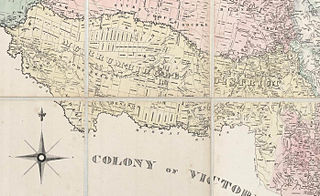
The Murrumbidgee District was a district used in New South Wales in the nineteenth century to refer to the land between the Murrumbidgee River and Murray River, that is now mostly known as the Riverina region. Some maps show the district included the parts of what is now the Australian Capital Territory that was to the west of the Murrumbidgee River. The district was originally one of the districts used to refer to the area outside the limits of location, but later continued to be used as the name after counties were proclaimed within this area. It went out of use after 1884, when new districts were proclaimed.

Bredbo River, a perennial stream that is part of the Murrumbidgee catchment within the Murray–Darling basin, is located in the Monaro region of New South Wales, Australia.

Adelong Creek river in New South Wales, Australia

The Adelong Creek, a perennial river that is part of the Murrumbidgee catchment within the Murray–Darling basin, is located in the South West Slopes, and Riverina regions of New South Wales, Australia.

Jugiong Creek river in Australia

The Jugiong Creek, a mostly–perennial river that is part of the Murrumbidgee catchment within the Murray–Darling basin, is located in the South West Slopes region of New South Wales, Australia.

Burkes Creek

The Burkes Creek, a mostly–perennial river that is part of the Murrumbidgee catchment within the Murray–Darling basin, is located in the Riverina region of New South Wales, Australia.

Burra Creek (Gundagai) locality in New South Wales, Australia

The Burra Creek, a mostly–perennial river that is part of the Murrumbidgee catchment within the Murray–Darling basin, is located in the South West Slopes region of New South Wales, Australia.

Cooma Creek

The Cooma Creek, a mostly–perennial river that is part of the Murrumbidgee catchment within the Murray–Darling basin, is located in the Monaro region of New South Wales, Australia.

Cooma Back Creek river in Australia

The Cooma Back Creek, a mostly–perennial river that is part of the Murrumbidgee catchment within the Murray–Darling basin, is located in the Monaro region of New South Wales, Australia.

Happy Jacks Creek

The Happy Jacks Creek, a perennial river that is part of the Murrumbidgee catchment within the Murray–Darling basin, is located in the Snowy Mountains region of New South Wales, Australia.

References

  1. "Caira". Geographical Names Register (GNR) of NSW. Geographical Names Board of New South Wales . Retrieved 3 August 2013.