Fitzroy County

Last updated

Map all coordinates using: OpenStreetMap  
Download coordinates as: KML  ·  GPX
Fitzroy
New South Wales
Fitzroy NSW.PNG
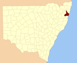
Location in New South Wales
Lands administrative divisions around Fitzroy:
Gresham Clarence Pacific Ocean
Gresham Fitzroy Pacific Ocean
Clarke Raleigh Pacific Ocean

Fitzroy County is one of the 141 Cadastral divisions of New South Wales. It lies south of the Orara River, and north of the Bellinger River, and includes Coffs Harbour.

Orara River, a perennial stream of the Clarence River catchment, is located in the Northern Rivers district of New South Wales, Australia.

Bellinger River river in Australia

Bellinger River, an open and trained mature wave dominated, barrier estuary, is located in the Mid North Coast region of New South Wales, Australia.

Coffs Harbour City in New South Wales, Australia

Coffs Harbour is a city on the Mid North Coast of New South Wales, Australia, 540 km (340 mi) north of Sydney, and 390 km (240 mi) south of Brisbane. It is one of the largest urban centres on the North Coast, with an estimated population of 71,822 in 2018.

Fitzroy County was named in honour of Governor of New South Wales Sir Charles Augustus Fitzroy. [1]

Parishes within this county

A full list of parishes found within this county; their current LGA and mapping coordinates to the approximate centre of each location is as follows:

Local government in Australia third tier of government in Australia

Local government in Australia is the third tier of government in Australia administered by the states and territories, which in turn are beneath the federal tier. Local government is not mentioned in the Constitution of Australia and two referenda in the 1970s and 1980s to alter the Constitution relating to local government were unsuccessful. Every state government recognises local government in their respective constitutions. Unlike Canada or the United States, there is only one level of local government in each state, with no distinction such as cities and counties.

ParishLGACoordinates
Allan Bellingen Shire Council 30°14′54″S152°45′04″E / 30.24833°S 152.75111°E / -30.24833; 152.75111 (Allan)
Allans Water Clarence Valley Council 30°18′54″S152°28′04″E / 30.31500°S 152.46778°E / -30.31500; 152.46778 (Allans Water)
Bagawa Clarence Valley Council 30°09′54″S152°59′04″E / 30.16500°S 152.98444°E / -30.16500; 152.98444 (Bagawa)
Bardool Clarence Valley Council 29°59′54″S152°45′04″E / 29.99833°S 152.75111°E / -29.99833; 152.75111 (Bardool)
Bardsley Clarence Valley Council 29°51′54″S152°53′04″E / 29.86500°S 152.88444°E / -29.86500; 152.88444 (Bardsley)
Blaxland Clarence Valley Council 29°51′54″S152°45′04″E / 29.86500°S 152.75111°E / -29.86500; 152.75111 (Blaxland)
Blicks Clarence Valley Council 30°10′54″S152°31′04″E / 30.18167°S 152.51778°E / -30.18167; 152.51778 (Blicks)
Bligh Bellingen Shire Council 30°21′54″S152°43′04″E / 30.36500°S 152.71778°E / -30.36500; 152.71778 (Bligh)
Bobo Clarence Valley Council 30°09′54″S152°44′04″E / 30.16500°S 152.73444°E / -30.16500; 152.73444 (Bobo)
Bostobrick Bellingen Shire Council 30°16′54″S152°36′04″E / 30.28167°S 152.60111°E / -30.28167; 152.60111 (Bostobrick)
Chambigne Clarence Valley Council 29°43′54″S152°43′04″E / 29.73167°S 152.71778°E / -29.73167; 152.71778 (Chambigne)
Coff City of Coffs Harbour 30°19′54″S153°00′04″E / 30.33167°S 153.00111°E / -30.33167; 153.00111 (Coff)
Comlaroi City of Coffs Harbour 30°14′54″S153°00′04″E / 30.24833°S 153.00111°E / -30.24833; 153.00111 (Comlaroi)
Cope Clarence Valley Council 30°05′54″S152°44′04″E / 30.09833°S 152.73444°E / -30.09833; 152.73444 (Cope)
Corindi Clarence Valley Council 30°00′54″S153°10′04″E / 30.01500°S 153.16778°E / -30.01500; 153.16778 (Corindi)
Duckan Duckan Clarence Valley Council 29°36′54″S152°39′04″E / 29.61500°S 152.65111°E / -29.61500; 152.65111 (Duckan Duckan)
Ermington Clarence Valley Council 29°47′54″S152°40′04″E / 29.79833°S 152.66778°E / -29.79833; 152.66778 (Ermington)
Fenton Bellingen Shire Council 30°20′54″S152°36′04″E / 30.34833°S 152.60111°E / -30.34833; 152.60111 (Fenton)
Gundar City of Coffs Harbour 30°10′54″S152°52′04″E / 30.18167°S 152.86778°E / -30.18167; 152.86778 (Gundar)
Hernani Clarence Valley Council 30°18′54″S152°24′04″E / 30.31500°S 152.40111°E / -30.31500; 152.40111 (Hernani)
Hyland Clarence Valley Council 30°15′24″S152°24′34″E / 30.25667°S 152.40944°E / -30.25667; 152.40944 (Hyland)
Jardine Clarence Valley Council 30°02′54″S152°42′04″E / 30.04833°S 152.70111°E / -30.04833; 152.70111 (Jardine)
Koukandowie Clarence Valley Council 29°55′54″S152°51′04″E / 29.93167°S 152.85111°E / -29.93167; 152.85111 (Koukandowie)
Kremnos Clarence Valley Council 29°59′54″S152°58′04″E / 29.99833°S 152.96778°E / -29.99833; 152.96778 (Kremnos)
Leigh Bellingen Shire Council 30°17′54″S152°45′04″E / 30.29833°S 152.75111°E / -30.29833; 152.75111 (Leigh)
Martin Clarence Valley Council 29°52′54″S152°42′04″E / 29.88167°S 152.70111°E / -29.88167; 152.70111 (Martin)
Meldrum Downs Bellingen Shire Council 30°21′54″S152°30′04″E / 30.36500°S 152.50111°E / -30.36500; 152.50111 (Meldrum Downs)
Moonee City of Coffs Harbour 30°13′54″S153°06′04″E / 30.23167°S 153.10111°E / -30.23167; 153.10111 (Moonee)
Moonpar Clarence Valley Council 30°13′54″S152°37′04″E / 30.23167°S 152.61778°E / -30.23167; 152.61778 (Moonpar)
Nymboida Clarence Valley Council 29°56′54″S152°45′04″E / 29.94833°S 152.75111°E / -29.94833; 152.75111 (Nymboida)
Orara City of Coffs Harbour 30°06′54″S153°03′04″E / 30.11500°S 153.05111°E / -30.11500; 153.05111 (Orara)
Ross Clarence Valley Council 29°42′54″S152°39′04″E / 29.71500°S 152.65111°E / -29.71500; 152.65111 (Ross)
Shannon Clarence Valley Council 29°57′54″S152°41′04″E / 29.96500°S 152.68444°E / -29.96500; 152.68444 (Shannon)
Shea Clarence Valley Council 30°05′54″S152°34′04″E / 30.09833°S 152.56778°E / -30.09833; 152.56778 (Shea)
Sherwood Clarence Valley Council 30°00′54″S153°00′04″E / 30.01500°S 153.00111°E / -30.01500; 153.00111 (Sherwood)
Sherwood Clarence Valley Council 29°57′54″S153°03′04″E / 29.96500°S 153.05111°E / -29.96500; 153.05111 (Sherwood)
Stewart Bellingen Shire Council 30°17′54″S152°52′04″E / 30.29833°S 152.86778°E / -30.29833; 152.86778 (Stewart)
Tallawudjah Clarence Valley Council 30°02′54″S152°57′04″E / 30.04833°S 152.95111°E / -30.04833; 152.95111 (Tallawudjah)
Toothill Clarence Valley Council 29°47′54″S152°48′04″E / 29.79833°S 152.80111°E / -29.79833; 152.80111 (Toothill)
Towallum Clarence Valley Council 30°04′54″S152°52′04″E / 30.08167°S 152.86778°E / -30.08167; 152.86778 (Towallum)
Turville Clarence Valley Council 29°38′54″S152°45′04″E / 29.64833°S 152.75111°E / -29.64833; 152.75111 (Turville)
Tyringham Clarence Valley Council 30°14′54″S152°30′04″E / 30.24833°S 152.50111°E / -30.24833; 152.50111 (Tyringham)
Ucombe Bellingen Shire Council 30°14′54″S152°54′04″E / 30.24833°S 152.90111°E / -30.24833; 152.90111 (Ucombe)
Waihou Clarence Valley Council 30°02′54″S153°00′04″E / 30.04833°S 153.00111°E / -30.04833; 153.00111 (Waihou)
Wiriri Clarence Valley Council 30°06′54″S152°40′04″E / 30.11500°S 152.66778°E / -30.11500; 152.66778 (Wiriri)
Wongawanga City of Coffs Harbour 30°17′54″S152°58′04″E / 30.29833°S 152.96778°E / -30.29833; 152.96778 (Wongawanga)
Woolgoolga City of Coffs Harbour 30°06′54″S153°09′04″E / 30.11500°S 153.15111°E / -30.11500; 153.15111 (Woolgoolga)

Related Research Articles

Morton National Park Protected area in New South Wales, Australia

The Morton National Park is a 199,745-hectare (493,580-acre) national park located in the Southern Highlands, South Coast and Illawarra regions of New South Wales, Australia, situated approximately 170 kilometres (110 mi) south southwest of Sydney.
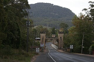
Kangaroo River (Shoalhaven) tributary of the Shoalhaven River in New South Wales, Australia

The Kangaroo River is a perennial river of the Shoalhaven catchment located in the Southern Highlands and Illawarra regions of New South Wales, Australia.

Yass River river in New South Wales, Australia

The Yass River, a perennial river that is part of the Murrumbidgee catchment within the Murray–Darling basin, is located in the Southern Tablelands and South Western Slopes districts of New South Wales, Australia.

Darbalara, New South Wales Town in New South Wales, Australia

Darbalara is a rural community on the east bank of the junction of the Murrumbidgee River and Tumut River in the Riverina. It is situated by road, about 25 kilometres north east of Gundagai and 25 kilometres south of Coolac.

Gloucester County, New South Wales Cadastral in New South Wales, Australia

Gloucester County was one of the original Nineteen Counties in New South Wales, and is now one of the 141 cadastral divisions of New South Wales. It includes the area around Port Stephens. It is bounded on the north and west by the Manning River, and on the south-west by the Williams River.

Northumberland County, New South Wales Cadastral in New South Wales, Australia

Northumberland County was one of the original Nineteen Counties in New South Wales and is now one of the 141 Cadastral divisions of New South Wales. It included the area to the north of Broken Bay, including Lake Macquarie and Newcastle. It was bounded by the part of the Hawkesbury River to the south, the Macdonald River to the south-west, and the Hunter River to the north.
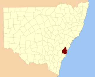
Camden County, New South Wales Cadastral in New South Wales, Australia

Camden County was one of the original Nineteen Counties in New South Wales and is now one of the 141 Cadastral divisions of New South Wales. It included the coastal area near Wollongong south to the Shoalhaven River, and also inland encompassing Berrima and Picton. Its western boundary was the Wollondilly River. The first settlement in the area was Camden Park, established by John Macarthur in 1806, just across the Nepean River from Cumberland County. It was the first land across the Nepean to be settled. Camden is a present-day suburb of Sydney in the same area, although parts of it are in Cumberland.

St Vincent County Cadastral in Australian Capital Territory

St Vincent County was one of the original Nineteen Counties in New South Wales and is now one of the 141 Cadastral divisions of New South Wales. It included the south coast area encompassing Batemans Bay, Ulladulla, Jervis Bay and inland to Braidwood. The Shoalhaven River is the boundary to the north and west, and the Deua River the boundary to the south.
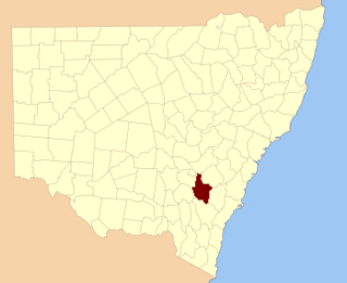
King County, New South Wales Cadastral in New South Wales, Australia

King County was one of the original Nineteen Counties in New South Wales and is now one of the 141 Cadastral divisions of New South Wales. It is in the area to the east of Yass. The northern part of it lies between the Lachlan River and the Boorowa River, including the locations of Frogmore, Taylors Flat, Gunnary, Rugby and Rye Park. The Crookwell River is also part of the northern boundary. The Yass River is the southern boundary.

Cowper County Cadastral in New South Wales, Australia

Cowper County, New South Wales is one of the 141 Cadastral divisions of New South Wales.

Irrara County Cadastral in New South Wales, Australia

Irrara County is one of the 141 Cadastral divisions of New South Wales. It is located south of the border with Queensland, east of the Paroo River, and west of the Warrego River.

Fitzroy Falls, New South Wales New South Wales, Australia

Fitzroy Falls is a village in the Wingecarribee Shire, located within the Southern Highlands region of New South Wales, Australia. The locality was known as Yarrunga, but was renamed after the 81-metre (266 ft) waterfall. At the 2016 census, Fitzroy Falls had a population of 216.

The Parish of Mittagong is a parish of the County of Camden in the Southern Highlands region of New South Wales. It includes the town of Bowral and the southern parts of Mittagong.

The Bemboka River, a perennial stream of the Bega River catchment, is located in the Monaro and South Coast regions of New South Wales, Australia.

Cobrabald River river in Australia

Cobrabald River, a mostly perennial river that is part of the Namoi catchment within the Murray–Darling basin, is located in the Northern Tablelands district of New South Wales, Australia.
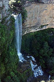
Kedumba River river in New South Wales, Australia

The Kedumba River, a perennial river that is part of the Hawkesbury-Nepean catchment, is located in the Blue Mountains and Macarthur regions of New South Wales, Australia.

Little Murray River, an anabranch of the Murray River and part of the Murray-Darling basin, is located in the western Riverina region of south western New South Wales, Australia.
County of Fitzroy, Queensland Cadastral in Queensland, Australia

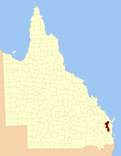
The County of Fitzroy is a county in Queensland, Australia. Like all counties in Queensland, it is a non-functional administrative unit, that is used mainly for the purpose of registering land titles.

Bettowynd Creek, a partly perennial stream of the Moruya River catchment, is located in the Southern Tablelands and South Coast regions of New South Wales, Australia.

Stewart is a civil parish of Fitzroy County in New South Wales. It is located in Bellingen Shire.
References

  1. "Fitzroy County". Geographical Names Register (GNR) of NSW. Geographical Names Board of New South Wales. OOjs UI icon edit-ltr-progressive.svg