| Woore New South Wales | |||||||||||||||
|---|---|---|---|---|---|---|---|---|---|---|---|---|---|---|---|
 Location in New South Wales | |||||||||||||||
| |||||||||||||||
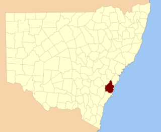
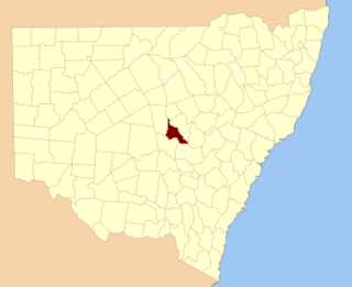
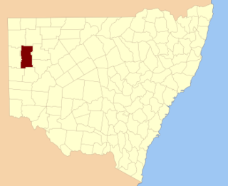
Woore County is one of the 141 Cadastral divisions of New South Wales.
Woore County was named in honour of Commissioner of Crown Lands John C Woore. [1]
| Woore New South Wales | |||||||||||||||
|---|---|---|---|---|---|---|---|---|---|---|---|---|---|---|---|
 Location in New South Wales | |||||||||||||||
| |||||||||||||||
Woore County is one of the 141 Cadastral divisions of New South Wales.
Woore County was named in honour of Commissioner of Crown Lands John C Woore. [1]
A full list of parishes found within this county; their current LGA and mapping coordinates to the approximate centre of each location is as follows:

Local government in Australia is the third tier of government in Australia administered by the states and territories, which in turn are beneath the federal tier. Local government is not mentioned in the Constitution of Australia and two referenda in the 1970s and 1980s to alter the Constitution relating to local government were unsuccessful. Every state government recognises local government in their respective constitutions. Unlike Canada or the United States, there is only one level of local government in each state, with no distinction such as cities and counties.

North Shropshire was a local government district in Shropshire, England. The district council was based at Edinburgh House, in Wem. Other settlements included the towns of Ellesmere, Market Drayton, Wem and Whitchurch, as well as the large villages of Shawbury and Baschurch. The district bordered onto Wales, Cheshire and Staffordshire as well as the Shropshire districts of Oswestry, Shrewsbury and Atcham and the unitary Telford and Wrekin.

Woore is a village and civil parish in the north east of Shropshire, England, of about 3,950 acres. It had a population of 1,004 in the 2001 Census, rising to 1,069 at the 2011 Census, by which time the number of households has increased by about 20%. The name means "boundary" in ancient Celtic or Anglo-Saxon ("Oure"), and this fits nicely with the fact that it is on the boundary with both the counties of Cheshire and Staffordshire. The parish is the most northerly in Shropshire.

The South Creek or Wianamatta, a creek that is part of the Hawkesbury-Nepean catchment, is located on the Cumberland Plain, also referred to as Greater Western Sydney, New South Wales, Australia.
The Geographical Names Board of New South Wales, a statutory authority of the Land and Property Information division, Department of Finance and Services in the Government of New South Wales, is the official body for naming and recording details of places and geographical names in the state of New South Wales, Australia.

Buerton is a village at SJ685435 and civil parish in the unitary authority of Cheshire East and the ceremonial county of Cheshire, England, about 7 miles south of the town of Nantwich and 1½ miles east of the village of Audlem, on the border with Shropshire. The parish also includes the small settlements of Hankins Heys, Moblake, Pinder's End and Three Wells, as well as parts of Chapel End, College Fields, Kinsey Heath, Longhill, Raven's Bank, Sandyford and Woolfall. In 2001, the total population was a little under 500, which had increased marginally to 503 at the 2011 Census. Nearby villages include Adderley, Audlem, Bridgemere, Hankelow, Hatherton, Hunsterson and Woore.
Commander Cortlandt James Woore Simpson, CBE, DSC, PM was an English polar explorer and naval officer.

Darbalara is a rural community on the east bank of the junction of the Murrumbidgee River and Tumut River in the Riverina. It is situated by road, about 25 kilometres north east of Gundagai and 25 kilometres south of Coolac.

Gloucester County was one of the original Nineteen Counties in New South Wales, and is now one of the 141 cadastral divisions of New South Wales. It includes the area around Port Stephens. It is bounded on the north and west by the Manning River, and on the south-west by the Williams River.

Northumberland County was one of the original Nineteen Counties in New South Wales and is now one of the 141 Cadastral divisions of New South Wales. It included the area to the north of Broken Bay, including Lake Macquarie and Newcastle. It was bounded by the part of the Hawkesbury River to the south, the Macdonald River to the south-west, and the Hunter River to the north.

Camden County was one of the original Nineteen Counties in New South Wales and is now one of the 141 Cadastral divisions of New South Wales. It included the coastal area near Wollongong south to the Shoalhaven River, and also inland encompassing Berrima and Picton. Its western boundary was the Wollondilly River. The first settlement in the area was Camden Park, established by John Macarthur in 1806, just across the Nepean River from Cumberland County. It was the first land across the Nepean to be settled. Camden is a present-day suburb of Sydney in the same area, although parts of it are in Cumberland.

St Vincent County was one of the original Nineteen Counties in New South Wales and is now one of the 141 Cadastral divisions of New South Wales. It included the south coast area encompassing Batemans Bay, Ulladulla, Jervis Bay and inland to Braidwood. The Shoalhaven River is the boundary to the north and west, and the Deua River the boundary to the south.

Cowper County, New South Wales is one of the 141 Cadastral divisions of New South Wales.

Irrara County is one of the 141 Cadastral divisions of New South Wales. It is located south of the border with Queensland, east of the Paroo River, and west of the Warrego River.

Kennedy County is one of the 141 Cadastral divisions of New South Wales. It is located to the west of the Bogan River in the area around Tottenham and Tullamore.

Mootwingee County, New South Wales is one of the 141 Cadastral divisions of New South Wales.

Oxley County, New South Wales is one of the 141 Cadastral divisions of New South Wales. It is located between the Bogan River on the west, and the Macquarie River on the east. This is the area approximately between Warren and Nyngan.
Edward Woore or Davie Woore (1880–1960) was a British stained glass artist and member of the British Society of Master Glass Painters. He was a student, apprentice and collaborator with Christopher Whall a stained glass artist and leader in the Arts and Crafts Movement.
Thomas Woore was a Royal Navy officer, grazier, railways leader and surveyor. Woore was born in Derry, County Londonderry, Ireland and died in Double Bay, Sydney, New South Wales.
William Busby was an English-born Australian politician.

Blowering, New South wales is a rural locality in the Snowy Mountains of New South wales and a civil Parish of Buccleuch County.