Brisbane County

Last updated

Map all coordinates using: OpenStreetMap  
Download coordinates as: KML  ·  GPX
Brisbane
New South Wales
Brisbane NSW.PNG
Location in New South Wales
Lands administrative divisions around Brisbane:
Pottinger Buckland Parry
Bligh Brisbane Hawes
Phillip Hunter Durham

Brisbane County was one of the original Nineteen Counties in New South Wales and is now one of the 141 Cadastral divisions of New South Wales. It includes Scone, Merriwa and Murrurundi. The Goulburn River is the boundary to the south and the Hunter River the boundary to the south-east. The Liverpool Range area is the boundary to the north, and the Krui River the boundary to the west.

Nineteen Counties area of New South Wales colony to which European settlement was legally restricted from 1826 until 1861

The Nineteen Counties were the limits of location in the colony of New South Wales, Australia. Settlers were permitted to take up land only within the counties due to the dangers in the wilderness.

New South Wales State of Australia

New South Wales is a state on the east coast of Australia. It borders Queensland to the north, Victoria to the south, and South Australia to the west. Its coast borders the Tasman Sea to the east. The Australian Capital Territory is an enclave within the state. New South Wales' state capital is Sydney, which is also Australia's most populous city. In December 2018, the population of New South Wales was over 8 million, making it Australia's most populous state. Just under two-thirds of the state's population, 5.1 million, live in the Greater Sydney area. Inhabitants of New South Wales are referred to as New South Welshmen.

Scone, New South Wales Town in New South Wales, Australia

Scone is a town in the Upper Hunter Shire in the Hunter Region of New South Wales, Australia. At the 2006 census, Scone had a population of 4,624 people. It is on the New England Highway north of Muswellbrook about 270 kilometres north of Sydney, and is part of the New England (federal) and New England (state) electorates. Scone is in a farming area and is also noted for breeding Thoroughbred racehorses. It is known as the 'Horse capital of Australia'.

Brisbane County was named in honour of Sir Thomas Makdougall Brisbane Governor (1773-1860). [1] The Electoral district of Phillip, Brisbane and Bligh was the first electoral district for the area, between 1856 and 1859.

Phillip, Brisbane and Bligh was an electoral district of the Legislative Assembly in the Australian state of New South Wales from 1856 to 1859. It included Phillip, Brisbane and Bligh counties, including Scone, Murrurundi, Dunedoo and Mudgee. It was replaced by Upper Hunter and Mudgee.

Parishes within this county

A full list of parishes found within this county; their current LGA and mapping coordinates to the approximate centre of each location is as follows:

Local government in Australia

Local government in Australia is the third tier of government in Australia administered by the states and territories, which in turn are beneath the federal tier. Local government is not mentioned in the Constitution of Australia and two referenda in the 1970s and 1980s to alter the Constitution relating to local government were unsuccessful. Every state government recognises local government in their respective constitutions. Unlike Canada or the United States, there is only one level of local government in each state, with no distinction such as cities and counties.

ParishLGACoordinates
Ailsa Upper Hunter Shire 32°03′54″S150°11′04″E / 32.06500°S 150.18444°E / -32.06500; 150.18444 (Ailsa Parish)
Alma Upper Hunter Shire 32°02′54″S150°59′04″E / 32.04833°S 150.98444°E / -32.04833; 150.98444 (Alma Parish)
Boggibri Upper Hunter Shire 32°02′54″S150°16′04″E / 32.04833°S 150.26778°E / -32.04833; 150.26778 (Boggibri Parish)
Brawboy Upper Hunter Shire 32°01′54″S150°41′04″E / 32.03167°S 150.68444°E / -32.03167; 150.68444 (Brawboy Parish)
Brogheda Muswellbrook Shire 32°11′54″S150°43′04″E / 32.19833°S 150.71778°E / -32.19833; 150.71778 (Brogheda Parish)
Campbell Upper Hunter Shire 32°17′54″S150°18′04″E / 32.29833°S 150.30111°E / -32.29833; 150.30111 (Campbell Parish)
Castle Sempill Upper Hunter Shire 31°51′54″S151°13′04″E / 31.86500°S 151.21778°E / -31.86500; 151.21778 (Castle Sempill Parish)
Cherson Upper Hunter Shire 31°55′54″S151°07′04″E / 31.93167°S 151.11778°E / -31.93167; 151.11778 (Cherson Parish)
Clanricard Muswellbrook Shire 32°14′54″S150°45′04″E / 32.24833°S 150.75111°E / -32.24833; 150.75111 (Clanricard Parish)
Coulson Upper Hunter Shire 31°58′54″S150°24′04″E / 31.98167°S 150.40111°E / -31.98167; 150.40111 (Coulson Parish)
Cranbourne Upper Hunter Shire 32°00′54″S150°19′04″E / 32.01500°S 150.31778°E / -32.01500; 150.31778 (Cranbourne Parish)
Crawney Upper Hunter Shire 31°44′54″S151°08′04″E / 31.74833°S 151.13444°E / -31.74833; 151.13444 (Crawney Parish)
Dangar Muswellbrook Shire 32°21′54″S150°27′04″E / 32.36500°S 150.45111°E / -32.36500; 150.45111 (Dangar Parish)
Denman Muswellbrook Shire 32°21′54″S150°40′04″E / 32.36500°S 150.66778°E / -32.36500; 150.66778 (Denman Parish)
Ellerston Upper Hunter Shire 31°45′54″S151°13′04″E / 31.76500°S 151.21778°E / -31.76500; 151.21778 (Ellerston Parish)
Ellis Muswellbrook Shire 32°12′54″S150°50′04″E / 32.21500°S 150.83444°E / -32.21500; 150.83444 (Ellis Parish)
Goulburn Upper Hunter Shire 32°19′54″S150°23′04″E / 32.33167°S 150.38444°E / -32.33167; 150.38444 (Goulburn Parish)
Guan Gua Upper Hunter Shire 32°05′54″S150°41′04″E / 32.09833°S 150.68444°E / -32.09833; 150.68444 (Guan Gua Parish)
Gundy Gundy Upper Hunter Shire 32°00′54″S150°58′04″E / 32.01500°S 150.96778°E / -32.01500; 150.96778 (Gundy Gundy Parish)
Hall Upper Hunter Shire 32°10′54″S150°32′04″E / 32.18167°S 150.53444°E / -32.18167; 150.53444 (Hall Parish)
Halscot Upper Hunter Shire 32°08′54″S150°47′04″E / 32.14833°S 150.78444°E / -32.14833; 150.78444 (Halscot Parish)
Howard Upper Hunter Shire 32°06′54″S150°19′04″E / 32.11500°S 150.31778°E / -32.11500; 150.31778 (Howard Parish)
Isis Upper Hunter Shire 31°49′54″S151°01′04″E / 31.83167°S 151.01778°E / -31.83167; 151.01778 (Isis Parish)
Killoe Upper Hunter Shire 32°06′54″S150°10′04″E / 32.11500°S 150.16778°E / -32.11500; 150.16778 (Killoe Parish)
Lincoln Upper Hunter Shire 31°39′54″S151°03′04″E / 31.66500°S 151.05111°E / -31.66500; 151.05111 (Lincoln Parish)
Mackenzie Upper Hunter Shire 32°15′54″S150°22′04″E / 32.26500°S 150.36778°E / -32.26500; 150.36778 (Mackenzie Parish)
Macqueen Upper Hunter Shire 32°07′54″S150°57′04″E / 32.13167°S 150.95111°E / -32.13167; 150.95111 (Macqueen Parish)
Manbus Upper Hunter Shire 32°01′54″S150°46′04″E / 32.03167°S 150.76778°E / -32.03167; 150.76778 (Manbus Parish)
Manobalai Muswellbrook Shire 32°11′54″S150°36′04″E / 32.19833°S 150.60111°E / -32.19833; 150.60111 (Manobalai Parish)
Melbourne Upper Hunter Shire 31°59′54″S150°49′04″E / 31.99833°S 150.81778°E / -31.99833; 150.81778 (Melbourne Parish)
Merriwa Upper Hunter Shire 32°09′54″S150°24′04″E / 32.16500°S 150.40111°E / -32.16500; 150.40111 (Merriwa Parish)
Murrurundi Upper Hunter Shire 31°45′54″S150°48′04″E / 31.76500°S 150.80111°E / -31.76500; 150.80111 (Murrurundi Parish)
Murulla Upper Hunter Shire 31°47′54″S150°55′04″E / 31.79833°S 150.91778°E / -31.79833; 150.91778 (Murulla Parish)
Myrabluan Upper Hunter Shire 32°07′54″S150°35′04″E / 32.13167°S 150.58444°E / -32.13167; 150.58444 (Myrabluan Parish)
Nerobingabla Upper Hunter Shire 31°55′54″S150°36′04″E / 31.93167°S 150.60111°E / -31.93167; 150.60111 (Nerobingabla Parish)
Oxley Upper Hunter Shire 31°55′49″S150°19′35″E / 31.93028°S 150.32639°E / -31.93028; 150.32639 (Oxley Parish)
Page Upper Hunter Shire 31°54′54″S150°58′04″E / 31.91500°S 150.96778°E / -31.91500; 150.96778 (Page Parish)
Park Upper Hunter Shire 32°00′54″S150°53′04″E / 32.01500°S 150.88444°E / -32.01500; 150.88444 (Park Parish)
Scone Upper Hunter Shire 32°02′54″S150°50′04″E / 32.04833°S 150.83444°E / -32.04833; 150.83444 (Scone Parish)
Strathearn Upper Hunter Shire 32°08′54″S150°51′04″E / 32.14833°S 150.85111°E / -32.14833; 150.85111 (Strathearn Parish)
Temi Upper Hunter Shire 31°41′54″S150°55′04″E / 31.69833°S 150.91778°E / -31.69833; 150.91778 (Temi Parish)
Terell Upper Hunter Shire 31°55′54″S150°30′04″E / 31.93167°S 150.50111°E / -31.93167; 150.50111 (Terell Parish)
Timor Upper Hunter Shire 31°46′54″S151°02′04″E / 31.78167°S 151.03444°E / -31.78167; 151.03444 (Timor Parish)
Tinagroo Upper Hunter Shire 31°49′54″S150°49′04″E / 31.83167°S 150.81778°E / -31.83167; 150.81778 (Tinagroo Parish)
Tongo Upper Hunter Shire 32°10′54″S150°10′04″E / 32.18167°S 150.16778°E / -32.18167; 150.16778 (Tongo Parish)
Tyrone Upper Hunter Shire 32°03′54″S150°38′04″E / 32.06500°S 150.63444°E / -32.06500; 150.63444 (Tyrone Parish)
Wandewoi Upper Hunter Shire 31°44′54″S151°20′04″E / 31.74833°S 151.33444°E / -31.74833; 151.33444 (Wandewoi Parish)
Watt Upper Hunter Shire 32°10′54″S150°17′04″E / 32.18167°S 150.28444°E / -32.18167; 150.28444 (Watt Parish)
Waverly Upper Hunter Shire 31°50′54″S151°08′04″E / 31.84833°S 151.13444°E / -31.84833; 151.13444 (Waverly Parish)
Webimble Upper Hunter Shire 32°02′54″S150°32′04″E / 32.04833°S 150.53444°E / -32.04833; 150.53444 (Webimble Parish)
Wentworth Upper Hunter Shire 31°54′54″S150°26′04″E / 31.91500°S 150.43444°E / -31.91500; 150.43444 (Wentworth Parish)
Wickham Upper Hunter Shire 32°14′54″S150°31′04″E / 32.24833°S 150.51778°E / -32.24833; 150.51778 (Wickham Parish)
Willis Upper Hunter Shire 31°53′54″S150°43′04″E / 31.89833°S 150.71778°E / -31.89833; 150.71778 (Willis Parish)
Wingen Upper Hunter Shire 31°53′54″S150°51′04″E / 31.89833°S 150.85111°E / -31.89833; 150.85111 (Wingen Parish)
Wollara Upper Hunter Shire 32°13′54″S150°12′04″E / 32.23167°S 150.20111°E / -32.23167; 150.20111 (Wollara Parish)
Worondi Upper Hunter Shire 32°17′54″S150°27′04″E / 32.29833°S 150.45111°E / -32.29833; 150.45111 (Worondi Parish)
Wybong Muswellbrook Shire 32°14′54″S150°40′04″E / 32.24833°S 150.66778°E / -32.24833; 150.66778 (Wybong Parish)
Yarraman Muswellbrook Shire 32°14′54″S150°37′04″E / 32.24833°S 150.61778°E / -32.24833; 150.61778 (Yarraman Parish)

Related Research Articles

Bingara, New South Wales Town in New South Wales, Australia

Bingara is a small town on the Gwydir River in Murchison County in the New England region of New South Wales, Australia. Bingara is currently the administrative centre for the Gwydir Shire that was created in 2003. Bingara is one of the few places in Australia where diamonds have been found. The Gwydir River being a main highlight of the town is a main catchment of the Murray-Darling System.

County of Canning Cadastral in Queensland, Australia

The County of Canning is a county in Queensland, Australia. The county consists of almost all of the former Shires of Caboolture, Maroochy and Kilcoy and the former City of Caloundra. Its main urbanised areas are centred on the Sunshine Coast and the areas surrounding Caboolture.

Lands administrative divisions of New South Wales Wikimedia list article

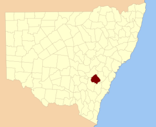
The lands administrative divisions of New South Wales refers to the 141 counties within the Colony of New South Wales, that later became the Australian state of New South Wales.

Lands administrative divisions of Australia

Lands administrative divisions of Australia are the cadastral divisions of Australia for the purposes of identification of land to ensure security of land ownership. Most states term these divisions as counties, parishes, hundreds, and other terms. The eastern states of Queensland, New South Wales, Victoria and Tasmania were divided into counties and parishes in the 19th century, although the Tasmanian counties were renamed land districts in the 20th century. Parts of South Australia (south-east) and Western Australia (south-west) were similarly divided into counties, and there were also five counties in a small part of the Northern Territory. However South Australia has subdivisions of hundreds instead of parishes, along with the Northern Territory, which was part of South Australia when the hundreds were proclaimed. There were also formerly hundreds in Tasmania. There have been at least 600 counties, 544 hundreds and at least 15,692 parishes in Australia, but there are none of these units for most of the sparsely inhabited central and western parts of the country.

Camden County, New South Wales Cadastral in New South Wales, Australia

Camden County was one of the original Nineteen Counties in New South Wales and is now one of the 141 Cadastral divisions of New South Wales. It included the coastal area near Wollongong south to the Shoalhaven River, and also inland encompassing Berrima and Picton. Its western boundary was the Wollondilly River. The first settlement in the area was Camden Park, established by John Macarthur in 1806, just across the Nepean River from Cumberland County. It was the first land across the Nepean to be settled. Camden is a present-day suburb of Sydney in the same area, although parts of it are in Cumberland.

St Vincent County Cadastral in Australian Capital Territory

St Vincent County was one of the original Nineteen Counties in New South Wales and is now one of the 141 Cadastral divisions of New South Wales. It included the south coast area encompassing Batemans Bay, Ulladulla, Jervis Bay and inland to Braidwood. The Shoalhaven River is the boundary to the north and west, and the Deua River the boundary to the south.

Cook County, New South Wales Cadastral in New South Wales, Australia

Cook County was one of the original Nineteen Counties in New South Wales and is now one of the 141 Cadastral divisions of New South Wales. It includes the area to the west of Sydney in the Blue Mountains, between the Colo River in the north, and the Coxs River in the south and west, encompassing Lithgow, Mount Victoria, Katoomba, Wentworth Falls, Lawson and most of the other towns in the Blue Mountains. The Nepean River is the border to the east. Before 1834, the area was part of the Westmoreland, Northumberland and Roxburgh counties.

Westmoreland County, New South Wales Cadastral in New South Wales, Australia

Westmoreland County was one of the original Nineteen Counties in New South Wales and is now one of the 141 Cadastral divisions of New South Wales. It is to the west of Sydney in the Blue Mountains. Coxs River is the border to the north, and the Wollondilly River to the east. Campbells River is the border in the north-east, where the county extends to near Bathurst, with the Fish River part of the border. It includes the town of Oberon, and the Kanangra-Boyd National Park.

Georgiana County Cadastral in New South Wales, Australia

Georgiana County was one of the original Nineteen Counties in New South Wales and is now one of the 141 Cadastral divisions of New South Wales. It lies in the area about halfway between Bathurst and Goulburn. The Lachlan River is the western boundary, with the Crookwell River the southern boundary. It includes Bigga, and the area surrounding the Abercrombie River. It was part of the Electoral district of King and Georgiana from 1856 to 1859.

Murray County, New South Wales Cadastral in New South Wales, Australia

Murray County was one of the original Nineteen Counties in New South Wales and is now one of the 141 Lands administrative divisions of New South Wales. It included the area which is now part of Canberra and as far north as Lake George and Yass. It was originally bounded on the west by the Murrumbidgee River, on the east by the Shoalhaven River and on the north by the Yass River. A large area of the county was transferred to the Commonwealth government in 1909 in the Seat of Government Acceptance Act to make part of the Australian Capital Territory, along with land in Cowley County. Since then, the ACT border is now part of the western boundary. Part of the ACT border is determined by property boundaries in the Parish of Keewong, in the County of Murray; specifically the southern end of portions 177, 218, 211, 36, and 38. This is mentioned in the Seat of Government Acceptance Act of 1909.

Argyle County Cadastral in New South Wales, Australia

Argyle County was one of the original Nineteen Counties in New South Wales and is now one of the 141 Cadastral divisions of New South Wales. It includes the area around Goulburn. It is bounded by Lake George in the south-west, the Shoalhaven River in the east, and the Wollondilly River in the north-east.

Bathurst County Cadastral in New South Wales, Australia

Bathurst County was one of the original Nineteen Counties in New South Wales and is now one of the 141 Cadastral divisions of New South Wales. It includes the area to the south-west of Bathurst to Cowra and Orange. The Lachlan River is the boundary to the south-west, the Belubula River forms part of the northern boundary, with the Fish River on the northeastern boundary. Blayney is located roughly in the middle.

Bligh County Cadastral in New South Wales, Australia

Bligh County was one of the original Nineteen Counties in New South Wales and is now one of the 141 Cadastral divisions of New South Wales. The Cudgegong River and the Goulburn River are its southern boundaries; the Krui River is the eastern boundary, and the Burragundy River the northern boundary. It includes the villages of Cassilis and Dunedoo.

Phillip County Cadastral in New South Wales, Australia

Phillip County was one of the original Nineteen Counties in New South Wales and is now one of the 141 Cadastral divisions of New South Wales. It includes the area to the east of Mudgee and Gulgong. The Cudgegong River is the border to the south-west, and the Goulburn River the border to the north.

Bukkulla, New South Wales Town in New South Wales, Australia

Bukkulla is a hamlet about 30 kilometres (19 mi) north of Inverell and north-east of Bannockburn on the Ashford Road. This hamlet is within the boundaries of Arrawatta County and Inverell Shire, New South Wales, Australia. The village is at elevation of about 580 metres. In the 2006 census, there were 145 persons usually resident in the Bukkulla area.

Heatherbrae, New South Wales Suburb of Port Stephens Council, New South Wales, Australia

Heatherbrae is a suburb of the Port Stephens local government area in the Hunter Region of New South Wales, Australia. The suburb lies to the east of the Hunter River and to the south of the town of Raymond Terrace. It is bisected by the Pacific Highway. At the 2011 census it had a population of 492. Most of the population lives to the west of the Pacific Highway in a housing subdivision while some residents live to the east of the highway in a semi-industrial area. Remaining residents live in rural and semi-rural areas adjacent to the highway and throughout the rest of the suburb.

Cobrabald River

Cobrabald River, a mostly perennial river that is part of the Namoi catchment within the Murray–Darling basin, is located in the Northern Tablelands district of New South Wales, Australia.

Electoral district of Counties of Gloucester, Macquarie, and Stanley

The Electoral district of Counties of Gloucester, Macquarie, and Stanley and from 1851, Gloucester and Macquarie, was an electorate of the partially elected New South Wales Legislative Council, created for the first elections for the Council in 1843. The counties of Gloucester and Macquarie were the settled coastal areas north of Northumberland County, while the County of Stanley was the area surrounding Brisbane, in what became part of Queensland after its separation in 1859. Polling took place at Raymond Terrace, Port Macquarie, Dungog, Stroud, Brisbane, Ipswich and Mr Rowley's residence on the Manning River. The County of Stanley was removed from the district with the expansion of the Council in 1851 and became the districts of County of Stanley and Stanley Boroughs.

The Electoral district of Counties of Hunter, Brisbane and Bligh and from 1851, Phillip, Brisbane and Bligh, was an electorate of the partially elected New South Wales Legislative Council, created for the first elections for the Council in 1843. The electoral district included the north western counties of Hunter, Brisbane, Bligh. Polling took place in the towns of Jerrys Plains, nearby Merton, Muswellbrook, Scone, as far north as Murrurundi, Watson's on the Macdonald River, Cassilis and as far west as Montefiores. With the expansion of the Council in 1851 Phillip, the other north west county, was added to the district, replacing Hunter which was combined with the lower Hunter county of Northumberland as Counties of Northumberland and Hunter.

References

  1. "Brisbane County". Geographical Names Register (GNR) of NSW. Geographical Names Board of New South Wales. OOjs UI icon edit-ltr-progressive.svg